- Tigard, Oregon
-
Tigard, Oregon — City — Main Street in Downtown
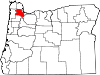
Motto: A Place to Call Home Location in Oregon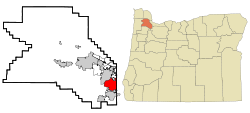
Coordinates: 45°25′40″N 122°46′44″W / 45.42778°N 122.77889°WCoordinates: 45°25′40″N 122°46′44″W / 45.42778°N 122.77889°W Country United States State Oregon County Washington Incorporated 1961 Government – Mayor Craig Dirksen Area – Total 11.8 sq mi (30.6 km2) – Land 11.8 sq mi (30.6 km2) – Water 0 sq mi (0 km2) Elevation 300 ft (91 m) Population (2010[1]) – Total 48,035 – Density 4,066.7/sq mi (1,570.2/km2) Time zone Pacific (UTC-8) – Summer (DST) Pacific (UTC-7) ZIP codes 97223, 97224, 97281 Area code(s) 503 and 971 FIPS code 41-73650[2] GNIS feature ID 1128092[3] Website http://www.tigard-or.gov Tigard (
 /ˈtaɪɡərd/) is a city in Washington County, Oregon, United States. The population was 48,035 at the 2010 census.[1] As of 2007, Tigard was the state's 12th largest city.[4] Incorporated in 1961, the city is located south of Beaverton and north of Tualatin, and is part of the Portland metropolitan area. Interstate 5 and Oregon Route 217 are the main freeways in the city, with Oregon Route 99W and Oregon Route 210 serving as other major highways, with rail service provided by the TriMet operated Westside Express Service.
Contents
History
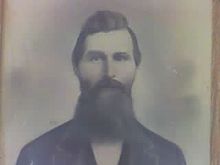 Wilson Tigard
Like many towns in the Willamette Valley, Tigard was originally settled by several families, the most noteworthy of which was the Tigard family, headed by Wilson M. Tigard. Arriving in the area known as "East Butte" in 1852, the family settled and became involved in organizing and building the East Butte School, a general store (which starting in 1886 housed the area's post office) and a meeting hall, and renamed East Butte to "Tigardville" in 1886.[5] The Evangelical organization built the Emanuel Evangelical Church at the foot of Bull Mountain, south of the Tigard store in 1886. A blacksmith shop was opened in the 1890s by John Gaarde across from the Tigard Store, and in 1896 a new E. Butte school was opened to handle the growth the community was experiencing from an incoming wave of German settlers.
The period between 1907 and 1910 marked a rapid acceleration in growth as Main Street blossomed with the construction of several new commercial buildings, Germania Hall (a two-story building featuring a restaurant, grocery store, dance hall, and rooms to rent), a shop/post office, and a livery stable. Limited telephone service began in 1908.
In 1910, the arrival of the Oregon Electric Railway triggered the development of Main Street and pushed Tigardville from being merely a small farming community into a period of growth which would lead to its incorporation as a city in 1961. The town was renamed Tigard in 1907 by the railroad to greater distinguish it from the nearby Wilsonville,[5] and the focus of the town reoriented northeast towards the new rail stop as growth accelerated.
1911 marked the introduction of electricity, as the Tualatin Valley Electric company joined Tigard to a service grid with Sherwood and Tualatin. William Ariss built a blacksmith shop on Main Street in 1912 that eventually evolved into a modern service station. In the 1930s the streets and walks of Main Street were finally paved, and another school established to accommodate growth.
The city was the respondent in (and eventual loser of) the landmark property rights case, Dolan v. City of Tigard, decided by the Supreme Court of the United States in 1994. The case established the "rough proportionality" test that is now applied throughout the United States when a local government evaluates a land use application and determines the exactions to require of the recipient of a land use approval.[6]
In the 2004 general elections, the city of Tigard won approval from its voters to annex the unincorporated suburbs on Bull Mountain, a hill to the west of Tigard. However, residents in that area have rejected annexation and are currently fighting in court various moves by the city.
Government
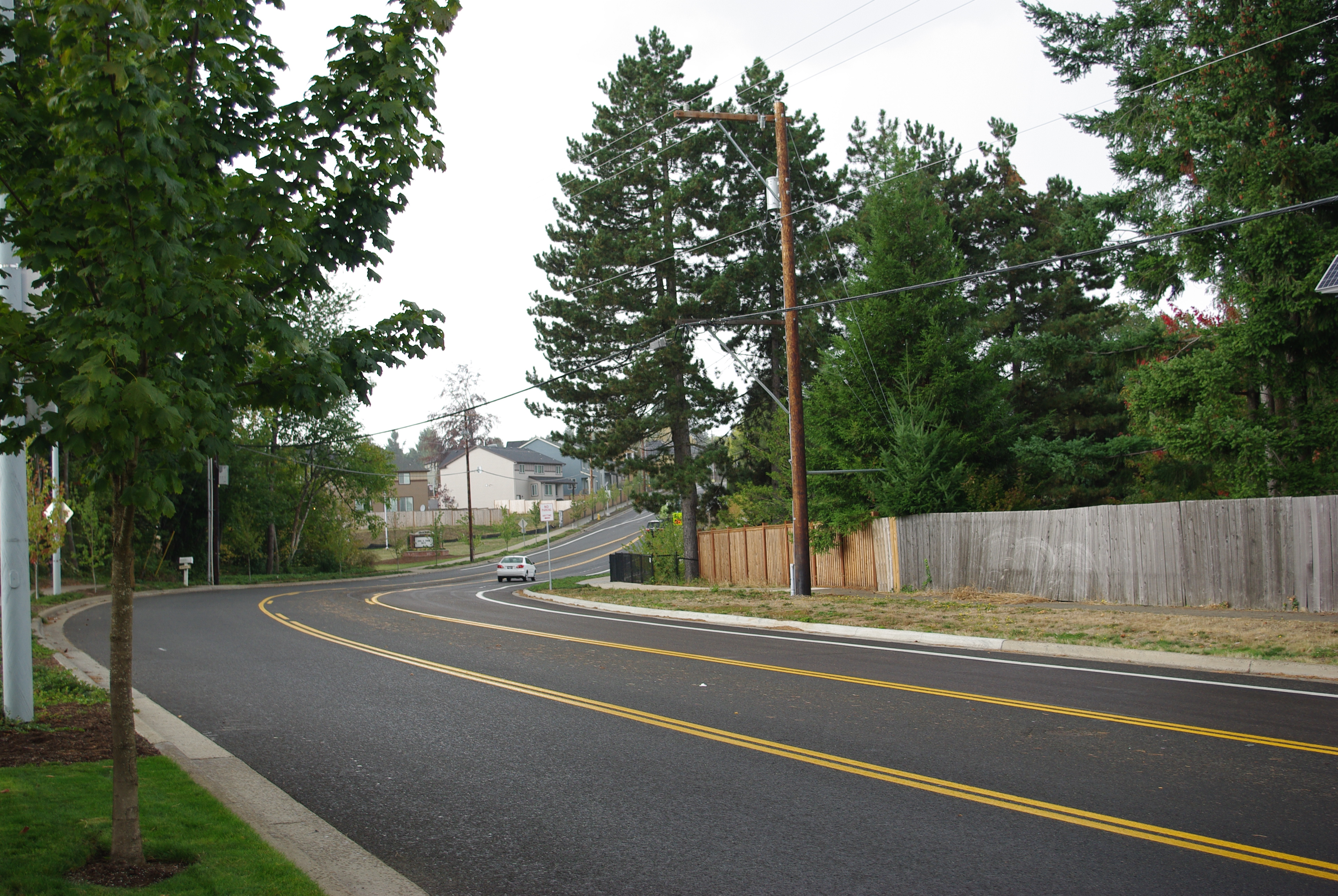
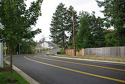 Bull Mountain Road in Tigard
Past mayors
These people have served as mayor of the city.[citation needed]
- 1974-1984: Wilbur Bishop
- 1984: Ken Scheckla[P]
- 1984-1986: John Cook
- 1987-1988: Tom Brian
- 1989-1994: Gerald Edwards
- 1994: Jack Schwab
- 1994-2000: Jim Nicoli[D]
- 2001-2003: Jim Griffith[A][D]
- From 2003: Craig Dirksen[A]
[A] Appointed to fill out term
[D] Died in office
[P] Mayor ProtemGeography
According to the United States Census Bureau, the city has a total area of 10.9 square miles (28 km2), of which, 10.9 square miles (28 km2) of it is land and 0.09% is water.
Demographics
Historical populations Year Pop. ±% 1961 1,084 — 1970 6,499 +499.5% 1980 14,799 +127.7% 1990 29,344 +98.3% 2000 42,482 +44.8% 2010 48,035 +13.1% 1961–2000,[7] 2010,[1] North of McDonald street, Tigard, along with Metzger and some of the unincorporated Bull Mountain area, uses the 97223 ZIP code for incoming mail, while the southern half of the city uses 97224, as does the nearby city of King City and the community of Durham. All mail for both ZIP codes are processed in Portland. The Tigard Post Office on Main street has a ZIP code of 97281, which is used only for post office boxes. Local phone numbers may be within the 503 or 971 area codes.
2000 Census data
As of the census[2] of 2000, there were 41,223 people, 16,507 households, and 10,746 families residing in the city. The population density was 3,795.3 people per square mile (1,465.6/km²). There were 17,369 housing units at an average density of 1,599.1 per square mile (617.5/km²). The racial makeup of the city was 85.38% White, 5.57% Asian, 1.14% African American, 0.61% Native American, 0.53% Pacific Islander, 3.76% from other races, and 3.00% from two or more races. Hispanic or Latino of any race were 8.94% of the population. There were 16,507 households out of which 33.5% had children under the age of 18 living with them, 52.0% were married couples living together, 9.2% had a female householder with no husband present, and 34.9% were non-families. 26.7% of all households were made up of individuals and 7.8% had someone living alone who was 65 years of age or older. The average household size was 2.48 and the average family size was 3.03.
In the city the population dispersal was 25.5% under the age of 18, 9.0% from 18 to 24, 34.1% from 25 to 44, 21.4% from 45 to 64, and 10.0% who were 65 years of age or older. The median age was 34 years. For every 100 females there were 96.0 males. For every 100 females age 18 and over, there were 92.8 males. The median income for a household in the city was $51,581, and the median income for a family was $61,656. Males had a median income of $44,597 versus $31,351 for females. The per capita income for the city was $25,110. About 5.0% of families and 6.6% of the population were below the poverty line, including 7.8% of those under age 18 and 3.6% of those age 65 or over.
Neighborhoods
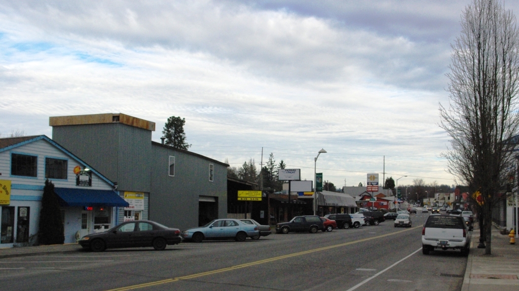
 Main Street in Tigard
Tigard is officially divided into 13 geographic areas around elementary schools and major transportation routes. Each neighborhood has been assigned an area number, 1-13, however some of the neighborhoods carry unofficial names long associated with them prior to their current numeric designations.[8] For instance: Area 1 does not have a particular name associated with it. Area 2 is often called Summerlake after Summerlake Park. Area 3 includes the historic Greenburg neighborhood. Area 4 is called either North Tigard or, more commonly, Metzger (though much of Metzger lies in unincorporated Washington County). Area 5 is commonly referred to as the "Tigard Triangle," with Oregon Highways 99W and 217 forming two sides of the triangle and Interstate 5 forming the other side. Area 6 contains Downtown Tigard and City Hall. This neighborhood will also be the focus for a long range plan to improve and redesign the center of the city.[9] Area 7 is sometimes called Bonita after Bonita Road and Bonita Park. Area 8 is called Southview and rests upon a broad hill named Little Bull Mountain across Oregon Highway 99W from the taller Bull Mountain. Area 9 is the Cook Park Neighborhood, named after the city's largest park. It also contains Tigard High School. Area 10 is Central Tigard. It is the site of the old downtown where there is now a strip mall along Highway 99W. Area 11 does not have a particular name associated with it. Area 12 is the incorporated part of East Bull Mountain. Area 13 lies on the northwest slope of Bull Mountain and is called West Tigard.
Local attractions
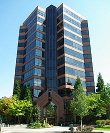 Lincoln Tower at Lincoln Center
The John Tigard House, constructed by the son of Wilson M. Tigard in 1880 at the corner of SW Pacific Hwy and SW Gaarde St, remains, having been saved from demolition in the 1970s by the Tigard Area Historical and Preservation Association. It became registered as a National Historic Place in 1979, and now resides at the corner of SW Canterbury Lane and SW 103rd.
During the Portland Rose Festival every summer, the Tigard Festival of Balloons is held at Cook Park near Tigard High School.[10] The tallest building in both the city and county is a 12-story building at Lincoln Center.[11]
Education
The city of Tigard falls mostly under the jurisdiction of the Tigard-Tualatin School District, however some of the northwestern most part of the city falls under the jurisdiction of the Beaverton School District. The Tigard-Tualatin School District contains 10 elementary schools, 3 middle schools, and 2 high schools. Tigard is home to Tigard High School, Fowler Middle School, Twality Middle School, Alberta Rider Elementary, CF Tigard Elementary, Durham Elementary, Mary Woodward Elementary and Templeton Elementary.
Notable people
- Kevin Duckworth, former professional basketball player
- Katherine Dunn, writer
- Mike Erickson, businessman and politician
- Larry Galizio, politician
- Mike Kinkade, professional baseball player
- Owen Marecic, college football star at Stanford University
- Kaitlin Olson, actress
See also
References
- ^ a b c "2010 Census profiles: Oregon cities alphabetically T-Y" (PDF). Portland State University Population Research Center. http://www.pdx.edu/sites/www.pdx.edu.prc/files/2010_PL94_cities_T-Y_updated.pdf. Retrieved September 16, 2011.
- ^ a b "American FactFinder". United States Census Bureau. http://factfinder.census.gov. Retrieved 2008-01-31.
- ^ "US Board on Geographic Names". United States Geological Survey. 2007-10-25. http://geonames.usgs.gov. Retrieved 2008-01-31.
- ^ Oregon Blue Book
- ^ a b Sherman, Barbara (March 27, 2009). "Nearing the century mark, Curtis Tigard reflects on his namesake city". The Times. http://www.tigardtimes.com/news/story.php?story_id=123817858168741600. Retrieved 21 December 2009.
- ^ Dolan v. Tigard
- ^ "Tigard Community Profile: 2006 Edition". City of Tigard. July 2006. p. 12. http://www.tigard-or.gov/community/community_profile/docs/profile.pdf. Retrieved 11 January 2010.
- ^ Neighborhood Networks
- ^ Downtown Tigard - The Heart of Our Community
- ^ Tigard Festival of Balloons
- ^ Allen, Martha. Tigard celebrates year of great growth, development. The Oregonian, December 29, 1987, West Zoner, p. C8.
External links
 Media related to Tigard, Oregon at Wikimedia Commons
Municipalities and communities of Washington County, Oregon Cities Banks | Beaverton | Cornelius | Durham | Forest Grove | Gaston | Hillsboro | King City | Lake Oswego‡ | North Plains | Portland‡ | Rivergrove‡ | Sherwood | Tigard | Tualatin‡ | Wilsonville‡
CDPs Aloha | Bethany | Bull Mountain | Cedar Hills | Cedar Mill | Garden Home-Whitford | Metzger | Oak Hills | Raleigh Hills | Rockcreek | West Haven-Sylvan | West Slope
Unincorporated
communitiesBlooming | Bonny Slope | Buxton | Carnation | Cherry Grove | Dilley | Farmington | Gales Creek | Glenwood | Hayward | Helvetia | Kansas City | Kinton | Laurel | Laurelwood | Manning | Marlene Village | Middleton | Midway | Mountaindale | Mulloy | Norwood | Roy | Scholls | Timber | Tonquin | Verboort | West Union | Wilkesboro
Ghost towns Dixie | Greenville | Thatcher
Footnotes ‡This populated place also has portions in an adjacent county or counties
Categories:- Cities in Oregon
- Populated places in Washington County, Oregon
- Populated places established in 1852
- Tigard, Oregon


Wikimedia Foundation. 2010.