- Timaru
-
Timaru 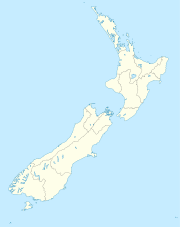
 Timaru
Urban Area Population: 27,200 Extent: Former Timaru City Council Territorial Authority Name: Timaru District Council Population: 42,867 (2006 census) Land area: 2,736.54 km² (1,056.58 sq mi) Mayor: Janie Annear Website: http://www.timaru.govt.nz/ Extent: Rangitata River to Pareora River, Pacific Ocean to Mackenzie District, including Rangitata Gorge Regional council Name: Canterbury Regional Council Timaru is a major port in the southern Canterbury region of New Zealand, located 160 kilometres southwest of Christchurch and about 200 kilometres northeast of Dunedin on the eastern Pacific coast of the South Island. The Timaru District, a territorial authority of 42,867 people (2006 census) in and around the former Timaru City (27,200), includes a prosperous agricultural hinterland with links to smaller rural communities such as Pleasant Point (1,170), Temuka (4,044), and Geraldine (2,244). The town of Waimate is about 40 kilometres to the south on the road to Oamaru and Dunedin. The Timaru urban area is the second largest city in the Canterbury Region, after Christchurch.
Caroline Bay beach is a popular recreational area located close to Timaru's town centre, just to the north of the substantial port facilities. Beyond Caroline Bay, the industrial suburb of Washdyke is at a major junction with State Highway 8, the main route into the Mackenzie Country. This provides a road link to Fairlie, Twizel, Lake Tekapo, Aoraki/Mount Cook and Queenstown.
Timaru has been constructed on rolling hills created from the lava flows of the extinct Mt Horrible volcano, which last erupted many thousands of years ago. The result is that most of the main streets are undulating, a clear contrast with the flat landscape of the Canterbury Plains to the north. This volcanic rock is used for the construction of local "bluestone" buildings.
Contents
Timaru district settlements
- Pleasant Point
- Temuka
- Cave
- Geraldine
- Orari
- Pareora
History
Early settlement
The origin of the name 'Timaru' is disputed . Some believe that it derives from Māori Te Maru, which can mean a 'place of shelter'. However, other authorities allege that Timaru originates from a literal translation of the combination of ti, a cabbage tree and maru, meaning 'shady'. Timaru is pronounced /ˈtɪməruː/ tim-ə-roo.
Māori canoes seem to have employed the site of Timaru as a place to rest on long journeys up and down the eastern coastline for many years before the arrival of the first Europeans in the 19th century. The area includes over 500 sites with traces of Māori rock art, particularly in the rock overhangs and caves of the Opuha and Opihi river valleys, to the west of modern day Timaru. Archaeologists have suggested that Māori tribes were permanently settled in the district before 1400 AD. During the 17th or 18th century the resident Ngāti Mamoe were driven southwards into Fiordland by an invasion of the Ngāi Tahu, who came from the North Island.
19th century European settlement
European settlement began with the construction of a whaling station in 1839 by the Weller brothers of Otago at Patiti Point, close to the present town centre.[1] A supply ship, The Caroline, provided the name for a local bay. Later a sheep station, known as The Levels, was created on land purchased by the Rhodes brothers. Few lived in Timaru until 1859 when the ship land reclamation around the Caroline Bay district, an area which is still growing today.
20th century development
Timaru continued to expand during the 20th century, with much of the development taking the form of wooden colonial style bungalows set in individual sections of land.
Geography
Climate
Timaru has a dry temperate climate similar to that of neighbouring Ashburton and Christchurch. Temperatures are warm in summer and cold in winter, with Timaru's extreme maximum temperature being 41.3°C on 6 February 2011[2] and extreme minimum temperature of -9.1°C on 3 August 1998.[3] Rain is evenly distributed throughout the year, with a very small proportion of it falling as snow.
Climate data for Timaru Month Jan Feb Mar Apr May Jun Jul Aug Sep Oct Nov Dec Year Average high °C (°F) 21.1
(70.0)20.9
(69.6)19.3
(66.7)16.6
(61.9)13.3
(55.9)10.6
(51.1)10.1
(50.2)11.4
(52.5)14.2
(57.6)16
(61)18.3
(64.9)19.9
(67.8)16 Average low °C (°F) 11.3
(52.3)11.1
(52.0)10
(50)7.1
(44.8)3.9
(39.0)1.3
(34.3)1.2
(34.2)2.3
(36.1)4.5
(40.1)6.4
(43.5)8.4
(47.1)10.4
(50.7)6.5 Precipitation mm (inches) 46
(1.81)38
(1.5)52
(2.05)66
(2.6)42
(1.65)41
(1.61)43
(1.69)45
(1.77)35
(1.38)55
(2.17)48
(1.89)53
(2.09)573
(22.56)Source: NIWA Climate Data[4] Government
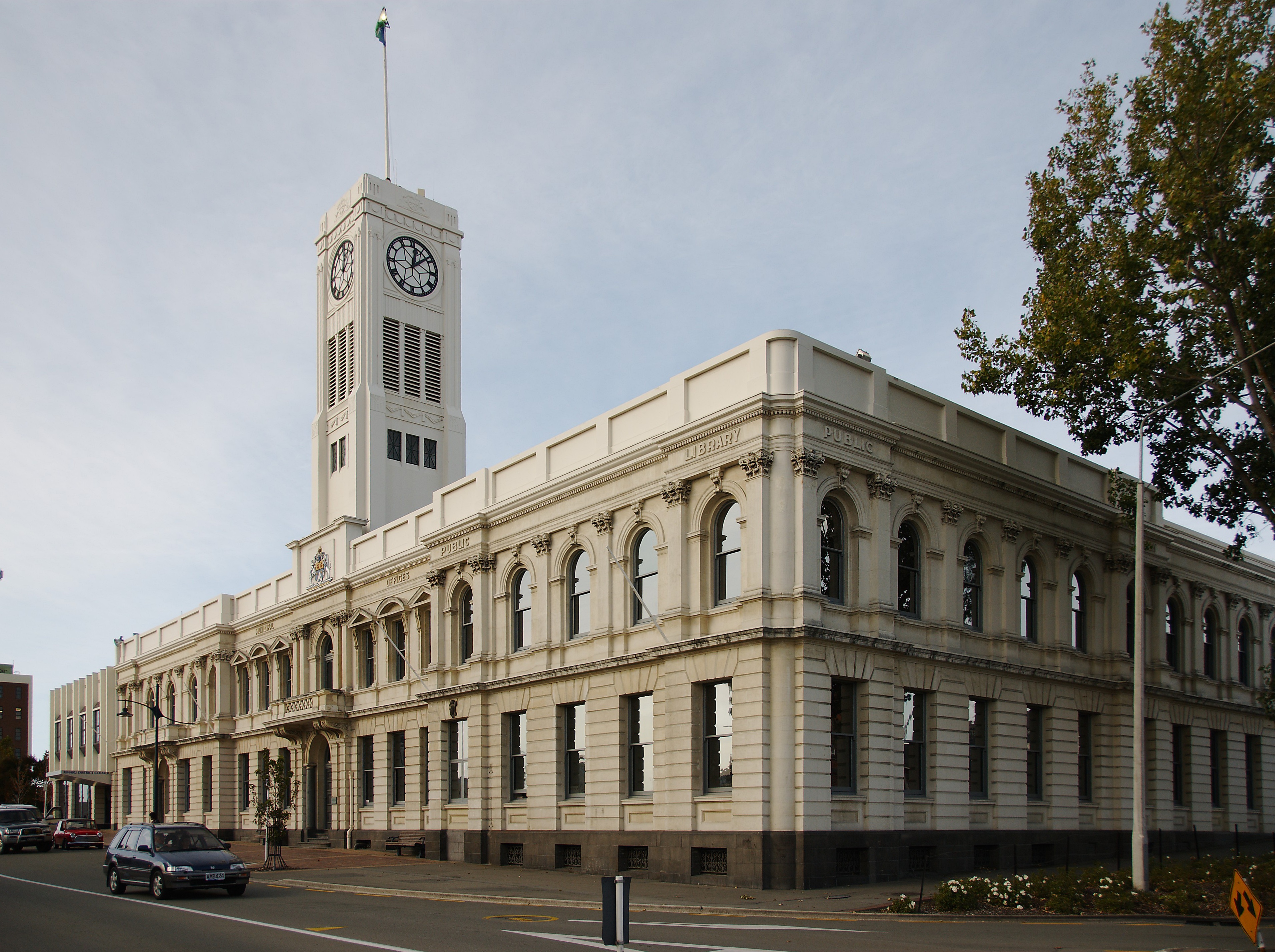
 Timaru Council Building
The mayor of Timaru is Janie Annear.
Timaru is part of the parliamentary electorate of Rangitata, represented by Jo Goodhew of the New Zealand National Party.
Economy
Timaru is one of the major cargo ports of the South Island, with a number of light manufacturing plants associated with the export and import trade. Many of these producers are concerned with processing, packing, and distributing meat, dairy and other agricultural produce.
Timaru is the second largest fishing port in New Zealand.
Transport
Timaru is located on State Highway One (SH1), the main road route down the eastern coast of the South Island.
There are regular coach and minibus services to Christchurch, Dunedin, Invercargill, Queenstown and the Mackenzie Country, leaving from outside the Visitor Information Centre, which provides booking facilities and other travel services.
The Main South Line section of the South Island Main Trunk Railway runs through Timaru and is a significant freight corridor. Passenger rail services were discontinued after the cancellation of the Southerner in February 2002. Between 1949 and 1970, Timaru was serviced by the South Island Limited, one of the former New Zealand Railways Department's most prestigious trains.
Richard Pearse Airport is located to the north of the town. It is equipped to handle light aircraft and short haul domestic flights, with regular services to Wellington.
A number of bus services connect Timaru's suburbs to the town centre.
Education
Further information: List of schools in Canterbury, New Zealand
- Pre-school
- Primary Schools
- Barton Rural (previously Fairview)
- Beaconsfield (previously Pareora West )
- Bluestone (previously West School)
- Gleniti
- Grantlea Downs (previously Grantlea )
- Highfield
- Oceanview Heights (previously Marchwiel School)
- Sacred Heart Primary
- St. Josephs School
- Timaru Christian
- Timaru South School
- Waimataitai
- Secondary Schools
- Timaru Boys' High School
- Timaru Girls' High School
- Roncalli College
- Craighead Diocesan School
- Mountainview High School
There are a number of primary schools including Timaru South School which has two campuses, one in Timaru and the other in Pareora 12 km away. Timaru also has many nurseries and Plunket rooms.
Shopping
Retailing is concentrated around the Stafford Street area. In addition there are a number of local shopping malls distributed around the town, with extensive parking facilities.
Timaru has a branch of The Warehouse, a major national retailer. Ballantynes is a large department store in the city centre.
A major online retailer is also based in Timaru with the main site, GeekStore run by Vetta Technologies.
Tourist attractions
 South Canterbury Museum
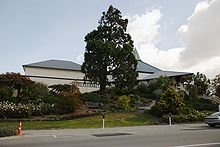
The South Canterbury Museum is the main museum for the region, containing exhibits relating to physical geography and the environment, fossil remains, Māori rock art, the early settlement of the district, local maritime history, scrimshaw, the E P Seally natural history collection, and information about Richard Pearse, a local inventor and his attempts at manned flight in the first years of the 20th century.
The Aigantighe (a Scots Gaelic word pronounced "egg and tie") Art Gallery in Wai-iti Road is the South Island’s third largest art museum. It holds a collection of New Zealand, Pacific, Asian and European art works from the sixteenth century to the present day and includes a sculpture garden. The gallery was founded in 1956 and is housed in a homestead built in 1908.
Timaru has with a number of open spaces, public gardens and parks. The Trevor Griffiths Rose Garden at Caroline Bay Park[5] is a major feature of the Timaru Piazza development. The parkland of the Bay Area contains a mini golf course, a roller skating rink, a maze and staging for musical events. It is home to the annual Summer Carnival that takes place over the Christmas and New Year holiday period. To the south of the city centre are the Timaru Botanic Gardens, first laid out in 1864, with a notable collection of roses and native tree ferns. To the west is the Centennial Park Reserve, opened in 1940, that includes a tranquil 3.5 km walkway following the wooded valley of the Otipua Creek.
The DB Mainland Brewery in Sheffield Street offers tours and tasting sessions.
The Caroline Bay Carnival, featuring live performances, games, and side shows, takes place from Boxing Day through to mid-January at Caroline Bay Park.[6]
Media
Print
The Timaru Herald is the local daily newspaper for the district and has been published since the mid nineteenth century. Papers are printed in Ashburton and then distributed throughout the Otago and South Canterbury region. The Herald is owned by Fairfax New Zealand. The High Country Herald, also published by Fairfax New Zealand, has a circulation of 43,000 copies.[7]
The region also supports a weekly community newspaper, The Timaru Courier which has a circulation of over 24,000 copies and is delivered free every Thursday to local households. The Courier is owned by Allied Press of Dunedin.
Radio
Timaru has 2 local FM radio stations, Classic Hits FM and Port FM. There are also many networked FM radio stations, and a voluntary Hospital Radio 88.1/107.5 which has been running for 20 years.
Notable residents
Academics
- Hugh D. Wilson, Botanist
Politics
- Basil Arthur, Politician
- Jo Goodhew, Politician
- Jim Sutton, Politician
Film and television
- Kevin Smith, Actor
- Neil Gudsell, Actor/Singer
Journalism
- Allen Curnow, Poet & Journalist
Music
- Peter Dawkins, Record producer and musician
- Michael Houstoun, Concert Pianist
Religious leaders
- Reginald Delargey, Roman Catholic cardinal
Aviation
- Richard Pearse, farmer, inventor & pioneering aviator
Sports
- Brendan Laney, professional rugby player
- Bob Fitzsimmons, World Heavyweight Champion from 17 March 1897 until 9 June 1899
- Danyon Loader, Men's swimming Olympic Champion, born in Timaru
- Ross Gillespie New Zealand Olympic Field Hockey Representative
- Jack Lovelock, New Zealand athlete, 1936 Olympic 1500m Champion
- Murray Parker, NZ Cricketer
- Mark Moreton Parker, NZ Cricketer
- Haidee Tiffen, NZ Women's Cricketer
- John Ward, NZ Cricketer
- Craig Cumming, NZ Cricketer
- Hamish Bennett, Cricketer
- Hayden Paddon, Off-Road Car Racer
Recreation and leisure
Performing arts
The Theatre Royal at 118 Stafford Street is home of much of Timaru's live entertainment.
Public libraries
The Timaru District Library has branches situated in Timaru, Temuka and Geraldine.
The first Reading Room was opened in the Scholl House, Barnard Street in 1862. It was open daily from 5.00pm - 10.00pm and on Saturdays 10.00am - 8.00pm. English and Colonial Newspapers were provided and a selection of Library Books for the use by members. In 1870 the Mechanics Institute was created by an addition on an existing building and aimed to provide a Library, Reading Room and News Room.
Timaru Public Library was officially opened in 1909 on the present Timaru District Council site. It was a Carnegie library, built with a 3,000 pound grant from Andrew Carnegie of New York - the condition under which the money was given was that the reading rooms should be open to everyone and that the lending Library should be free to ratepayers of the borough. The current library was opened on Sophia Street in 1979. It was designed by Miles, Warren and Mahoney.[8]
Sports
Sporting venues
Timaru has a comprehensive range of community sporting facilities designed to international standards for rugby, tennis, yachting, swimming, netball, cricket, golf, hockey, croquet and bowls. Aorangi Park is Timaru's major sporting venue. The Council also operates two swimming pools.
Football
Timaru's main football ground is Sir Basil Arthur Park. It has 4 senior pitches and 4 junior pitches. Football is also played at The Caledonian Grounds, Anzac Square, Russell Square, West End Park, Aorangi Park and Marchwiel Park. Clubs include West End AFC, Northern Hearts, Timaru City, Timaru Thistle and Pleasant Point.
Rugby
- South Canterbury Rugby Football Union is based in Timaru. Alpine Energy Stadium is the home of local rugby.
- In the wake of the February 2011 Christchurch earthquake, the Super Rugby team, the Crusaders, moved at least one seasonal game to Timaru.[9]
Golf
Timaru has many Golf Clubs and well maintained Golf courses. Most have green fees of around $15 NZD. Clubs include:
- Highfield Golf Club ($20) NZ Golf - Highfield Golf Club
- Gleniti Golf Club ($20) NZ Golf - Gleniti Golf Club
- Timaru Golf Club ($25–35) NZ Golf - Timaru Golf Club
and in close proximity to these (15 minute drive)
- Pleasant Point Golf Club ($15) NZ Golf - Pleasant Point Golf Club
- St.Andrews Golf Club ($15–$25) NZ Golf - St.Andrews Golf Club
- Maungati Golf Club (9 holes) ($7) NZ Golf - Maungati Golf Club
- Temuka Golf Club ($15) NZ Golf - Temuka
Surfing
- Patiti Point, near Timaru city, has a left-hand reef break, which operates very consistently in any swell from the east or south.
- Jack’s Point (3 km south of Timaru) has both left and right-hand reef breaks at high tide, as does Lighthouse Reef, a short walk to the south. Southerly swells produce super-heavyweight monster breakers along the Timaru coast, which are only suitable for top-gun surfers.
Suburbs
- Washdyke
- Puhuka
- Smithfield
- Grantlea
- Waimataitai
- Marchwiel
- Caroline bay
- Maori Hill
- Highfield
- Glenwood
- Gleniti
- Seaview
- West End
- Watlington
- Parkside
- Kensington
- Redruth
Sister cities
 Eniwa City, Hokkaido, Japan
 Orange, Australia
 Weihai, China
 Orange, USA
References
- ^ Entwisle, Behold the Moon, revised edition, 2010, ISBN 978-0-473-17534-4, p.126, n.515.
- ^ http://www.scoop.co.nz/stories/SC1103/S00010/climate-summary-february-2011-a-tale-of-two-islands.htm
- ^ http://www.weatherzone.co.nz/south-island/timaru
- ^ "Climate Data". NIWA. http://www.niwascience.co.nz/edu/resources/climate/. Retrieved 2 November 2007.
- ^ Caroline Bay,
- ^ Caroline Bay Carnival
- ^ "High Country Herald". Fairfax New Zealand. http://www.fairfaxnz.co.nz/publications/general/info48.html. Retrieved 2009-01-29.[dead link]
- ^ "Timaru Library History". Timaru District Council. http://www.timaru.govt.nz/services/Librarynew/timaru_history.htm. Retrieved 5 August 2009.[dead link]
- ^ http://www.stuff.co.nz/the-press/news/4870201/Timaru-crowd-flock-to-game/
Further reading
- James Belich, Russell Brown, and Martin Robinson (2004) New Zealand, Lonely Planet Series
- Darroch Donald (2003) New Zealand, 2nd Edition, Footprint Guide Series.
- Laura Harper, Tony Mudd and Paul Whitfield (2000) The Rough Guide to New Zealand, Rough Guide Series
External links
- Timaru District Council
- Tourist information
- Timaru District Library
- Historic images of Timaru from the collection of the Museum of New Zealand Te Papa Tongarewa
Towns of the Timaru District, Canterbury, New Zealand Major Towns Arundel • Cave • Geraldine • Orari • Pareora • Pleasant Point • Rangitata • Temuka • Timaru • WinchesterTimaru/Temuka suburbs Andrewville • Arowhenua/Pa • Caroline Bay • Gleniti • Glenwood • Grantlea • Highfield • Kensington • Maori Hill • Marchwiel • Parkside • Puhuka • Redruth • Seaview • Smithfield • Waimataitai • Washdyke • Watlington • West EndLocalities Adair • Beautiful Valley • Belfield • Blandswood • Clandeboye • Claremont • Coopers Creek • Epworth • Evans Flat • Four Peaks • Gapes Valley • Geraldine Downs • Geraldine Flat • Hadlow • Hanging Rock • Hazelburn • Hilton • Kakahu • Kakahu Bush • Kerrytown • Kingsdown • Levels • Levels Valley • Mesopotamia • Milford • Milford Huts • Mount Peel • Normanby • Ohapi • Opihi • Opuha • Orari Bridge • Orton • Otipua • Pareora West • Peel Forest • Pleasant Valley • Raincliff • Rangatira Valley • Rangitata Gorge • Rangitata Island • Rapuwai • Rosewill • Salisbury • Scarborough • Seadown • Seaforth • Sutherlands • Taiko • Taiko Flat • Te Awa • Te Moana • Totara Valley • Tripp Settlement • Upper Waitohi • Waiapi • Waihi Gorge • Waipopo • Waitawa • Waitohi • Woodbury •
 New Zealand topics
History 
Geography Time zones · Environment · National Parks · Marine reserves · Islands · Lakes · Rivers · Caves · Cities · Towns · BiodiversityGovernance Politics Economy Society Culture Māori culture · Māori language · NZ English · Art · Cinema · Kiwi (people) · Literature · Music · Sport · Public holidaysMain cities Categories:- Timaru
- Populated places in New Zealand
- Port cities in New Zealand


Wikimedia Foundation. 2010.