- Mount Kōya
-
- This article is about the mountain in Japan. For the historical Haida chief in the Queen Charlotte Islands of British Columbia, see Koyah. For the language spoken in India, see Koya language
Sacred Sites and Pilgrimage Routes in the Kii Mountain Range * UNESCO World Heritage Site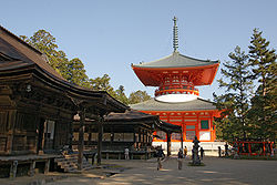
Country  Japan
JapanType Cultural, Religious Criteria ii, iii, iv, vi Reference 1142 Region ** Asia-Pacific Inscription history Inscription 2004 (28th Session) * Name as inscribed on World Heritage List
** Region as classified by UNESCOMount Kōya (高野山 Kōya-san) is the name of mountains in Wakayama Prefecture to the south of Osaka. Also, Kōya-san is a modifying word for Kongōbuji (金剛峯寺). There is no one mountain officially called Kōya-san (高野山) in Japan.
First settled in 819 by the monk Kūkai, Mt. Kōya is primarily known as the world headquarters of the Kōyasan Shingon sect of Japanese Buddhism. Located in an 800 m high valley amid the eight peaks of the mountain (which was the reason this location was selected, in that the terrain is supposed to resemble a lotus plant), the original monastery has grown into the town of Kōya, featuring a university dedicated to religious studies and 120 temples, many of which offer lodging to pilgrims. The mountain is home to the following famous sites:
- Okunoin (奥の院), the mausoleum of Kūkai, surrounded by an immense graveyard (the largest in Japan)
- Danjogaran (壇上伽藍), a heartland of Mt. Kōya.
- Kongōbu-ji (金剛峯寺), the head temple of the Kōyasan Shingon Buddhism
- Kōyasan chōishi-michi, the traditional route up the mountain
In 2004, UNESCO designated Mt. Kōya, along with two other locations on the Kii Peninsula, Yoshino and Omine; and Kumano Sanzan, as World Heritage Sites "Sacred Sites and Pilgrimage Routes in the Kii Mountain Range".[1]
Contents
Access
The mountain is accessible primarily by the Nankai Electric Railway from Namba Station (in Osaka) to Gokurakubashi Station at the base of the mountain. A cable car from Gokurakubashi then whisks visitors to the top in 5 minutes. The entire trip takes about 1.5 hours on an express train or 2 hours by non-express. Traffic by vehicle can be terrible on weekends until well into the evening. On weekdays, the mountain offers a pleasant drive followed by the excitement upon reaching the monasteries lining the summit. Many Buddhist monasteries on the mountain function as hotels for visitors providing traditional accommodation with an evening meal and breakfast.
Images
-

Danjogaran Kondo, the main hall of Mt. Kōya
-

Danjogaran Saito
-

Danjogaran Toto
-

Danjogaran Fudodo (National Treasure)
-

Danjogaran Sano-in
-

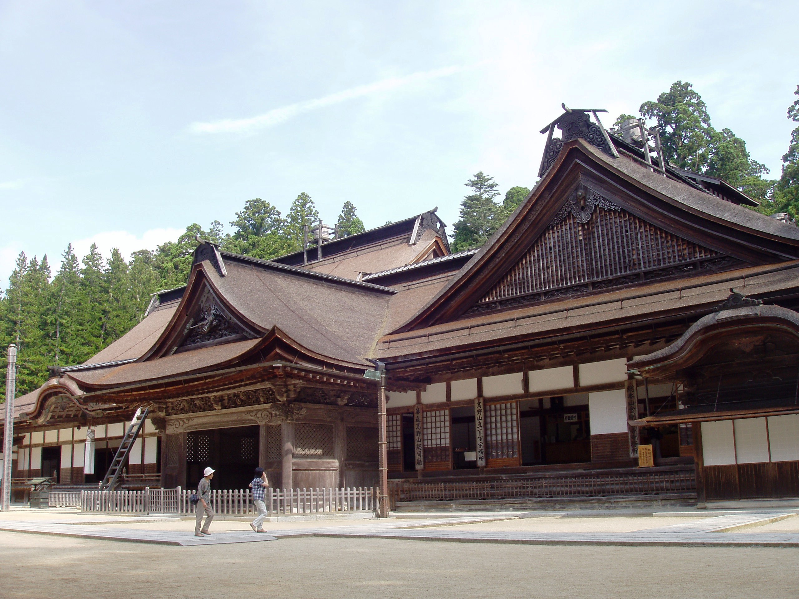
Kongobuji Temple
-

Banryutei rock garden, Kongobuji Temple
-

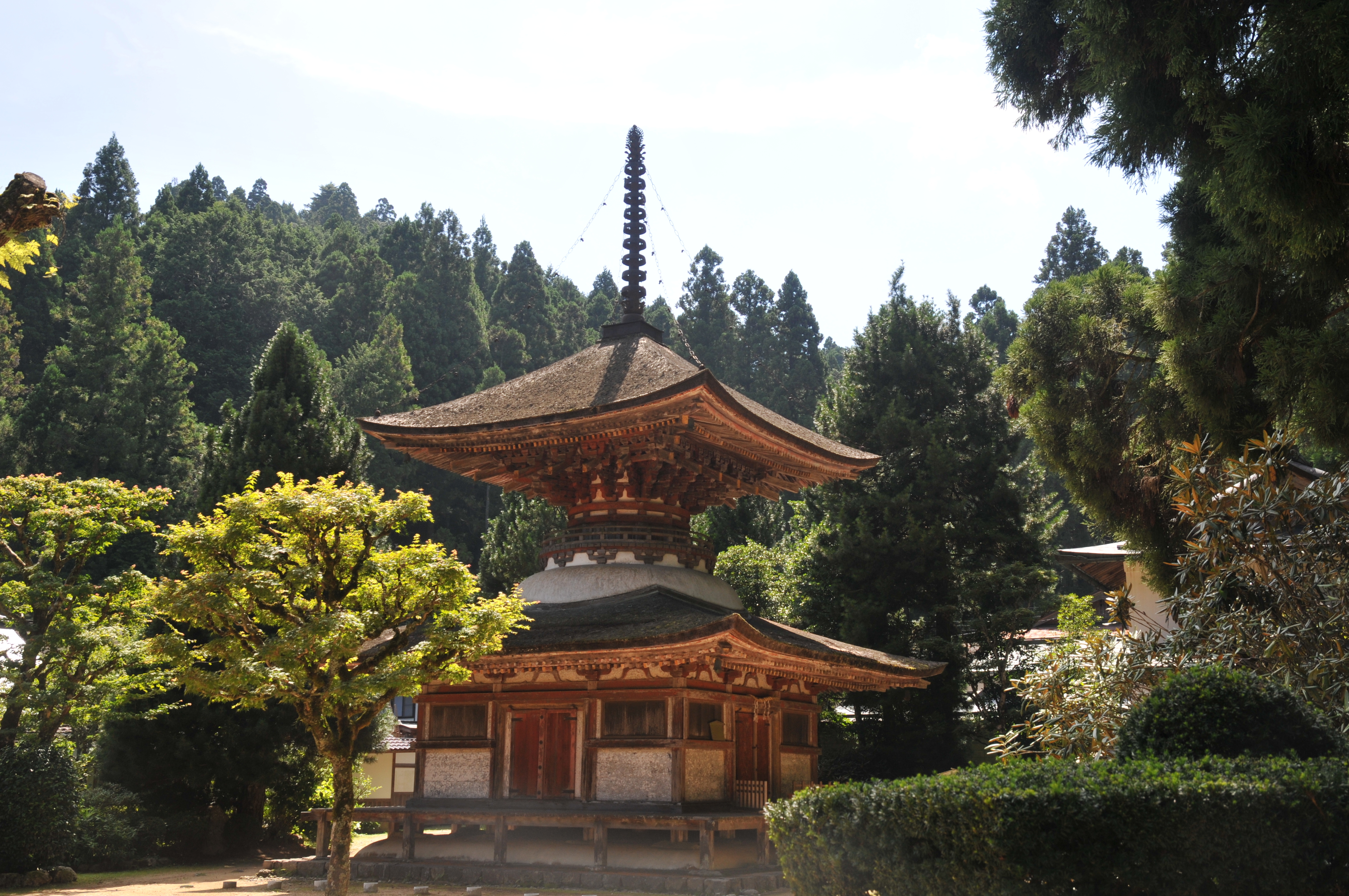
Pagoda of Kongozanmaiin (National Treasure)
-

Shingon Buddhist monks, Mt. Kōya, 2004
-
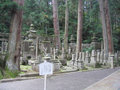
Okunoin Cemetery
-

Graves in Okunoin Cemetery
-

A statue in Okunoin Cemetery
-

Another statue in Okunoin Cemetery
-

Detail, Okunoin Cemetery
-

Okunoin Cemetery
-

Tokugawa Mausoleum
Notes
- ^ Hiragana Times, "Koyasan- A Sacred Tranquility", Volume #294, April 2011, pp. 34-37.
See also
External links
- Wikitravel: Mount Koya
- JAPANiCAN.com Temple lodging online booking
- Sacred Sites and Pilgrimage Routes in the Kii Mountain Range (UNESCO)
- Official site
- Photo set of the Okunoin cemetery of Koyasan (photos under Creative Commons licence)
- :World Heritage KOYASAN
Further reading
Nicoloff, Philip L. (2008). Sacred Koyasan: A pilgrimage to the Mountain Temple of Saint Kōbō Daishi and the Great Sun Buddha. State University of New York Press. ISBN 978-0-7914-7259-0.
Coordinates: 34°12′45″N 135°35′11″E / 34.2125°N 135.58639°E
Categories:- Mountains of Wakayama Prefecture
- Buddhist temples in Wakayama Prefecture
- Shingon Buddhism
- World Heritage Sites in Japan


Wikimedia Foundation. 2010.