- Phoenix, Arizona
-
Phoenix, Arizona — City — Images, from top, left to right: Downtown Phoenix skyline, Saint Mary's Basilica, Arizona Biltmore Hotel, Tovrea Castle, a saguaro cactus, Camelback Mountain

Flag
SealNickname(s): "Valley of the Sun", The 602, Pho-Town, Seis Cero Dos Location in Maricopa County and the state of Arizona Location in the United States
 Phoenix, Arizona
Coordinates: 33°27′N 112°4′W / 33.45°N 112.067°W Country United States State Arizona County Maricopa Incorporated February 5, 1881 Government - Type Council-Manager - Mayor Phil Gordon Area - City 517.948 sq mi (1,341.5 km2) - Land 516.704 sq mi (1,338.3 km2) - Water 1.244 sq mi (3.2 km2) Elevation 1,150 ft (350 m) Population (2010) - City 1,445,632 (6th) - Density 3,071.8/sq mi (1,188.4/km2) - Metro 4,192,887 - Demonym Phoenician Time zone MST (UTC−7) - Summer (DST) no DST (UTC−7) Area code(s) 602, 480, 623, 520 FIPS code 04-55000 Major Airport Phoenix Sky Harbor International Airport- PHX (Major/International) Website http://www.phoenix.gov/ Phoenix (
 /ˈfiːnɪks/ fee-niks; O'odham: Ski:kigk; Yavapai: Wasinka or Wakatehe; Western Apache: Fiinigis; Navajo: Hoozdoh; Mojave: Hachpa 'Anya Nyava[1]) is the capital, and largest city, of the U.S. state of Arizona, as well as the sixth most populated city in the United States. Phoenix is home to 1,445,632 people according to the official 2010 U.S. Census Bureau data.[2] It is the anchor of the Phoenix metropolitan area (also known as the Valley of the Sun), and is the 14th largest metro area by population in the United States with about 4.2 million people in 2010. In addition, Phoenix is the county seat of Maricopa County, and is one of the largest cities in the United States by land area.[3] Phoenix is the largest capital city in the United States and the only state capital with over 1,000,000 people.
Phoenix was incorporated as a city in 1881, after being founded in 1861 near the Salt River, close to the confluence with the Gila River. The city has a notable and famous political culture and has been home to numerous influential American politicians and other dignitaries, including Barry Goldwater, William Rehnquist, John McCain, Carl Hayden, and Sandra Day O'Connor. Residents of the city are known as Phoenicians.
Located in the northeastern reaches of the Sonoran Desert, Phoenix has a subtropical arid climate. In summer average high temperatures are typically over 100 °F (38 °C) and over 120 °F (49 °C) on occasion.[4]
Contents
History
American Indian period
For more than 1,000 years, the Hohokam peoples occupied the land that would become Phoenix.[5] The Hohokam created roughly 135 miles (217 km) of irrigation canals, making the desert land arable. Paths of these canals would later become used for the modern Arizona Canal, Central Arizona Project Canal, and the Hayden-Rhodes Aqueduct. The Hohokam also carried out extensive trade with the nearby Anasazi, Mogollon and Sinagua, in addition to Mesoamerican civilizations. It is believed that a Hohokam witness of the supernova that occurred in 1006 CE, created a representation of the event in the form of a petroglyph that can be found in the White Tank Mountain Regional Park west of Phoenix. This has been interpreted as the first known North American representation of the supernova.[6]
It is believed that between 1300 and 1450, periods of drought and severe floods led to the Hohokam civilization's abandonment of the area.[5] Local Akimel O'odham settlements, thought to be the descendants of the formerly urbanized Hohokam, concentrated on the Gila River. Some family groups did continue to live near the Salt River, but no large villages existed. Yavapai also had settlements in the area. Later, Maricopa peoples fleeing enemy tribes, came from the lower Gila River near its confluence with the Colorado River, and settled alongside the Akimel O'odham.
Father Eusebio Kino (1645–1711) was among the few Europeans to travel here in the 17th and 18th centuries. The Spanish focused mostly on the Pima missions in southern Arizona; the Salt River Valley had almost no European inhabitants for several centuries before the 1860s.
Early United States period
American and European "Mountain Men" likely came through the area, while exploring what is now central Arizona during the early 19th century. They obtained valuable beaver and otter pelts; these animals, as well as deer and Mexican wolves, often lived in the Salt River Valley when water supplies and temperatures allowed.
When the Mexican-American War ended in 1848, most of Mexico's northern zone passed to United States control, and a portion of it was made the New Mexico Territory (including what is now Phoenix) shortly afterward. The Gadsden Purchase was completed in 1853. The land was contested ground during the American Civil War: both the Confederate Arizona Territory, organized by Southern sympathizers in 1861 with its capital in Tucson, and the United States Arizona Territory, formed by the United States Congress in 1863 with its capital at Fort Whipple (now Prescott), included the Salt River Valley within their borders. The valley was not militarily important, however, and did not witness conflict.
In 1863, the mining town of Wickenburg was the first to be established in what is now Maricopa County. At the time this county did not exist, as the land was within Yavapai County along with the other major town of Prescott.
The US Army created Fort McDowell on the Verde River in 1865 to quell Native American uprisings. Hispanic workers serving the fort established a camp on the south side of the Salt River by 1866, which was the first non-native settlement in the valley after the decline of the Hohokam. In later years, other nearby settlements would form and merge to become the city of Tempe,[7] but this community was incorporated after Phoenix.
Founding
The history of Phoenix as a city begins with Jack Swilling, a Confederate veteran of the American Civil War (1861-1865), who had come west to seek wealth in the 1850s, and worked primarily in Wickenburg. On an outing in 1857, he stopped to rest at the foot of the White Tank Mountains. Swilling observed the abandoned river valley and considered its potential for farming, much like that already cultivated by the military further east, near Fort McDowell. The terrain and climate were optimal; only a regular source of water was necessary. The existence of the old Hohokam ruins, showing clear paths for canals, made Swilling imagine new possibilities.
Swilling had a series of canals built, which followed those of the ancient Native American system. A small community formed that same year about 4 miles (6 km) east of the present city. It was first called Pumpkinville, due to the large pumpkins that flourished in fields along the canals. Later it was called Swilling's Mill in his honor, though later renamed to Helling Mill, Mill City, and finally, East Phoenix. Swilling, a former Confederate soldier, wanted to name the city "Stonewall", after General Stonewall Jackson. Others suggested the name of "Salina". However, neither name was supported by the community.
Finally, Lord Darrell Duppa suggested the name "Phoenix", as it described a city born from the ruins of a former civilization.[8]
The Board of Supervisors in Yavapai County, which at the time encompassed Phoenix, officially recognized the new town on May 4, 1865, and formed an election precinct. The first post office was established on June 15, 1868, with Jack Swilling serving as the postmaster. With the number of residents growing (the 1870 U.S. census reported about a total Salt River Valley population of 240), a town site needed to be selected. On October 20, 1872, the residents held a meeting to decide where to locate it. A 320 acres (1.3 km2) plot of land was purchased in what is now the downtown business section.[9]
On February 12, 1871, the territorial legislature created Maricopa County, the sixth one formed, by dividing Yavapai County. The first election for county office was held in 1871, when Tom Barnum was elected the first sheriff. Barnum ran unopposed as the other two candidates, John A. Chenowth and Jim Favorite, had a shootout that ended in Favorite's death and Chenowth withdrawing from the race.[10]
Several lots of land were sold in 1870 at an average price of $48. The first church opened in 1871, as did the first store. Public school had its first class on September 5, 1872, in the courtroom of the county building. By October 1873, a small school was completed on Center Street (now Central Avenue).[10] Land entry was recorded by the Florence Land Office on November 19, 1873, and a declaratory statement filed in the Prescott Land Office on February 15, 1872. President Ulysses S. Grant issued a land patent for the present site of Phoenix on April 10, 1874. The total value of the Phoenix Townsite was $550, with downtown lots selling for between $7 and $11 each. A short time later, a telegraph office, 16 saloons, four dance halls and two banks were opened.[11]
 Aerial lithograph of Phoenix from 1885
Incorporation
By 1881, Phoenix had outgrown its original townsite-commissioner form of government. The 11th Territorial Legislature passed "The Phoenix Charter Bill", incorporating Phoenix and providing for a mayor-council government. The bill was signed by Governor John C. Fremont on February 25, 1881. Phoenix was incorporated with a population of approximately 2,500, and on May 3, 1881, Phoenix held its first city election. Judge John T. Alsap defeated James D. Monihon, 127 to 107, to become the city's first mayor.[12] In early 1888, the city offices were moved into the new City Hall, at Washington and Central (later the site of the city bus terminal, until Central Station was built in the 1990s). This building also provided temporary offices for the territorial government, when it moved to Phoenix by the 15th Territorial Legislature in 1889.[13]
The coming of the railroad in the 1880s was the first of several important events that revolutionized the economy of Phoenix. A spur of the Southern Pacific Railroad, the Phoenix and Maricopa, was extended from Maricopa into Tempe in the late 1880s. Merchandise now flowed into the city by rail instead of wagon. Phoenix became a trade center, with its products reaching eastern and western markets. In response, the Phoenix Chamber of Commerce was organized on November 4, 1888.[13] The Phoenix Street Railway electrified its mule-drawn streetcar lines in the 1890s, with streetcar service continuing until a 1947 fire. From 1911 to 1926, an interurban line carried passengers and express packages between Glendale and downtown Phoenix.
Modern Phoenix (1900–present)
 Central Avenue, Phoenix, Arizona, 1908
In 1902, President Theodore Roosevelt signed the National Reclamation Act, allowing for dams to be built on western streams for reclamation purposes. Residents were quick to enhance this by organizing the Salt River Valley Water Users' Association (on February 7, 1903), to manage the water and power supply. The agency still exists as part of the Salt River Project.[14] The Roosevelt Dam east of the valley was completed in 1911. Several new lakes were formed in the surrounding mountain ranges. In the Phoenix area, the river is now often dry due to large irrigation diversions[citation needed], taking with it the large populations of migrating birds, beaver dams, and cottonwood trees that had lived on its waters.
On February 14, 1912, under President William Howard Taft, Phoenix became the capital of the newly formed state of Arizona.[15] Phoenix was considered preferable, as both territorial and state capital, due to its more central location, compared to Tucson or Prescott. It was smaller than Tucson, but outgrew that city within the next few decades, to become the state's largest city.
In 1913, Phoenix adopted a new form of government, from mayor-council to council-manager, making it one of the first cities in the United States with this form of city government.[16]
During World War II, Phoenix's economy shifted to that of a distribution center, rapidly turning into an embryonic industrial city with mass production of military supplies. Luke Field, Williams Field, and Falcon Field, coupled with the giant ground-training center at Hyder, west of Phoenix, brought thousands of new people into Phoenix.[17]
On Thanksgiving night 1942, an illegal prize fight between a champion boxer of a black regiment and a white boxer of another army regiment, degenerated into a melee between competing camps. Subsequently, the black regiment left their barracks en masse, and began attacking whites and rioting into downtown. Unable to contain the spreading violence by the black soldiers, local police called in the military. The rioters were met by several military police units that attempted to arrest the rioters. Instead, the rest of the black soldiers based nearby joined the rioters with firearms. The Army quickly responded to the mutiny, and surrounded the area with armored personnel carriers and machine guns, ordering soldiers to use full military force against the mutineers, which resulted in dozens of fatalities. The Colonel of Luke Field, who had oversight of the city, soon declared Army personnel banned from Phoenix. This pressured civic leaders to reform local government, by firing a number of corrupt officials, in turn getting the ban lifted. This same bipartisan effort also successfully convinced the city council to give more power to the city manager to run the government and spend public funds, making Phoenix one of the largest cities in the country to not use the strong mayor structure for municipal government.
Another wartime incident took place at a Prisoner of War Camp that was established at the site of what is now Papago Park and Phoenix Zoo, for the internment of German soldiers captured in Europe.[18] In 1944, dozens of prisoners had devised a plan to escape from the camp and use boats to go down the nearby Salt River to reach Mexico. However, they were unaware that the river was mostly dry and had not been navigable for decades, and were thus easily apprehended near the camp.
The long established relationships between organized crime and the business elite grew after World War II. A primary incident, which marked the post-war face of Phoenix, was its involvement in the Great American streetcar scandal, in which arson and sabotage was added to the list of illegal business activities in destroying the city's mass transit system. A fire in October 1947 destroyed most of the Phoenix Street Railway fleet, making the city choose between implementing a new street railway system, or using buses and cars. Simultaneously, the city began changing the rights of way downtown, expanding street sizes, raising speed rates, thereby lowering the quality of life in many old neighborhoods. As a result of these changes, automobiles became the city's preferred method of transportation. This was followed by a number of the first housing developments that helped spread the size of Phoenix, and in turn enriched many of the area's largest landowners.[citation needed] By 1950, over 100,000 people lived within the city and thousands more in surrounding communities. There were 148 miles (238 km) of paved streets and 163 miles (262 km) of unpaved streets.[17]
Over the next several decades, the city and metropolitan area attracted more growth and became a favored tourist destination for its exotic desert setting and recreational opportunities. Nightlife and civic events concentrated along now skyscraper-flanked Central Avenue. In 1968, the city was surprisingly awarded the Phoenix Suns NBA franchise, and the Arizona Veterans Memorial Coliseum was built. By the 1970s, however, there was rising crime and a decline in business within the downtown core.
Arizona Republic writer Don Bolles was murdered by a car bomb in the city in 1976. It was believed that his investigative reporting on organized crime and politics, particularly the relationships in Phoenix between real-estate developers, organized crime, and out-of-state corporations, especially in regards to land and housing fraud, made him a target. Bolles' last words referred to Phoenix land and cattle magnate Kemper Marley,[19] who was widely regarded to have ordered Bolles' murder, as well as John Harvey Adamson, who pleaded guilty to second-degree murder in 1977 in return for testimony against contractors Max Dunlap and James Robison. Dunlap was convicted of first degree murder in the case in 1990 and received a life sentence. He died at the Arizona State Prison Complex - Tucson on July 21, 2009 due to natural causesregards to land and housing fraud, made him a target. Bolles' last words referred to Phoenix land and cattle magnate Kemper Marley.[20] Robison was acquitted, but pleaded guilty to charges of soliciting violence against Adamson.
With the advent of desegregation and the Fair Housing Act, the white flight, which had begun with the Great American streetcar scandal accelerated, as the remaining white middle class families fled the growing street gangs, violent crime, and the drug trade. As a result, by the 1980s, these criminal activities had become public safety issues with the transplanted, noncohesive nature of many neighborhoods, which made crime difficult to monitor. Van Buren Street, East of downtown (near 24th St), became associated with prostitution, and many sections of the city's south and west sides were ravaged by the crack epidemic. The city's crime rates in many categories have improved since that time, but still exceed state and national averages[citation needed].
After the Salt River flooded in 1980 and damaged many bridges, the Arizona Department of Transportation and Amtrak worked together and temporarily operated a train service, referred in Metro Light Rail (Phoenix) as the "Hattie B." line, between central Phoenix and the southeast suburbs. It was discontinued because of high operating costs and a lack of interest from local authorities in maintaining funding.[21]
The famous "Phoenix Lights" UFO sightings took place in March 1997. The Baseline Killer and Serial Shooter crime sprees occurred in Phoenix, Tempe, and Mesa. Steele Indian School Park was the site of a mid-air collision between two news helicopters in July 2007. In 2008, Squaw Peak, the second tallest mountain in the city, was officially renamed Piestewa Peak after Army Specialist Lori Ann Piestewa, an Arizona native who was the first Native American woman to die in combat with the U.S. military, and the first American female casualty in the 2003 Iraq War.
Phoenix has maintained a growth streak in recent years, growing by 24.2% before 2007. This made it the second-fastest-growing metropolitan area in the United States following only Las Vegas, whose population had grown by 29.2% in that time.[22] In 2008, Phoenix was one of the hardest hit by the Subprime mortgage crisis. In early 2009, the median home price was $150,000, down from its $262,000 peak in recent years.[23] Crime rates in Phoenix have gone down in recent years and once troubled, decaying neighborhoods such as South Mountain, Alhambra, and Maryvale have recovered and stabilized. Recently Downtown Phoenix and the central core have experienced renewed interest and growth, resulting in numerous restaurant, stores and businesses opening or relocating to central Phoenix.[24]
 A panoramic view of Phoenix from the South Mountain Range, Winter 2008 with Sky Harbor Int'l Airport on the far right.
Geography
 Landsat 7 Satellite image of the Phoenix Metro Area in 2002.
Phoenix is located at 33°27' North, 112°4' West (33.4485°, -112.0738°)[25] in the Salt River Valley, or "Valley of the Sun", in central Arizona. It lies at a mean elevation of 1,117 feet (340 m), in the northern reaches of the Sonoran Desert.
Other than the mountains in and around the city, the topography of Phoenix is generally flat, allowing the city's main streets to run on a precise grid with wide, open-spaced roadways.
The Salt River runs westward through the city of Phoenix; the riverbed is often dry or a trickle due to large irrigation diversions, except after the area's infrequent rainstorms or when more water is released from upstream dams. The city of Tempe has built two inflatable dams in the Salt River bed to create a year-round recreational lake, called Tempe Town Lake. The dams are deflated to allow the river to flow unimpeded during releases. Lake Pleasant Regional Park is located in Northwest Phoenix within the suburb of Peoria, Arizona
The Phoenix area is surrounded by the McDowell Mountains to the northeast, the White Tank Mountains to the west, the Superstition Mountains far to the east, and the Sierra Estrella to the southwest. Within the city are the Phoenix Mountains and South Mountains. Current development (as of 2005) is pushing beyond the geographic boundaries to the north and west, and south through Pinal County. According to the United States Census Bureau, the city has a total area of 517.9 square miles (1,341 km2); 474.9 square miles (1,230 km2) of it is land and 0.2 square miles (0.6 km², or 0.05%) of it is water.
The Phoenix Metropolitan Statistical Area (MSA) (officially known as the Phoenix-Mesa-Glendale MSA), is the 12th largest in the United States, with a total population of 4,192,887 as of the Census 2010. It includes the Arizona counties of Maricopa and Pinal. Other cities in the MSA include Mesa, Scottsdale, Glendale, Tempe, Chandler, Gilbert, and Peoria. Several smaller communities are also included, such as Cave Creek, Queen Creek, Buckeye, Goodyear, Guadalupe, Fountain Hills, Litchfield Park, Anthem, Sun Lakes, Sun City, Sun City West, Avondale, Surprise, El Mirage, Paradise Valley, and Tolleson. The communities of Ahwatukee, Arcadia, Laveen and some others are part of the city of Phoenix; Ahwatukee being separated from the rest of the city by South Mountain.
The city is the largest city in the Arizona Sun Corridor. The Sun Corridor is the 8th largest megaregion, in terms of area, in the United States of America and is predicted to be the 10th most populous megaregion in 2025. The Sun Corridor is equivalent to Indiana in size and population and had a GDP of $191 billion in 2005.
Phoenix is the nation's sixth most populous city with approximately 1.44 million people, however, with a huge land area of 475 square miles (1,230 km2), the city has a low density rate of about 2,785 people per square mile due to 1/3rd of its land area being undeveloped desert. By comparison, Philadelphia has approximately 1.5 million people in a land area of 127 square miles (330 km2), giving it a high density rate of over 11,000 people per square mile.
As with most of Arizona, Phoenix does not observe daylight saving time. In 1973, Gov. Jack Williams argued to the US Congress that energy use would increase in the evening, as refrigeration units were not used as often in the morning on standard time. He went on to say that energy use would rise "because there would be more lights on in the early morning." He was also concerned about children going to school in the dark, which indeed they were.[26] The exception to this are lands of the Navajo Nation in Northeastern Arizona, which observe daylight saving time in conjunction with the rest of their tribal lands in other states.
Climate
Phoenix has a subtropical arid climate (Köppen: BWh), typical of the Sonoran Desert in which it lies. Phoenix has extremely hot summers and warm winters. The average summer high temperatures are some of the hottest of any major city in the United States, and approach those of cities such as Riyadh and Baghdad. The temperature reaches and exceeds 100°F (38°C), on average for 110 days of the year, including most days from late May through to early September. Highs top 110 °F (43 °C) an average of 18 days during the year. On June 26, 1990, the temperature reached an all-time recorded high of 122 °F (50 °C).[27]
Overnight lows greater than 80 °F (27 °C) occur frequently each summer, with the average July low being 81 °F (27 °C), and the average August low being 80 °F (27 °C). On average, 67 days throughout the year will see the nighttime low at or above 80 °F (27 °C). The highest low temperature recorded in Phoenix was 96 °F (36 °C), which occurred on July 15, 2003.[28]
Precipitation is sparse during a large part of the summer, but the influx of monsoonal moisture, which generally begins in early July and lasts until mid-September, raises humidity levels and can cause heavy localized precipitation and flooding occasionally. Winter months are warm, with daily high temperatures ranging from the mid-60's to low 70's (18–22 °C), and low temperatures rarely dipping below 40 °F (4 °C).
 Midtown Phoenix skyline, looking north up Central Avenue
Phoenix averages 85% of possible sunshine[29] and receives scant rainfall, the average annual total at Phoenix Sky Harbor International Airport being 8.3 inches (210 mm). March is the wettest month of the year (1.07 inches or 27 mm) with June being the driest (0.09 inches or 2 mm). Although thunderstorms are possible at any time of the year, they are most common during the monsoon from July to mid-September as humid air surges in from the Gulf of California. These can bring strong winds, large hail, or rarely, tornadoes. Winter storms moving inland from the Pacific Ocean occasionally produce significant rains but occur infrequently. Fog is rare but can be observed from time to time during the winter months.
On average, Phoenix has only 5 days per year where the temperature drops to or below freezing.[30] The long-term mean date of the first frost is December 15 and the last is February 1; however, these dates do not represent the city as a whole because the frequency of freezes increases the further one moves outward from the urban heat island. Frequently, outlying areas of Phoenix see frost, but the airport does not. The earliest frost on record occurred on November 3, 1946, and the latest occurred on April 4, 1945. The all-time lowest recorded temperature in Phoenix was 16 °F (−9 °C) on January 7, 1913.
Snow is extremely rare in the area but is possible. Snowfall was first officially recorded in 1896, and since then, accumulations of 0.1 inches (0.25 cm) or greater have occurred only seven times. The heaviest snowstorm on record dates to January 20, 1937 – January 21, 1937, when 1 to 4 inches (2.5 to 10 cm) fell in parts of the city and did not melt entirely for four days. Before that, 1 inch (2.5 cm) had fallen on January 20, 1933. On February 2, 1939, 0.5 inches (1.3 cm) fell. Most recently, 0.4 inches (1.0 cm) fell on December 21, 1990 – December 22, 1990 (but not in the city). Snow also fell on March 12, 1917, on November 28, 1919, and on December 11, 1985 (at the airport). On December 30, 2010, graupel fell, although it was widely believed to be snow.[31] Not a single snowflake has hit downtown Phoenix since 1939.
Dust storms form mostly during the summer. Three major ones occurred in the summer of 2011. These dust storms form from monsoon storm "outflows", or sudden gusts of wind.
Climate data for Phoenix, Arizona (Phoenix Int'l) Month Jan Feb Mar Apr May Jun Jul Aug Sep Oct Nov Dec Year Record high °F (°C) 88
(31)92
(33)100
(38)105
(41)114
(46)122
(50)121
(49)116
(47)116
(47)107
(42)96
(36)87
(31)122
(50)Average high °F (°C) 67.3
(19.6)71.4
(21.9)76.1
(24.5)84.7
(29.3)93.9
(34.4)103.9
(39.9)106.6
(41.4)104.5
(40.3)99.0
(37.2)87.7
(30.9)75.0
(23.9)67.1
(19.5)86.4 Average low °F (°C) 44.8
(7.1)48.4
(9.1)53.0
(11.7)57.6
(14.2)67.4
(19.7)75.6
(24.2)82.9
(28.3)81.6
(27.6)75.6
(24.2)62.1
(16.7)50.4
(10.2)43.9
(6.6)61.9 Record low °F (°C) 16
(−8.9)24
(−4.4)25
(−3.9)35
(2)39
(4)49
(9)63
(17)58
(14)47
(8)34
(1)27
(−2.8)22
(−5.6)16
(−8.9)Rainfall inches (mm) .83
(21.1).77
(19.6)1.07
(27.2).25
(6.4).16
(4.1).09
(2.3).99
(25.1).94
(23.9).75
(19.1).79
(20.1).73
(18.5).92
(23.4)8.29
(210.6)Avg. rainy days (≥ 0.01 in) 4.2 4.3 4.6 1.7 1.1 .7 4.2 4.5 3.1 2.9 2.7 3.7 37.7 Sunshine hours 257.3 259.9 319.3 354.0 399.9 408.0 378.2 359.6 330.0 310.0 255.0 244.9 3,876.1 Source no. 1: WRCC (temperature normals, 1971–2000) [32], NOAA (precipitation normals, 1971–2000)[33], Weather.com (extreme temps) [34] Source no. 2: HKO (sun, 1961–1990) [35] Cityscape
See also: List of tallest buildings in Phoenix Map of the urban villages of Phoenix
Since 1986, the city of Phoenix has been divided into urban villages, many of which are based upon historically significant neighborhoods and communities that have since been annexed into Phoenix.[36] Each village has a planning committee that is appointed directly by the city council. According to the village planning handbook issued by the city, the purpose of the village planning committees is to work with the city's planning commission to ensure a balance of housing and employment in each village, concentrate development at identified village cores, and to promote the unique character and identity of the villages.[37]
Currently, there are 15 urban villages in the city: Ahwatukee Foothills, Alhambra, Camelback East, Central City, Deer Valley, Desert View, Encanto, Estrella, Laveen, Maryvale, North Gateway, North Mountain, Paradise Valley (not to be confused with the town of Paradise Valley), South Mountain and Rio Vista. Rio Vista was created as New Village in 2004 and is currently very sparsely populated, with no large amount of development expected in the near future.[38]
Commonly referred-to Phoenix regions and districts include Downtown, Midtown, West Phoenix, North Phoenix, South Phoenix, Biltmore Area, Arcadia, Sunnyslope, Ahwatukee.
Demographics
Phoenix is the sixth largest city in the nation according to the 2010 United States Census, making it the most populous state capital in the United States, with a population of 1,445,632.[39] According to the Census:[40]
- White: 76.7% (46.5% non-Hispanic)
- Hispanic or Latino (of any race): 40.8% (35.9% Mexican, 0.6% Puerto Rican 0.5% Guatemalan, 0.3% Salvadoran, 0.3% Cuban)
- Black or African American: 6.5% (6.0% non-Hispanic)
- Asian: 3.0% (0.8% Indian, 0.5% Filipino, 0.5% Chinese, 0.4% Vietnamese, 0.2% Korean, 0.1% Japanese, 0.1% Burmese)
- Two or more races: 1.7%
- Native American: 1.6%
- Native Hawaiian and Other Pacific Islander: 0.1%
- Some other race: 0.2%
Ancestry and language
According to the survey, the top ten ancestries were Mexican (38.4%), German (12.8%), Irish (8.8%), English (7.1%), African American (6.0%), Italian (4.0%), American (3.5%), Polish (2.2%), French (1.4%), and Scottish (1.6%).[41]
According to the survey, the linguistic abilities of Phoenix residents were as follows:[41]
- Population 5 years and over: 1,335,333
- English only: 68.8%
- Language other than English: 32.2%
- Spanish: 27.6%
- Speak English less than "very well": 14.1%
- Other Indo-European languages: 0.7%
- Speak English less than "very well": 0.2%
- Asian languages and Pacific Islander languages: 1.5%
- Speak English less than "very well": 0.8%
- Other languages: 1.4%
- Speak English less than "very well": 0.4%
2000 census
Historical populations Census Pop. %± 1880 1,708 — 1890 3,152 84.5% 1900 5,544 75.9% 1910 11,314 104.1% 1920 29,053 156.8% 1930 48,118 65.6% 1940 65,414 35.9% 1950 106,818 63.3% 1960 439,170 311.1% 1970 581,572 32.4% 1980 789,704 35.8% 1990 983,403 24.5% 2000 1,321,045 34.3% 2010 1,445,632 9.4% sources:[42][43] According to the 2000 census, there were 1,321,045 people, 865,834 households, and 407,450 families residing in the city. The population density was 2,782 people per square mile (1,074/km²). There were 895,832 housing units at an average density of 1,044 per square mile (403/km²).
There were 865,834 households out of which 35.7% had children under the age of 18 living with them, 46.9% were married couples living together, 12.9% had a female householder with no husband present, and 34.0% were non-traditional families. 25.4% of all households were made up of individuals and 6.3% had someone living alone who was 65 years of age or older. The average household size was 2.79 and the average family size was 3.39.
In the city the population age distribution was 28.9% under the age of 18, 10.9% from 18 to 24, 33.2% from 25 to 44, 18.8% from 45 to 64, and 8.1% who were 65 years of age or older. The median age was 31 years. For every 100 females there were 103.5 males. For every 100 females age 18 and over, there were 102.7 males.
The median income for a household in the city was $41,207, and the median income for a family was $46,467. Males had a median income of $32,820 versus $27,466 for females. The per capita income for the city was $19,833. 15.8% of the population and 11.5% of families were below the poverty line. Out of the total population, 21.0% of those under the age of 18 and 10.3% of those 65 and older were living below the poverty line.
As of 2000, the racial makeup of the Phoenix population was 71.1% White, 5.1% African American, 2.0% Native American, 2.0% Asian, 0.1% Pacific Islander, 16.4% from other races, and 3.3% from two or more races. Hispanic or Latino of any race were 34.1% of the population.[44] Since the 2000 census, the non-Hispanic white population in Phoenix dropped below 50.0%, according to William Frey, a demographer with the Brookings Institution.[45]
In 2000, the Phoenix metro area's religious composition was reported as 45% Catholic, 13% LDS (concentrated heavily in the suburb of Mesa) and 5% Jewish. The remaining 37% are largely members of Protestant denominations or are unaffiliated.[46]
Economy
The early economy of Phoenix was primarily agricultural, dependent mainly on the "5Cs" which were copper, cattle, climate, cotton and citrus. In the last four decades most of the farmlands have been turned into suburbs, and the economy has diversified as swiftly as the population has grown. The construction boom collapsed in 2008, as the financial crisis of 2007–2010 began; housing prices plunged. As Phoenix is the state capital, many residents in the area are employed by the government. Arizona State University has also enhanced the area's population through education and its growing research capabilities. Numerous high-tech and telecommunications companies have also recently relocated to the area. Due to the warm climate in winter, Phoenix benefits greatly from seasonal tourism and recreation, such as the golf industry.[47]
Phoenix is currently home to seven Fortune 500 companies: Allied Waste, electronics corporation Avnet, Apollo Group (which operates the University of Phoenix), mining company Freeport-McMoRan (recently merged with Phoenix based Phelps Dodge), retailer PetSmart and energy supplier Pinnacle West. Honeywell's Aerospace division is headquartered in Phoenix, and the valley hosts many of their avionics and mechanical facilities. Intel has one of their largest sites here, employing about 10,000 employees and 7 chip manufacturing fabs, including the $3 billion state-of-the-art 300 mm and 45 nm Fab 32. American Express hosts their financial transactions, customer information, and their entire website in Phoenix. The city is also home to the headquarters of U-HAUL International, a rental and moving supply company, as well as Best Western, the world's largest family of hotels. Mesa Air Group, a regional airline group, is headquartered in Phoenix.[48]
Despite the housing collapse, Phoenix is seeing an improvement in its rental housing. “Commercial-property owners are counting on apartment buildings to lead the Phoenix area's real-estate market toward recovery, based on a recent rebound for units rented and buildings sold.”[49] The military has a significant presence in Phoenix with Luke Air Force Base located in the western suburbs. At its height, in the 1940s, the Phoenix area had three military bases: Luke Field (still in use), Falcon Field, and Williams Air Force Base (now Phoenix-Mesa Gateway Airport), with numerous auxiliary air fields located throughout the region.[50]
Foreign governments have established 30 consular offices and eleven active foreign chambers of commerce and trade associations in metropolitan Phoenix[51][52]
See also: List of corporations in PhoenixCulture
Phoenix and the surrounding area have several cultural activities, including the performing arts, museums, and events.
Performing arts
Several music venues take place around Arizona, but primarily in and around downtown Phoenix and in Scottsdale. One such venue is the Phoenix Symphony Hall, where performances from groups such as the Phoenix Symphony Orchestra, Arizona Opera and Ballet Arizona often occur. Another venue is the Orpheum Theatre which is home to the Phoenix Metropolitan Opera. Concerts also regularly make stops in the area. Venues for concerts include the US Airways Center and the Comerica Theatre in downtown Phoenix, Cricket Wireless Pavilion in Maryvale, Jobing.com Arena in Glendale, and Gammage Auditorium in Tempe. Since 2002, Phoenix has also seen a rapid growth in local arts through Artlink Phoenix. Several smaller theatres including Trunk Space, Space 55 and Modified Arts support regular independent musical and theatre performances.
Phoenix has been home to numerous popular musicians, mostly of the country and rock genres. Solo artists originally from the area include Duane Eddy, Stevie Nicks, Willy Northpole, Buck Owens, Wayne Newton, Jordin Sparks, Marty Robbins, CeCe Peniston, Dierks Bentley, Alice Cooper, and Linkin Park's Chester Bennington. Several prominent rock groups have come from the Valley, including Meat Puppets, The Refreshments, Jimmy Eat World, Mr. Mister, Gin Blossoms, Several Members of the Coasters and The Tubes. Phoenix is becoming a musical hot spot as more established artists like George Benson, Steve Gadd, Bob Hoag, Joey DeFrancesco, Samuel David Moore have moved to the city, drawn by the lower cost of living and comfortable climate.
Several television series were set in Phoenix, including the current top-rated Medium, the 1960–1961 syndicated crime drama, The Brothers Brannagan, Alice and the CBS sitcom, The New Dick Van Dyke Show from 1971 to 1974.
Museums
Several museums exist throughout the Valley.
Phoenix Art Museum is the Southwest’s largest destination for visual art from across the world. Located at 1625 North Central Avenue, the 285,000-square-foot (26,500 m2) art museum stands at the intersection of Central Avenue and McDowell Road on the historic Central Avenue corridor. Phoenix Art Museum displays international exhibitions along side the Museum’s comprehensive collection of more than 18,000 works of American, Asian, European, Latin American, Western American, modern and contemporary art, and fashion design. A community center since 1951, Phoenix Art Museum presents a year-round program of festivals, live performances, independent art films and educational programs. Visitors can also experience PhxArtKids, an interactive space for children; photography exhibitions through the Museum’s partnership with the Center for Creative Photography; the landscaped Sculpture Garden; dining at Arcadia Farms at Phoenix Art Museum; and shopping at The Museum Store.
Another prominent area museum is the Heard Museum just north of downtown. It has over 130,000 square feet (12,000 m²) of gallery, classroom and performance space. Some of the signature exhibits include a full Navajo hogan, the Mareen Allen Nichols Collection containing 260 pieces of contemporary jewelry, the Barry Goldwater Collection of 437 historic Hopi kachina dolls, and an exhibit on the 19th century boarding school experiences of Native Americans. The Heard Museum attracts about 250,000 visitors a year.
Other notable museums in the city include the Arizona Science Center, Hall of Flame Firefighting Museum, Phoenix Museum of History, the Phoenix Zoo, the Pueblo Grande Museum and Cultural Park, and the Children's Museum of Phoenix. In 2010 the Musical Instrument Museum opened their doors, featuring the biggest musical instrument collection in the world.
Fine arts
The downtown Phoenix art scene has developed in the past decade. The Artlink organization and the galleries downtown have successfully launched a First Friday cross-Phoenix gallery opening.
In April 2009, artist Janet Echelman inaugurated her monumental sculpture, Her Secret Is Patience, a civic icon suspended above the new Phoenix Civic Space Park, a two-city-block park in the middle of downtown. This netted sculpture makes the invisible patterns of desert wind visible to the human eye. During the day, the 100-foot (30 m)-tall sculpture hovers high above heads, treetops, and buildings, the sculpture creates what the artist calls "shadow drawings", which she says are inspired by Phoenix's cloud shadows. At night, the illumination changes color gradually through the seasons. The large three-dimensional multi-layered form is created by a combination of hand-baiting and machine-loomed knotting, and is the result of a collaborative effort with an international team of award-winning engineers.
Author Prof. Patrick Frank writes of the sculpture that "...most Arizonans look on the work with pride: this unique visual delight will forever mark the city of Phoenix just as the Eiffel Tower marks Paris."[53]
The Arizona Republic editorialized: "This is just what Phoenix need: a distinctive feature that helps create a real sense of place."
Cuisine
Phoenix has long been renowned for authentic Mexican food, thanks to both the large Hispanic population and proximity to Mexico. But the recent population boom has brought people from all over the nation, and to a lesser extent from other countries, and has since influenced the local cuisine. International food, such as Korean, Brazilian, and French, has become more common throughout the valley in recent years. However, Mexican food is arguably still the most popular food, with Mexican restaurants found all over the area.
Sports
Phoenix is home to several professional sports franchises, including representatives of all four major professional sports leagues in the U.S. – although only two of these teams actually carry the city name and play within the city limits. Of all the U.S. metropolitan areas with teams in all four leagues, Phoenix was the last to get its first major franchise, this being the Phoenix Suns of the National Basketball Association (NBA), which started play in 1968 at the Arizona Veterans Memorial Coliseum. In 1992 the Suns moved to the America West Arena, which is now the US Airways Center. In 1997, the Phoenix Mercury was one of the original eight teams to launch the Women's National Basketball Association (WNBA). Both teams play at U.S. Airways Center. The U.S. Airways Center was the setting for both the 1995 and the 2009 NBA All-Star Games. The Phoenix Flame of the International Basketball League began play in the spring of 2007. They play at the Arizona Veterans Memorial Coliseum.

The Arizona Cardinals moved to Phoenix from St. Louis, Missouri in 1988 and currently play in the Western Division of the National Football League's National Football Conference. The team, however, has never played in the city itself; they played at Sun Devil Stadium on the campus of Arizona State University in nearby Tempe until 2006. Sun Devil Stadium held Super Bowl XXX in 1996 when the Dallas Cowboys defeated the Pittsburgh Steelers. The Cardinals now play at University of Phoenix Stadium in west suburban Glendale. University of Phoenix Stadium hosted Super Bowl XLII on February 3, 2008, in which the New York Giants defeated the New England Patriots. It is also the home of the annual Tostitos Fiesta Bowl, a college football bowl game that is part of the Bowl Championship Series (BCS).
Phoenix has an arena football team, the Arizona Rattlers of the Arena Football League. Games are played at US Airways Center downtown.
The Phoenix Coyotes of the National Hockey League moved to the area in 1996; they were formerly the Winnipeg Jets franchise. They play at Jobing.com Arena, adjacent to University of Phoenix Stadium in Glendale.
The Arizona Diamondbacks of Major League Baseball (National League West Division) began play as an expansion team in 1998. The team plays at Chase Field (downtown). In 2001, the Diamondbacks defeated the New York Yankees 4 games to 3 in the World Series, becoming not only the city's first professional sports franchise to win a national championship while located in Arizona, but also one of the youngest expansion franchise in U.S. professional sports to ever win a championship.
Additionally, due to the favorable climate, fifteen Major League Baseball teams conduct spring training in the metro Phoenix area in what is known as The Cactus League. The Cincinnati Reds were the last team to begin play in Goodyear, AZ as the 15th Cactus League team and share the stadium in Goodyear with the Cleveland Indians. Beginning in 2011, the Cactus League will be based solely in greater metro Phoenix as the last two teams that had played in Tucson (The Colorado Rockies and the Arizona Diamondbacks) will be sharing a spring training home near Scottsdale.
The Phoenix International Raceway is a major venue for two NASCAR auto racing events per season. Boat racing, drag racing, and road course racing are also held at Firebird International Raceway. Sprint car racing is no longer held at Manzanita Speedway.
Phoenix hosted the United States Grand Prix from 1989 to 1991. The race was discontinued after poor crowd numbers.[54]
Phoenix has also hosted the Insight Bowl at Chase Field until 2005, after which it moved to nearby Tempe, as well as several major professional golf events, including the LPGA's Safeway International and The Tradition of the Champions Tour. Phoenix was originally scheduled to host the 2006 NHL All-Star Game, but it was canceled due to the 2006 Winter Olympics (the recently adopted NHL collective bargaining agreement prohibits the All-Star Game to be held during Olympic years).
Phoenix has been named as a team in the WAMNRL which will begin in summer 2011.[55]
Phoenix's Ahwatukee American Little League reached the 2006 Little League World Series as the representative from the U.S. West region. Phoenix is one of the three cities that hosts the annual Rock 'n' Roll Arizona Marathon in January.On March 28, 2010 The University of Phoenix stadium hosted WWE's annual extravaganza WrestleMania XXVI which had broke the stadium's attendance record with 72,219 fans which have been broken by the 2011 BCS National Championship Game with 78,603 fans.
Club Sport League Venue Championships Arizona Rattlers Arena Football Arena Football League US Airways Center 2 Arizona Cardinals Football National Football League – NFC University of Phoenix Stadium 2* Arizona Diamondbacks Baseball Major League Baseball – National League Chase Field 1 Phoenix Suns Basketball National Basketball Association – Western Conference US Airways Center 0 Phoenix Coyotes Ice hockey National Hockey League – Western Conference Jobing.com Arena 0 Phoenix Mercury Basketball Women's National Basketball Association US Airways Center 2 Phoenix Monsoon Indoor Soccer Professional Arena Soccer League Castle Sports Club 0 (*) Note: The Cardinals won 2 of their championships while in Chicago.
Parks and recreation
Phoenix is home to a large number of parks and recreation areas. Many waterparks are scattered around the valley to help residents cope with the harsh desert heat during the summer months. Some of the notable parks include Big Surf in Tempe, Wet 'n' Wild Phoenix in Phoenix (has a Glendale mailing address), Golfland Sunsplash in Mesa, and the Oasis Water Park at the Arizona Grand Resort – formerly known as Pointe South Mountain Resort – in Phoenix. The area also has two amusement parks, Castles N' Coasters in north Phoenix, next to the Metrocenter Mall and Enchanted Island located at Encanto Park.
 Midtown Phoenix is visible to the left in this view from the Phoenix Mountain Preserve, December 2010.
Many parks have been established to preserve the desert landscape in areas that would otherwise quickly be developed with commercial and residential zoning. The most noteworthy park is South Mountain Park, the world's largest municipal park with 16,500 acres (67 km2); others include Camelback Mountain, and Sunnyslope Mountain, also known as "S" Mountain. The Desert Botanical Garden displays desert plant life from deserts all over the world. Encanto Park is the city's largest and primary urban park, and lies just northwest of downtown Phoenix. Papago Park in east Phoenix is home to both the Desert Botanical Garden and the Phoenix Zoo, in addition to several golf courses and the Hole-in-the-Rock geological formation.
Media
The first newspaper in Phoenix was the weekly Salt River Valley Herald, which later changed its name to the Phoenix Herald in 1880.
Today, the city is served by two major daily newspapers: The Arizona Republic (serving the greater metropolitan area) and the East Valley Tribune (serving primarily the cities of the East Valley). The Jewish News of Greater Phoenix is an independent weekly Jewish newspaper that was established in 1948. In addition, the city is also served by numerous free neighborhood papers and weeklies such as the Phoenix New Times, Arizona State University's The State Press, and the College Times. For 40 years, The Bachelor's Beat, a paid weekly newspaper, has covered local politics while selling ads for area strip clubs and escort services.
The Phoenix metro area is served by many local television stations and is the 12th largest designated market area (DMA) in the U.S. with 1,802,550 homes (1.6% of the total U.S.).[56] The major network television affiliates are KPNX 12 (NBC), KNXV 15 (ABC), KPHO 5 (CBS), KSAZ 10 (Fox), KUTP 45 (MNTV), KASW 61 (CW) and KAET 8 (PBS, operated by ASU). Other network television affiliates operating in the area include KPAZ 21 (TBN), KTVW 33 (Univision), KTAZ 39 (Telemundo), KDPH 48 (Daystar), and KPPX 51 (ION). KTVK 3 (3TV) and KAZT 7 (AZ-TV) are independent television stations operating in the metro area. KAZT broadcasts in digital format only.
The radio airwaves in Phoenix cater to a wide variety of musical and talk radio interests.
Many major feature films and television programs have been filmed in the city, including, Waiting to Exhale, War of the Worlds, Days of Thunder, Anastasia, American Anthem, 24, The Kingdom, Transamerica, The Uninvited, What Planet Are You From, Take Me Home Tonight, Titan A.E., O.C. and Stiggs, Pardners, Private Lessons, Song of the South, The Gauntlet, Psycho, Raising Arizona, Jerry Maguire, Baraka, Little Miss Sunshine, Interstate 60, Gunfight at the O.K. Corral, Beyond the Law, A Home at the End of the World, The Prophecy, A Boy and His Dog, Used Cars, Bill & Ted's Excellent Adventure (used as a stand-in for San Dimas, California), U Turn, Eight Legged Freaks, Bus Stop, The Getaway, The Grifters, Electra Glide in Blue, Private Lessons, Medium, Blue Collar Comedy Tour: The Movie, Never Been Thawed, Just One of the Guys, Away We Go, Terminal Velocity, Taxi, Twilight, and The Banger Sisters.[57]
Government
See also: List of mayors of Phoenix, Arizona The Arizona State Capitol, which used to house the state legislature, is now a museum.
As the capital of Arizona, Phoenix houses the state legislature. In 1913, the commission form of government was adopted. The city of Phoenix is served by a city council consisting of a mayor and eight city council members. The mayor is elected in a citywide vote to a four-year term. Phoenix City Council members are elected to four-year terms by voters in each of the eight separate districts that they represent.[58] The current mayor of Phoenix is Phil Gordon, a Democrat who was elected to a four-year term in 2003 and re-elected to an additional four-year term in 2007.[59] However, being term-limited, Gordon is ineligible to run in the next mayoral election. The mayor and city council members have equal voting power to adopt ordinances and set the policies that govern the city.[58]
Phoenix operates under a council-manager form of government, with a strong city manager supervising all city departments and executing policies adopted by the Council.[60]
As of February 9, 2009, Phoenix offers a domestic partnership registry open to opposite- and same-sex couples with no resident requirements for registrants.[61]
The city's website was given a "Sunny Award" by Sunshine Review for its transparency efforts.[62]
State government facilities
The Arizona Department of Juvenile Corrections operates the Adobe Mountain School and the Black Canyon School in Phoenix.[63] Another major state government facility is the Arizona State Hospital, operated by the Arizona Department of Health Services. This is a mental health center which is the only medical facility run by the state government.
The headquarters of numerous Arizona state government agencies are in Phoenix, with many located in the State Capitol district immediately west of downtown.
Federal government facilities
The Federal Bureau of Prisons operates the Federal Correctional Institution (FCI) Phoenix near the northern boundary of the city.
The Sandra Day O'Connor US Courthouse, US District Court of Arizona, is located on Washington Street downtown. It is named in honor of retired US Supreme Court Justice Sandra Day O'Connor, who was raised in Arizona.
The Federal Building is at the intersection of Van Buren Road and First Avenue downtown, and contains various federal field offices and the local division of the US Bankruptcy Court. This building also formerly housed the US District Court offices and courtrooms, but these were moved in 2001 to the new Sandra Day O'Connor US Courthouse. Before the construction of this building in 1961, federal government offices were housed in the historic US Post Office on Central Avenue, completed in the 1930s.
Crime
By the 1970s there was rising crime and a decline in business within the downtown core. Arizona Republic writer Don Bolles was murdered by a car bomb at the Clarendon Hotel in 1976. It was believed that his investigative reporting on organized crime in Phoenix made him a target. Bolles' last words referred to Phoenix land and cattle magnate Kemper Marley, who was widely regarded to have ordered Bolles' murder, as well as John Harvey Adamson, who pleaded guilty to second-degree murder in 1977 in return for testimony against contractors Max Dunlap and James Robison. Dunlap was convicted of first degree murder in the case in 1990 and remained in prison, until his death on July 21, 2009, while Robison was acquitted, but pleaded guilty to charges of soliciting violence against Adamson. Street gangs and the drug trade had turned into public safety issues by the 1980s. Van Buren Street, East of downtown (near 24th St), became associated with prostitution. The city's crime rates in many categories have improved since that time, but still exceed state and national averages.
The city has recently seen a tremendous drop in crime in recent years with 2008 and 2009 recording large declines in car thefts and murders. Phoenix expects to report to the FBI nearly 100 murders fewer in 2009 compared to two years prior when 222 murders occurred.[64] Through November 2009, 106 murders were recorded in Phoenix.[65]
Car theft has been a problem in Phoenix. The city consistently ranks high for both total thefts and rate per 100,000. In 2001, Phoenix was number one for theft rate with 35,161 total thefts, giving a rate of 1,081.25 per 100,000.[66] However, in 2003, Phoenix dropped to second place with 1,253.71 per 100,000 (behind Modesto, California), although total car thefts rose to 40,769.[67]
In 2008 Phoenix also experienced a huge decline in auto thefts dropping the city to the number 19 spot for such crimes; credit for the decline has been given to the Phoenix Police Department's efforts to patrol areas where reporting of thefts is prevalent and in use of bait cars to deter would-be thieves.[68]
Phoenix continues to experience large drops in all crimes in 2009 (A 24% drop in all violent crimes in Phoenix for 2008, and a further 18% drop in crime through November 2009 have been experienced in the city).
In the late 2000s, Phoenix earned the title "Kidnapping capital of the USA".[69] The majority of the kidnapped are believed to be victims of human smuggling, or related to illegal drug trade, while the kidnappers are believed to be part of Mexican Drug War cartels, particularly the Sinaloa Cartel. John McCain has also called Phoenix the "Number-Two Kidnapping Capital of the World".[70]
Education
Public education in the Phoenix area is provided by over 30 school districts.[71] The Phoenix Union High School District operates most of the public high schools in the city of Phoenix. Charter schools such as North Pointe Preparatory, Sonoran Science Academy, and Veritas Preparatory Academy also exist.
Post-secondary education

- Arizona State University is the main institution of higher education in the region, with campuses located in Tempe, Northwest Phoenix (ASU West Campus), Downtown Phoenix (ASU Downtown Campus) and Mesa (ASU Polytechnic Campus). A branch of the University of Arizona College of Medicine is located at the downtown Phoenix campus. ASU is currently one of the largest public universities in the U.S., with a 2011 student enrollment of 72,250.
There are also small satellite offices for the University of Arizona (based in Tucson) and Northern Arizona University (based in Flagstaff) located in Phoenix.
- Grand Canyon University is the nation's only private, for-profit, Christian university. Initially a non-profit school started in 1949, it was purchased by three investors who brought it out of bankruptcy. Since the takeover in 2004, enrollment has increased each year. It currently has over 10,000 students; almost 85% attend the school online.
- Arizona Christian University is Arizona’s only private, accredited, non-profit, non-denominational Christian liberal arts university, founded in 1960.
- Midwestern University-Glendale is located in Glendale, northwest of Phoenix proper. Founded as a sister school to the original campus in Downers Grove, Illinois, it is home to a number of professional health care education programs at the doctorate and master's level. The degrees offered include the Doctor of Osteopathic Medicine (DO), Master of Medical Science (MMS) in Physician Assistant Studies, Doctor of Pharmacy (PharmD), Doctor of Clinical Psychology (PsyD), Master of Occupational Therapy (MOT), Doctor of Dental Medicine (DMD), Doctor of Podiatric Medicine (DPM) and Doctor of Optometry (OD).
- Thunderbird School of Global Management is regarded as a leading institution in the education of global managers and has operations in the United States (Glendale), Switzerland, the Czech Republic, Russia, Mexico, Central and South America and China, and was ranked number 1 in international business by The Wall Street Journal's poll of corporate recruiters, U.S. News & World Report, and the Financial Times.[72]
- American Indian College is a private, Christian college located in the northwestern section of Phoenix.
- The Art Institute of Phoenix is a small, private undergraduate college which offers various majors in the areas of design, fashion, media, and culinary arts. It admitted its first class in 1996.
- Western Governors University opened a business office in Phoenix in 2006. WGU is an online non-profit university. Former Governor Janet Napolitano was on the WGU board until 2008. Former NAU President Clara Lovett was very active in the creation of WGU during its early days. WGU has employees and students in Phoenix and throughout Arizona. In early June 2008, WGU passed current enrollment of 10,000 students spread throughout the U.S.
- The University of Phoenix is also headquartered in Phoenix. This is the nation's largest for-profit university with over 130,000 students at campuses throughout the United States (including Puerto Rico), Canada, Mexico, and the Netherlands, as well as online.
- University of Advancing Technology is a small, for-profit university, notable for being a technology-oriented school. Their newly expanded campus is located in Tempe, bordering Phoenix. The university is composed of four colleges, along with an online program for continuing adult education. As of 2009, about 1200 undergraduates and 50 postgraduates enroll at UAT.
- Collins College is a for-profit career college focusing on visual arts. It has two campuses, one in Tempe and one in Phoenix. Both campuses are very small and do not include student housing; instead, Collins students must rent apartments in the area. In 2007, the Phoenix Business Journal ranked Collins as Arizona's top computer training school. Like many for-profit institutions, Collins is nationally accredited and its credits are not accepted by most regionally accredited institutions. In the past, Collins has drawn controversy for abuse of the federal financial aid program.
- DeVry University and Argosy University are for-profit institutions with small campuses across the country and a large online presence. Both operate post-secondary schools on the west side of Phoenix.
- Fortis College is a private college offering diplomas and degrees in the medical field.
- The Maricopa County Community College District includes ten community colleges and two skills centers throughout Maricopa County, providing adult education and job training. The first community college in the district as well as the state is Phoenix College.
- The Phoenix School of Law is a private law school located in downtown Phoenix and within the Phoenix Central Neighborhood. The Phoenix School of Law is the only private law school in Arizona and the only one with both a part-time evening program and full-time program; it is not affiliated with the similarly named University of Phoenix. Phoenix Law reports that 97% percent of its first graduating class passed the Arizona State Bar examination in July 2008.
- Phoenix Seminary is a seminary that has been fully accredited by the Association of Theological Schools in the United States and Canada (ATS) since 2002. Their ministry philosophy is "Scholarship with a Shepherd’s Heart".[73] The seminary holds to a modified version of the National Association of Evangelicals Statement of Faith.[74]
Transportation
Air
 An aerial view of the control tower at Phoenix Sky Harbor that began operations on January 17, 2007.
Phoenix is served by Sky Harbor International Airport (IATA: PHX, ICAO: KPHX), which is centrally located in the metro area near several major freeway interchanges east of downtown Phoenix. Sky Harbor is the tenth-busiest airport in the U.S. and 24th in the world[75] for passenger traffic, handling more than 42 million travelers in 2007. The airport serves more than 100 cities with non-stop flights.[76] Aeroméxico, Air Canada, British Airways, and WestJet are among several international carriers as well as American carrier US Airways (which maintains a hub at the airport) providing flights to destinations such as Canada, Costa Rica, and Mexico.[77]
The Phoenix-Mesa Gateway Airport (IATA: AZA, ICAO: KIWA) in neighboring Mesa also serves the area's commercial air traffic. It was converted from Williams Air Force Base, which closed in 1993. The airport has recently received substantial commercial service with Allegiant Air opening a focus city operation at the airport with non-stop service to over a dozen destinations.
Smaller airports that primarily handle private and corporate jets include Phoenix Deer Valley Airport (IATA: DVT, ICAO: KDVT), located in the Deer Valley district of northwest Phoenix, as well as municipal airports including Glendale Municipal Airport and Phoenix Goodyear Airport.
Rail and bus
Amtrak has not served Phoenix Union Station since 1996; Phoenix is the largest incorporated city in the United States without intercity passenger train service. The Sunset Limited and Texas Eagle stop three times a week at Maricopa, thirty miles south of downtown Phoenix (for shuttle and other travel information, see the Texas Eagle site).
Amtrak Thruway buses connect Sky Harbor to Flagstaff for connection with the daily Southwest Chief service to Los Angeles and Chicago. Phoenix is served by Greyhound bus service, with the station at 24th Street located near the airport.
Public transportation
 Opening day of the light rail, December 27, 2008.
Valley Metro provides public transportation throughout the metropolitan area, with its trains, buses, and a ride-share program. 3.38% of workers commute by public transit. During the summer it is very difficult to wait for a bus in the heat as many of the stops have no canopies.[78] Valley Metro's 20-mile (32 km) light rail project, called METRO, through north-central Phoenix, downtown, and eastward through Tempe and Mesa, opened December 27, 2008. Future rail segments of more than 30 miles (48 km) are planned to open by 2030.[79]
For additional information, see: METRO Light Rail (Phoenix).
Bicycle transportation
In 2000, bicycle transportation was a mode that 0.89% of Phoenix commuters utilized, down from 1.12% a decade earlier.[78]
The Maricopa Association of Governments has a bicycle advisory committee working to improve conditions for bicycling on city streets and off-road paths.[80]
Walkability
A 2011 study by Walk Score ranked Phoenix the 33rd most walkable of fifty largest cities in the United States.[81]
Roads and freeways
Main article: Roads and freeways in metropolitan PhoenixThe street system in Phoenix (also adhered to by some of its suburbs, such as Glendale and Scottsdale) is laid out in a traditional grid system, with most roads oriented either north-south or east-west. The zero point is the intersection of Central Avenue and Washington Street. Numbered Avenues run north–south west of Central; numbered Streets run north–south east of Central. Major arterial streets are spaced one mile (1.6 km) apart. The one-mile (1.6 km) blocks are divided into approximately 1000 house numbers north and south, and 800 house numbers east and west, although this varies. Scottsdale Road, being 7200 East, is approximately 7200 / 800 = 9 miles (14 km) east of Central. The Valley Metro bus numbers are also based on this numbering system, with the Central Avenue bus being Route Zero, and Scottsdale Road being Route 72.
Phoenix is served by a growing network of freeways, many of which were initiated by a ½ cent general sales tax measure approved by voters in 1985. Before this network, Interstate 10 and Interstate 17 handled almost all freeway traffic in Phoenix, placing a large burden on surface arterial streets, leading to increased traffic congestion as the area grew in size.
The current freeway system comprises two interstate routes (I-10 and I-17), the nearly transcontinental US 60, and several state highways as well – including SR 51, SR 85, Loop 101, SR 143, and Loop 202.
Eventually, several other state highways (Loop 303, SR 24, and SR 30) will make their way into the system as they are needed.
 Interstate 10
 Interstate 17
 State Route 51
 State Route 101
 State Route 143
 State Route 202
 State Route 303 (planned)
 U.S. 60
Sister cities
 Sign showing Phoenix's sister cities
Phoenix, Arizona, has ten sister cities, as designated by the Phoenix Sister Cities Commission:[82]
 – Grenoble (Rhône-Alpes, France) (1990)[83]
 – Hermosillo (Sonora, Mexico) (1975)
 – Himeji (Hyōgo, Japan) (1976)
 – Prague (Czech Republic) (1991) but currently inactive
 – Ramat Gan (Israel) (2005)
 – Dubai (United Arab Emirates) Partner city[84]
See also
- Largest cities in the Americas
- List of tallest buildings in Phoenix
- Notable people from Phoenix, Arizona
- Phoenix metropolitan area
References
- ^ Munro, P et al. A Mojave Dictionary Los Angeles: UCLA, 1992
- ^ "Philadelphia Inquirer. Annual Estimates of the Resident Population for Incorporated Places Over 100,000, Ranked by July 1, 2009 Census estimates". United States Census Bureau. http://www.philly.com/philly/news/breaking/117761248.html. Retrieved February 6, 2011.
- ^ "Find a County". National Association of Counties. http://www.naco.org/Counties/Pages/FindACounty.aspx. Retrieved 2011-06-07.
- ^ "Average Weather for Phoenix, AZ – Temperature and Precipitation". Weather.com. http://www.weather.com/weather/wxclimatology/monthly/graph/USAZ0166?from=dayDetails_bottomnav_undeclared. Retrieved June 30, 2010.
- ^ a b "Out of the Ashes, Early Life along the Salt River." City of Phoenix. Retrieved on November 26, 2006.
- ^ "CNN.com – Ancient rock art may depict exploding star – Jun 5, 2006". CNN. http://www.cnn.com/2006/TECH/space/06/05/rock.art/index.html. Retrieved May 23, 2010.
- ^ Tempe history timeline." 1866 entry discussing early farm camp. Tempe Historical Museum. Retrieved on January 20, 2008.
- ^ "Out of the Ashes, Phoenix is Born." City of Phoenix. Retrieved on November 26, 2006.
- ^ "Out of the Ashes, Selecting a Town site." City of Phoenix. Retrieved on November 26, 2006.
- ^ a b "Out of the Ashes, The Great Sale." City of Phoenix. Retrieved on November 26, 2006.
- ^ "Out of the Ashes, Whole Town Worth $550." City of Phoenix. Retrieved on November 26, 2006.
- ^ "Out of the Ashes, Incorporation in 1881." City of Phoenix. Retrieved on November 26, 2006.
- ^ a b "Out of the Ashes, Transportation: Horses and Rails." City of Phoenix. Retrieved on November 26, 2006.
- ^ "SRP: Historical timeline." Salt River Project. Retrieved on November 30, 2006.
- ^ "Out of the Ashes, Roosevelt and Reclamation." City of Phoenix. Retrieved on November 26, 2006.
- ^ "Out of the Ashes, Establishing a Council-Manager Government." City of Phoenix. Retrieved on November 26, 2006.
- ^ a b "Out of the Ashes, Growing into a Metropolis." City of Phoenix. Retrieved on November 26, 2006.
- ^ "Papago Park Facts". Phoenix.gov. http://replay.web.archive.org/20100528080246/http://phoenix.gov/PARKS/hikpafac.html. Retrieved April 27, 2011.
- ^ "Kemper Marley Sr. Is Dead at 83; Name Arose in '76 Slaying Inquiry". The New York Times. http://www.nytimes.com/1990/06/28/obituaries/kemper-marley-sr-is-dead-at-83-name-arose-in-76-slaying-inquiry.html. Retrieved October 24, 2011.
- ^ "Max Dunlap dies; was guilty of killing 'Republic' reporter". The Arizona Republic. http://www.azcentral.com/arizonarepublic/local/articles/2009/07/22/20090722dunlap0722.html. Retrieved October 24, 2011.
- ^ "The 1980 "Hattie B." Flood Relief Train." Retrieved on January 19, 2008.
- ^ "In Pictures: America's Fastest-Growing Cities from". Forbes. October 31, 2007. http://www.forbes.com/2007/10/31/property-cities-growth-forbeslife-cx_mw_1031realestate_slide_3.html?thisSpeed=15000. Retrieved June 30, 2010.
- ^ "Obama expected to announce foreclosure plan". CNN. February 17, 2009. http://www.cnn.com/2009/POLITICS/02/17/obama.foreclosures/. Retrieved May 22, 2010.
- ^ Nora Burba Trulsson, "Phoenix Rising," Sunset (March 2005) pp 27+.
- ^ "US Gazetteer files: 2010, 2000, and 1990". United States Census Bureau. 2011-02-12. http://www.census.gov/geo/www/gazetteer/gazette.html. Retrieved 2011-04-23.
- ^ "Arizona does not need daylight saving time." Arizona Daily Star. Published on May 19, 2005. Retrieved on December 15, 2006.
- ^ "Climatology of heat in the southwest". National Weather Service. http://www.wrh.noaa.gov/psr/general/safety/heat/. Retrieved January 6, 2009.
- ^ "University of Phoenix – Phoenix Campus". University of Phoenix. Archived from the original on February 15, 2008. http://web.archive.org/web/20080215024718/http://www.earnacollegedegree.com/university-of-phoenix/campus/phoenix-campus.htm?CampusId=2. Retrieved February 17, 2009.[dead link]
- ^ "WXPART4". Geography.asu.edu. http://geography.asu.edu/cerveny/wxpart4.htm#sun2. Retrieved June 30, 2010.
- ^ Mean Number of Days With Minimum Temperature 32 °F (0 °C) or Less. National Climatic Data Center. June 23, 2004. Last Retrieved February 16, 2006.
- ^ Haldiman, Philip (December 30, 2010). "Phoenix-area residents report snow falling across Valley". Azcentral.com. http://www.azcentral.com/community/scottsdale/articles/2010/12/30/20101230phoenix-area-residents-report-snow-falling-valley.html. Retrieved February 7, 2011.
- ^ "PHOENIX WSFO AP, ARIZONA NCDC 1971-2000 Monthly Normals". National Oceanic and Atmospheric Administration. http://www.wrcc.dri.edu/cgi-bin/cliNORMNCDC2000.pl?azphoe. Retrieved 2010-06-07.
- ^ "Climatography of the United States No. 20 1971–2000: PHOENIX SKY HRBR INTL AP, AZ" (PDF). National Oceanic and Atmospheric Administration. 2004. http://cdo.ncdc.noaa.gov/climatenormals/clim20/az/026481.pdf. Retrieved 2010-05-25.
- ^ "Monthly Averages for Phoenix, AZ – Temperature and Precipitation". The Weather Channel. http://www.weather.com/outlook/travel/businesstraveler/wxclimatology/monthly/graph/USAZ0166?from=36hr_bottomnav_undeclared. Retrieved 2009-05-07.
- ^ "Climatological Normals of Phoenix". Hong Kong Observatory. http://www.weather.gov.hk/wxinfo/climat/world/eng/n_america/us/Phoenix_e.htm. Retrieved 2010-05-25.
- ^ "Village Planning Committees." Phoenix City Government. January 9, 2007. Retrieved on February 22, 2007.
- ^ "The Village Planning Handbook" (PDF). City of Phoenix. http://www.phoenix.gov/PLANNING/vpbook.pdf. Retrieved July 7, 2009.
- ^ "Village Planning Committees." Phoenix City Government. March 21, 2008. Retrieved on April 15, 2008.
- ^ Arizona Republic: “Phoenix drops to sixth largest city.” Lynh Bui. March 13, 2011.
- ^ Factfinder2census.gov
- ^ a b "Phoenix, Arizona Selected Social Characteristics in the United States: 2006–2008". http://factfinder.census.gov/servlet/ADPTable?_bm=y&-geo_id=16000US0455000&-qr_name=ACS_2008_3YR_G00_DP3YR2&-ds_name=&-_lang=en&-redoLog=false. Retrieved June 29, 2010.
- ^ Moffatt, Riley. Population History of Western U.S. Cities & Towns, 1850–1990. Lanham: Scarecrow, 1996, 14.
- ^ "Subcounty population estimates: Arizona 2000–2007" (CSV). United States Census Bureau, Population Division. March 18, 2009. http://www.census.gov/popest/cities/files/SUB-EST2007-3.csv. Retrieved April 25, 2009.[dead link][dead link]
- ^ "Phoenix (city) MapStats from FedStats". Fedstats.gov. http://www.fedstats.gov/qf/states/04/0455000.html. Retrieved June 30, 2010.
- ^ Asthana, Anushka (August 21, 2006). "Changing Face of Western Cities". The Washington Post. http://www.washingtonpost.com/wp-dyn/content/article/2006/08/20/AR2006082000629.html. Retrieved June 30, 2010.
- ^ Religion demographic data from The Association of Religion Data Archives.
- ^ Daniel Bubb, "McCarran International and Phoenix Sky Harbor International: Airport Expansion, Tourism, and Urbanization in the Modern Southwest," Nevada Historical Society Quarterly, Dec 2002, Vol. 45 Issue 4, pp 125–142
- ^ "Contact Us." Mesa Air Group. Retrieved on January 30, 2009.
- ^ "AZCentral: Phoenix Rental Market Showing Signs of Rebound". http://www.azcentral.com/business/articles/2010/06/17/20100617phoenix-rental-market-rebounding.html. Retrieved October 27, 2010.
- ^ Matthew G. McCoy, "Base Instinct: Phoenix and the Fight Over Luke Field, 1946–1948," Military History of the West, 2003, Vol. 35, pp 57–76
- ^ Phoenix Consulates
- ^ Phoenix Chambers
- ^ Frank, Patrick (2011). Prebles' ARTFORMS. Prentice Hall. ISBN 0205797539.
- ^ Indianapolis Monthly (June 2004) p. 40
- ^ "RL Hopes to Move West". Americanrugbynews.com. http://www.americanrugbynews.com/artman/publish/rugby_league/RL_Hopes_To_Move_West.shtml. Retrieved February 7, 2011.
- ^ "Nielsen Reports 1.3% increase in U.S. Television Households for the 2007–2008 Season." Nielsen Media Research. (September 22, 2007) Retrieved on March 3, 2008.
- ^ "Titles with locations including Phoenix, Arizona, USA." IMDb. Retrieved on May 3, 2007.
- ^ a b Official Site of the City of Phoenix- About the Phoenix City Council
- ^ Official website of the City of Phoenix- Mayor Home
- ^ Official website of the City of Phoenix, What Type of Government Does Phoenix Have?
- ^ Human Rights Campaign
- ^ "''City of Phoenix'', City Web Site Recognized for Transparency in Government Information, April 8, 2010". Phoenix.gov. April 8, 2010. http://phoenix.gov/news/040810sunnyaward.html. Retrieved February 7, 2011.
- ^ "Safe Schools/Secure Facilities." Arizona Department of Juvenile Corrections. Retrieved on August 13, 2010.
- ^ Ferraresi, Michael (January 6, 2010). "Phoenix shootings leave 3 dead in 1st murders of '10". Azcentral.com. http://www.azcentral.com/arizonarepublic/local/articles/2010/01/06/20100106violence0106.html. Retrieved June 30, 2010.
- ^ Ferraresi, Michael (November 12, 2009). "Fewer murders expected in Phoenix". Azcentral.com. http://www.azcentral.com/news/articles/2009/11/12/20091112phxhomicides1113.html. Retrieved June 30, 2010.
- ^ "Cities with the worst auto theft". http://www.insure.com/car-insurance/thefts-cities2.html. Retrieved July 4, 2009.[dead link]
- ^ "'Hot spots' for stolen cars". CNN. November 30, 2004. http://money.cnn.com/2004/11/16/pf/hot_spots_for_hot_cars/. Retrieved July 4, 2009.
- ^ Stern, Ray (April 15, 2009). "Auto Theft Down in Phoenix and Tucson; Arizona DPS Takes Credit – Phoenix News – Valley Fever". Blogs.phoenixnewtimes.com. http://blogs.phoenixnewtimes.com/valleyfever/2009/04/auto_theft_down_in_phoenix_and.php. Retrieved June 30, 2010.
- ^ "Kidnapping Capital of the U.S.A.". February 11, 2009. http://abcnews.go.com/Blotter/story?id=6848672&page=1. Retrieved July 29, 2010.
- ^ . June 28, 2010. http://www.huffingtonpost.com/2010/06/28/mccain-falsely-claims-pho_n_627605.html. Retrieved July 29, 2010.
- ^ "Schools in Phoenix." Phoenix.gov.
- ^ [1][dead link] "Best in international business: 1.- Thunderbird"
- ^ "Ministry Phiosophy". Phoenix Seminary. http://www.ps.edu/about-us/mission-vision-philosophy/. Retrieved July 20, 2010.
- ^ "Statement of Faith". Phoenix Seminary. http://www.ps.edu/about-us/statement-of-faith/. Retrieved July 20, 2010.
- ^ "Airports Council International Passenger Traffic, 2007 Final." Airports Council International. Retrieved on January 18, 2009.
- ^ "Sky Harbor International Airport Domestic Destinations[dead link]." Sky Harbor International Airport. Retrieved on August 8, 2007.
- ^ "Sky Harbor International Airport International Destinations." Sky Harbor International Airport. Retrieved on August 8, 2007.
- ^ a b "Most bicycle commuters". Bikes At Work Inc.. http://www.bikesatwork.com/carfree/census-lookup.php?state_select=ALL_STATES&sort_num=2&lower_pop=250000&upper_pop=999999999&first_row=25&show_rows=25. Retrieved July 1, 2008.
- ^ "Welcome". Valley Metro. http://www.valleymetro.org/metro_light_rail/. Retrieved June 30, 2010.
- ^ "MAG Regional Bike Map 2005[dead link]." Maricopa Association of Governments. Retrieved on April 21, 2006.
- ^ "2011 City and Neighborhood Rankings". Walk Score. 2011. http://www.walkscore.com/rankings/cities/. Retrieved Aug 28, 2011.
- ^ Sister Cities information obtained from the Phoenix Sister Cities Commission." Retrieved on April 21, 2006.
- ^ Jérôme Steffenino, Marguerite Masson. "Ville de Grenoble – Coopérations et villes jumelles". Grenoble.fr. http://www.grenoble.fr/jsp/site/Portal.jsp?page_id=92. Retrieved October 29, 2009.[dead link]
- ^ "Dubai partners with the U.S. city of Phoenix UAE – The Official Web Site – News". Uaeinteract.com. http://uaeinteract.com/docs/Dubai_partners_with_the_U.S._city_of_Phoenix_/35613.htm. Retrieved July 14, 2009.
Further reading
- Larson, Kelli L.; Gustafson, Annie; Hirt, Paul (April 2009). "Insatiable Thirst and a Finite Supply: An Assessment of Municipal Water-Conservation Policy in Greater Phoenix, Arizona, 1980–2007". Journal of Policy History 21 (2): 107–137. doi:10.1017/S0898030609090058.
- Johnson, G. Wesley, Jr. (1993). Phoenix in the Twentieth Century: Essays in Community History. Diane Pub Co. ISBN 0788162497.
- Johnson, G. Wesley, Jr. (1982). Phoenix, Valley of the Sun. Continental Heritage Press. ISBN 0932986331.
- Luckingham, Bradford (1995). Phoenix: The History of a Southwestern Metropolis. University of Arizona Press. ISBN 0816511160.
- VanderMeer, Philip (2010). Desert Visions and the Making of Phoenix, 1860–2009. Univ of New Mexico Press. ISBN 978-0-8263-4891-3.
- VanderMeer, Philip; Mary VanderMeer (2002). Phoenix Rising: The Making of a Desert Metropolis. Heritage Media Corp.. ISBN 1886483698.
External links
- Official Government Website
- Phoenix Art Museum
- Phoenix.org
- Phoenix City Data
- Arizona State University
- Phoenix Central Neighborhood Association
- Greater Phoenix Chamber of Commerce
- Greater Phoenix Convention & Visitors Bureau
- Phoenix Public Library
- USGS—Phoenix Elevation
- Phoenix, Arizona travel guide from Wikitravel
Coordinates: 33°26′54″N 112°04′26″W / 33.4482°N 112.0738°W
Categories:- Cities in Arizona
- County seats in Arizona
- Phoenix metropolitan area
- Phoenix, Arizona
- Populated places established in 1868
- Populated places in Maricopa County, Arizona
- Populated places in the Sonoran Desert
- UFO-related locations


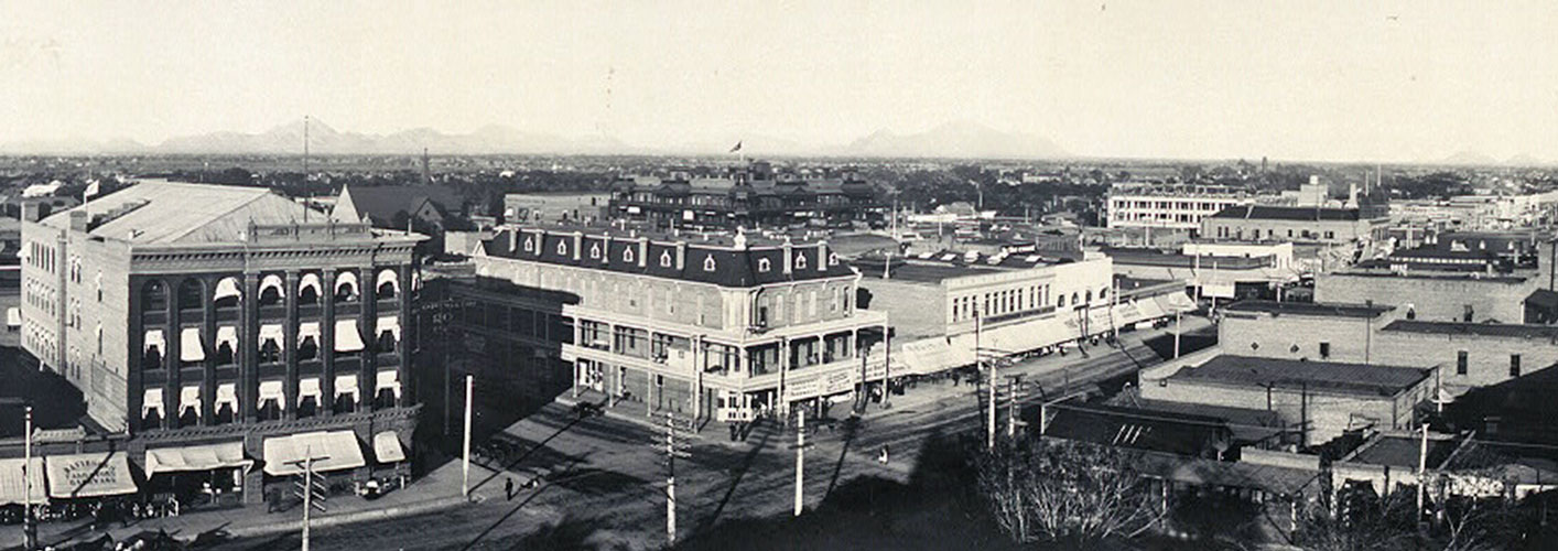

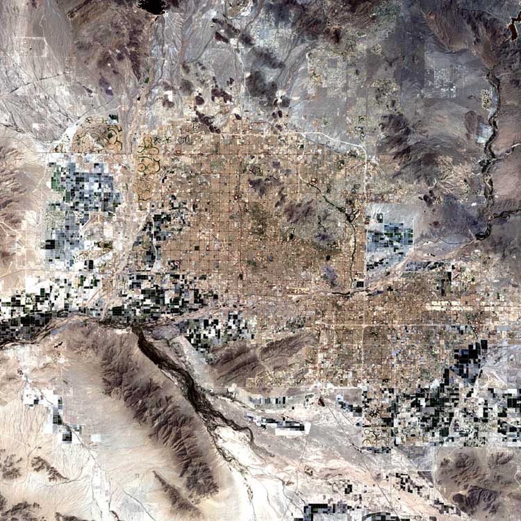


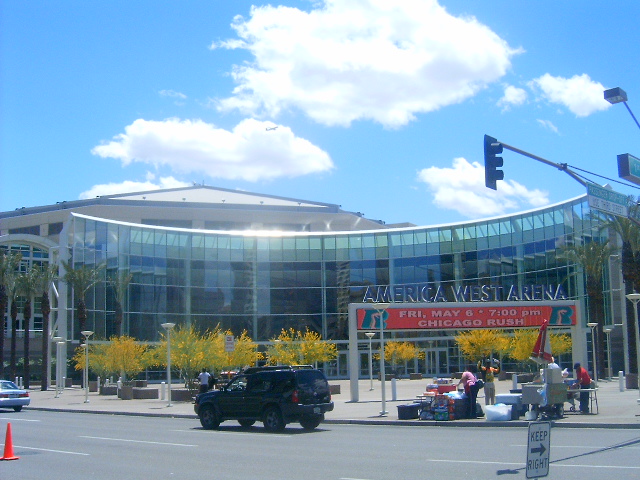
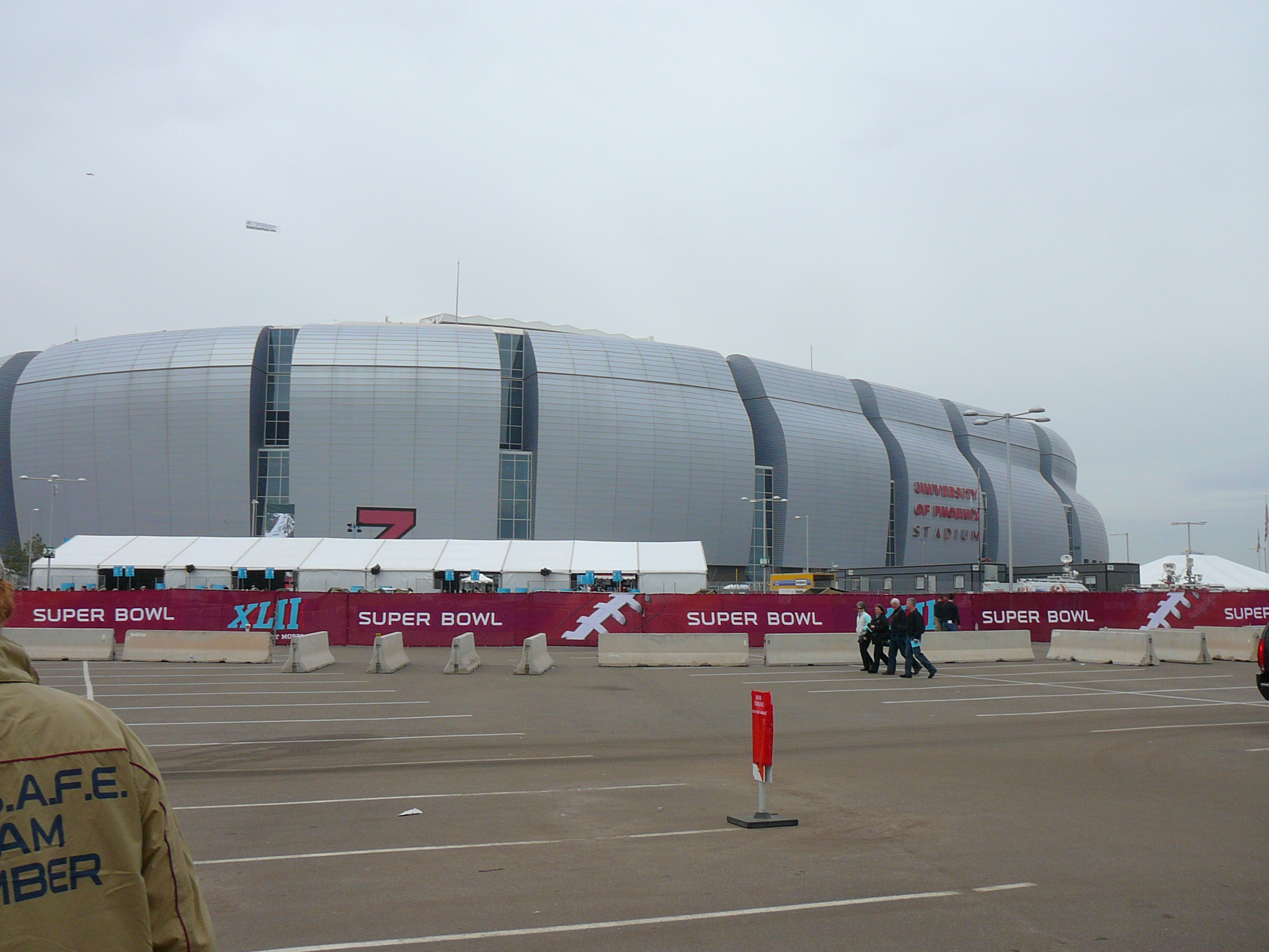

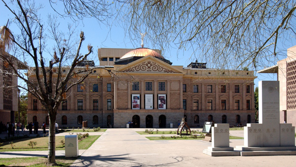
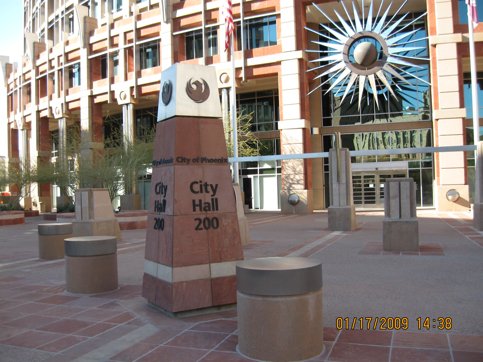
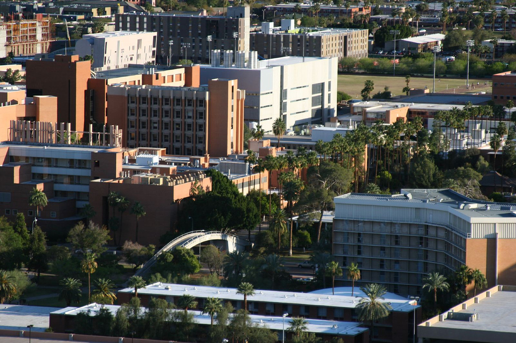

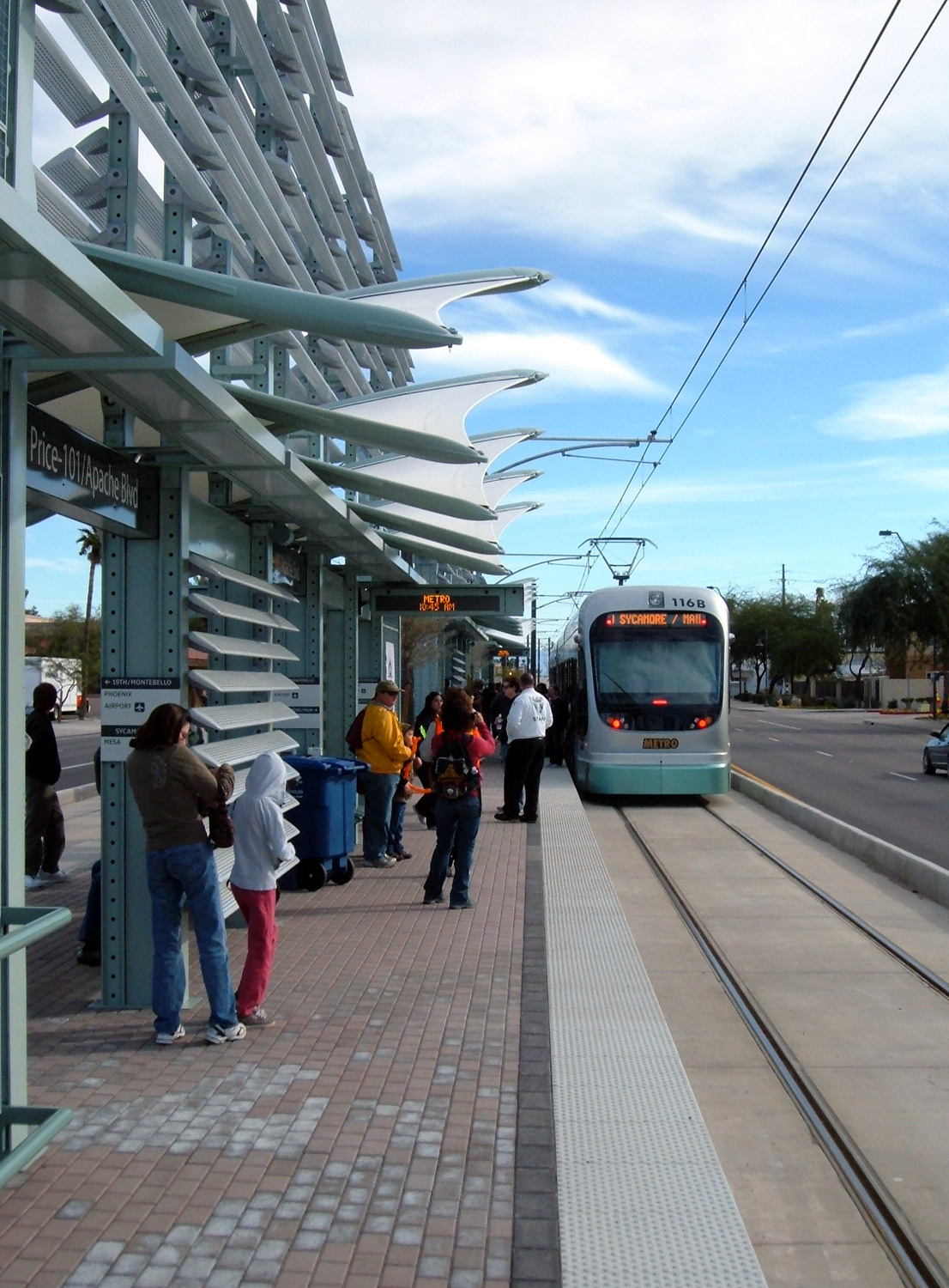
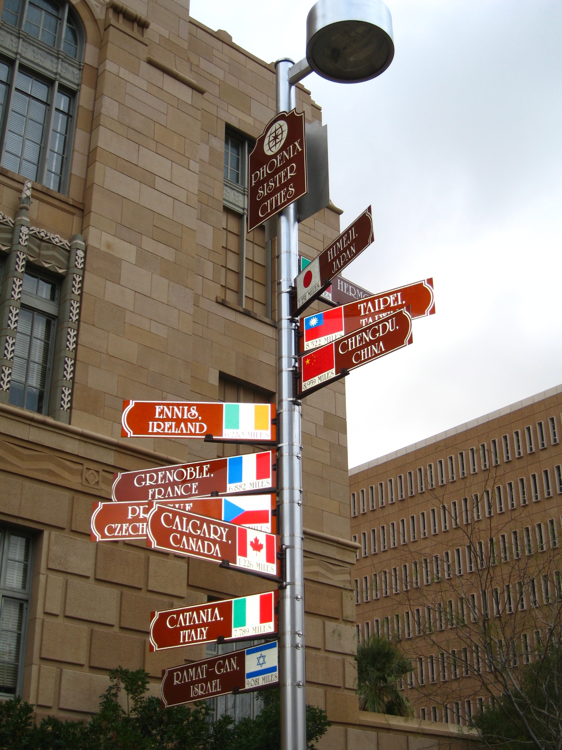

Wikimedia Foundation. 2010.