- Hiram M. Chittenden Locks
-
Chittenden Locks and Lake Washington Ship Canal
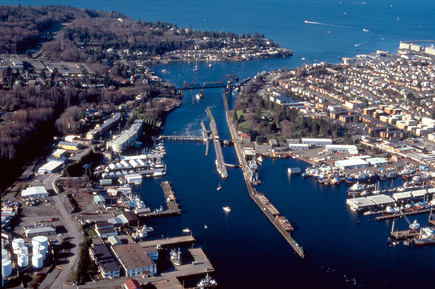
 An aerial view of the locks, facing west
Location: Salmon Bay, Seattle, Washington Built: 1906 Architect: Multiple Architectural style: Late 19th And 20th Century Revivals, Other Governing body: Army Corps of Engineers NRHP Reference#: 78002751[1] Added to NRHP: December 14, 1978 The Hiram M. Chittenden Locks are a complex of locks that sit at the west end of Salmon Bay, part of Seattle's Lake Washington Ship Canal.[2] They are known locally as the Ballard Locks[3][4] after the neighborhood to their north. (Magnolia lies to the south.)
The locks and associated facilities serve three purposes:
- To maintain the water level of the fresh water Lake Washington and Lake Union at 20–22 feet above sea level[2][3] (Puget Sound's mean low tide).[citation needed]
- To prevent the mixing of sea water from Puget Sound with the fresh water of the lakes (saltwater intrusion).[5]
- To move boats from the water level of the lakes to the water level of Puget Sound, and vice versa.[6]
The complex includes two locks, a small (30 x 150 ft, 8.5 x 45.7 meter) and a large (80 x 825 ft, 24.4 x 251.5 meter).[7] The complex also includes a (235-foot, 71.6 meter) spillway with six (32 x 12-foot (3.7 m), 9.8 x 3.7 meter) gates to assist in water-level control.[7] A fish ladder is integrated into the locks for migration of anadromous fish, notably salmon.[6][8]
The grounds feature a visitors center,[9] as well as the Carl S. English, Jr., Botanical Gardens.[10]
Operated by the U.S. Army Corps of Engineers,[11] the locks were formally opened on July 4, 1917,[12] although the first ship passed on August 3, 1916.[13] They were named after U.S. Army Major Hiram Martin Chittenden, the Seattle District Engineer for the Corps of Engineers from April 1906 to September 1908.[9] They were added to the National Register of Historic Places in 1978.[1]
Contents
The locks proper
 The Chittenden Locks shortly after their construction. The Carl P. English Gardens had not yet been started. The inset shows the nearby Fishermen's Terminal.
As noted above, the complex includes two locks, a small (30 x 150 ft, 8.5 x 45.7 meter) and a large (80 x 825 ft, 24.4 x 251.5 meter).[7] Using the small lock when boat traffic is low conserves fresh water during summer, when the lakes receive less inflow. Having two locks also allows one of the locks to be drained for maintenance without blocking all boat traffic.
The locks can elevate a 760-foot (230 m) by 80-foot (24 m) wide vessel 26 feet (7.9 m), from the level of Puget Sound at a very low tide to the level of freshwater Salmon Bay, in 10–15 minutes. The locks handle both pleasure boats and commercial vessels, ranging from kayaks to fishing boats returning from the Bering Sea to cargo ships. Over 1 million tons of cargo, fuel, building materials, and seafood products pass through the locks each year.[4]
How the locks work
 How the locks work; see article text.
Vessels passing from the freshwater lakes (Lakes Washington and Union) to Puget Sound enter the lock chamber through the open upper gates (A in the accompanying diagram). The lower gates (B) and the draining valve (D) are closed. The vessel is assisted by the lockwall attendants who assure it is tied down and ready for the chamber to be drained.[2]
Next, the upper gates (A) and the filling valve (C) are closed and the draining valve (D) is opened allowing water to drain via gravity out to Puget Sound.[2]
When the water pressure is equal on both sides of the gate, the lower gates (B) are opened, allowing the vessels to leave the lock chamber.[2]
The process is reversed for upstream locking.[2]
Spillway
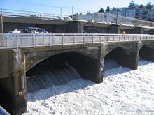 Spillway
South of the small lock is a spillway dam with tainter gates used to regulate the freshwater levels of the ship canal and lakes. The gates on the dam release or store water to maintain the lake within a two-foot range of 20 to 22 feet (6.7 m) above sea level. This elevation is necessary for floating bridges, mooring facilities, and vessel clearances under bridges.[2]
"Smolt flumes" in the spillway help young salmon to pass safely downstream.[14] Higher water levels are maintained in the summer to accommodate recreation as well as to allow the lakes to act as a water storage basin in anticipation of drought conditions.[2]
Salt water barrier
If excessive salt water were allowed to migrate into Salmon Bay, the salt could eventually damage the freshwater ecosystem. To prevent this, a basin was dredged just above (east of) the large lock. The heavier salt water settles into the basin and drains through a pipe discharging downstream of the locks area. In 1975, the saltwater drain was modified to divert some salt water from the basin to the fish ladder, where it is added via a diffuser to the fish ladder attraction water; see below.[5]
To further restrict saltwater intrusion, in 1966 a hinged barrier was installed just upstream of the large lock. This hollow metal barrier is filled with air to remain in the upright position, blocking the heavier salt water. When necessary to accommodate deep-draft vessels, the barrier is flooded and sinks to the bottom of the chamber.[6]
Fish ladder
 Attraction water is visible in two places in this photo; the lower part of the fish ladder snakes around the diffuser well.
 Fish ladder viewing room.
 View from above of the part of the fish ladder over the viewing room.
The fish ladder at the Chittenden locks is unusual—materials published by the federal government say "unique"—in being located where salt and fresh water meet. Normally, fish ladders are located entirely within fresh water.[15]
When the Corps of Engineers first built the locks and dam, they changed the natural drainage route of Lake Washington. The locks and dam blocked all salmon runs out of the Cedar River watershed. (Pacific salmon are anadromous: they hatch in lakes, rivers, and streams—or, nowadays fish hatcheries—migrate to sea, and only at the end of their life return to fresh water to spawn.) To correct this problem, the Corps built a fish ladder as the locks were constructed to allow salmon to pass around the locks and dam.[15]
The ladder was designed to use attraction water: fresh water flowing swiftly out the bottom of the fish ladder, in the direction opposite which anadromous fish migrate at the end of their lives. However, the attraction water from this first ladder was not effective. Instead, most salmon used the locks. This made them an easy target for predators; also, many were injured by hitting the walls and gates of the locks, or by hitting boat propellers.[15]
The Corps rebuilt the fish ladder in 1976 by increasing the flow of attraction water and adding more weirs: most weirs are now one foot higher than the previous one. The old fish ladder had only 10 "steps"; the new one has 21. A diffuser well mixes salt water in gradually through the last 10 weirs. As a part of the rebuilding, the Corps also added an underground chamber with a viewing gallery.[14][15][16]
The fish approaching the ladder smell the attraction water, recognizing the scent of Lake Washington and its tributaries. They enter the ladder, and either jump over each of the 21 weirs or swim though tunnel-like openings. They exit the ladder into the fresh water of Salmon Bay. They continue following the waterway to the lake, river, or stream where they were born. Once there, the females lay eggs, which the males fertilize. Most salmon die shortly after spawning.[15][17]
The offspring remain in the fresh water until they are ready to return to the ocean as smolts. In a few years, the surviving adults return, climb the fish ladder, and reach their spawning ground to continue the life cycle.[17] Of the millions of young fish born, only a relative few survive to adulthood. Causes of death include natural predators, commercial and sport fishing, disease, low stream flows, poor water quality, flooding, and concentrated developments along streams and lakes.[18]
Visitors to the locks can observe the salmons' progress through windows along their route. Although the viewing area is open year-round, the "peak" viewing time is during spawning season, from about the beginning of July through mid-August. A public art work, commissioned by the Seattle Arts Commission, provides literary interpretation of the experience through recordings of Seattle poet Judith Roche's "Salmon Suite," a sequence of five poems tied to the annual migratory sequence of the fish.
 The fish ladder in profile. The actual fish ladder makes several right angle turns, which are not reflected in this diagram. The pamphlet shows the height of each weir. The last three weirs are adjustable to the level of Salmon Bay. Salt water is mixed with fresh water by the diffuser well in weirs indicated here by a darker gray. The longest weir in the ladder is for the viewing window.[16]
Gallery: Migratory fish
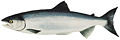
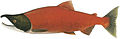
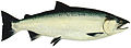
Among the species of salmon migrating routinely through the ladder at the Chittenden Locks are Chinook (king) Salmon (Oncorhynchus tshawytscha), Coho (silver) Salmon (Oncorhynchus kisutch), Sockeye (red) Salmon (Oncorhynchus nerka), and Steelhead (Oncorhynchus mykiss).[19]
Seattle salmon run viewing schedule at the Seattle Fish Ladder. Sockeye – June, July; Chinook and Coho – Sept, Oct; Steelhead – late fall and winter
-

Chinook: ocean phase
-

Chinook: male - freshwater phase
-
Sockeye: ocean phase
-
Sockeye: male - freshwater phase
-
Coho: ocean phase
-

Coho: male - freshwater phase
-

Steelhead: ocean phase
-

Steelhead: male - freshwater phase
Gallery: the facility
-

Dedication on 4 July 1917
-

The locks and the adjacent Commodore Park
-
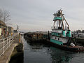
Boat and barge in the large lock
-

Control tower
-

Boat entering the small lock
-

Tying off at the small lock
-

Fish ladder
Notes
 The cover of the U.S. government pamphlet "Lake Washington Ship Canal Fish Ladder" depicts the fish ladder at the locks.
- ^ a b "National Register Information System". National Register of Historic Places. National Park Service. 2007-01-23. http://nrhp.focus.nps.gov/natreg/docs/All_Data.html.
- ^ a b c d e f g h "Lake Washington Ship Canal and Hiram M. Chittenden Locks", p. 2.
- ^ a b Ballard Locks, Seattle Virtual Tour, City of Seattle web site. Accessed 21 September 2007.
- ^ a b "Lake Washington Ship Canal: Hiram M. Chittenden Locks" (2006), p. 6.
- ^ a b "Lake Washington Ship Canal and Hiram M. Chittenden Locks", p. 2–3.
- ^ a b c "Lake Washington Ship Canal and Hiram M. Chittenden Locks", p. 3.
- ^ a b c "Lake Washington Ship Canal and Hiram M. Chittenden Locks", p. 8.
- ^ "The Lake Washington Ship Canal Fish Ladder", passim.
- ^ a b "Lake Washington Ship Canal and Hiram M. Chittenden Locks", p. 4.
- ^ "Lake Washington Ship Canal and Hiram M. Chittenden Locks", p. 5.
- ^ Sherrill Mausshardt and Glen Singleton, "Mitigating Salt-Water Intrusion through Hiram M. Chittenden Locks", Journal of Waterway, Port, Coastal and Ocean Engineering, Vol. 121, No. 4, July/August 1995, pp. 224-227 , (doi 10.1061/(ASCE)0733-950X(1995)121:4(224)). Abstract on site of American Society of Civil Engineers mentions that the locks are operated by the Corps. Accessed 21 September 2007.
- ^ Walt Crowley, Turning Point 11: Borne on 4 July: The Saga of the Lake Washington Ship Canal, HistoryLink.org Essay 3425, July 3, 2001. Accessed 21 September 2007.
- ^ Gordy Holt, Short Trips: Fascinating history sets the stage for a Ballard Locks outing, Seattle Post-Intelligencer, Last updated August 15, 2007. Accessed 21 September 2007.
- ^ a b "Lake Washington Ship Canal: Hiram M. Chittenden Locks" (2006), p. 8.
- ^ a b c d e "The Lake Washington Ship Canal Fish Ladder", p. 2. This document is in the public domain, and some of the wording here is almost verbatim from the pamphlet.
- ^ a b "The Lake Washington Ship Canal Fish Ladder", p. 6.
- ^ a b "The Lake Washington Ship Canal Fish Ladder", p. 3.
- ^ "The Lake Washington Ship Canal Fish Ladder", p. 4.
- ^ "The Lake Washington Ship Canal Fish Ladder", p. 5–6.
References
- "Lake Washington Ship Canal and Hiram M. Chittenden Locks" (pamphlet), U.S. Government Printing Office: 1999-791-887. As work of the Federal Government, this document is in the public domain, and some of the wording in this article is almost verbatim from the pamphlet.
- "The Lake Washington Ship Canal Fish Ladder" (pamphlet), U.S. Government Printing Office: 1996-792-501. As work of the Federal Government, this document is in the public domain, and some of the wording in this article is almost verbatim from the pamphlet.
- "Lake Washington Ship Canal: Hiram M. Chittenden Locks" (pamphlet), US Army Corps of Engineers, 2006. As work of the Federal Government, this document is in the public domain, and some of the wording in this article is almost verbatim from the pamphlet.
External links
- U.S. Army Corps of Engineers, Seattle District: Lake Washington Ship Canal and Hiram M. Chittenden Locks
- Chittenden Locks on SeattleWiki
- Virtual tour of Chittenden (Ballard) Locks on vrseattle.com: several 360° photographic panoramas of the locks.
U.S. National Register of Historic Places Topics Lists by states Alabama • Alaska • Arizona • Arkansas • California • Colorado • Connecticut • Delaware • Florida • Georgia • Hawaii • Idaho • Illinois • Indiana • Iowa • Kansas • Kentucky • Louisiana • Maine • Maryland • Massachusetts • Michigan • Minnesota • Mississippi • Missouri • Montana • Nebraska • Nevada • New Hampshire • New Jersey • New Mexico • New York • North Carolina • North Dakota • Ohio • Oklahoma • Oregon • Pennsylvania • Rhode Island • South Carolina • South Dakota • Tennessee • Texas • Utah • Vermont • Virginia • Washington • West Virginia • Wisconsin • WyomingLists by territories Lists by associated states Other Coordinates: 47°39′55.68″N 122°23′49.56″W / 47.6654667°N 122.3971°W
Categories:- Transportation in Seattle, Washington
- National Register of Historic Places in Seattle, Washington
- Locks of the United States
- Dams on the National Register of Historic Places
- Historic Civil Engineering Landmarks
- Buildings and structures in Seattle, Washington
- Buildings and structures on the National Register of Historic Places in Washington (state)


Wikimedia Foundation. 2010.