- Sligo
-
See also: Sligo (disambiguation)
Sligo
Sligeach— Town — Sligo at dusk Location in Ireland
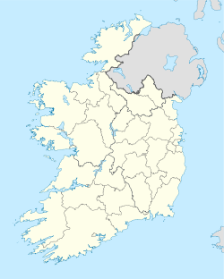
 Sligo
SligoCoordinates: 54°16′00″N 8°29′00″W / 54.2667°N 8.4833°WCoordinates: 54°16′00″N 8°29′00″W / 54.2667°N 8.4833°W Country Ireland Province Connacht County County Sligo Dáil Éireann Sligo–North Leitrim EU Parliament North–West Area[1] - Town 12.9 km2 (5 sq mi) Elevation 13 m (43 ft) Population (2006)[2] - Urban 17,892 - Rural 1,510 Irish Grid Reference G685354 Dialing code +353 71 Website sligoborough.ie Sligo (Irish: Sligeach, meaning "shelly place" — English pronunciation: /ˈslaɪɡoʊ/ sly-goh, Irish pronunciation: [ˈɕlʲɪɟəx]) is the county town of County Sligo in Ireland. The town is a borough and has a charter and a town mayor. It is sometimes referred to as a city, and sometimes as a town,[3][4] and is the second largest urban area in Connacht (after Galway).[5] The town is currently campaigning for city status.
Contents
History
Sligo's Irish name Sligeach - meaning shelly place - allegedly originates in the abundance of shellfish found in the river and its estuary, and from the extensive 'shell middens' or Stone Age food preparation areas in the vicinity.[6] [7] The river (now known as the Garavogue 'rough river' ) was also called the Sligeach.[7][8] The Ordnance Survey letters of 1836 state that "cart loads of shells were found underground in many places within the town where houses now stand". At that time shells were constantly being dug up during the construction of foundations for buildings. This whole area, from the river estuary at Sligo, around the coast to the river at Ballysadare Bay, is rich in marine resources which were utilised as far back as the Mesolithic period.
The significance of Sligo in the Early Neolithic period is demonstrated by the abundance of ancient sites close by, not least Carrowmore, on the Cuil Irra peninsula, 3 km (1.9 mi) from the town. The NRA excavation for the N4 Sligo Inner Relief Road in 2002 revealed an early Neolithic causewayed enclosure (c. 4000 B.C.) overlooking the town. It would have been enclosed by a ditch and palisade, and was perhaps an area of commerce and ritual. According to Edward Danagher, who excavated there, 'Magheraboy demonstrates the early Neolithic settlement of this area of Sligo, while the longevity of the activity on the site indicates a stable and successful population during the final centuries of the fifth millennium and the first centuries of the fourth millennium BC'.[9] Sligo town's first roundabout was constructed around a megalithic tomb (Abbeyquarter North, in Garavogue Villas [10]).
 An aerial view of Sligo.
 The Garavogue River and Rockwood Parade (right).
Maurice Fitzgerald, the Lord Chief Justice of Ireland, is generally credited with the establishment of the mediaeval town of Sligo, building the Castle of Sligo in 1245. Sligo was burned several times during the mediaeval period. In 1257, Geoffry O'Donnell, chief of Tirconnell, marched on Sligo and burned the town. The annalists refer to this Sligo as a sradbhaile ('street settlement'): a village or town not defended by an enclosure or wall, and consisting of one street. By the mid 15th century the town and port had grown in importance. Amongst the earliest preserved specimens of written English in Connacht is a receipt for 20 marks, dated August 1430, paid by Saunder Lynche and Davy Botyller, to Henry Blake and Walter Blake, customers of "ye King and John Rede, controller of ye porte of Galvy and of Slego". Over a century later an order was sent by the Elizabethan Government to Sir Nicholas Malby, Knight, willing him to establish "apt and safe" places for the keeping of the Assizes & Sessions, with walls of lime & stone, in each county of Connacht, "judging that the aptest place be in Sligo, for the County of Sligo…"[11] Sligo Abbey, the Dominican Friary, is the only mediaeval building left standing in the town (Bram Stoker, whose mother came from Sligo, has cited ghost stories about the abbey as part of the inspiration for his infamous novel, Dracula). The abbey was founded by Fitzgerald in 1253 but was accidentally destroyed by fire in 1414, and was rebuilt in its present form. When Frederick Hamilton’s soldiers sacked Sligo Town in 1642, the Abbey was burned and everything valuable in it was destroyed. Much of the structure, including the choir, carved altar and cloisters remains.
Between 1847 and 1851 over 30,000 people emigrated through the port of Sligo.[12] On the Quays, overlooking the Garavogue River, is a sculpted memorial to the emigrants. This is one of a suite of three sculptures commissioned by the Sligo Famine Commemoration Committee to honour the victims of the Great Famine. A plaque in the background, headed 'Letter to America, January 2, 1850' tells one family's sad story: "I am now, I may say, alone in the world. All my brothers and sisters are dead and children but yourself... We are all ejected out of Mr. Enright's ground... The times was so bad and all Ireland in such a state of poverty that no person could pay rent. My only hope now rests with you, as I am without one shilling and as I said before I must either beg or go to the poorhouse... I remain your affectionate father, Owen Larkin. Be sure answer this by return of post."
Sligo town recently highlighted its connections with Goon Show star and writer Spike Milligan by unveiling a plaque at the former Milligan family home at Number 5 Holborn Street.
Media
There are three local newspapers in Sligo: the Sligo Weekender - out every Tuesday, the Northwest Express -out every Thursday and The Sligo Champion - out every Wednesday. The area has a local radio station, Ocean FM, which also broadcasts to Counties Donegal, Leitrim and Sligo. Sligo is also served by the West youth radio station I102-104FM.
Education
Sligo has 6 secondary schools (one of which is located outside the borough boundary) and 42 primary schools (one of which is located outside the borough boundary). St Angela's College and Institute of Technology, Sligo are third-level colleges located in or near the town.
Transport
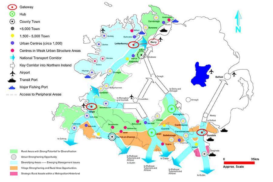
 Sligo Hub & Gateway access
The main roads to Sligo are the N4 to Dublin, the N15 to Lifford, County Donegal; and the N16 to Blacklion, County Cavan. The section of the N4 road between Sligo and Collooney is made up of dual carriageway. The first phase of this road was completed in January 1998, bypassing the towns of Collooney and Ballysadare. An extension to this road was completed in September 2005, and is known as the Sligo Inner Relief Road.
O'Connell Street - the main street in the town - was pedestrianised on 15 August 2006. Plans for the proposed redevelopment and paving of this street were publicly unveiled on 23 July 2008 in The Sligo Champion. The newspaper later revealed that people were not in favour of the pedestrianisation of the street. The street was reopened to traffic in December 2009.
Sligo acquired a rail link to Dublin on 3 December 1862, with the opening of Sligo railway station.[13] Connections to Enniskillen and the north followed in 1881 and Limerick and the south in 1895. The line to Enniskillen closed in 1957 and passenger services to Galway-Ennis-Limerick closed in 1963. For many years CIE kept the latter line open for freight traffic, and although it is now disused, it forms part of the Western Rail Corridor redevelopment project. In 1966 Sligo railway station was renamed Mac Diarmada Station after Irish rebel Seán Mac Diarmada from County Leitrim.[14] Iarnród Éireann, Ireland's national railway operator, runs inter-city rail services between Sligo and Dublin Connolly.
Sligo Town and County Sligo are served by Sligo Airport, 8 km (5.0 mi) from Sligo town and close to Strandhill village, though no scheduled flights currently operate out of the airport.
Sligo port handles small ships up to 2,000 metric tons deadweight (DWT).[15]
Bus Éireann operates 4 bus routes in the town: one serves the town centre and one which serves the western area of the town. The other two routes run from the town to Strandhill and Rosses Point respectively.[4]
Development
Like many towns in the west of Ireland, Sligo suffered for many years from a lack of development, mainly[citation needed] due to its relative isolation. However this has improved in most sectors in the past decade.
Development has occurred along the river Garavogue with the regeneration of J.F.K. Parade (2000), Rockwood Parade (1993–1997), and The Riverside (1997–2006), as well as two new footbridges over the river, one on Rockwood Parade (1996) and one on The Riverside (1999).
Twinning
Sligo is twinned with the following places:
 Crozon, Brittany, France
 Illapel, Choapa Province, Chile
 Kempten im Allgäu, Bavaria, Germany
 Tallahassee, Florida, United States[16]
Gallery
- Images of Sligo
-

Yeats' statue outside the Ulster Bank
-

The choir of Sligo Abbey
-

The Sligo Famine Memorial on the Quays
-

Clock tower of the Roman Catholic Cathedral
-

The Roman Catholic Cathedral
-

Sligo Borough Council
-

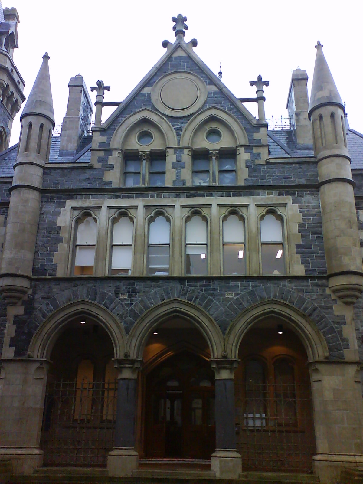
The Court House
-

Sligo Post Office in 1996
See also
- Development of Sligo
- List of Sligo people
- List of towns and villages in Ireland
- Sligo Jail
- Sligo Rovers F.C.
References
- ^ "Table 6 - Population and area of each Province, County, City, urban area, rural area and Electoral Division, 2002 and 2006" (PDF). Census 2006, Volume 1 - Population Classified by Area. Central Statistics Office. 2007-04-26. pp. 111–112. http://www.cso.ie/census/documents/census2006_Table_6.pdf. Retrieved 2007-10-10.
- ^ "Table 7 - Persons in each town of 1,500 population and over, ..." (PDF). Census 2006, Volume 1 - Population Classified by Area. Central Statistics Office. 2007-04-26. p. 119. http://www.cso.ie/census/documents/census2006_Table_7_and_12.pdf. Retrieved 2008-02-13.
- ^ "Sligo town? City? Does it matter?". Sligo Weekender. Sligo Weekender Ltd. 2008-02-05. http://www.sligoweekender.ie/news/story/?trs=mheyqlsnmh. Retrieved 2010-02-09.
- ^ a b "City/Town Services - Bus Éireann". Bus Éireann printed timetables. http://www.buseireann.ie/bubble.php?id=59#Sligo. Retrieved 2010-02-09.
- ^ "County Profiles - Sligo". Western Development Commission. Archived from the original on 2007-11-18. http://web.archive.org/web/20071118174420/http://www.wdc.ie/countyprofiles_sligo.html. Retrieved 2008-05-13.
- ^ Wood-Martin's History of Sligo, 1882
- ^ a b "History of Sligo". Sligo Borough Council - About Us. http://www.sligoborough.ie/asp/AboutUs/HistorySligo.asp. Retrieved 2008-05-13. "The scallop shells [...] were once abundant in the estuary at the mouth of the Garavogue - a river once known as the 'Sligeach', or 'shelly place', giving Sligo its name"
- ^ Joyce, LL.D., M.R.I.A., P.W.. "Irish Local Names Explained". Library Ireland. libraryireland.com. Archived from the original on 2007-04-07. http://web.archive.org/web/20070407182550/http://www.booksulster.com/library/plnm/placenamesS.php. Retrieved 2007-07-03. "Sligo; (not correct)named from the river: Sligeach [Sliggagh], F. M., shelly river (slig, a shell).It is more likely to have originated from "Slige atha da" anglice "the place of two fords or crossings. These were at Cartron and Ballisodare (Ballydrehid) in the days when travel was on shanks mare. Ireland was heavily wooded hence most travel was coastal. Sligo was a place of importance on the north/south way. The Cuill Iarra peninsula lies in the middle between the Sligo River and Ballisodare Bay, with the Carrowkeel Megalithic Cemetery in the middle. This cemetery would have been an important place of pilgrimage for travellers to visit. Through elision etc the sound of the name altered down the centuries, hence the 'shell theory'."
- ^ Danaher, Edward (2007). Monumental beginnings: the archaeology of the N4 Sligo Inner Relief Road. Wordwell Books. ISBN 978-1-905569-15-1.
- ^ Bergh, Stefan (1995). Landscape of the monuments. A study of the passage tombs in the Cúil Irra region, Co. Sligo, Ireland. Stockholm: Riksantikvarieämbetet Arkeologiska Undersökningar. ISBN 91-7192-945-2.
- ^ Wood-Martin, W.G. (1892). History of Sligo, County and Town. From the accession of James 1. to the Revolution of 1688.. Vol. 2. Dublin: Hodge & Figgis.
- ^ Norton, Desmond (2003). "Lord Palmerston and the Irish Famine Emigration: A Rejoinder". Cambridge University Press, the Historical Journal (46): 155–165.
- ^ "Sligo station" (PDF). Railscot - Irish Railways. http://www.railscot.co.uk/Ireland/Irish_railways.pdf. Retrieved 2007-09-07.
- ^ Gilligan, James (2006-12-19). "Restore name to Sligo rail station". Sligo Weekender. Sligo Weekender Ltd. http://www.sligoweekender.ie/news/story.asp?j=31127. Retrieved 2007-07-03.
- ^ "A Profile of County Sligo". Sligo County Enterprise Board. http://www.sligoenterprise.ie/sligo_county_profile.html#sea. Retrieved 2007-02-09.
- ^ "Tallahassee Irish Society". http://www.irishtallahassee.org. Retrieved 2008-05-15.
External links
- Official site - Sligo Borough Council
- Sligo Heritage
- Sligo Town and the surrounding area
- Sligo Town on the Net
- CraicTunes.ie - Traditional & Contemporary Music Downloads from Sligo
- Sligo travel guide from Wikitravel
 "Sligo. The capital of County Sligo, Ireland". New International Encyclopedia. 1905.
Places in County Sligo County town: Sligo Towns Sligo
Villages and
TownlandsAchonry · Aclare · Aughris · Ballaghnatrillick · Ballinafad · Ballintogher · Ballymote · Ballynary · Ballysadare · Banada · Beltra · Bunninadden · Carney · Carrickbanagher · Carrowhubbock South · Castlebaldwin · Cliffoney · Cloonacool · Collooney · Coolaney · Dromore West · Drumcliffe · Easky · Enniscrone · Geevagh · Grange · Gorteen · Kilglass · Killeenduff · Kilmactigue · Keash · Monasteraden · Mullaghmore · Rathcormack · Riverstown · Rosses Point · Rathbraughan · Skreen · Strandhill · Tourlestrane · Tubbercurry · Tullavilla
List of townlands in County Sligo · Category:Mountains and hills of County Sligo · Category:Rivers of County Sligo · Category:Geography of County Sligo Categories:- Port cities and towns in the Republic of Ireland
- Towns and villages in County Sligo
- Sligo (town)
- Horse racing venues in the Republic of Ireland
- County towns in the Republic of Ireland


Wikimedia Foundation. 2010.