- Greens Farms
-
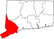
Greens Farms (rarely spelled in its original form, Green's Farms) is a neighborhood or section in the town of Westport in Fairfield County, Connecticut, United States.
The boundaries of the neighborhood, like those of most neighborhoods with no governmental status, are vague, but according to a New York Times article in 2001, "generally, a resident can confidently claim a Green's Farms address if the property lies within the area bounded by Hillspoint Road, the Fairfield town line and the Post Road". According to the same article, Turkey Hill Road and Morningside Drive are the heart of the neighborhood.[1]
It enjoys a temperate climate and has many ecological systems, including a salt marsh.
Greens Farms is the home to a private coeducational K-12 institution that bears its namesake: Greens Farms Academy. The Green's Farms Railroad Station is located on New Creek Road. Exit 18 of Interstate 95 serves the neighborhood. Sherwood Island State Park is at the western edge of Greens Farms. The Nyala Farms Corporate Center, north of Sherwood Island, is home to Terex Corporation, a Fortune 500 company, and Pequot Capital Management, a large hedge fund.
The First Congregational Church of Green's Farms, Green's Farms Railroad Station and The New York Times all use the apostrophe in the neighborhood name, which is used about half of the time. The Town of Westport, Connecticut state government and local newspapers do not.[1]
Famous residents of the neighborhood include Marlo Thomas and her husband, Phil Donahue, and the radio talk-show host Don Imus. Martha Stewart once owned a home on Turkey Hill Road, from which she taped a television program, but she moved after long-running controversies about the effect of her television production business on the neighborhood.[1]
Green's Farms Elementary School serves students in kindergarten through Grade 5 in a Gothic-style building with a newer wing on the back containing a library-media center, computer lab and gymnasium.[1]
History
The area was originally called Machamux ("beautiful land") by the Pequot people and then within the original boundaries of the Town of Fairfield. It was renamed Green's Farms in 1732 after one of the original five settlers (the "Bankside Farmers") in the area, John Green. The other Bankside Farmers were Thomas Newton and Henry Gray, who, together with Green, were the first three; then Daniel Frost (for whom Frost Point is named) and Francis Andrews. The Town of Fairfield officially gave permission to the Bankside Farmers to settle the land in 1648. They lived at the western end of what is now Beachside Avenue.[2]
On Green's Farms Road near Morningside Drive is the site of the first West Parish Common, the first schoolhouse, and the first meeting house. A small park is now there with a monument called Machamux Boulder.[2]
Over the next 50 years, more land was bought from the Indians and the community grew. In 1711 the "West Parish of Fairfield" was established with church and civil functions. In 1732, the area was renamed "Green's Farms" in honor of John Green, one of the original five Bankside Farmers.[2]
During the American Revolution, British soldiers burned down the Meeting House in a raid that also destroyed 15 houses and 11 barns.[1] The only church property saved was the communion service that Deacon Ebenezer Jesup rescued by hiding it in his well. For the next 10 years, members of the church met in private homes. In 1789 a new church building was erected at the church's current site at Hillandale Road. To raise money, pews were auctioned off. That building was replaced and, in April 1852, a fire forced another replacement the next year.[3]
Burial Hill Beach was acquired by the Town of Westport in 1893.[2]
In 1950, strong winds toppled the Congregational Church steeple, sending it through the roof of the Sunday School room, now the church parlor. The repair effort was expanded to include lighting for the steeple and a new Sunday School room which would double as a church social hall and the construction of a Sunday School wing. In 1961, the present social hall was added, together with more classrooms, a church office, ministers' offices and a choir room.[3]
Notes
- ^ a b c d e [1] Prevost, Lisa, "If You're Thinking of Living In/Green's Farms; A Country Atmosphere Near the Sound", article in the Real Estate Section, The New York Times, January 7, 2001, accessed November 18, 2007
- ^ a b c d [2] Web page titled "Colonial Green's Farms" at the Friends of Sherwood Island State Park Web site, accessed November 18, 2007
- ^ a b [3] Web page titled "The Congregational Church of Green's Farms / History of Green's Farms Congregational Church, accessed November 18, 2007
External links
- Greens Farms Association
- History page of the Greens Farms Association
- History of Green's Farms from the Friends of Sherwood Island Web site
- Congregational Church of Greens Farms
- New York Times article about Greens Farms
Municipalities and communities of Fairfield County, Connecticut Cities Bridgeport | Danbury | Norwalk | Shelton | Stamford
Towns Bethel | Brookfield | Darien | Easton | Fairfield | Greenwich | Monroe | New Canaan | New Fairfield | Newtown | Redding | Ridgefield | Sherman | Stratford | Trumbull | Weston | Westport | Wilton
Borough Other
communitiesAspetuck | Botsford | Black Rock | Branchville | Byram | Cannondale | Compo | Cos Cob | Cranbury | East Norwalk | Georgetown | Glenbrook | Glenville | Greenfield Hill | Greens Farms | Hattertown | Hawleyville | Huntington Center | Long Ridge | Lordship | Mianus | Old Greenwich | Riverside | Round Hill | Rowayton | Sandy Hook | Silvermine | South Norwalk | Southport | Stepney | Springdale
Coordinates: 41°07′26″N 73°19′09″W / 41.12389°N 73.31917°W
Categories:- Westport, Connecticut
- Neighborhoods in Connecticut

Wikimedia Foundation. 2010.