- Cloford Quarry
-
Cloford Quarry Site of Special Scientific Interest 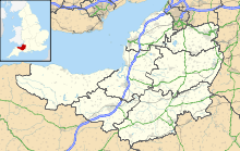
 Shown within Somerset
Area of Search Somerset Grid reference ST718444 Coordinates 51°11′53″N 2°24′18″W / 51.19811°N 2.40497°WCoordinates: 51°11′53″N 2°24′18″W / 51.19811°N 2.40497°W Interest Geological Area 39.92 ha (98.6 acres) Notification 1994 Natural England website Cloford Quarry (grid reference ST718444) is a 39.92-hectare (98.6-acre) geological Site of Special Scientific Interest to the south of the A361 approximately 350 metres (1,150 ft) north of the hamlet of Cloford and 1 kilometre (0.6 mi) west of Nunney on the Mendip Hills in Somerset. It was notified in 1994.
It is a Geological Conservation Review site important for the exposures of sediments of Triassic and Jurassic age which occur in major fissures within the Carboniferous Limestone laid down beneath the sea some 350 million years ago. Fissures, created by the uplift, folding and faulting of the Carboniferous Limestone, periodically opened and closed which were filled with deposits of Rhaetic, Hettangian, Sinemurian, Pliensbachian, Toarcian and Bathonian ages. The surface also contains large number of borings made into it by bivalved molluscs living in the Jurassic seas. No other site in Britain shows such a variety and abundance of sediment-infilled fissures of this age.[1]
In 2006 planning permission was granted for continued extraction of limestone until 2042.[2]
Cloford Quarry was the main location used for the planet Lakertya in the Doctor Who story Time and the Rani.[3] Shots filmed here include the exterior of the Rani’s laboratory.
See also
References
- ^ English Nature citation sheet for the site (accessed 7 August 2006)
- ^ "winning and working of limestone, creation of a tunnel under the a361 and associated plant and works on land at cloford and crees quarry". Mendip. Somerset County Council. http://www.somerset.gov.uk/council/board11/2006%20october%203%20item%205%20winning%20&%20working%20of%20limestone%20at%20cloford%20&%20crees%20quarry.htm. Retrieved 2008-10-19.
- ^ "Cloford Quarry". Dr Who Locations Guide. http://www.doctorwholocations.net/locations/clofordquarry. Retrieved 5 March 2010.
External links
- English Nature website (SSSI information)
Summary SSSIs Ben Knowle · Blue Anchor to Lilstock Coast · Brean Down · Brimble Pit and Cross Swallet Basins · Bruton Railway Cutting · Cheddar Complex · Cloford Quarry · Cook's Wood Quarry · Crook Peak to Shute Shelve Hill · Doulting Railway Cutting · Emborough Quarries · Glenthorne · Godminster Lane Quarry and Railway Cutting · Greylake · Ham Hill · Hobbs Quarry · Holwell Quarries · Hurcott Farm · Hurcott Lane Cutting · Lamb Leer · Langport Railway Cutting · Laycock Railway Cutting · Leighton Road Cutting · Low Ham · Maes Down · Maesbury Railway Cutting · Miller's Hill, Milborne Wick · Moon's Hill Quarry · Priddy Caves · Priddy Pools · Rodney Stoke SSSI · Sandpit Hole and Bishop's Lot · Seavington St Mary · Shepton Montague Railway Cutting · Snowdon Hill Quarry · St. Dunstan's Well Catchment · Thrupe Lane Swallet · Vallis Vale · Viaduct Quarry · Windsor Hill Quarry · Wookey Hole · Wookey Station · Wurt Pit and Devil's Punchbowl
Neighbouring areas Avon · Devon · Dorset · Wiltshire
Categories:- Mendip Hills
- Sites of Special Scientific Interest in Somerset
- Sites of Special Scientific Interest notified in 1994
- Mining in Somerset
- Quarries in the United Kingdom

Wikimedia Foundation. 2010.