- Cross River Tram
-
Cross River Tram 
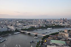
Waterloo Bridge, the planned crossing point for the tram over the River ThamesInfo Owner Transport for London Locale Camden, Southwark & Lambeth, London, England, UK Transit type Tram Operation Operation will start Abandoned proposal/On Hold[1] Technical Track gauge Standard gauge Cross River Tram (formerly Cross River Transit) was a Transport for London proposal[2] for a 10-mile (16 km) tram system in London, England, UK. It was planned to run on a north-south route from Camden Town in the north, through Euston and King's Cross, to Peckham and Brixton in the south.
The Cross River Tram scheme was proposed to relieve overcrowding on the London Underground and was due to begin operation by 2016. The project was cancelled in 2008 due to funding problems.
Contents
Overview
The tram was planned to relieve overcrowding on the London Underground, and to improve transport in areas currently without good public transport, such as the Aylesbury Estate in Southwark, to support regeneration.
Trams would have run up to every 4 minutes on each branch, giving a 2 minute service through central London at peak times.
On hold
On 18 July 2007, former London Mayor Ken Livingstone told the London Assembly[3] that he had asked TfL to consider splitting the implementation by building the southern section in advance of the northern section; it was not, however, clear where such a split would be. In May 2008, Livingstone's successor as mayor, Boris Johnson, announced that he intended to review the project in light of the lack of central government funding for the planned route[4].
On 6 November 2008, Transport for London announced that the Cross River Tram would not be built. In a statement, they said: "Given the lack of funding available to implement the project and the likelihood of not securing additional third party funding, TfL is not in a position to develop the scheme any further." [5] Currently (as of July 2010) on the Transport for London website, the project is said to be on hold.[1]
Proposed route
Cross River Tram (outline of proposals) Legend


 Camden Town


 Mornington Cres.


 Euston
King's Cross Tavistock Square Russell Square HolbornAldwych Waterloo Bridge 
River Thames  South Bank
Waterloo Lambeth NorthSt George's Circus Imperial War Museum Elephant & Castle Kennington Cross 
 Oval
OvalHeygate Street Thurlow Street 
Wells Way Burgess Park Southampton Way Chandler Way 
Peckham StockwellBrixton Road Brixton Pope's Rd Brixtonterminus St Matthew's Rd In late 2006 and early 2007 TfL consulted residents on their views of the following route options:
- Camden Town to Waterloo
Camden Town - Mornington Crescent - Euston - Tavistock Square - Russell Square - Holborn - Aldwych - South Bank - Waterloo
- Waterloo to Brixton
Waterloo - (either Lambeth North/Imperial War Museum/Kennington Cross or Elephant & Castle) - Oval - (either Stockwell or Brixton Road) - Brixton (either Pope's Road or Brixton St Matthew's Church)
- Waterloo to Peckham
Waterloo - St. George's Circus - Elephant & Castle - Heygate Street - Thurlow Street - (either Burgess Park/Chandler Way or Wells Way/Southampton Way) - Peckham
- Euston to King's Cross
Euston - (either Crowndale Road or Somers Town) - King's Cross
On 11 September 2007, TfL published the results of their 2007 consultation:[6]
- Euston to King's Cross - the majority of respondents preferred the route via Somers Town, except Somers Town's residents who preferred the Crowndale Road route
- Euston to Camden Town - the majority of respondents preferred the route via Camden High Street
- Waterloo to Oval - the majority of respondents preferred the route via Elephant & Castle
- Oval to Brixton - most respondents preferred the route via Brixton Road
- In Brixton town centre - the majority of respondents preferred the route via Effra Road
- Waterloo to Peckham - the majority of respondents preferred the route via Burgess Park
- In Peckham town centre - the majority of respondents preferred the route via Jocelyn Street and north of Peckham Library and Cerise Road as the terminus
References
- ^ a b Transport for London: Cross River Tram Accessed July 2010
- ^ Transport for London. Cross River Tram
- ^ http://www.london.gov.uk/webcast/jul07/mqt_180707.asx
- ^ Cross River Tram under review says Boris Johnson London SE1 Community Website - 29 May 2008
- ^ http://www.tfl.gov.uk/corporate/media/newscentre/archive/10231.aspx
- ^ Transport for London. Public consultation on route options September 2007
External links
- Cross River Tram Official TfL page (defunct, archived site)
- Cross River Tram - Cross River Partnership tram page
- Official consultation documents
- Local campaigns
- Cross River Tram - Peckham Vision (local community group wiki)
- PDF of proposed routes superimposed on map
- Cross River Tram information at alwaystouchout.com
UK light rail systems Tramways CurrentFutureEdinburgh TramsProposedCancelledBristol Supertram · CITI Belfast · Cross River Tram · Leeds Supertram · Merseytram · Penistone Line Tram-Train · West London Tram
Metro CurrentProposedNorth and West London Light Railway · West London OrbitalPreserved Black Country Living Museum · East Anglia Transport Museum · Heaton Park Tramway · National Tramway Museum · Seaton Tramway · Wirral Transport Museum · Wirral TramwayCategories:

Wikimedia Foundation. 2010.