- County Fermanagh
-
County Fermanagh
Contae Fhear Manach
Coontie Fermanagh
Coat of armsMotto: Feor Magh Eanagh 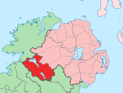
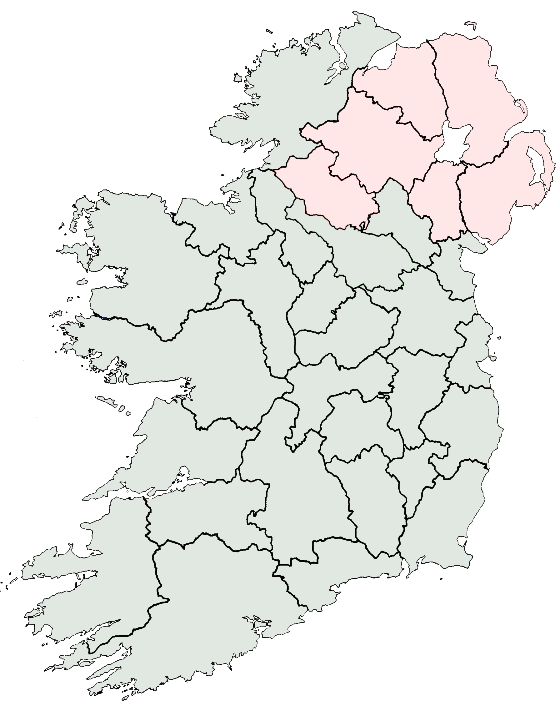
Country United Kingdom Region Northern Ireland Province Ulster County seat Enniskillen Area – Total 652.9 sq mi (1,691 km2) Area rank 25th Population (est.) 57,527 – Rank 28th[1] Contae Fhear Manach is the Irish name; Countie Fermanagh,[2] Coontie Fermanagh[3] and Coontie Fermanay[4] are Ulster Scots spellings (the latter used only by Dungannon & South Tyrone Borough Council). County Fermanagh (from Irish: Fear Manach meaning "men of Manach") is the only one of six counties that form Northern Ireland, situated in the north of the island of Ireland to not adjoin Lough Neagh. Lying within the historical province of Ulster, it is also one of the thirty-two traditional counties of Ireland.
The county covers an area of 1,691 km² (653 sq; mi), with a population of approximately 57,527, with Enniskillen its county town. It is a mainly rural landscape.
It is one of four counties of Northern Ireland presently to have a majority of the population from a Catholic background, according to the 2001 census.
Contents
Geography
Fermanagh borders County Tyrone to the north-east, County Monaghan to the south-east, County Cavan to the south-west, County Leitrim to the west and County Donegal to the north-west.
The county is situated mostly in the basin of the River Erne. It is approximately 120 km (75 mi) from Belfast and 160 km (99 mi) from Dublin.
History
The Annals of Ulster which cover medieval Ireland between AD 431 to AD 1540 were written at Belle Isle on Lough Erne near Lisbellaw.
Fermanagh was a stronghold of the Maguire clan and Donn Carrach Maguire (died 1302) was the first of the chiefs of the Maguire dynasty. However on the confiscation of lands relating to Hugh Maguire, Fermanagh was divided in similar manner to the other five escheated counties among Scottish and English undertakers and native Irish. The baronies of Knockinny and Maghenaboy were allotted to Scottish undertakers, those of Clankelly, Magherastephana and Lurg to English undertakers and those of Clanawley, Coole, and Tyrkennedy, to servitors and natives. The chief families to benefit under the new settlement were the families of Cole, Blennerhasset, Butler, Hume, and Dunbar.
Fermanagh was made into a county by statute of Elizabeth I, but it was not until the time of the Plantation of Ulster that it was finally brought under civil government.
Administration
Historical populations Year Pop. ±% 1659 7,102 — 1821 130,997 +1744.5% 1831 149,763 +14.3% 1841 156,481 +4.5% 1851 116,047 −25.8% 1861 105,768 −8.9% 1871 92,794 −12.3% 1881 84,879 −8.5% 1891 74,170 −12.6% 1901 65,430 −11.8% 1911 61,836 −5.5% 1926 57,984 −6.2% 1937 54,569 −5.9% 1951 53,044 −2.8% 1961 51,531 −2.9% 1966 49,886 −3.2% 1971 50,255 +0.7% 1981 51,594 +2.7% 1991 54,033 +4.7% 2001 57,527 +6.5% [5][6][7][8][9][10] Fermanagh District Council is the only one of the 26 district councils in Northern Ireland that contains all of the county it is named after. The district council also contains a small section of County Tyrone in the Dromore and Kilskeery road areas.
Fermanagh is part of the Fermanagh and South Tyrone Parliamentary Constituency, renowned for high levels of voting and for electing Provisional IRA hunger-striker Bobby Sands as a Member of Parliament in the Fermanagh and South Tyrone by-election, April 1981, shortly before his death.
Industry and tourism
Agriculture and tourism are two of the most important industries in Fermanagh. The main types of farming in the area are beef, dairy, sheep, pigs and some poultry. Most of the agricultural land is used as grassland for grazing and silage or hay rather than for other crops.
The waterways are extensively used by cabin cruisers, other small pleasure craft and anglers. The main town of Fermanagh is Enniskillen (Inis Ceithleann, 'Ceithleann's island'). The island town hosts a range of attractions including the Castle Coole Estate and Enniskillen Castle, which is home to the museum of The Royal Inniskilling Fusiliers and the 5th Royal Inniskilling Dragoon Guards.
Attractions outside Enniskillen include:
- Belleek Pottery
- Castle Archdale
- Crom Estate
- Devenish Island
- Florence Court
- Lough Navar Forest Park
- Marble Arch Caves
Fermanagh Orangeism
Main article: Fermanagh OrangeismThe Orange Institution is a Protestant fraternal organisation which has almost 100 lodges in Fermanagh. It consists of approximately 2200 male members and 300 female members.
Settlements
Large towns
(population of 18,000 or more and under 75,000 at 2001 Census)[11]
- none
Medium towns
(population of 10,000 or more and under 18,000 at 2001 Census)[11]
Small towns
(population of 4,500 or more and under 10,000 at 2001 Census)[11]
- none
Intermediate settlements
(population of 2,250 or more and under 4,500 at 2001 Census)[11]
Villages
(population of 1,000 or more and under 2,250 at 2001 Census)[11]
Small villages or hamlets
(population of less than 1,000 at 2001 Census)[11]
- Belcoo
- Bellanaleck
- Belleek
- Boho
- Brookeborough
- Corranny
- Derrygonnelly
- Derrylin
- Ederney
- Garrison
- Kesh
- Maguiresbridge
- Newtownbutler
- Rosslea
- Teemore
- Tempo
Subdivisions
Baronies
 Baronies of County Fermanagh within Northern Ireland with civil parish boundaries
 Main article: Baronies of Ireland
- Clanawley
- Clankelly
- Coole
- Knockninny
- Lurg
- Magheraboy
- Magherastephana
- Tirkennedy
Parishes
Main article: List of civil parishes of County FermanaghTownlands
Main article: List of townlands in County FermanaghMedia
Newspapers
- The Fermanagh Herald
- The Fermanagh News
- The Impartial Reporter
Radio
New Media
- Fermanagh.tv
Sport
 Fermanagh born Goalkeeper Roy Carroll playing with Derby County.Main article: Fermanagh GAA
Fermanagh GAA has never won an Senior Provincial or an All-Ireland title in any Gaelic games.
No Fermanagh clubs take part in the Northern Ireland football league system. Fermanagh clubs play in the Fermanagh & Western FA league systems. Famous Football players from Fermanagh include Roy Carroll, Harry Chatton and Kyle Lafferty.
Notable people
Famous people born, raised in or living in Fermanagh. (Please make additions in alphabetical order.)
- John Armstrong (1717–1795), born in Fermanagh, United States Congressman[12]
- Samuel Beckett (1906–1989), author and playwright (educated in Portora Royal School)
- Denis Parsons Burkitt (1911–1993), doctor – discoverer of Burkitt's lymphoma
- Roy Carroll (1977– ), association footballer
- Brendan Dolan (1973- ), Professional darts player for the PDC
- Charles Lawson (1959– ), actor (plays Jim McDonald in Coronation Street)
- Edward Cooney (1867–1960), evangelist and early leader of the Cooneyite and Go-Preachers
- Brian D'Arcy (1945– ), C.P. Passionist priest and media personality
- Adrian Dunbar (1958– ), actor
- Neil Hannon (1970– ), musician
- Robert Kerr (1882–1963), athlete & Olympic Gold Medalist
- Kyle Lafferty (1987– ), Northern Ireland International association footballer
- Terence MacManus (c. 1823–1861), leader in Young Irelander Rebellion of 1848
- Sean Quinn (1947– ), entrepreneur
- Oscar Wilde (1854–1900), author and playwright (educated in Portora Royal School)
- Gordon Wilson (1927–1995), Peace campaigner and Irish senator
See also
- Extreme points of the United Kingdom
- Abbeys and priories in Northern Ireland (County Fermanagh)
- People from County Fermanagh
- Castles in County Fermanagh
- Silver bands in County Fermanagh
- List of places in County Fermanagh
- List of parishes of County Fermanagh
- List of townlands in County Fermanagh
- Lord Lieutenant of Fermanagh
- High Sheriff of Fermanagh
Notes
- ^ http://cain.ulst.ac.uk/ni/popul.htm Background Information on Northern Ireland Society – Population and Vital Statistics
- ^ North-South Ministerial Council: 2004 Annual Report in Ulster Scots
- ^ Tourism Ireland: 2007 Yearly Report in Ulster Scots
- ^ Dungannon & South Tyrone Borough Council (Ulstèr-Scotch)
- ^ For 1653 and 1659 figures from Civil Survey Census of those years, Paper of Mr Hardinge to Royal Irish Academy March 14, 1865.
- ^ Census for post 1821 figures.
- ^ http://www.histpop.org
- ^ http://www.nisranew.nisra.gov.uk/census
- ^ Lee, JJ (1981). "On the accuracy of the Pre-famine Irish censuses". In Goldstrom, J. M.; Clarkson, L. A.. Irish Population, Economy, and Society: Essays in Honour of the Late K. H. Connell. Oxford, England: Clarendon Press.
- ^ Mokyr, Joel; O Grada, Cormac (November). "New Developments in Irish Population History, 1700–1850". The Economic History Review 37 (4): 473–488. doi:10.1111/j.1468-0289.1984.tb00344.x. http://www3.interscience.wiley.com/journal/120035880/abstract.
- ^ a b c d e f "Statistical classification of settlements". NI Neighbourhood Information Service. http://www.ninis.nisra.gov.uk/mapxtreme_towns/statistical%20classification.htm. Retrieved 23 February 2009.
- ^ Who Was Who in America, Historical Volume, 1607–1896. Chicago: Marquis Who's Who. 1963.
References
- Clogher Record
- "Fermanagh" A Dictionary of British Place-Names. A. D. Mills. Oxford University Press, 2003. Oxford Reference Online. Oxford University Press. Northern Ireland Public Libraries. 25 July 2007
- "Fermanagh" Encyclopædia Britannica. 2007. Encyclopædia Britannica Online Library Edition. 25 July 2007 <http://library.eb.co.uk/eb/article-9034047>.
- Fermanagh: its special landscapes: a study of the Fermanagh countryside and its heritage /Department of the Environment for Northern Ireland. – Belfast: HMSO, 1991 ISBN 0-337-08276-6
- Livingstone, Peadar. – The Fermanagh story:a documented history of the County Fermanagh from the earliest times to the present day – Enniskillen: Cumann Seanchais Chlochair, 1969.
- Lowe, Henry N. – County Fermanagh 100 years ago: a guide and directory 1880. – Belfast: Friar's Bush Press, 1990. ISBN 0-946872-29-5
- Parke, William K. – A Fermanagh Childhood. Derrygonnelly, Co Fermanagh: Friar's Bush Press, 1988. ISBN 0-946872-12-0
- Impartial Reporter
- Fermanagh Herald
External links
- County Fermanagh at the Open Directory Project
- Clogherhistory.ie
- Fermanagh GAA
- A folk history of Fermanagh
Counties and cities of Northern Ireland Counties - Antrim
- Armagh
- Down
- Fermanagh
- Londonderry
- Tyrone
Cities Counties of Ireland The counties are listed per provinceConnacht 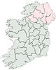
Munster Leinster Ulster Italics denote non-administrative counties. Brackets denote eponymous cities or non-traditional counties. † denotes counties of Northern IrelandCategories:- County Fermanagh
- Geography of County Fermanagh
- Counties of Northern Ireland


Wikimedia Foundation. 2010.