- Lancaster, Ohio
-
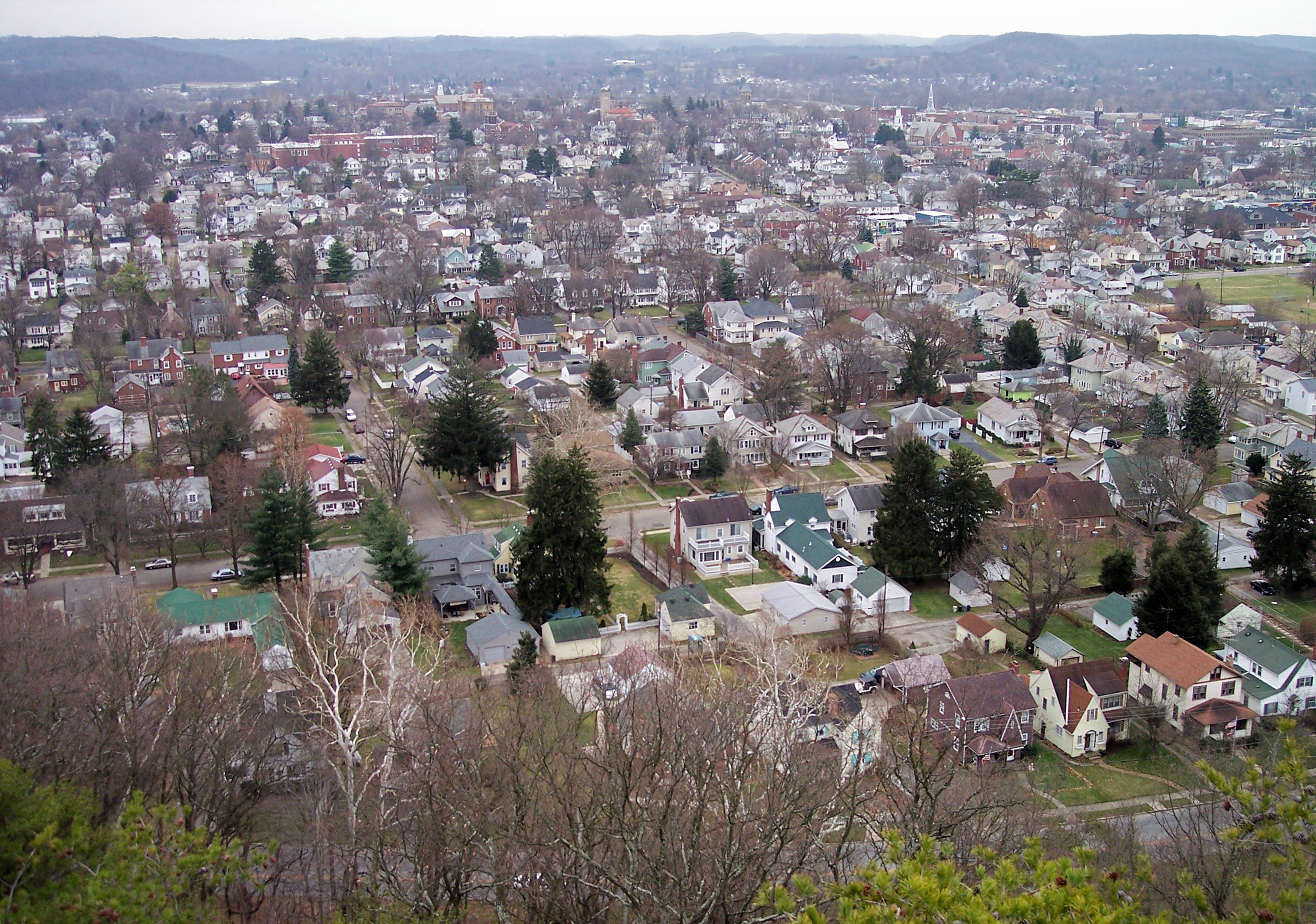
City of Lancaster, Ohio — City — Lancaster as viewed from Mount Pleasant in 2006
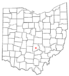
Nickname(s): "Glass City", "The 740","The Stir" Location of Lancaster, Ohio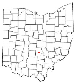
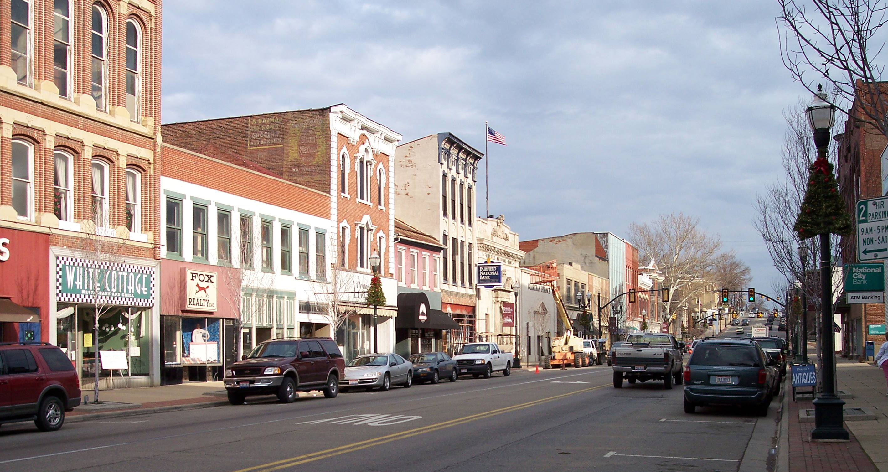
Coordinates: 39°43′9″N 82°36′19″W / 39.71917°N 82.60528°W Country United States State Ohio County Fairfield Government - Mayor David S. Smith (R) Area - Total 18.1 sq mi (46.8 km2) - Land 18.1 sq mi (46.8 km2) - Water 0.0 sq mi (0.02 km2) Elevation 879 ft (268 m) Population (2010) - Total 38,780 - Density 1,955.5/sq mi (755.02/km2) Estimated population is 40,000 Time zone EST (UTC−5) - Summer (DST) EDT (UTC−4) ZIP code 43130 Area code(s) 740 FIPS code 39-41720[1] GNIS feature ID 1048903[2] Website www.ci.lancaster.oh.us  West Main Street in downtown Lancaster in 2006
Lancaster (local pronunciation is
 /ˈlæŋkɨstər/ langk-i-stər (or even /ˈlæŋkstər/ langks-tər), rather than the wider American pronunciation /ˈlæn.kæstər/ lan-kast-ər) is a city in Fairfield County, Ohio, United States. As of the 2010 census, the city population was 38,780. It is located near the Hocking River, approximately 33 miles (53 km) southeast of Columbus, Ohio. It is the county seat of Fairfield County.[3] The current mayor of Lancaster is Republican David S. Smith, who took office in January 2004. In November 2007, Smith won reelection to a second four-year term commencing in January 2008.
Contents
History
The earliest known inhabitants of the southeastern and central Ohio region were the Hopewell, Adena, and Fort Ancient Native Americans, of whom little evidence survived, beyond the burial and ceremonial mounds built throughout the Ohio and Mississippi valleys. Many mounds and burial sites have also yielded archaeological artifacts.[4] (See also: Serpent Mound and Hopewell Culture National Historic Park, which though not located in Fairfield County proper, are close by.)
Prior to and immediately after European settlement, the land today comprising Lancaster and Fairfield County, Ohio was inhabited variously by the Shawnee, Iroquois, Wyandot, and other Native American tribes. It served as a natural crossroads for the inter-tribal and intra-tribal wars fought at various times.[5] (See also: Beaver Wars) Noted frontier explorer Christopher Gist reached the vicinity of Lancaster on January 19, 1751, when he visited the small Delaware town of "Hockhocking" nearby. Leaving the area the next day, Gist rode southwest to "Maguck," another Delaware town near Circleville.
Having been ceded to the United States by Great Britain after the American Revolution by the Treaty of Paris, the lands north of the Ohio River and west of the Appalachian Mountains became, in 1784, incorporated into the Northwest Territory. White settlers began to encroach on Native American lands in the Ohio Territory. As the new government of the United States began to cast its eye westward, the stage was set for the series of campaigns that culminated in the Battle of Fallen Timbers in 1794 , and the Treaty of Greenville in 1795. With pioneer settlement within Ohio made legal and safe from Indian raids, developers began to speculate in land sales in earnest.
Knowing that such speculation, combined with Congressional grants of land sections to veterans of the Revolution, could result in a lucrative opportunity, Ebenezer Zane in 1796 petitioned the US Congress to grant him a contract to blaze a trail through Ohio, from Wheeling, West Virginia, to Limestone, Kentucky, (near modern Maysville, Kentucky) a distance of 266 miles (428 km). As part of the deal, Zane was awarded square-mile tracts of land at the points where his trace crossed the Hocking, Muskingum, and Scioto rivers. Zane's Trace, as it has become known, was completed by 1797, and as Zane's sons began to carve the square-mile tract astride the Hocking into saleable plots, the city of Lancaster formally came into being in 1800. It predated the formal establishment of the State of Ohio by three years.
The initial settlers were predominantly of German stock, and emigrated from Pennsylvania. Ohio's longest continuously operating newspaper, the Lancaster Eagle-Gazette was born of a merger of the early Der Ohio Adler, founded about 1807, with the Ohio Gazette, founded in the 1830s. The two newspapers were ferocious competitors since they were on opposite sides of the American Civil War, as was the split populace of the city itself, until they merged seventy-two years after the war's end in 1937. This was shortly after the Gazette was acquired by glassmaker Anchor-Hocking. The newspaper is currently part of the Newspaper Network of Central Ohio, which is in turn a unit of Gannett Company, Inc.
Initially known as New Lancaster, and later shortened by city ordinance (1805), the town quickly grew; formal incorporation as a city came in 1831. The connection of the Hocking Canal to the Ohio and Erie Canal in this era provided a convenient way for the region's rich agricultural produce to reach eastern markets.
Modern Lancaster is distinguished by a rich blend of 19th-century architecture (best evidenced in historic Square 13, part of Zane's original plot) and natural beauty (best evidenced by the famous Standing Stone, today known as Mount Pleasant) with all the typical modern accoutrements of a small-medium-sized American city.
Notable natives and residents
Lancaster is the birthplace and/or hometown of:- Allan Anderson, Minnesota Twins baseball pitcher and 1988 American League ERA champion
- Mark Baltz, NFL Official 1989–present
- Bobby Carpenter, former Dallas Cowboys NFL linebacker, current Detroit Lions linebacker
- Rob Carpenter, NFL player New York Giants, Houston Oilers
- Hugh Boyle Ewing, Union Army Major General
- Thomas Ewing, first Secretary of the Interior, appointed by President Zachary Taylor
- Thomas Ewing, Jr., Union Army brigadier general
- Rebecca A. Fannin, journalist and author
- David Graf, actor, best known as Sgt. Eugene Tackleberry in the Police Academy series of films.
- Robert G. Heft, designer of the current 50-star flag of the United States, adopted by the Congress in 1960
- James A. Hill, retired U.S. Air Force general and former Vice Chief of Staff of the Air Force
- James Hyde, actor, daytime television show Passions, plays the role of Sam Bennett
- Ted H. Jordan, actor, Born in 1924, TV Show Gunsmoke, character Nathan Burke (1966–1975)
- Rex Kern, Football quarterback, Ohio State Buckeyes football 1968 National Championship team, All-American, College Football Hall of Fame (2007)
- Gene Cole, 1952 Olympic Silver Medalist
- Dr. Marc Wolfgang Miller, author, explorer, known for his cryptozoology expeditions
- Clarence E. Miller, a Republican Congressman from Ohio, serving January 3, 1967 to January 3, 1993
- Mary Murphy, ballroom dance champion, accredited dance judge, and a regular judge and choreographer on the television show So You Think You Can Dance
- Joe Ogilvie, PGA Golfer
- Richard F. Outcault, Cartoonist and creator of "Yellow Kid" and "Buster Brown"; who is known as the "Father of the American Comic Strip"
- Jacob Parrott, First recipient of the Medal Of Honor
- Stan Robinson, Television and radio personality; inducted into the Ohio Associated Press Broadcaster Hall of Fame in 2011
- John Sherman, Secretary of State, Secretary of the Treasury, and U.S. Senator, author of the Sherman Anti-Trust Act
- William Tecumseh Sherman, Union Army general
- Josh Kinniard, Football All-American
- Henry Stanbery, Attorney General, defender of President Andrew Johnson at his impeachment trial
- Lancaster was the home of the first newspaper published by Malcolm Forbes in 1941
- Additional Notables and Natives[6]
Society and culture
 Romanesque-style City Hall building downtown
- Lancaster is home to the Lancaster campus of Ohio University, offering a variety of two and four year baccalaureate degrees, and several master's programs. This continually expanding branch offers many courses in a variety of settings, including multi-site classes via the Ohio University Learning Network and online classes.
- Lancaster is home to the Lancaster campus of Daymar College,[7] offering two year degrees in various fields and career paths.
- Lancaster is home to the Lancaster Festival,[8] an 11-day arts and music festival.
- Lancaster is home to both the Decorative Arts Center of Ohio[9] and the Ohio Glass Museum,[10] both located within the downtown area.
- Lancaster is home to the Lancaster Eagle-Gazette newspaper.
- The 1948 20th Century Fox movie Green Grass of Wyoming was filmed at the Fairfield County Fairground in Lancaster, making it the first community in Ohio to act as the setting for a feature length Hollywood movie[citation needed].
- Lancaster is home to the Fairfield County Fair,[11] a week-long fair and the last (88th) county fair in Ohio each year, always on the second week of October. It features a variety of attractions including truck, tractor, and horse pulls, demolition derbies, concerts, bands, and horse races. The Fairfield County Fair also includes lots of food, exhibits, games, and rides for people of all ages.
Industry
Lancaster saw a dimunution of its industrial capacity during the 1980s. Industry in Lancaster includes:
Glass
Agriculture
Fiberglass
Cereal production
- Ralston Foods
Meters and regulators
Sites of interest
Mount Pleasant
A famous Lancaster landmark is Mount Pleasant, a 250-foot (76 m) high sandstone bluff called "Standing Stone" by earlier Native American peoples. It is located in Rising Park, a large city park on the city's north side. It is possible to climb to the top of Mount Pleasant by following a short marked trail from the park through the woods that cover the bluff's other sides. There is also a cave known unofficially as "Devils Kitchen" in the front in which braver people are willing to climb about 20 feet (6.1 m) using only shallow "bear claws". Experienced rock climbers have climbed the sandstone face of the bluff many times as well. Once one has reached the top, there is a lookout area from which one can see over great distances, and take in not just a panoramic view of the nearby Fairfield County fairgrounds and much of the city of Lancaster, but the changing landscape of Central Ohio as well—from the relatively flat farmlands north of Lancaster to the wooded hills lying south of the city.
Museums
AHA! A Hands on Adventure
AHA! is a children's museum founded in 2006 whose sole mission is to surround children and the adults in their lives with a hands-on, interactive, playful and educational environment that invites curiosity, allows exploration, encourages participation and celebrates the child-like wonder in us all.[12]
Georgian Museum
Originally built in 1832 for the Maccracken Family, this Federal home is constructed predominantly of brick and local limestone. Converted into a museum, it is now furnished as it would have been in the 1830s with some original pieces and numerous early Fairfield County, Ohio items. Located in one of Lancaster's three National Historic Districts, the structure mixes elements of American, Georgian and Regency architecture.[13]
The Decorative Arts Center of Ohio
The Decorative Arts Center of Ohio is a not-for-profit museum whose mission is to foster knowledge and appreciation of the decorative arts; celebrate the architecture and heritage of the Reese-Peters House; and enhance the vitality and integrity of historic Lancaster. The Center provides exhibitions, public programs, art classes and workshops for all ages, and a focus for research and communication about the decorative arts of Ohio.[14]
Ohio Glass Museum
Opened in 2002, the Ohio Glass Museum is located in historic downtown Lancaster and dedicated to recording the history of the glass industry, which for over 100 years has been one of the mainstays of the economy of Fairfield County.[15]
Sherman House
Lancaster was the birthplace of Civil War General William Tecumseh Sherman and his brother, Senator John Sherman. The house in which they were born has been converted into a museum, housing both articles related to the life of General Sherman and Civil War artifacts. Originally built in 1811, this frame house was expanded by the Sherman family in 1816 and again with an additional brick front in 1870.[16]
Geography
Lancaster is located at 39°43′9″N 82°36′19″W / 39.71917°N 82.60528°W (39.719297, -82.605293)[17]. According to the United States Census Bureau, the city has a total area of 18.1 square miles (47 km2), of which, 18.1 square miles (47 km2) of it is land and 0.06% is water.
Demographics
Historical populations Census Pop. %± 1830 1,530 — 1840 3,272 113.9% 1850 3,483 6.4% 1860 4,308 23.7% 1870 4,725 9.7% 1880 6,803 44.0% 1890 7,555 11.1% 1900 8,991 19.0% 1910 13,093 45.6% 1920 14,706 12.3% 1930 18,716 27.3% 1940 21,940 17.2% 1950 24,180 10.2% 1960 29,916 23.7% 1970 32,911 10.0% 1980 34,925 6.1% 1990 34,507 −1.2% 2000 35,335 2.4% Est. 2008 36,976 4.6% As of the census[1] of 2000, there were 35,335 people, 14,852 households, and 9,564 families residing in the city. The population density was 1,955.9 people per square mile (755.0/km²). There were 15,891 housing units at an average density of 879.6 per square mile (339.5/km²). The racial makeup of the city was 97.38% White, 0.61% African American, 0.47% Asian, 0.30% Native American, 0.04% Pacific Islander, 0.18% from other races, and 1.03% from two or more races. Hispanic or Latino of any race were 0.82% of the population.
There were 14,852 households out of which 30.5% had children under the age of 18 living with them, 47.9% were married couples living together, 12.9% had a female householder with no husband present, and 35.6% were non-families. 30.3% of all households were made up of individuals and 13.5% had someone living alone who was 65 years of age or older. The average household size was 2.35 and the average family size was 2.91.
In the city the population was spread out with 24.6% under the age of 18, 9.3% from 18 to 24, 29.0% from 25 to 44, 21.2% from 45 to 64, and 16.0% who were 65 years of age or older. The median age was 36 years. For every 100 females there were 89.9 males. For every 100 females age 18 and over, there were 85.0 males.
The median income for a household in the city was $33,321, and the median income for a family was $39,773. Males had a median income of $30,462 versus $23,023 for females. The per capita income for the city was $17,648. About 8.7% of families and 10.6% of the population were below the poverty line, including 14.8% of those under age 18 and 8.1% of those age 65 or over.
References
- ^ a b "American FactFinder". United States Census Bureau. http://factfinder.census.gov. Retrieved 2008-01-31.
- ^ "US Board on Geographic Names". United States Geological Survey. 2007-10-25. http://geonames.usgs.gov. Retrieved 2008-01-31.
- ^ "Find a County". National Association of Counties. http://www.naco.org/Counties/Pages/FindACounty.aspx. Retrieved 2011-06-07.
- ^ Woodward, Susan L., and McDonald, Jerry N., Indian mounds of the middle Ohio Valley : a guide to mounds and earthworks of the Adena, Hopewell, Cole, and Fort Ancient people, University of Nebraska Press, 2002
- ^ Garbarino,William M. Indian wars along the Upper Ohio: a history of the Indian Wars and related events along the Upper Ohio and its tributaries Midway, PA : Midway Pub., c2001.
- ^ LHS59.org
- ^ Daymarcollege.edu
- ^ Lanfest.org
- ^ Decartsohio.org
- ^ Ohioglassmuseum.org
- ^ Fairfieldcountyfair.com
- ^ "AHA! A Hands-On Adventure". http://www.aha4kids.org. Retrieved 9 May 2011.
- ^ "The Georgian Museum". http://www.thegeorgianmuseum.org/. Retrieved 6 March 2011.
- ^ "The Decorative Arts Center of Ohio". http://www.decartsohio.org/. Retrieved 9 May 2011.
- ^ "Ohio Glass Museum". http://www.ohioglassmuseum.org. Retrieved 9 May 2011.
- ^ "Sherman House Museum". http://www.shermanhouse.org/. Retrieved 2011-03-05.
- ^ "US Gazetteer files: 2010, 2000, and 1990". United States Census Bureau. 2011-02-12. http://www.census.gov/geo/www/gazetteer/gazette.html. Retrieved 2011-04-23.
External links
- City website
- Fairfield County Visitors and Convention Bureau
- LHS59.org, Notable Natives and Residents
Coordinates: 39°43′09″N 82°36′19″W / 39.719297°N 82.605293°W
Municipalities and communities of Fairfield County, Ohio County seat: Lancaster Cities Canal Winchester‡ | Columbus‡ | Lancaster | Pickerington‡ | Reynoldsburg‡

Villages Amanda | Baltimore | Bremen | Buckeye Lake‡ | Carroll | Lithopolis‡ | Millersport | Pleasantville | Rushville | Stoutsville | Sugar Grove | Tarlton‡ | Thurston | West Rushville
Townships Amanda | Berne | Bloom | Clearcreek | Greenfield | Hocking | Liberty | Madison | Pleasant | Richland | Rush Creek | Violet | Walnut
CDP Unincorporated
communitiesFootnotes ‡This populated place also has portions in an adjacent county or counties
Categories:- Cities in Ohio
- County seats in Ohio
- Populated places in Fairfield County, Ohio
- Columbus, Ohio metropolitan area
- Populated places established in 1800


Wikimedia Foundation. 2010.