- Oberon, New South Wales
-
Oberon
New South Wales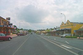
Oberon Town Centre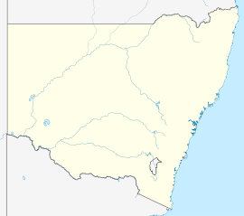
 Oberon
Population: 2,473 (2006 Census)[1] Postcode: 2787 Elevation: 1,113 m (3,652 ft) LGA: Oberon Shire Mean max temp Mean min temp Annual rainfall 16.9 °C
62 °F5.2 °C
41 °F843.0 mm
33.2 inOberon is a town and Local Government Area (see Oberon Shire) in the central tablelands of New South Wales, Australia. The main industries are farming, forestry and wood products. The town usually receives snowfall during the winter months due to its high altitude. At the 2006 census, Oberon had a population of 2,473 people.[1]
It is the birthplace of Greens politician Bob Brown. Oberon is located near the famed Jenolan Caves and the Kanangra-Boyd National Park.
Contents
History
Fish River Creek Post Office opened on 1 January 1855 and was renamed Oberon in 1866.[2]
Commercial area
Oberon's main streets are Carrington Avenue-Oberon Street and Ross Street. The town has several parks and sports facilities. Such parks include the Oberon Showground,Cunynghame Oval, Apex Park and The Hillary Camwich Memorial park. Oberon also has a museum on North Street. Oberon has a caravan park on Cunynghame Street off North Street, a hospital on North Street, a camping ground adjacent to the caravan park and a wood gallery on Oberon Street. Rotarys Lookout is located on Abercrombie Road and to the east of the town is the Blenheim State Forest which includes walking tracks.
Culture
Fishing is a pastime possible at Lake Oberon and The Reef Reserve. Oberon also has a golf club off Hume Street.
Oberon is known for its two inns, the Big Trout Motor Inn and the Highlands Motor Inn.
South of the town is Lake Oberon, Oberon Dam and the Fish River. There is a picnic area at the dam and a reserve with walking tracks near the lake.
Transport
From 1923 to 1979 Oberon was served by a branch railway line noted for its very steep 4% gradients and very sharp 100 m radius curves. Following closure, that line was allowed to fall into disrepair, but has been under restoration by a volunteer organisation called Oberon Tarana Heritage Railway since 2005.[3]
Access
- From Bathurst it is around 49 km south along the sealed O'Connell Road.
- From Great Western Highway near Hartley it's around 50 km along the sealed Jenolan Caves and Duckmaloi Roads.
- From Goulburn it's around 140 km along the sealed Goulburn-Oberon Road.
- Relief maps of the area - Provided by NSW Central Ranges Weather - see link below.
Climate
Oberon has a oceanic climate with mild to warm summers, cool to cold winters and evenly spread rainfall throughout the year. Frosts occur regularly during autumn, winter and spring. Because of its elevation, several snowfalls can be expected each year during winter.[citation needed]
Climate data for Oberon Month Jan Feb Mar Apr May Jun Jul Aug Sep Oct Nov Dec Year Record high °C (°F) 35.9
(96.6)35.9
(96.6)32.6
(90.7)25.0
(77.0)23.1
(73.6)17.1
(62.8)16.8
(62.2)20.2
(68.4)25.6
(78.1)30.1
(86.2)35.2
(95.4)35.0
(95.0)35.9
(96.6)Average high °C (°F) 24.8
(76.6)23.8
(74.8)21.5
(70.7)17.1
(62.8)13.1
(55.6)9.4
(48.9)8.6
(47.5)10.3
(50.5)13.6
(56.5)17.0
(62.6)19.8
(67.6)23.3
(73.9)16.9 Average low °C (°F) 10.7
(51.3)11.1
(52.0)8.9
(48.0)5.3
(41.5)2.6
(36.7)0.8
(33.4)−0.4
(31.3)−0.3
(31.5)2.3
(36.1)4.8
(40.6)6.6
(43.9)8.9
(48.0)5.2 Record low °C (°F) 1.1
(34.0)1.7
(35.1)−2.2
(28.0)−4
(24.8)−6.3
(20.7)−8.5
(16.7)−8.7
(16.3)−7.2
(19.0)−4.5
(23.9)−2.8
(27.0)−2.5
(27.5)−3
(26.6)−8.7
(16.3)Precipitation mm (inches) 81.0
(3.189)60.4
(2.378)64.7
(2.547)57.8
(2.276)60.7
(2.39)79.6
(3.134)71.1
(2.799)75.8
(2.984)67.5
(2.657)79.2
(3.118)71.1
(2.799)74.0
(2.913)843.0
(33.189)Avg. precipitation days 7.8 7.3 7.7 7.5 8.7 11.4 10.6 10.5 9.3 9.4 8.0 7.4 105.6 Source: [4] See also
References
- ^ a b Australian Bureau of Statistics (25 October 2007). "Oberon (Urban Centre/Locality)". 2006 Census QuickStats. http://www.censusdata.abs.gov.au/ABSNavigation/prenav/LocationSearch?collection=Census&period=2006&areacode=UCL162200&producttype=QuickStats&breadcrumb=PL&action=401. Retrieved 9 November 2009.
- ^ Premier Postal History. "Post Office List". Premier Postal Auctions. https://www.premierpostal.com/cgi-bin/wsProd.sh/Viewpocdwrapper.p?SortBy=NSW&country=. Retrieved 2011-05-26.
- ^ http://othr.com.au/
- ^ http://www.bom.gov.au/climate/averages/tables/cw_063063_All.shtml
External links
Categories:- Towns in New South Wales


Wikimedia Foundation. 2010.