- Pittwater Council
Infobox Australian Place | type = lga
name = Pittwater Council
state = nsw
caption =
pop = 56,829
density = 530
area = 91
est =
seat = Mona Vale
mayor = Cr David James JP
region = Metropolitan Sydney

url = http://www.pittwater.nsw.gov.au/
stategov = Pittwater
fedgov = Mackellar
near-nw =
near-n = "Broken Bay "
near-ne =
near-e = "Pacific Ocean "
near-w = Hornsby
near-sw =
near-s = Warringah
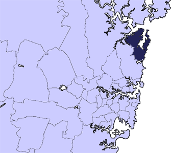
near-se =Pittwater Council is a Local Government Area on the Northern Beaches of
Sydney , in the state ofNew South Wales ,Australia . The suburbs which comprise the Pittwater LGA were detached from theWarringah local government area in1993 . It covers a region adjacent to theTasman Sea about 30 km north of the CBD ofSydney .It is named after
Pittwater , the body of water adjacent to much of the area governed.uburbs and localities of the local government area
Suburbs serviced by Pittwater Council are:
*Avalon
**"Avalon Beach"
**"Avalon North"
**"Careel Bay"
*Bayview
*Bilgola
**"Bilgola Beach"
**"Bilgola Plateau"
*Church Point
*Clareville
**"Clareville Beach"
*Coasters Retreat
*Currawong Beach
*Elvina Bay
*Elanora Heights
**"Foleys Hill"
*Great Mackerel Beach
*Ingleside
**"Ingleside Heights"
**"Loquat Valley"
**"Tumbledown Dick"
*Lovett Bay
**"McCarrs Creek"
*Mona Vale
**"Turimetta"
*Newport
**"Bungan Beach"
**"Bungan Head"
**"Salt Pan Cove"
*Newport Beach
*North Narrabeen
*Palm Beach
**"Paradise Beach"
**"Barrenjoey"
**"Sand Point"
**"Careel Head"
*Scotland Island
**"Stokes Point"
*Taylors Point
*The Basin
*Towlers Bay
*Warriewood
**"South Warriewood"
**"Warriewood Beach"
*Whale BeachBrief history
The Pittwater shire was named after an estuary of
Broken Bay which the shire surrounds, Broken Bay forms the mouth of theHawkesbury River , the main river which formed theCumberland Plain andSydney basin . Pittwater was discovered in 1788, the year the first British colony was established in Australia. However, Pittwater and the surrounding region was inhabited for many millennia by local Aboriginal tribes and much evidence of their habitation remains especially their rock etchings inKuring-gai Chase National Park which borders Pittwater's western side. Pittwater was named in about1800 by the colony's first Governor, Governor Phillip, [Ernest Scott , "A Short History of Australia" [http://gutenberg.net.au/plusfifty.html#scott] ] honouring the then British Prime Minister,William Pitt the Younger . Phillip called it "the finest piece of water I ever saw".Pittwater in the early 1800s was developed as a new port with loading and unloading facilities erected at what is now the current Newport public wharf. As the port developed so did local industry such as sheep at Mona Vale, orchards at southern Newport (on the western ridge below Bushranger's Hill) and Church Point, salt from Saltpan cove and Scotland Island. During the period from the 1950s to the early 1970s, sand mining operations were undertaken in the upper reaches of McCarr's Creek. After sand mining operations ceased, the tailings ponds were all that remained of the mining operation. The tailings ponds consisted of a very fine black mud which created the opportunity for "mud-larking". Participants used the mud for all sorts of activities. (this can be left to the reader's imagination). The mining area and tailings ponds were later rehabilitated into a park and re-vegetated with local flora.
Another less acknowledged industry was rum smuggling (rum being one of the earliest currencies in the original colony), a customs lookout was originally based on
Barrenjoey Head with, initially a long boat (Jolly boat) manned by convict oarsmen, then later a fast Customs sloop. Even as recently as the 1990s smuggling (of illegal drugs) was still occurring in Pittwater.Around the 1850s a school was established on the site of what is now Newport Public school. Over later periods, public (primary) schools were established at Mona Vale, Avalon and Bilgola Plateau. In 1963, Pittwater high school was opened at Mona Vale (located on Pittwater Road), Barrenjoey high school (located at the southern end of Palm Beach next to Avalon beach) was opened in 1968.
Both high schools were highly innovative and front runners in establishing and offering alternative sporting activities. Pittwater was one of the first public high schools in Australia to offer sailing as a sport and even built is own 30' yacht (International Diamond class). The construction of the yacht was undertaken by the students with the assistance of local boat building companies and donations from numerous local organisations. The construction and launch of the yacht 'Kalori' in 1968-69 was even documented by Movietone news. Barrenjoey high school was one of the first public high schools in Australia to offer surfing as a sport. This being a reflection of the popularity and history of surfing which has been associated with this area for many decades. The Pittwater area has seen the development and success of a large number of world champions in both sailing and surfing along with many other elite sports people in many sporting disciplines.
During the Second World War, unlike Sydney Harbour (
Port Jackson ), Pittwater was not protected by a boom net. As a consequence local militia and later Australian Army were stationed at the western side of the entrance to Pittwater and were dispersed along the western shore in a network of trenches, pillboxes and gun emplacements. Most defence activity was centred around West Head with two large guns placed at the base of the cliff. Many of the WW2 defence structures still exist today although many are overgrown. One noticeable structure still very visible from the water is the "railway" which was cut into the West Head cliff and was used to supply the defenders encamped along the western shore line. The railway cutting was cut at an angle of around 60 degrees with rail sleepers concreted into place to keep the rails in place. A rudimentary wharf was constructed just south of West Head and was formed between the shore line and a rock outcrop, access to the rock outcrop was via a ramp made of two large poles and a walkway on top. The ramp poles were still in place as late as the 1980s. After WW2, an RAN torpedo testing facility was built on the northern side of Taylor's Point (eastern side of central Pittwater) with a large building perched at the end of a long wharf. Three target pontoons were permanently moored at 1 nautical mile intervals along the central and northern part of Pittwater. On a number of occasions, test torpedoes went off course and either ending up on Clareville beach or were lost only to be later found by local fishermen. The torpedo test facility has since been removed although some of the shore based buildings still remain.Due mainly to its shallow entrance, Pittwater was never developed as a commercial port. It has remained as a waterway primarily used for either the transport of residents and visitors to the less accessible parts of the western shore or for water based activities such as sailing, boating in various forms and the occasional amphibious aircraft. Regular sight seeing flights operate between Palm Beach at the northern end of Pittwater and Rose Bay on Sydney Harbour. Pittwater is home to a number of Motor, Yacht and Sailing clubs who utilise the comparatively less congested waterway on a year round basis. Pittwater is also the starting line for the Pittwater to Coff's Harbour Yacht race which commences in early January each year. The northward Pittwater to Coffs Harbour race has become very popular as an alternative to the more demanding southward Sydney to Hobart yacht race.
ettlement of Pittwater
The Pittwater area has had European settlement since the beginning of British colonisation. Up until the early part of the 20th century, the area was primarily used for either agriculture or leisure activities. Its pristine beaches were popular for holidays and a number of camping areas, and later caravan parks, were established on or near Pittwater. After
World War I , early urban settlement patterns were beginning to develop although most of the area's urbanisation occurred after the second world war with major home building activity occurring the full length of the Pittwater peninsula. The Pittwater shire is now the northern most shire of Sydney's coastal metropolitan areas. The area remains very popular and is still growing in population numbers. The area provides a vast number of leisure activities centred around the waterway and the adjacent beaches on the eastern side of the Pittwater peninsular.Transport to Pittwater
Although there were plans to construct a railway to the area, it was never brought to fruition. Debate still remains as to the benefits and disadvantages of a railway into this area. As a consequence, access to the area has primarily been by road although in earlier times there was a regular steamer service to Newport. One of the earliest forms of public transport were horse drawn coaches from Manly on Sydney Harbour. Coach trips were an overnight event with passengers staying in a hotel at Mona Vale (which still remains beside Pittwater Road). Mona Vale was and still is the junction of Pittwater road (leads to Bayview, Church Point, McCarrs Creek,
Scotland Island at the southern end of Pittwater) and Barrenjoey Road (which runs up the Pittwater peninsular leading to Newport and onto Barrenjoey Lighthouse on Barrenjoey Headland (north end of Palm Beach)). Just south of Newport is Bushranger's Hill, which provided an ideal location for watching for coaches en route to Newport. However, local history does not indicate whether any Bushranger "bail-ups" of coaches actually occurred.Access into the Pittwater shire is still via the original Pittwater Road and later, Mona Vale Road. The only mass form of transport available is buses although a large proportion of commuters choose to use private vehicles.
ervices in Pittwater
Airports
*
Palm Beach Water Airport Ambulance stations
Churches
Fire stations
*Palm Beach
*Avalon
*Mona Vale
*Elanora Heights
*Ingleside
*Scotland IslandHospitals
*Mona Vale Public Hospital
*Avalon Clinic
*Palm Beach Private Hospital Politics
Since Pittwaters' secession from
Warringah Council in 1992, the Council has been dominated by Independents, holding all nine seats.The current Mayor is Councillor David James, who was relected for a second term after the 2008 NSW Local Government Election.
Places of interest at Pittwater
* The Newport Arms Hotel on Saturday or Sunday afternoon
* The Basin (Coaster's Retreat)
* Palm BeachSand Dune at the north of Palm Beach.
* Barrenjoey Lighthouse on Barrenjoey Headland
* West Head lookout at the northern end of Kuring-Gai Chase
* Lion Island (no landing permitted to protect penguins)
* Upper Gledhill Falls and the Duck Ponds on McCarrs Creek Road
* The Bahá'í House of Worship at Tumble Down Dick/Ingleside
* St Michael's Cave at the border of Avalon Beach and Palm Beach
* Little Reef at Newport
* Portuguese Beach on the western side of Pittwater
* Commodore Heights (Kuring-Gai Chase National Park)port in Pittwater
Various sporting activities have always been part of life in the Pittwater area. Many different types of sport and other leisure activities are available in the area;
*Australian Rules Football
*Athletics (track and field)
*Basketball
*Curling
*Cricket
*Equestrian
*Fishing
*Football (Soccer )
*Football (Rugby League )
*Football (Rugby Union )
*Golf
*Hockey
*Netball
*Paragliding
*Sailing (Yachts &dinghies ,sailboard ,kite surfing )
*Softball
*Squash
*Surf (Rescue & Life Saving)
*Surfing
*Swimming
*Tennis
* Dragon Boating
* Outrigging(please add any other sports)Pittwater sailing/yacht clubs
*Avalon Sailing Club
*Bayview Yacht Racing Association
*Royal Prince Alfred Yacht Club
*Royal Motor Yacht Club
*Pittwater Aquatic Club
*Palm Beach Sailing Club
*Sailability Pittwater (Bayview)urf life saving clubs
*Warriewood Beach
*Mona Vale Beach
*Bungan Beach
*Newport Beach
*Bilgola Beach
*Avalon Beach
*Whale Beach
*Palm Beach
*North Palm Beachwimming clubs
*Avalon Bilgola Amateur Swimming Club
*Narrabeen Swimming Club
*Narrabeen Ladies Amateur Swimming ClubGolf clubs
*Mona Vale Golf Club
*Bayview Golf Club
*Avalon Golf Club
*Palm Beach Golf ClubRSL clubs
*Pittwater RSL (Mona Vale)
*Avalon RSL
*Palm Beach RSL
*Elanora Heights RSLFootball clubs (all codes)
*Avalon Soccer Club (Soccer)
*Pittwater RSL Football Club (Soccer)
*Mona Vale Raiders Rugby League Club (Rugby League)
*Avalon Bulldogs Rugby League Club (Rugby League)
*Newport Breakers Rugby Union Club (Rugby Union)Netball clubs
*Avalon Netball Club
* Peninsula Netball Club
*Commodores Netball ClubAFL clubs
*Pittwater Tigers (Junior)
Tennis
* Careel Bay Tennis Club
* Mona Vale Tennis
* Bayview Tennis Club
* Elanora Heights Tennis ClubCanoeing * Pittwater Outrigging Canoe Club
* Bei LoonDragon Boat Club(please add any other types of sports and community clubs)Cricket *Peninsula Cricket Club (Junior)
ister cities
Pittwater's sister city in the
USA isWilmette ,Illinois and they participate in an annual student exchange program between their high schools. Pittwater and Wilmette are connected spiritually as well, each is home to aBahá'í House of Worship , of which there are only seven in the world.References
External links
* [http://www.abs.gov.au/ausstats/abs@census.nsf/Lookup2001Census/03ACE38E1581F3C1CA256BBE0083CBC7 2001 Census Information]
* [http://www.pittwaterlga.com.au/rwp/pitthome.nsf]
* [http://members.ozemail.com.au/~russo/tour/pittwater.html] from Beachnet
Wikimedia Foundation. 2010.