North Cape (Prince Edward Island)

North Cape (Prince Edward Island)
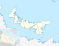
North Cape (Prince Edward Island) is located in PEI
{{{alt}}}
Location of North Cape in PEI

North Cape is a cape at the northern-most extremity of Prince Edward Island, Canada.

It is the dividing point for delineating the western limits of the Northumberland Strait. An extensive reef made up of sedimentary rock extends into the Gulf of St. Lawrence from its low sandstone cliffs. The Canadian Coast Guard maintains a lighthouse as a navigational aid beacon.

The Meteorological Service of Canada has a remote weather station next to the lighthouse (ID - WNE).[1]

Contents

Wind Farms

North Cape Wind Farm is a small wind farm project built near Tignish, Prince Edward Island. It was completed on November 16, 2001. The facility is owned and operated by the Prince Edward Island Energy Corporation, a Crown corporation that also owns and operates the Eastern Cape Wind Farm. It provides four per cent of PEI’s electricity.[1] The wind farm was constructed next to the existing Atlantic Wind Test Site at North Cape.[2] The federal government established a wind power test and research site at North Cape during the 1970s energy crisis on account of it being one of the most consistently windy locations in Canada. Since the 1990s a small commercial wind farm has been constructed adjacent to the test site.

The farms has eight Vestas V-47-660 wind turbines, and generates 5.2800 MW hours a year of electrical power.[3]

Capital to build the farm was raised through the purchase of PEI Energy Saving Bonds.[4]

The power is purchased by Maritime Electric Company Limited who then distributes it to customers.[5]

Seaweed harvest

During the summer, seaweed is harvested at the site. The seaweed is used in baking, fertilizer, and, until recently, as a stabilizer in commercial products.

Coordinates: 47°04′N 64°00′W / 47.067°N 64°W / 47.067; -64

Gallery


See also

References

  1. ^ http://www.gov.pe.ca/index.php3?number=news&lang=E&newsnumber=4992
  2. ^ http://www.gov.pe.ca/news/getrelease.php3?number=2352
  3. ^ http://www.canwea.ca/featuredWindFarm_e.php?farmId=44
  4. ^ http://www.gov.pe.ca/index.php3?number=news&lang=E&newsnumber=4992
  5. ^ http://www.gov.pe.ca/news/getrelease.php3?number=2352

External links


Wikimedia Foundation. 2010.

Игры ⚽ Поможем написать курсовую

Look at other dictionaries:

  • Prince Edward Island — This article is about the Canadian province. For the sub Antarctic islands, see Prince Edward Islands. For other uses of PEI, see Pei (disambiguation). Prince Edward Island Île du Prince Édouard (French) …   Wikipedia

  • Prince Edward Island Railway — The Prince Edward Island Railway (PEIR) was a historic Canadian railway.ConstructionLocated wholly within the province of Prince Edward Island, construction of the PEIR started in 1871, financed by the United Kingdom. The line was initially built …   Wikipedia

  • Prince Edward Island — an island in the Gulf of St. Lawrence, forming a province of Canada: 116,251; 2184 sq. mi. (5655 sq. km). Cap.: Charlottetown. * * * Province (pop., 2000 est.: 138,900), Canada. One of the Maritime Provinces and Canada s smallest province, it is… …   Universalium

  • North Cape — may refer to: North Cape, Prince Edward Island North Cape, New Zealand North Cape, Norway, also known as Nordkapp North Cape, Wisconsin, an unincorporated community North Cape (ship), a barge which ran aground in Rhode Island in 1996, causing a… …   Wikipedia

  • Borden-Carleton, Prince Edward Island — Infobox Settlement official name = Borden Carleton, Prince Edward Island other name = native name = nickname = settlement type = Village motto = imagesize = image caption = flag size = image seal size = image shield = shield size = city logo =… …   Wikipedia

  • Demographics of Prince Edward Island — Demographics of the province of Prince Edward Island, Canada. Contents 1 Population 2 Ethnic Groups 3 Languages 4 Migration …   Wikipedia

  • West Point, Prince Edward Island — West Point is a cape and an unincorporated community located in the southwestern corner of Prince Edward Island, Canada.The Canadian Coast Guard maintains a lighthouse as a navigational aid beacon, although the living quarters of the lighthouse… …   Wikipedia

  • Wood Islands, Prince Edward Island — Wood Islands is a Canadian rural farming and fishing community located in southeastern Queens County, Prince Edward Island on the Northumberland Strait.The population of the community is unavailable as a result of its small size; Wood Islands… …   Wikipedia

  • Tyne Valley, Prince Edward Island — Tyne Valley (2006 population: 226) is a Canadian village in Prince County, Prince Edward Island.Incorporated in 1966, the community is located in the township of Lot 13 at the intersection of Routes 12 and 167. History In 1765, the Tyne Valley… …   Wikipedia

  • Route 153 (Prince Edward Island) — Greenmount Road, labeled Route 153, is a 2 lane collector highway in western Prince County, Prince Edward Island, Canada. It is between the communities of Tignish and Alberton. Its maximum speed limit is 90 km/h. The road is considered part of… …   Wikipedia

Share the article and excerpts

Direct link
Do a right-click on the link above
and select “Copy Link”