- Lihir Island
-
Lihir Native name: Niolam 
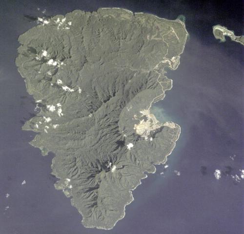
NASA Space Shuttle image of Lihir Island.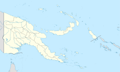
 Lihir Island (Papua New Guinea)
Geography Location Melanesia Coordinates 3°7′30″S 152°38′30″E / 3.125°S 152.64167°E Archipelago Bismarck Archipelago Length 22 km (13.7 mi) Width 14.5 km (9.01 mi) Highest elevation 700 m (2,300 ft) Country Province New Ireland Province Demographics Population 18,000 Lihir Island (aka Niolam Island) is the largest island in the Lihir group of islands, 22 km long and 14.5 km wide, in Papua New Guinea's New Ireland Province. It consists of a complex of several overlapping basaltic stratovolcanoes rising 700m above sea level. While the volcanoes are not currently active, geothermal activity is still present. The island is in what was the forearc basin associated with the subduction of the Pacific Plate beneath the North Bismarck Plate.[1] Subduction stopped about 10 million years ago with the collision of the Ontong Java plateau with the subduction zone.[2]
The Island is located 900 km NE of Port Moresby. Annual rainfall averages 4800mm per annum, temperature ranges between 19 and 35 degrees Celsius. The population of the Lihir Group increased from 12,570 in 2000[3] to an estimated 18,000 in 2007. Residents are of Melanesian descent and have predominatly a subsistence lifestyle.
Lihirians still follow traditional belief systems, although official census records indicate that 99% of the PNG population are Christians, with Catholicism being the largest denomination. Most villages are located on the coastal fringe, although it is thought that originally some villages were located inland but were moved to the coast at the encouragement of missionaries.
The economic focal point of the Island is the Lihir Gold Mine. The mine is operated by Newcrest Mining Limited. The mine holds one of the world's largest gold resources (40 million ounces).
The mine is located on a geothermically active area and to enable the mine to proceed, holes have been drilled into the ground to release subterranean pressure. These gases have been, in part, captured and are used to operate a 56MW geothermal power station which generates 75% of the mine's power requirements. It is proposed to extend the capacity of the plant so that the entire mine will be run on geothermal power.
The largest settlement on the Island is Londolovit, where most of the expatriate mine employees live. Basic shopping and health care facilities are located here. The local hospital has inpatient and outpatient facilities and provides health care services to both the expatriate and local communities.
An airstrip large enough to land a small jet is also located north of Londolovit, at Kunaye.
As is the case in many tropical regions, mosquito borne viruses are present on the island, as is malaria.
Land ownership follows traditional models with land being owned by clans. Insofar as it relates to land ownership, the society is matriarchal with land being passed though the female generations. The land cannot be sold; however, usage rights can be granted.
See also
References
- ^ "Submarine Volcanoes". Department of Geosciences, Oregon State University. http://volcano.oregonstate.edu/book/export/html/138. Retrieved 9 March 2011.
- ^ McInnes, Brent I. A.; Jannene S. McBride, Noreen J. Evans, David D. Lambert and Anita S. Andrew (1999-10-15). "Osmium Isotope Constraints on Ore Metal Recycling in Subduction Zones". Science (AAAS) 286 (5439): 512–516. doi:10.1126/science.286.5439.512.
- ^ (PNG Census 2000)
- Global Volcanism Program: Lihir
- Lihir mine information
- A Case Study on Indigenous People, Extractive Industries and the World Bank. Papua New Guinea.
External links
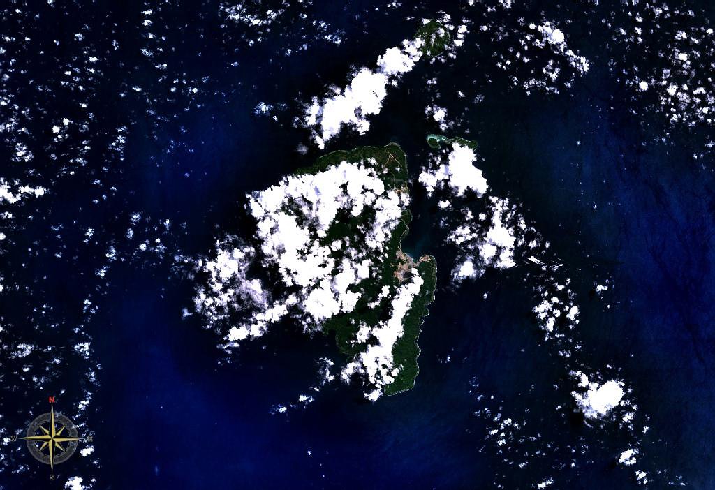
 Lihir Group seen from space (Mahur Island not visible)
 Categories:
- Islands of Papua New Guinea
- New Ireland Province
- Volcanoes of Papua New Guinea
- Complex volcanoes

Wikimedia Foundation. 2010.