- Domokos
-
For the village of Dămăcuşeni, Romania, called Domokos in Hungarian, see Târgu Lăpuş.
Domokos
Δομοκός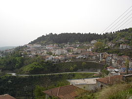
DomokosLocation 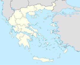
 Domokos
Coordinates 39°8′N 22°18′E / 39.133°N 22.3°ECoordinates: 39°8′N 22°18′E / 39.133°N 22.3°E Location within the region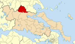
Government Country: Greece Region: Central Greece Regional unit: Phthiotis Population statistics (as of 2001) Municipality - Population: 14,793 - Area: 707.5 km2 (273 sq mi) - Density: 21 /km2 (54 /sq mi) Municipal unit - Population: 5,692 Community - Population: 1,556 Other Time zone: EET/EEST (UTC+2/3) Auto: ΜΙ Domokos (Greek: Δομοκός) is a town and a municipality in Phthiotis, Greece. The town Domokos is the seat of the municipality of Domokos[1] and of the former Domokos Province. The town is built on a mountain slope overlooking the plain of Thessaly, 36km from the city of Lamia.
Contents
Battle of Domokos
In 1897, during the Greco-Turkish War, some Italian volunteers helped Greeks in the battle of Domokos: among them there was also one of the members of Italian Parliament, Antonio Fratti, who heroically died in fightening.
Municipality
The municipality Domokos was formed at the 2011 local government reform by the merger of the following 3 former municipalities, that became municipal units:[1]
- Domokos
- Thessaliotida
- Xyniada
External links
- Municipality of Domokos (Greek) (English)
References
- ^ a b Kallikratis law Greece Ministry of Interior (Greek)
Area: 15,549 km² • Population : 605,329 (2001) • Capital: Lamia Regional unit of Boeotia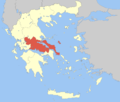 Regional unit of EuboeaChalcis • Dirfys–Messapia • Eretria • Istiaia–Aidipsos • Karystos • Kymi–Aliveri • Mantoudi–Limni–Agia Anna • SkyrosRegional unit of EvrytaniaAgrafa • KarpenisiRegional unit of PhocisRegional unit of Phthiotis
Regional governor: Klearchos Pergantas (el) • Website: www.nafthiotidas.gr Municipal unit of Xyniada Categories:- Populated places in Phthiotis
- Municipalities of Central Greece
- Central Greece geography stubs


Wikimedia Foundation. 2010.