- Neighborhoods of Milwaukee
-
Contents
This is a list of Neighborhoods of Milwaukee.
Two residents of the same neighborhood may describe different neighborhood boundaries, which could be based on zip codes, ethnic groupings, or simply personal opinion. Although rooted in real history, neighborhoods remain social constructions, to which seemingly concrete things like boundaries are much rather in flux.
This encyclopedic problem is true for all cities, but is particularly complicated in Milwaukee when identified neighborhoods can be within other neighborhoods. For instance, Brady Street and East Village are actually inside of the East Side, while Beerline B is essentially located in Riverwest. At the same time some Riverwest residents may regard the Beerline B as a separate distinct neighborhood, or perhaps part of adjacent Brewer's Hill. On the other hand, Beerline B and Brewer's Hill residents might or might not agree that Beerline B is part of Brewer's Hill. Certainly, residents and realtors tend to assign new names as neighborhoods evolve, while some historic identities are revived by community or political groups, Bronzeville for instance. In 1990, the Neighborhood Identification Project set boundaries and names for 75 areas of the city. Prior to this, neighborhood names were not official and many areas had no names, official or otherwise.
Milwaukee's North Side
Arlington Heights
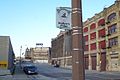
Arlington Heights is a predominantly African American neighborhood on Milwaukee's north side. It is bordered by I-43 on the east, 20th Street on the west, Capitol Drive on the north, and Keefe avenue on the south. It is home to Lindbergh Park, an elementary school, a middle school, and a Lutheran grade school. Union Cemetery is located at the far southwest corner of the neighborhood.
-

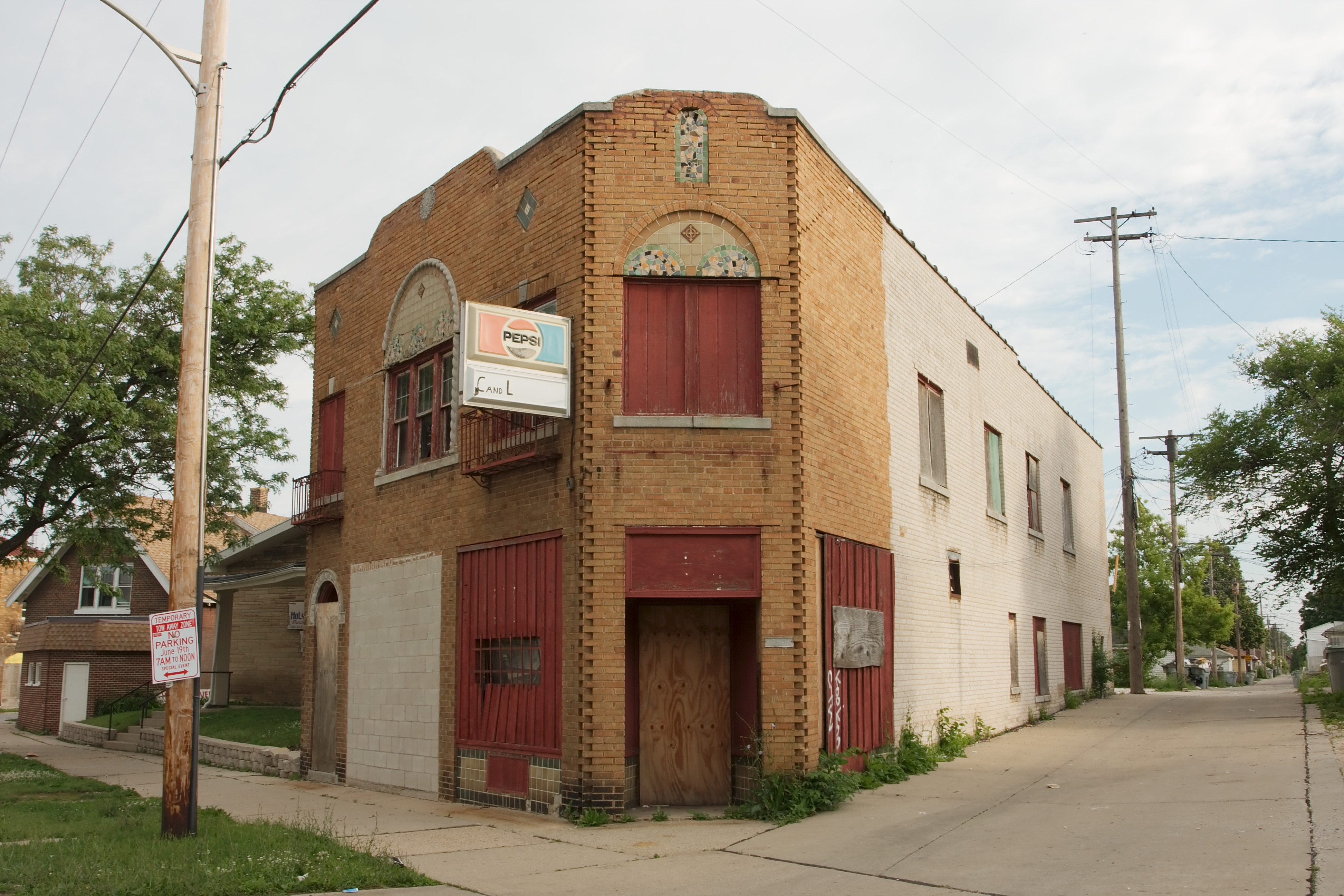
Vacant building near 12th and W Atkinson
-

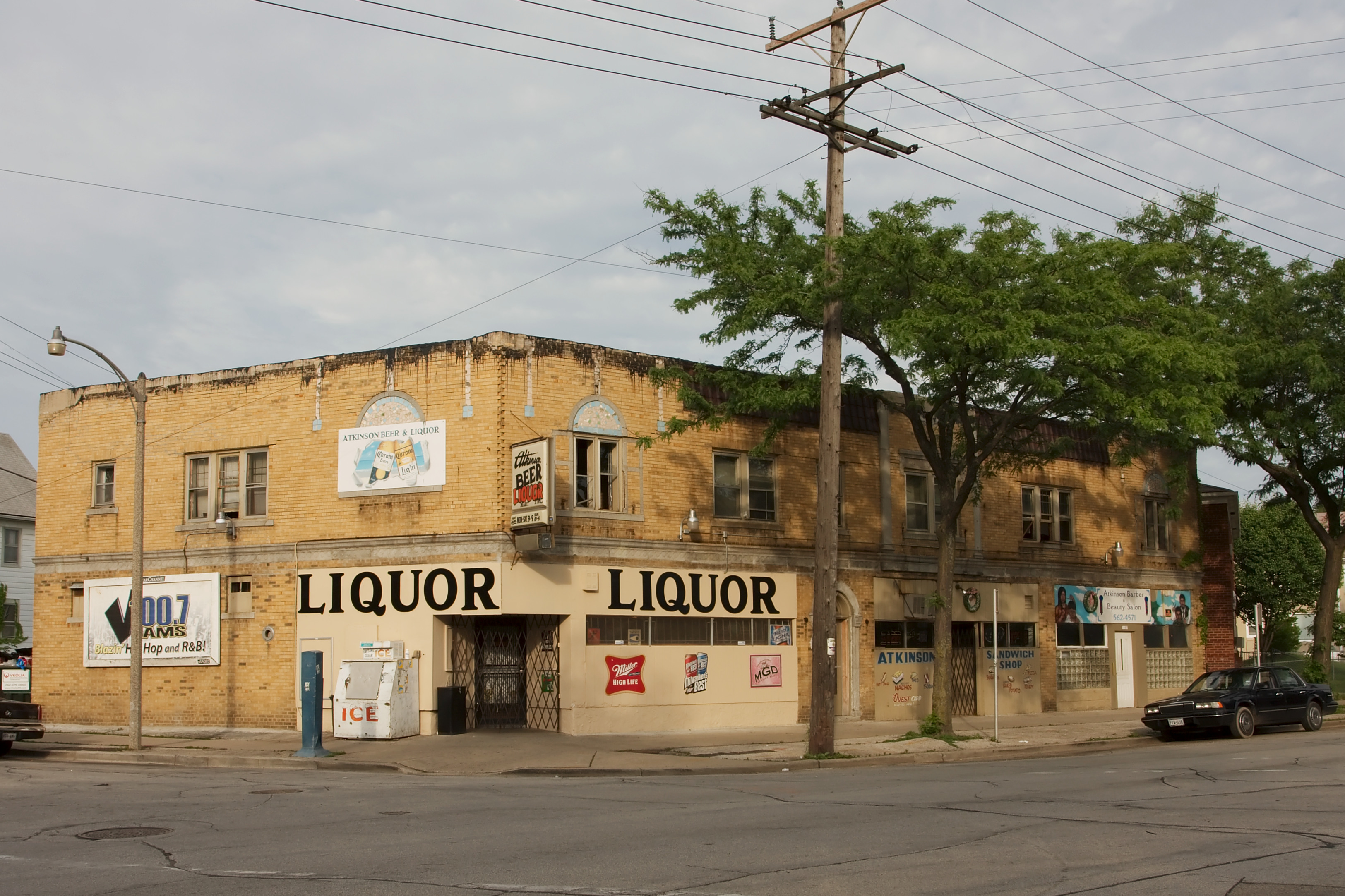
Liquor store near 12th and W Atkinson
-
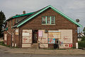
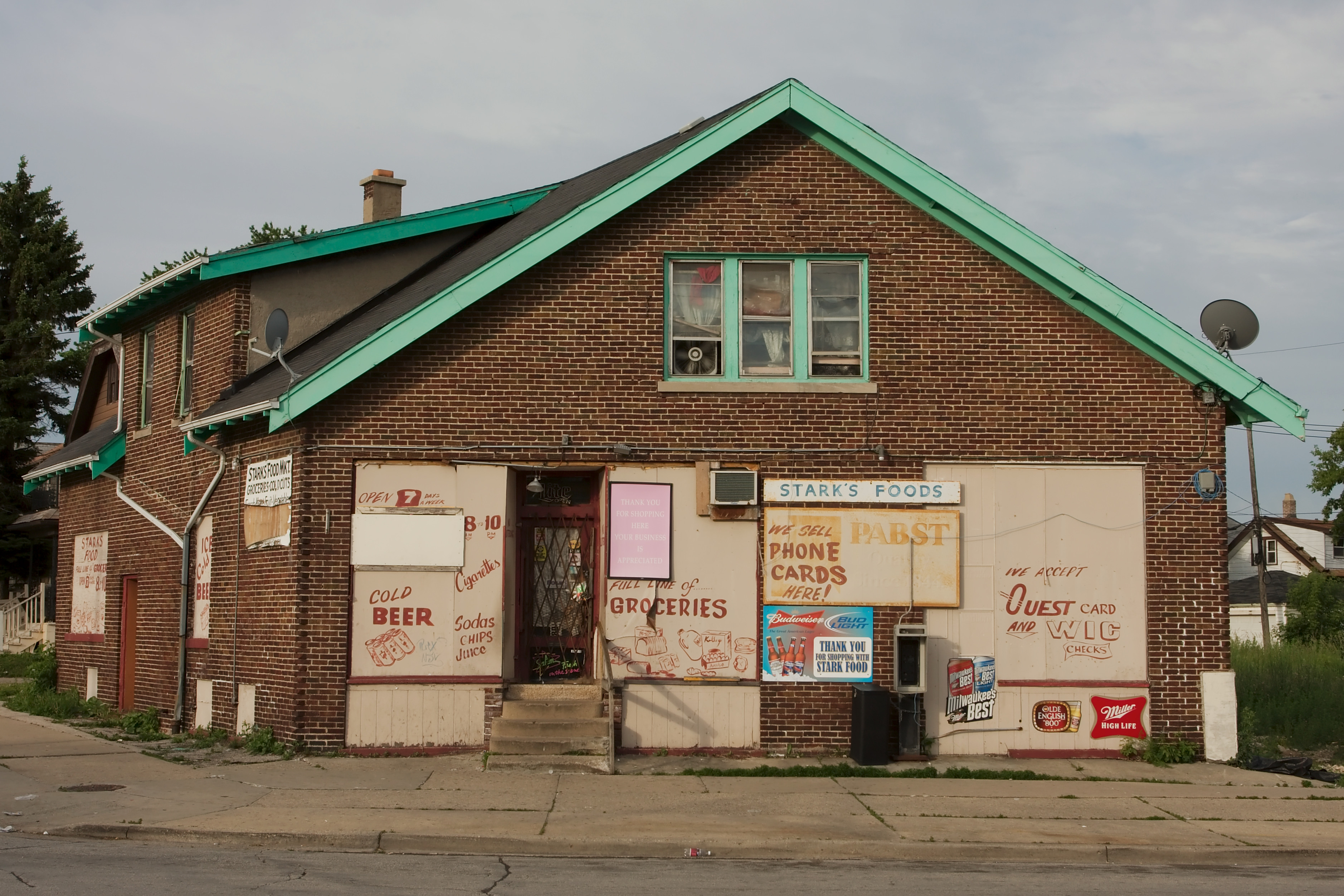
Stark's foods at 13th and W Atkinson
-

Building at 13th and W Atkinson
Franklin Heights
Franklin Heights is bound by W. Capitol Drive on the north, Burleigh Street on the south, North 20th Street on the east, and North 35th to West Townsend Street to the railroad tracks on the west. One third of the Franklin Heights population is below the poverty line.[1]
Granville
Main article: Granville, WisconsinGranville is a historically working class neighborhood located on Milwaukee's far northwest side, featuring new subdivisions, industrial parks, and Granville Station, which was formerly the Northridge mall, having undergone extensive renovations and attracting new large-format tenants.
Halyard Park
Harambee
Harambee (translates to "all pull together" in Swahili) is just north of downtown Milwaukee and is bounded by I-43 on the west, Capitol Drive to the north, Holton St. on the east, and North Avenue to the south. Harambee includes the highest residential elevation in the city, a tall ridge running along 1st Street, that in the early 20th century was built upon by the city's wealthy families.[citation needed]
This area was first settled by early German-Americans in the 19th century and served as a key German-American business community for Milwaukee. Daniel Richards built a home in 1837 (2863 N. 1st Street) on 160 acres (65 ha) of land that ran from Richards Street west to between 5th and 6th and from Center Street north to Burleigh Street. The home stood until the 21st century when a fire destroyed the house. Richards started Milwaukee's first newspaper and spent a lifetime tending to his garden on Richards Hill.[citation needed] Richards Hill is located immediately north of Hadley Street between 2nd Street and Palmer and is the location of the highest natural point in the City. Richards Hill still flourishes in the spring with thousands of perennials planted by Daniel Richards some 160 years ago. The Harambee Great Neighborhoods Initiative has identified the land near this historic site for a historic sites observation tower to be constructed in 2010.[citation needed]
The area's west and central areas had become the center of the City's African American community by the 1950s. By 1970 it had been devastated by redlining, slum clearance, the construction of the I-43 freeway through its center, race riots, and the exodus of its middle class and more affluent residents once open housing legislation ended redlining.[citation needed]
Bronzeville
Bronzeville was an African-American neighborhood that historically was situated between what is now the Harambee neighborhood and the North Division neighborhood. Specifically, Bronzeville was bordered by State Street on the south, North Avenue on the north, 3rd street on the east and 12th street on the west.[2] Much of this former district was centered along Walnut Street (essentially halfway between State Street and North Avenue) until it was razed to make room for the Interstate 43 and other arterial road expansions. After that the community was displaced.
Today there is a rebuilding and rebranding of the commercial area of nearby North Avenue and Martin Luther King Jr. Drive into "Bronzeville", including many new businesses and the Black Holocaust Museum(CLOSED).[3]
The name "Bronzeville" is not Milwaukee-specific, but rather a term used throughout the United States and applied to an historic area of a city populated primarily by blacks.[2]
-

Black Holocaust Museum on 4th and North
Havenwoods
Havenwoods is a working class, mostly African-American neighborhood on Milwaukee's north side, centered near Silver Spring Drive and 60th Street. The neighborhood itself is moderately urban in character, with a mix of strip malls, older retail buildings, and townhouses. Within the neighborhood's boundaries lie the 237-acre (960,000 m2) Havenwoods State Forest and the US Army Reserve Center.
-

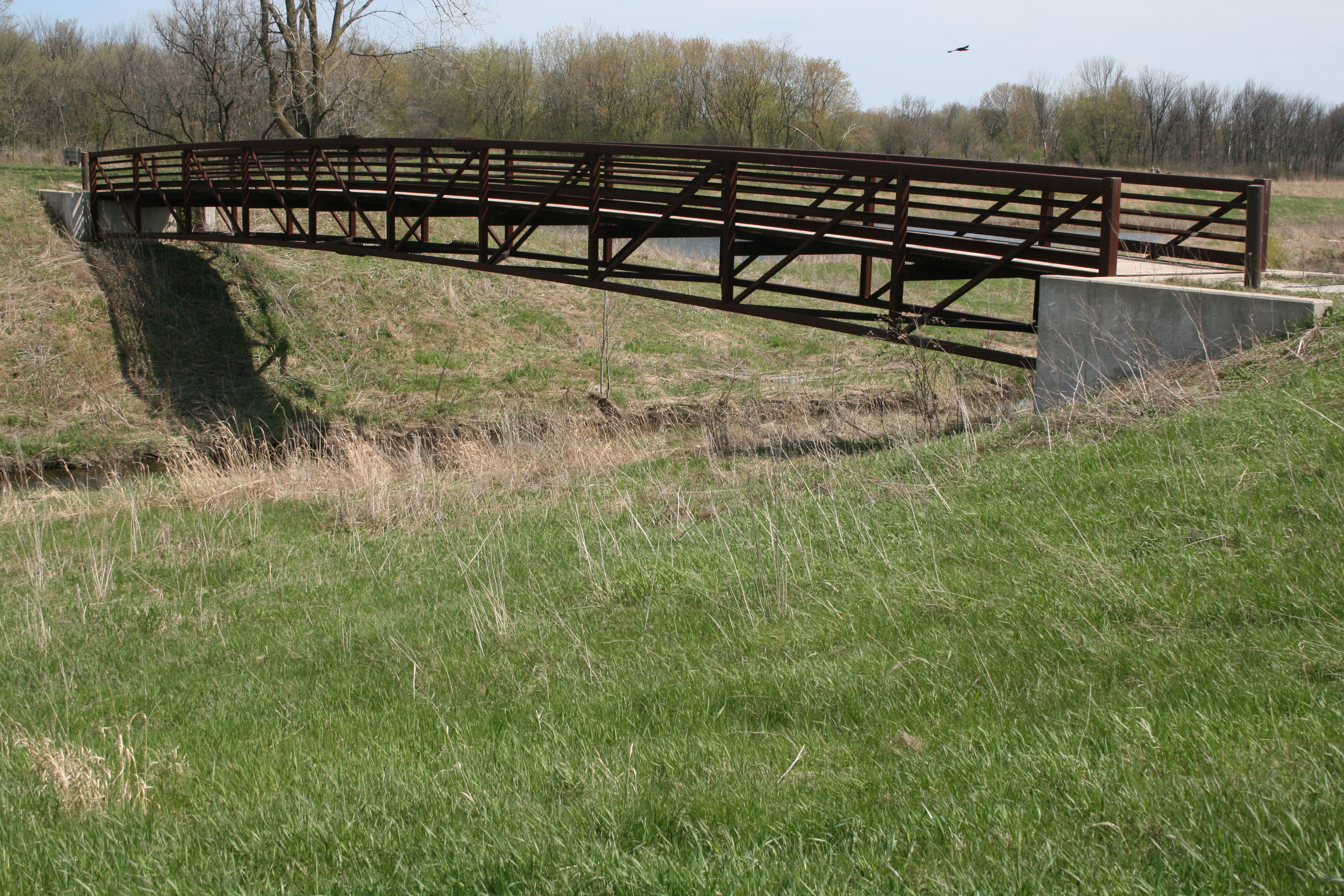
Pedestrian bridge in the Havenwoods State Forest
Hillside / Lapham Park
Hillside and Lapham Park lies north of Downtown from Metro Bvld (W Fond Du Lac) on the south to Brown street on the north. It includes Carver Park that lies north of Lapham Park. It lies west from 6th street to east 12th street. It lies east of Interstate 43.
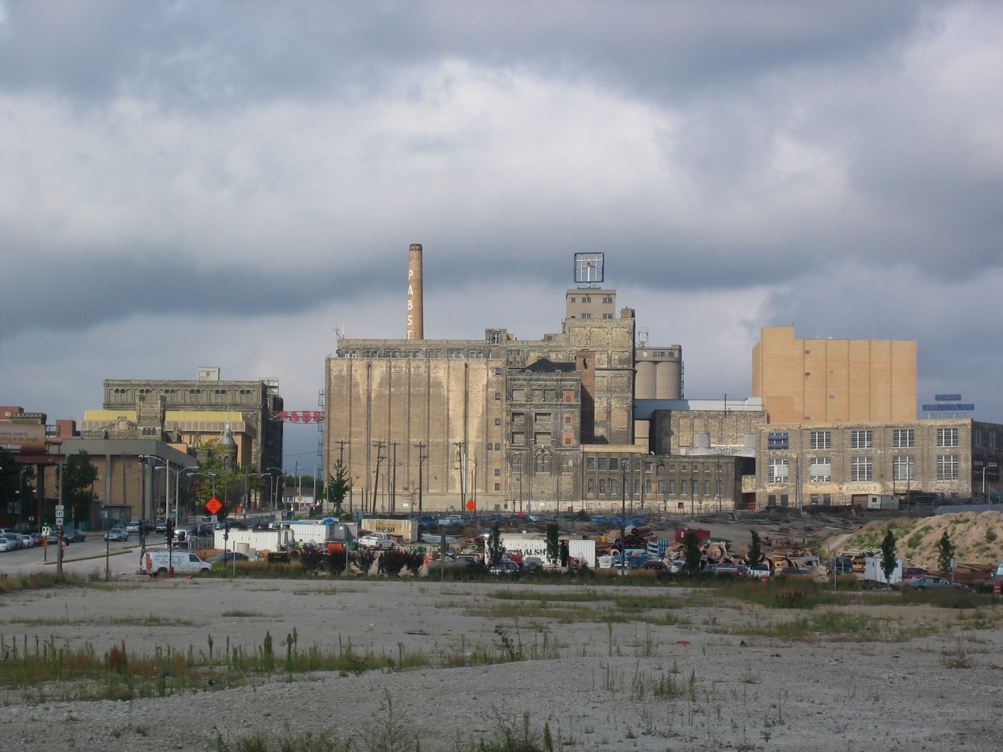
The Pabst Brewery Complex is situated in the far southwest corner of the Hillside neighborhood. The Pabst brewery was closed in 1997, however, the property is under redevelopment and speculation.
Metcalfe Park
Metcalfe Park is an area bordered by Burleigh Street on the north, North Avenue on the south, 20th Street on the east, and 35th Street on the west.
Metcalfe Park is often considered one of Milwaukee's most dangerous neighborhoods.[4] Certainly, one of the poorest; according to the U.S. Census, the poverty rate for the neighborhood and adjoining areas exceeds 60%. Local media devotes much attention to the problems in this area. And after a mob beating perpetrated by neighborhood youth - some under 13 years old - left a man dead, the national media did as well.[5]
Despite challenges and in the face of its negative reputation, the neighborhood continues to make efforts to improve. For instance, new commercial and residential development have recently sprung up along North Avenue, a main thoroughfare. The neighborhood has many active community groups, which aim to help improve the conditions in and image of Metcalfe Park.[6]
Midtown
Once synonymous with crime and poverty, this neighborhood on Milwaukee's North Side is being improved through commercial redevelopment and community nonprofit organizations. Midtown Centre, a newly developed shopping center off of Capitol Drive, is considered the economic heart of the area, filling the void left by what was once the Capitol Court mall.[7]
North Division
Park West
Park West is a neighborhood located on the northwest side of Milwaukee. It is bordered by Burleigh Street on the north, Center Street and North Avenue on the south, 20th St on the east, and 27th Street and a railroad on the west.
Rufus King
Sherman Park
Sherman Park is a north side, middle class, very integrated neighborhood. 51st Blvd in Sherman Park was once home to many of Milwaukee's first business owners. These pioneers built beautiful homes in the 1920s and 1930s at the western most point of the city at the time. The wide boulevard gave it a more suburban feel. St. Joseph's Hospital anchors the community of large Tudor and Georgian revival homes and tree lined streets. The Boulevard Inn restaurant was once a favorite local restaurant of the neighborhood, but burned in the 1990s.
Sherman Park was also once the heart of Milwaukee's Jewish population. Sherman Park retains a small, close-knit, and growing group of Chasidic Orthodox Jews.[citation needed] Herb Kohl, U.S. Senator from Wisconsin and his college roommate Bud Selig, current MLB commissioner, grew up in Sherman Park in the 1940s and both attended Washington High School, which is located in the neighborhood. Today, residents are a mix of Caucasian, Latin, African American and Asian residents.
Thurston Woods
Thurston Woods is a diverse community in Milwaukee bounded by Sherman Boulevard on the west, Douglas Avenue on the north, Teutonia Avenue on the east, and Silver Spring Drive on the south. (Milwaukee's Neighborhood Map shows Thurston Woods as extending to 27th Street on the east; some identify the eastern boundary as Teutonia Avenue.) Thurston Woods has tree-lined streets, an accessible location, affordable homes, and a strong network of neighbors.[citation needed] Havenwoods State Forest is located just across Sherman Boulevard, business and industrial neighbors lie just north of Thurston Woods along Mill Road, and retail establishments along Silver Spring Drive and Teutonia Avenue provide services for residents.[8]
Uptown Crossing
The Uptown Crossing commercial District is located on West North Avenue and Lisbon Avenue on Milwaukee’s north side. It is adjacent to Washington Heights, and is home to a variety of national and local retail, as well as several public institutions. Several architecturally unique buildings give Uptown Crossing a unique feel, and a business improvement district and business association support the district’s vitality. It is a diverse area with about a quarter Caucasian, a quarter southeast Asian and half African American population.[9]
Milwaukee's South Side
For many residents, Milwaukee's South Side is synonymous with the Polish community which settled here. The group's proud ethnicity maintained a high profile here for decades and it was not until the 1950s and 60s that the families began to disperse to the southern suburbs.
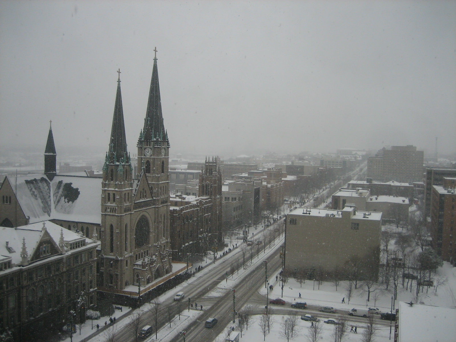
By 1850, there were seventy-five Poles in Milwaukee County and the US Census indicates that they had a variety of occupations: grocers, blacksmiths, tavernkeepers, coopers, butchers, broommakers, shoemakers, draymen, laborers, and farmers. Three distinct Polish communities evolved in Milwaukee, with the majority settling in the area south of Greenfield Avenue. Milwaukee County's Polish population of 30,000 in 1890 rose to 100,000 by 1915. Poles historically have had a strong national cultural and social identity, maintained through the Catholic Church. A view of Milwaukee's South Side Skyline is replete with the steeples of the many churches these immigrants built, churches that are still vital centers of the community.
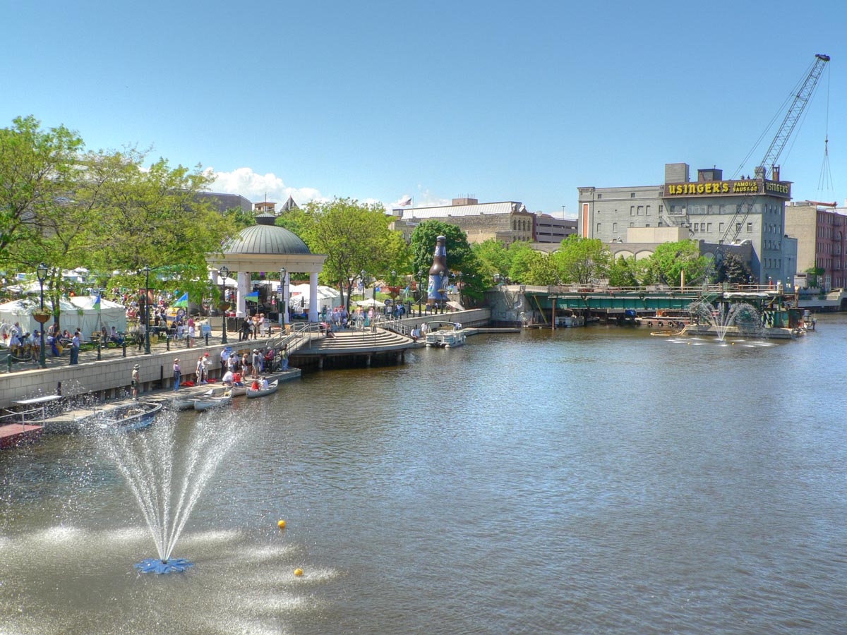
Bay View
Main article: Bay View, MilwaukeeBay View is located on the southeast shore of the city of Milwaukee overlooking Lake Michigan. Bay View boundaries Becher Street/Bay Street to the north, Morgan Avenue to the south, and Sixth Street to the west.[10] Located about 3 miles (5 km) south of downtown on the lake, Bay View originally sprang up around the Milwaukee Iron Company rolling mill as a company town.
Bay View incorporated in 1879 (Milwaukee's first suburb) with 2,592 people and 892 acres (361 ha) of land; but by 1887 Bay View's 4,000 residents voted overwhelmingly to join the city of Milwaukee, mostly in order to get city services of which water was the most important. The former village became Milwaukee's 17th ward.
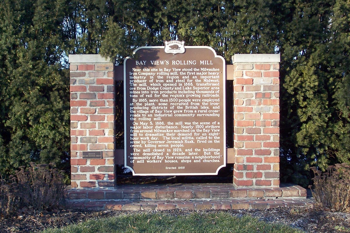
Bay View is best known to labor historians as the site of the 1886 Bay View Massacre. Father James Groppi, a noted Milwaukee civil rights activist from the 1960s, was born in Bay View, where his father ran a grocery business.
Presently, the neighborhood hosts the annual South Shore Water Frolics, a free three-day summer festival featuring a parade, live music and fireworks, held at South Shore Park. Today the neighborhood has the last remaining public well in the city of Milwaukee: the Pryor Avenue Iron Well.
-

Historical marker for the Bay View Massacre
-
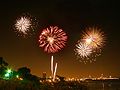
Fireworks at the South Shore Water Frolics
Clarke Square
Holler Park
Holler Park is a small neighborhood located on the far south side near General Mitchell International Airport. It is located along 6th Street between Layton Avenue and Grange Avenue. This neighborhood is somewhat isolated from the rest of residential Milwaukee by an industrial park. The neighborhoods racial makeup is mostly Caucasian. The Holler Park Neighborhood has an active volunteer Neighborhood Association. Holler Park features a 10,000-square-foot (930 m2) "Rain Garden" with native Wisconsin perennials, walking paths and benches. The Holler Park Neighborhood serves as an island of natural oasis in the heart of the Gateway to Milwaukee.[clarification needed] In the neighborhood there are mature old growth oak trees and abundant wildlife, including Whitetail Deer, Raccoons, Opossums, Geese, Ducks, Great Horned Owls, Hawks and varied bird species.
Jackson Park
Jackson Park is a neighborhood on the south side, located about 6 miles (10 km) south of downtown. It is bordered by Lincoln Ave to the north, Morgan Ave to the south, 35th St to the east, and 43rd St to the west. Jackson Park's architecture consists largely of two-story wood frame houses that were constructed in the early 20th century. Jackson Park's makeup is mostly Caucasian, working middle class people: teachers, nurses, firefighters, police officers, government and blue collar workers. In recent years, it has also seen a growing number of Hispanic residents.
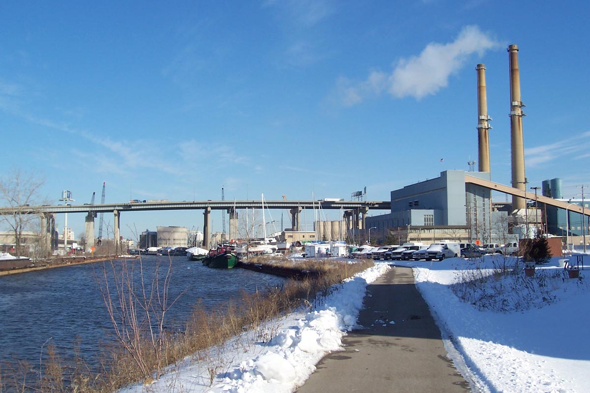
Jones Island
Main article: Jones Island, MilwaukeeJones Island is a peninsula located at the Milwaukee Harbor. It began as a fishing village populated by Polish settlers from the Kaszub region as well as some German immigrants in 1870. The settlers made their living by fishing Lake Michigan. Having never officially obtained a deed for the land, they were considered squatters by the City of Milwaukee and evicted in the 1940s. The city then proceeded to make way for a shipping port as part of an inner harbor design.
The area is now heavily industrialized, containing only a few mature trees. Jones Island hosts much of the city's municipal services, including the Milwaukee Metropolitan Sewerage District. The area supports the Hoan Bridge and includes a shipping port, the Port of Milwaukee.
Layton Park
Layton Park is located on the city's near southwest side. The neighborhood is bordered by 35th Street in the west and by Historic Layton Boulevard to the east. Layton Park is today a diverse neighborhood with a large Hispanic population. The neighborhood was developed in the 1920s and comprises red brick bungalows and duplexes.
Lincoln Village
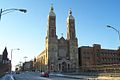
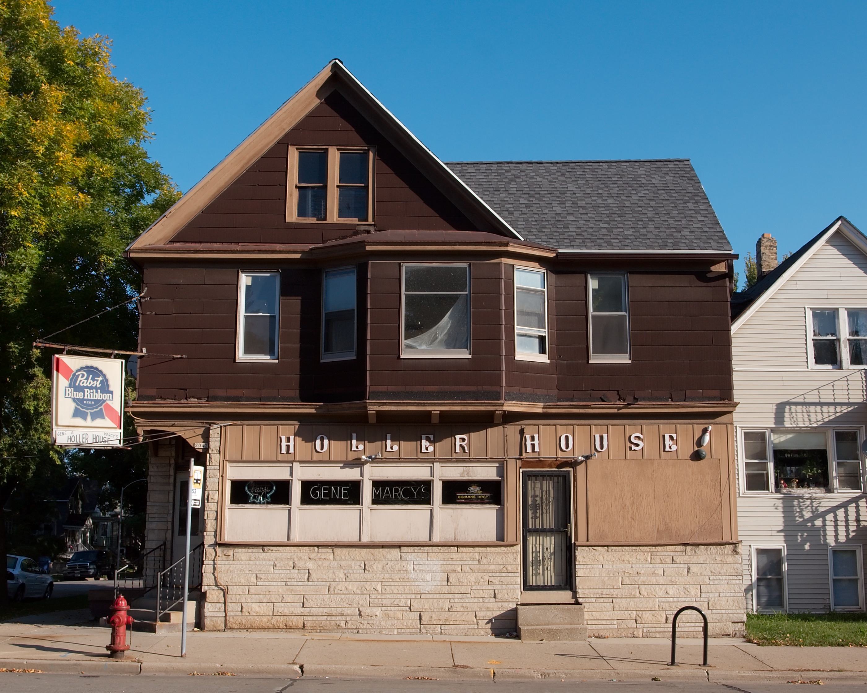
Main article: Lincoln Village, City of Milwaukee, WisconsinThis neighborhood is located along Lincoln Avenue between 5th and 20th Streets on the south side of Milwaukee. Lincoln Village contains a national landmark, the Basilica of St. Josaphat. The Holler House tavern, which contains the oldest certified bowling alley in the United States, is located on the far west end of the neighborhood. The Historic Forest Home Cemetery is located just west, adjacent to the neighborhood.
In the early 20th century the area was home to a large Polish population. The neighborhood is currently experiencing a large influx of Hispanic immigration and is now majority Mexican, with many coming from rural areas of Mexico and Los Angeles.[11]
-
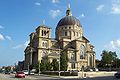
Basilica of St. Josaphat, on Lincoln and 5th St.
-

The Basilica of Saint Josaphat.
-

-
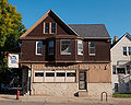
Holler House, on Lincoln and 20th St.
-
Landmark Chapel in Forest Home Cemetery on Lincoln and 24th St.
-
Lincoln Village homes.
-
GrutzaBldg.JPG
Lincoln Village street scape in spring.
-
Downtown Lincoln Village.
-
-
-

-
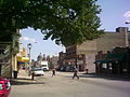
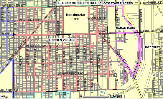
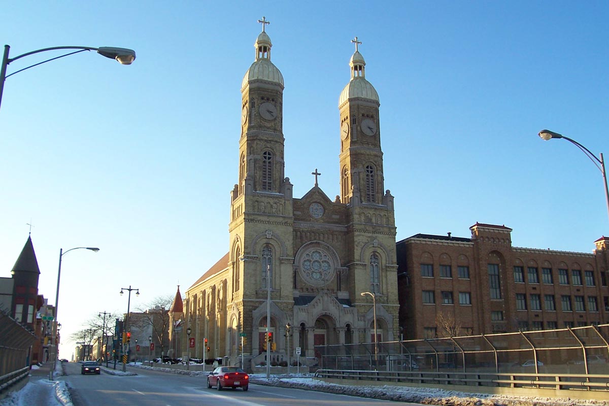
Mitchell Street
Historic Mitchell Street is a street located about 1.5 miles (2.4 km) southwest of downtown. The Mitchell Street neighborhood is the heart of a densely-populated, largely Mexican area of Milwaukee's near south side.
Most of the houses in the neighborhood are two- or three-story Polish flats, but this area also has a fair amount of five to six story brick walk-ups and apartment buildings. Mitchell Street itself is a popular and vibrant retail district that is only six blocks long.
-
St. Stanislaus Catholic Church on Mitchell at 5th
Tippecanoe
Tippecanoe is located on the city's far south side. A solidly middle class and well maintained neighborhood. Most of the neighborhood's homes date back to the 1940s and 1950s. The homes are often in the Cape Cod style and made of red brick. The area was named from the political rallying cry "Tippecanoe and Tyler too" by landowner John Saveland, an outspoken local Republican who intended to develop it as an upper income suburban community.[12]
Town of Lake
Main article: Lake, Milwaukee County, WisconsinTown of Lake, located near the Mitchell airport, is a neighborhood based on its namesake township which was established by the Territorial Legislature in 1838 and covered much of what is now the south side of Milwaukee, as well as the city of St. Francis. Over time, the township was parceled out among different area cities. The original boundaries for the Town of Lake were Greenfield Ave to the North, Lake Michigan to the East, College Ave (originally called Town Line Rd) to the south, and 27th Street to the west. In 1951, St. Francis incorporated to prevent annexation by Milwaukee, in effect "seceding" from the Town of Lake. Before being annexed, the township's northern boundary was Howard Ave, except for a strip of land west of 20th Street going farther north to Morgan Ave. The old town hall on 6th & Howard is still referred to as the "Town of Lake Water Tower". Now officially called the Robert A. Anderson Municipal Building by the City of Milwaukee, it currently serves as office space and water treatment facility. The Town of Lake was officially annexed in 1954. The township's residents had voted not to incorporate as the "City of Lake" in 1928; had they chosen to incorporate, the remaining area of the Town of Lake would probably have never been annexed by Milwaukee, and Milwaukee would have likely expanded further west and north instead. In addition, it is also likely that the Milwaukee suburb of St. Francis would not have felt the pressure to incorporate, nor (hypothetically) would Cudahy have made further strides into the township's agricultural land. The ethnic makeup of this neighborhood is predominantly white.
-
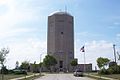
Town of Lake Water Tower
Walker's Point
Walker's Point is a neighborhood that lies south of the Third Ward and the eastern part of the Menomonee River Valley. Founded by George H. Walker in 1835 as a fur trading post, the area is now noted for being mostly an industrial neighborhood, with limited housing scattered in pockets throughout the area, particularly on the eastern end of Walker's Point.
There is a strong presence of the city's gay and lesbian community throughout the nightclubs and bars in the neighborhood. And recently this area has seen some condo, office, and retail development spill over the Milwaukee River to this neighborhood. However, it is not displacing anyone as the spaces undergoing development have mainly been former storage or empty industrial space.
Rockwell Automation has their headquarters in this neighborhood. The Allen-Bradley Clock Tower, part of the Rockwell complex, is an icon of the neighborhood and is the world’s largest four-faced clock, as listed in Guinness World Records. Esperanza Unida, a community-based nonprofit organization, is located on the western end of Walker's Point.
Walker's Point has recently been referred to as the "Fifth Ward," by real estate agents and promoters[13] apparently[who?] hoping to capitalize on the prestige of the Third Ward, located just north across the Milwaukee River.
-
Warehouse district
-

South down 2nd Street to Clock Tower
-

Esperanza Unida on National at 6th
Milwaukee's East Side
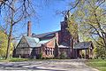
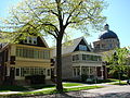
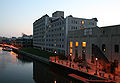
Brewer's Hill
Brewer's Hill is a small, diverse neighborhood north of downtown on the Milwaukee River. The neighborhood is bordered by North Avenue to the north, Holton Ave to the east, the Milwaukee River and Pleasant Street on the south, and Martin Luther King Drive on the west.[14]
The name Brewer's Hill (formerly "Uihlein Hill") is derived from the large number of brewery workers and owners that once inhabited the area. Just to the south of the neighborhood, the Schlitz and Blatz breweries were once in operation.[15]
Brewer's Hill contains a rich architectural mix of Greek Revival, Italianate, Queen Anne (including Stick-style), and Colonial Revival buildings dating from the 1850s to the 1920s.[16] Part of the neighborhood, the Brewer's Hill Historic District, is listed on the National Register of Historic Places. The neighborhood has been gentrified since 1980; the former factories have been converted into businesses and condominiums.
In 2009, This Old House named Brewers Hill as one of its "Best Old House Neighborhoods," where the neighborhood was referred to as "a distinctly Victorian-era neighborhood that's found new life in recent years as rehabbers buy up its blighted old mansions and restore them into beautiful urban homes." [17]
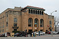
"The East Side"
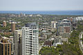
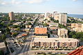
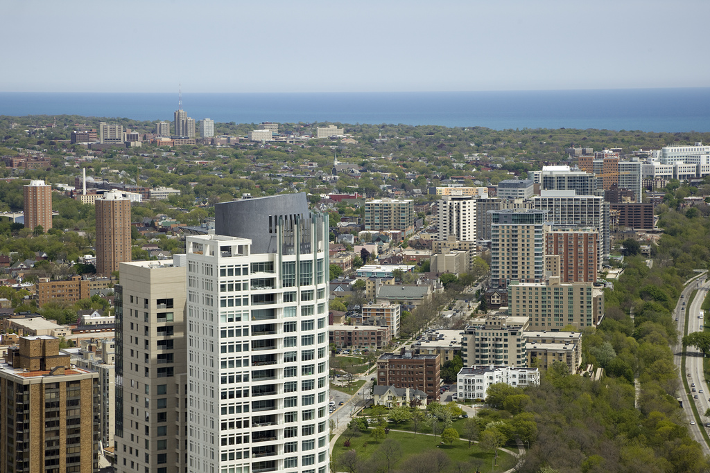
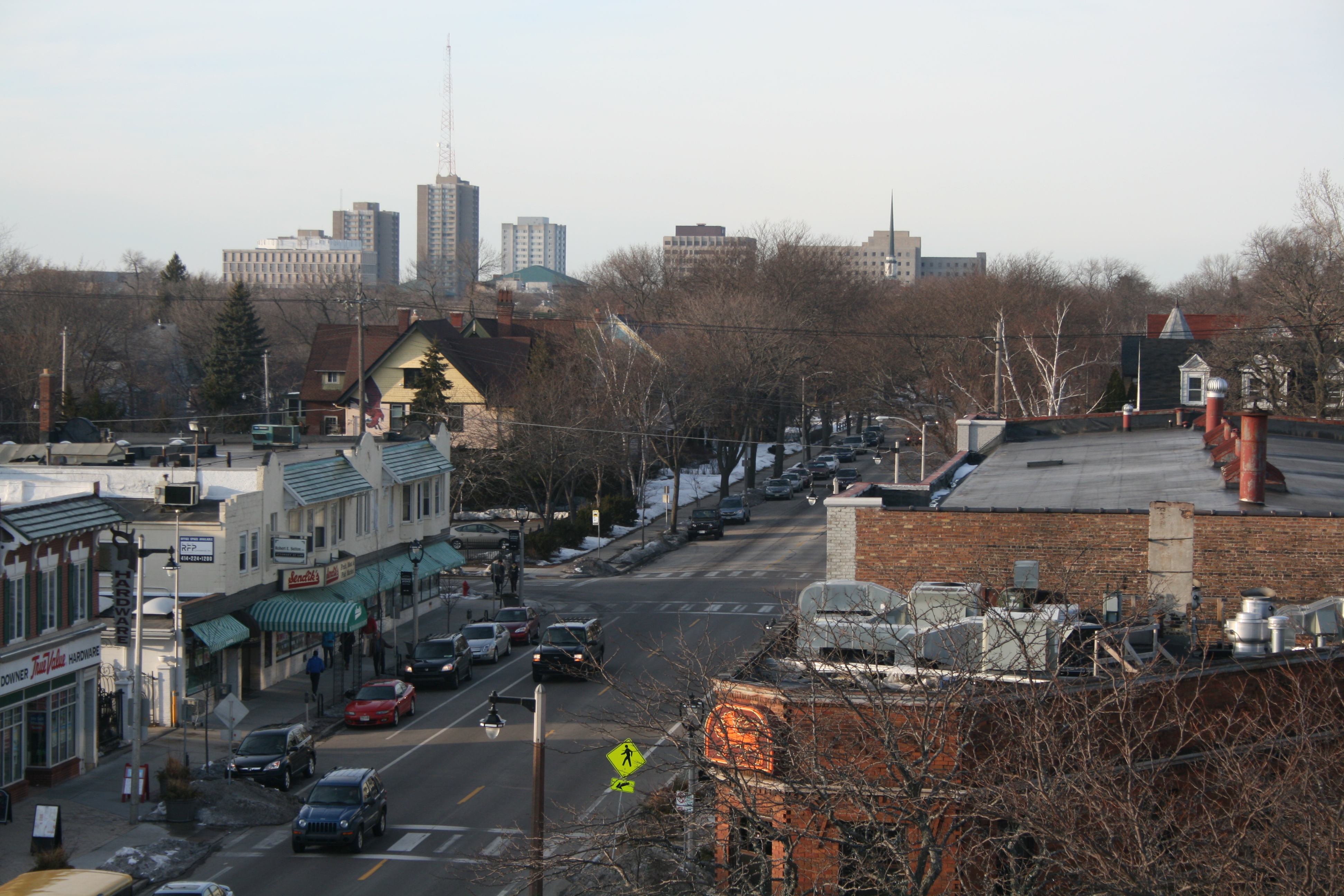
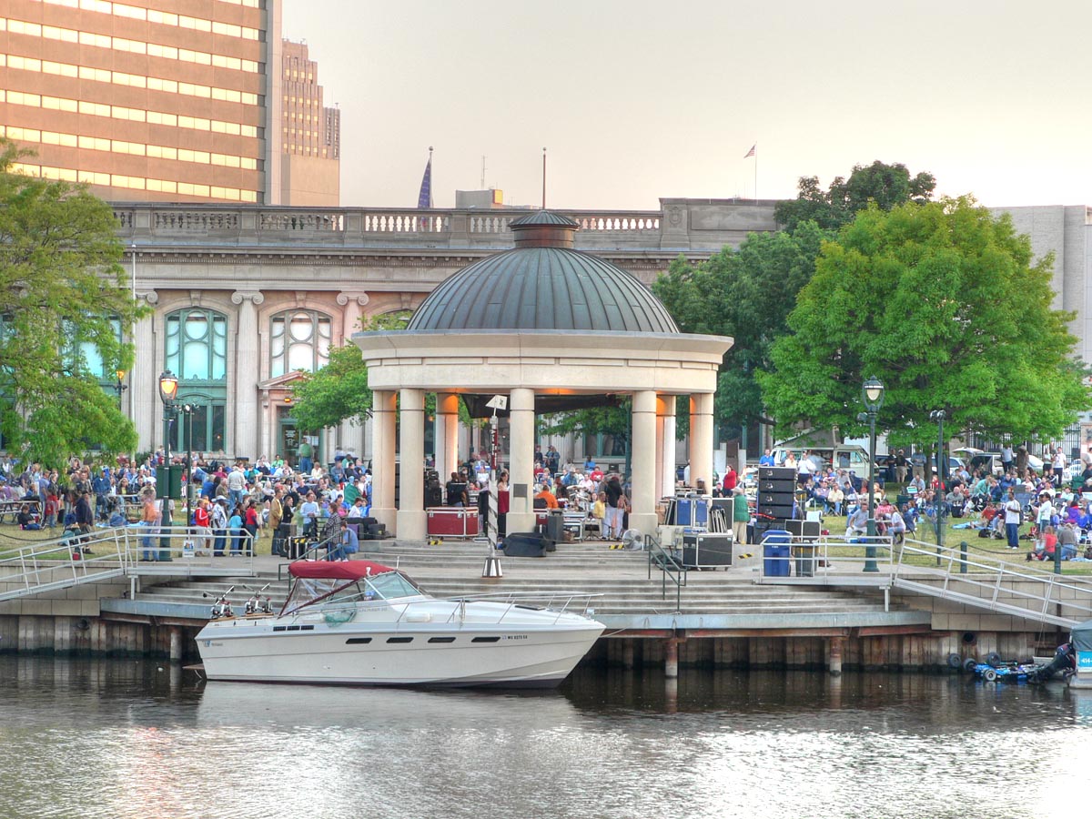
Main article: East Side, MilwaukeeThe East Side is a broad area that refers to anything east of the Milwaukee River, north of downtown, and south of the suburb of Shorewood. This area includes Brady Street, the University of Wisconsin–Milwaukee campus, the lakefront, and the marina. The streets and buildings in this neighborhood range from towering, expensive high rises and condominiums along the lake to brownstones and walkups a few blocks inland to more affordable duplexes near the river. An economically diverse group of people live in this neighborhood. Brady Street (from Prospect to Holton) and North Avenue (from Prospect to the Milwaukee River) both feature popular, pedestrian-friendly commercial strips of nightlife, restaurants, and shops intermingled with residences. Downer Avenue (from Bradford to Park) is a similar commercial strip but with fewer bars. Milwaukee County Transit System's bus routes 30 and 15 are the major North-South transit arteries for the neighborhood.
The east side is also home to renowned parks. Frederick Law Olmsted - famed designer of New York's Central Park - designed both Lake Park and Riverside Park (originally "River Park"), with Newberry Boulevard being the deliberate connector between the two.[18] Lake Park is part of Milwaukee's Grand Necklace of Parks and is known for lawn bowling; French restaurant, the Lake Park Bistro; and the North Point lighthouse.
-
East side lake front
-

UW-Milwaukee and Downer Avenue at East Side
-
Overlooking the east side along N Farwell
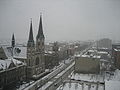
Brady Street
Brady Street is a neighborhood street within Milwaukee's Lower East Side neighborhood. It is bounded by the Milwaukee River on the west, Lake Michigan on the east, Kane Place on the north, and Ogden Avenue on the south.[19] Brady Street itself runs west from Prospect Avenue (overlooking the Lake) to Water Street.
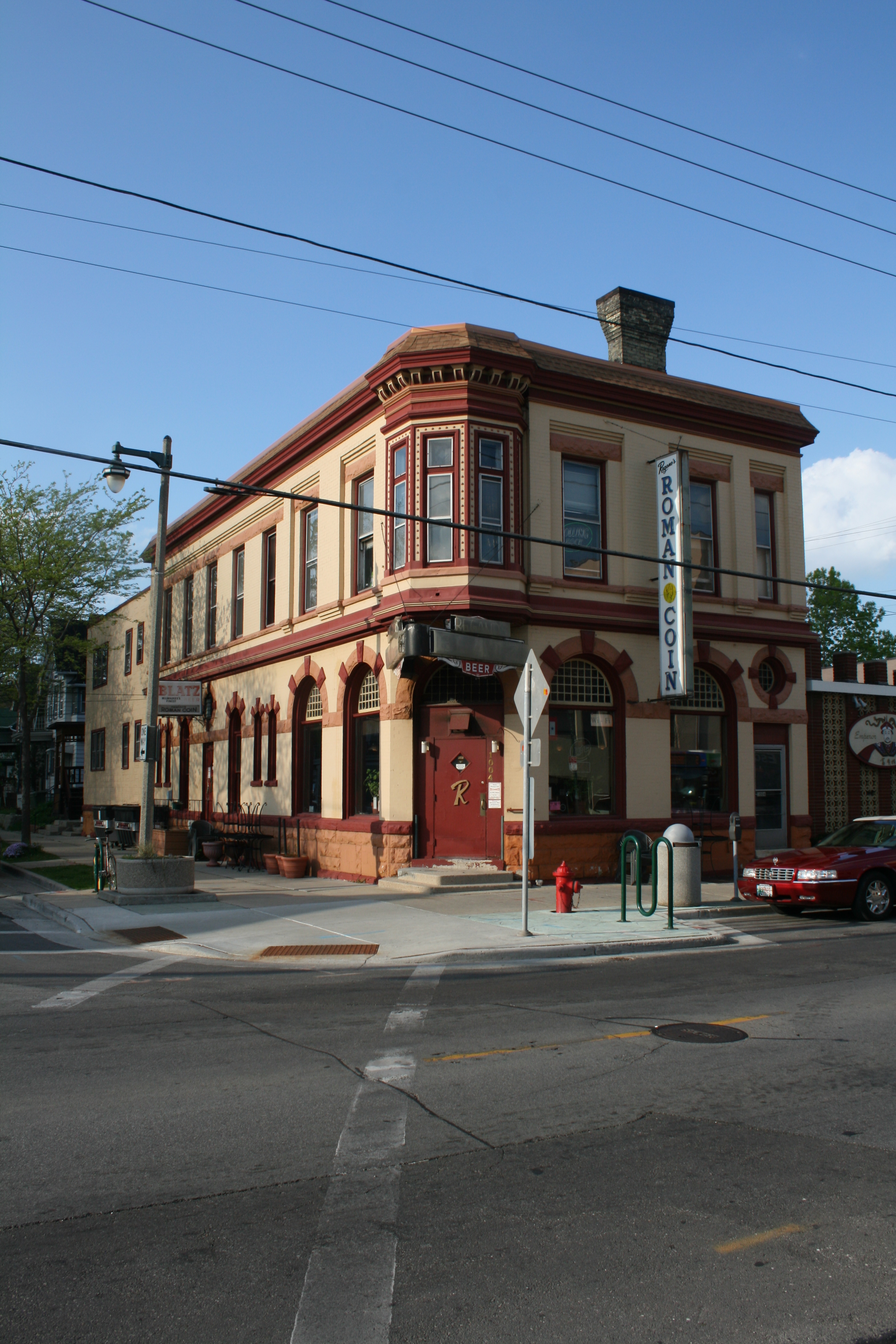
In the 1880s, Brady Street became a commercial district of Yankee and German owned shops.[20] Regano's Roman Coin, one of the original Pabst tied house taverns, is still located on Brady Street, though the vintaged beer signs outside read "Blatz". This tavern was built in 1890 and is unique in that it was designed by architect Otto Strack, who also designed Milwaukee's Pabst Theater.[21] Today, Brady Street is filled with coffee houses, nightclubs, restaurants, vintage clothing, and thrift stores.
Brady Street is often associated with being once the heart of Milwaukee's Italian community, even being called "Milwaukee's Little Italy". But before World War II, it was largely home to Polish immigrants. In fact, historic St. Hedwig's Roman Catholic Church, a long-time Polish church, which was built in 1871, stands at the corner of Brady Street and Humboldt Avenue. In the 1960s, Italians and other assimilated groups began to leave the neighborhood for the suburbs, while the hippies and other bohemians moved in.[19] The 1980s saw blight, neglect and decay, but now the area has been revitalized and has become a model for New Urbanism.[19] Starting in the late 1990s, gentrification has now forced out most of the bohemian population, many moving to Riverwest and Bay View for cheaper rents.[citation needed] But this neighborhood still exhibits a strong, albeit upscale, independent flair. For instance, the Annual Brady Street festival in July brings together the neighborhood in block party fashion.
-

Regano's Roman Coin tavern
-

St. Hedwig's Roman Catholic Church in the distance off of Brady
-
Public art sculpture at the Brady Street Footbridge to Lake Michigan
East Village
The East Village is a term for the Lower East Side area on the east bank of the Milwaukee River north of Brady Street, from Humboldt Avenue east to Warren Avenue.[22] Most of the neighborhood makes up the Brewers Hill Historic District, which is listed on the National Register of Historic Places.
It includes Caesar's Park and Pulaski Playground. The area was a traditional working-class neighborhood inhabited by Polish-Americans, including many Kaszubs; the architecture includes a number of Polish flats and other forms of modest housing.[23]
Murray Hill
Murray Hill is located adjacent to the University of Wisconsin–Milwaukee within the larger East Side neighborhood. It is bounded by Downer Avenue on the east, Oakland Avenue on the west, Hartford Avenue on the north, and Bradford Avenue on the south. It is primarily a residential neighborhood with housing dating to the early decades of the 20th century, primarily bungalows, two-family duplexes, and larger apartment buildings. The neighborhood is bisected by Newberry Blvd. which connects parks on Lake Michigan (Lake Park) and the Milwaukee River (Riverside Park). Murray Hill is home to both a student population and many long term residents. The neighborhood has an active neighborhood group, the Murray Hill Neighborhood Association.[24]
Riverwest
Riverwest is a primarily residential neighborhood located west of the Milwaukee River and east of Holton Street, situated south of Estabrook Park, between Milwaukee's East Side, Brewer's Hill, Williamsburg Heights, and Harambee neighborhoods. The main east-west arterial streets - Capitol Drive, Locust Street, and North Avenue - connect Riverwest to the East Side via bridges. The main north-south arterial streets - Holton Street and Humboldt Boulevard - connect Riverwest to the downtown area, the lower East Side (specifically Brady Street), and suburban Shorewood. Along with those streets, Locust, Center and Burleigh Streets are the major east-west corridors with cafes, bars and shops where people congregate.
Riverwest is noted[who?] for its racial and ethnic diversity including large numbers of African-Americans and Caucasians as well as growing Iranian, Russian, Asian and Hispanic populations.[citation needed] And with the neighborhood's proximity to the university, a sizable college student population resides in Riverwest. In 2007, a student dormitory was opened along the river on the south-east of the neighborhood. This development along with other housing and commercial developments followed a long period of decline up through the 1990s.[citation needed] More recently, the trend has been rising property values and an increase in owner-occupied housing.[citation needed] Though Riverwest still features cheaper rental opportunities in its bungalows, duplexes, and "Polish flats" than what is generally found closer to the university.
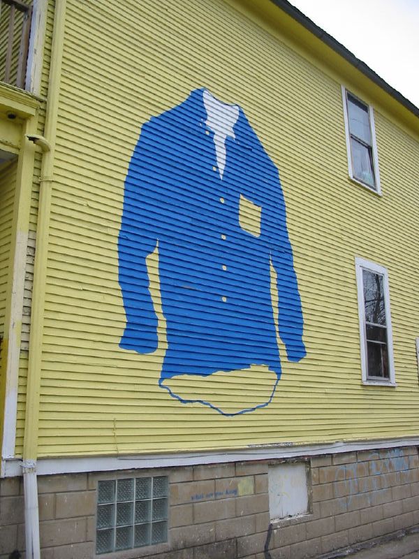
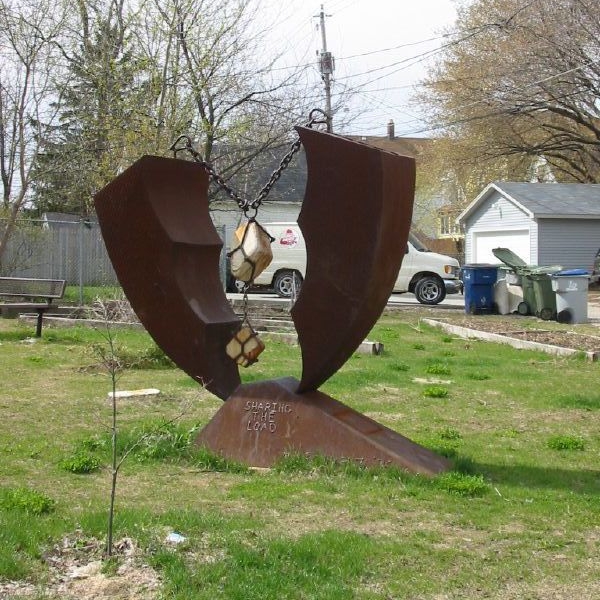
Riverwest has many volunteer-run organizations such as its neighborhood association, a community newspaper, a grocery co-op, The Public House (co-op bar) co-op, an investment co-op and an infoshop. Riverwest has many festivals including Locust Street Days, Center Street Daze, and Rockerbox (a motorcycle and scooter rally).[25] The Riverwest 24, Milwaukee's only 24-hour annual bike race started in 2008 and features local bands with multiple block parties.[26] There is also the Riverwest Art Walk, the state's largest walking tour of artists' homes and studios, neighborhood galleries and various alternative spaces.[27] In 2003, the neighborhood was the subject of its own book, Riverwest: A Community History by Tom Tolan.[28] In 2011, the neighborhood was the subject of a play, Riverwest: a Rhapsody, written by Eric Theis and performed by Broom Street Theater in Madison.[29]
-
Street art on a house
-
Public art sculpture off of Locust St.
-
Eccentrically decorated duplex
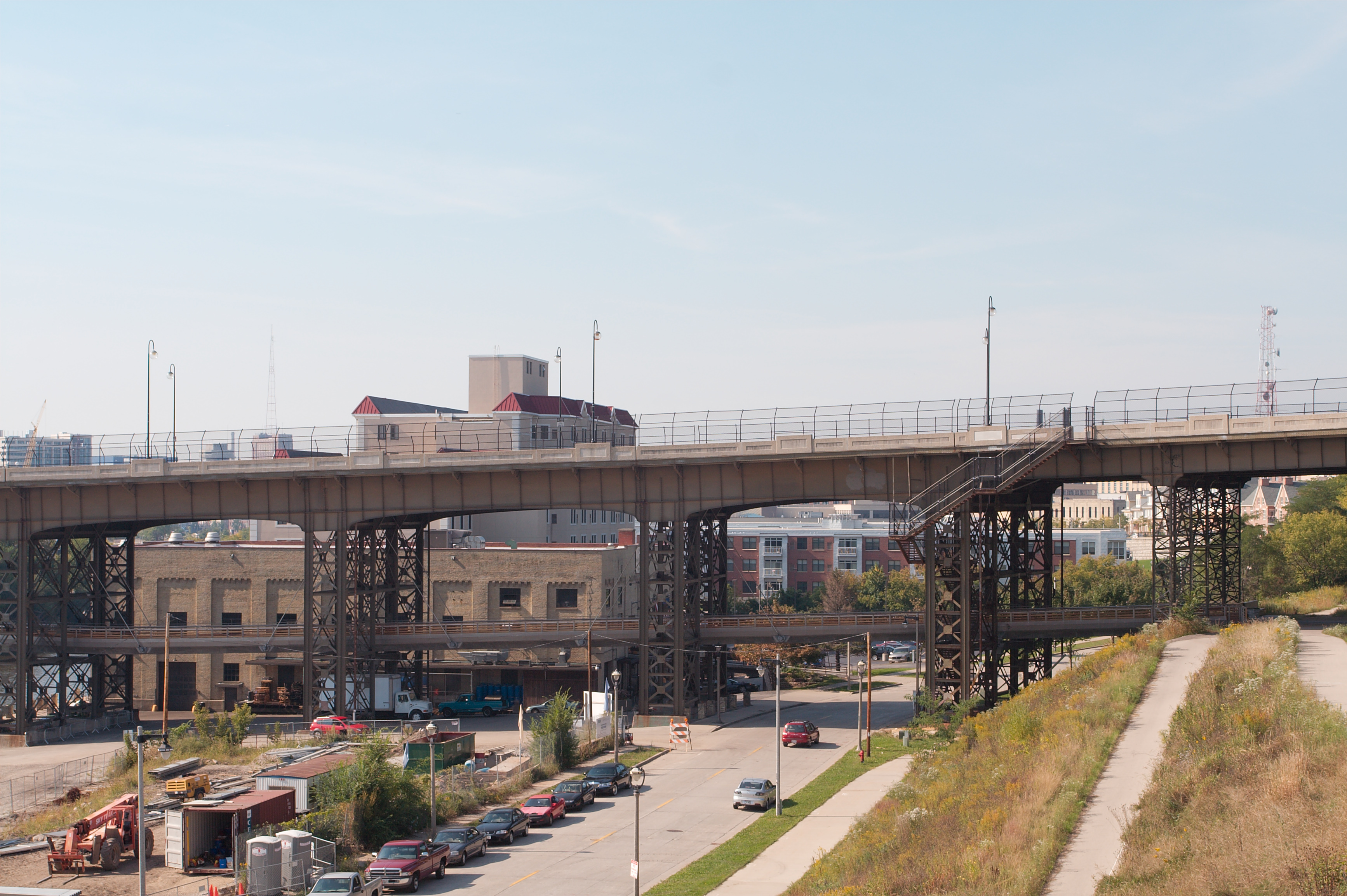
Beerline B
Beerline B runs along the north side of the Milwaukee River, adjacent to the southern end of Brewers Hill, between Palmer St. and Humboldt Blvd. or the Milwaukee River. The Beerline is centered around one street, Commerce Street. The Holton Viaduct with its marsupial bridge runs overhead through the center of the Beerline, connecting Brady Street (Lower East Side) with Holton Street (Brewer's Hill, Riverwest, and Harambee).[30]
Historically, Commerce Street was intended to be a canal to the Rock River owned by Byron Kilbourn.[citation needed] By the 1850s, breweries, tanneries, lumberyards, coal piles, and other industrial uses dominated the river valley along Commerce Street.[31]
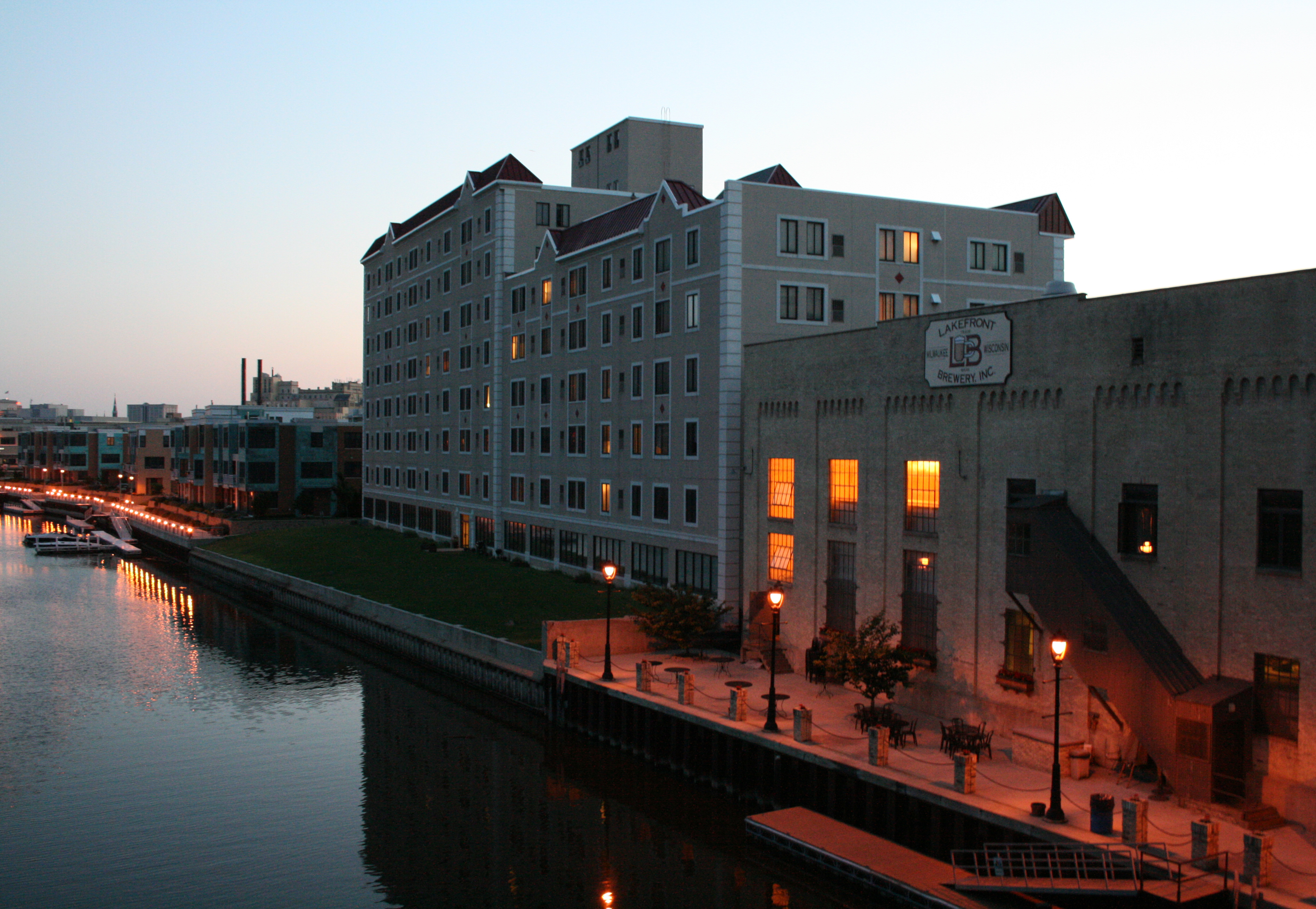
The Beerline in its present form developed in the 1990s after the removal of the Beerline B railroad spur that once provided service to Pabst, Blatz, and Schlitz breweries just south of the neighborhood. Now, the neighborhood is primarily an area of condominium development. The neighborhood is also home to Lakefront Brewery, which advertises itself as "the southernmost point in Riverwest."[32]
The Beerline might be called an "emerging" neighborhood, since it was formerly considered part of Riverwest by residents when it was largely an undeveloped, post-industrial brownfield. The City of Milwaukee's official neighborhoods map does not include the Beerline, and the Milwaukee Department of City Development has said the Beerline is not being considered a neighborhood by the city.[33] Nevertheless, it has developed its own neighborhood association, and a distinct identity appears to be emerging in the Beerline. Adding to the ambiguity, police redistricting has separated and (in 2009) rejoined the Beerline with Riverwest, while harp lights on Commerce St. east of Humboldt display banners that identify that section of Commerce St. as the "Rivercrest neighborhood," referring to the Rivercrest condominiums there.
-
Recent condo development
-

Row house styled condos
-
Holton Viaduct Marsupial Bridge
-
Lakefront Brewery and Brewers' Point Apts
-

Last of the Beerline B railroad spur
Milwaukee's West Side
Avenues West
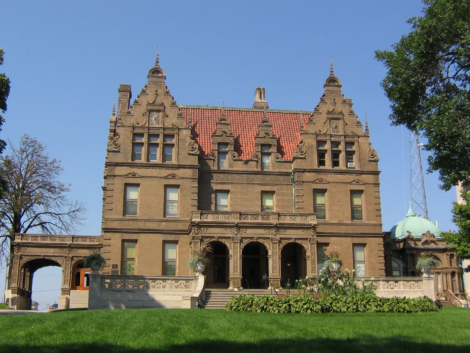
Avenues West is an area west of Milwaukee's downtown. It is bordered by I-43 on the east, 27th St. on the west, I-94 on the south, and on the north by Highland Avenue. While in the recent past this neighborhood has been one of low income levels and property values, it has seen some signs of beginning redevelopment.[34] The most commonly cited example being the Ambassador Hotel that, until recently, was linked with drug dealing and prostitution and has since been restored to an upscale establishment. Prostitution, although not quite as prevalent as it was 10 years ago is still a concern in the Avenues West area. In an attempt to help control crime in this area, Marquette University went so far as to provide a small additional station for the Milwaukee Police Department's 3rd District, fittingly named "Avenues West". Other notable places in the area include Marquette University, the Pabst Mansion, the Joseph B. Kalvelage House and the Rave/Eagles Ballroom. The western portion of the neighborhood along 27th Street has been recently dubbed SoHi (i.e., South of Highland Boulevard) by the business owners to help jumpstart the area.[35]
On May 18, 2006 a construction worker unearthed human remains in the neighborhood believed to be the location of Milwaukee's first cemetery established in the First Ward (known as the "Old Cemetery") near 22nd and Michigan. Thirteen burials have since been identified, and archaeologists are unsure if they are remnants from the Old Cemetery or an earlier burial site used by a Potawatomi village.[36]
University Hill
University Hill (or simply Marquette) is a campus neighborhood, generally combined with the Avenues West neighborhood (since it is within), that, as its name implies, is home to the Marquette University campus. The neighborhood encompasses 93-acre (380,000 m2) from 9th Street on the east, to 20th Street on the west, and from Wells Street on the north, to Clybourn Street on the south. Wisconsin Avenue, a major thoroughfare in Milwaukee, bisects the campus neighborhood. The neighborhood is positioned adjacent northwest and partially northeast of the Marquette Interchange, which was named so because of its proximity to Marquette University. Lake Michigan is roughly one mile east of the neighborhood. Gesu Church is located within the campus' urban setting, but is not affiliated with the University. The area was at one time the site of the Wisconsin State Fairgrounds.[citation needed]
-

The Pabst Mansion at 20th and W Wisconsin
-
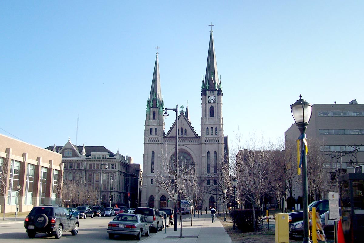
Gesu Church at 12th and W Wisconsin
-
Looking west along W Wisconsin, with Gesu Church visible
-
The Rave/Eagles Ballroom at 24th and W Wisconsin
Cold Spring Park
Cold Spring Park is a small neighborhood near the Miller Brewing Company on the west side. Cold Spring Park has been around since the mid-19th century. It is named for a natural spring that was found in the northwest corner of the neighborhood (then bounded by 27th Street, 35th Street, West Juneau Avenue, and Vliet Street). As far as crime, Cold Spring Park is a rather calm area, as opposed to other nearby sections of Milwaukee.
In 1852, Cold Spring Park was the site of the Wisconsin State Agricultural Society fair and exhibition. During the American Civil War, Cold Spring Park became Camp Washburn, housing the 2nd Cavalry, 30th Infantry, and the 39th Regiment. After the Civil War, Cold Spring Park once again became a race track. A race that was commemorated by Currier and Ives depicted an 1871 record breaking race by the mare Goldsmith Maid, with a time of 2 minutes and 17 seconds.
Adjacent to Cold Spring Park was the Cold Spring House, a hotel which housed visitors and drivers for the races. It was notorious for its gambling, cockfights, courtesans and dances. At the close of the 19th century, Milwaukee saw a population boom, prompting two new streets in Cold Spring Park; Highland Boulevard (1896) and McKinley Boulevard (1906).
Cold Spring Park initially drew German-American residents of the moderate to upper income scale. The upper end residing primarily on Highland and McKinley, while the middle to moderate income resided on Juneau and the numbered streets. Highland Blvd, Juneau Ave, and McKinley Blvd are designated as historical streets by the city of Milwaukee.
Concordia
Historic Concordia is an area between 27th St, 35th St, Wisconsin Ave, and Highland Blvd on Milwaukee's near west side. It is the home of both a local historic district and many national register historic properties, such as the Tripoli Shrine Temple. Many Victorian homes in the neighborhood have been converted into bed and breakfasts. Notable homes include the 1850s Tower House and 1860s Col. Theodore Yates residence. Several private residences are opened to the public each year on the Saturday of Fathers Day weekend for a home tour by Historic Concordia Neighbors, Inc.[37]
Concordia college (now known as Concordia University) was located in the neighborhood for 100 years, until 1983. The college's former facilities, between 31st and 33rd streets and State St. and Highland Blvd., are now home to the Indian Community School.
-
Tripoli Shrine Temple on Wisconsin at 30th
Enderis Park
The Enderis Park neighborhood is a primarily residential neighborhood bounded by North 76th Steet, North 67th Street, West Center Street, and Burleigh/Lisbon Avenue. Many houses date from the 1930s and 1940s. The geographic and cultural heart of the neighborhood is the Enderis Playfield, named for Dorothy Enderis, a public recreation pioneer who retired as an assistant superintendent in the Milwaukee Public Schools teacher in 1948.[38] In 2006, neighbors rallied to rejuvenate the park, which had fallen into disrepair. "Magic Grove," a monumental steel sculpture by Wisconsin artist Nancy Metz White, was installed, providing a community gathering place in the park.[39]
Grantosa Heights
Located between Granville and Wauwatosa, Grantosa Heights is a highly urban neighborhood with a diverse population. This is a lower middle class area with predominantly African-American and Laotian residents.[citation needed] The neighborhood is named after Grantosa Drive, which seems to be the border with Midtown. Much of the architecture consists of tract homes from the 1950s and 1960s. In recent years, this neighborhood has become home to many of the refugees that have fled Laos.[citation needed]
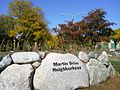
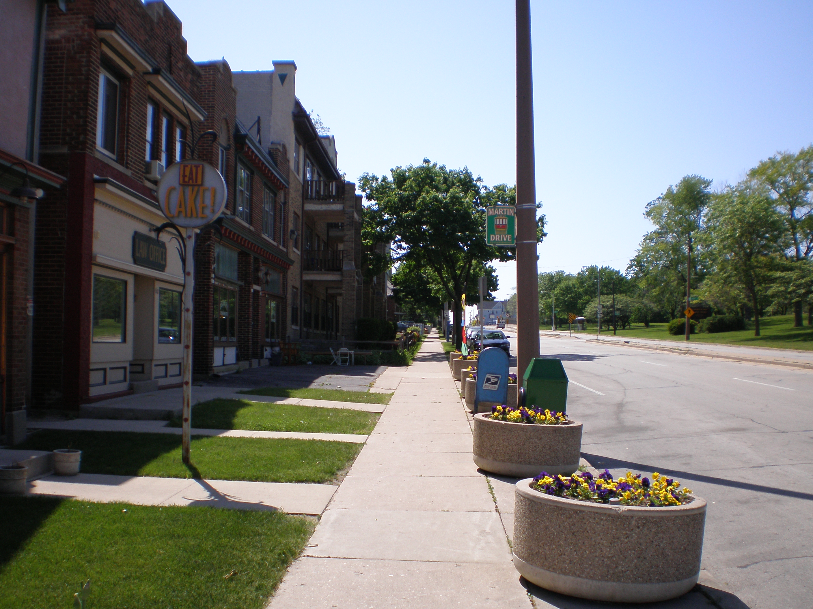
Martin Drive
Main article: Martin Drive, MilwaukeeThe Martin Drive neighborhood is located on Milwaukee's west side. The neighborhood is located north and west of Miller Brewing Company. It includes Harley-Davidson and the Highland Avenue Viaduct. The neighborhood was built up in the 1920s and is home to several old apartment buildings. The neighborhood has retained its density and is still one of the safest neighborhoods in the city.[40] Martin Drive is bordered by Martin Drive in the south, 35th Street in the east, Vliet Street in the north, and US 41 in the west. Milwaukee's Washington Park is located adjacent, just north of the neighborhood.
After several decades of stagnant growth the neighborhood is now seeing redevelopment with a few new businesses and building renovations. As such, the neighborhood supports many small and upstart businesses such as Eat Cake, Birdie's Cafe, Milwaukee Nut Company, a law office and State Street Animal Hospital among others. Martin Drive has several private and public schools nearby. Grocery stores, hardware stores and pharmacies are within close proximity to the Martin Drive Neighborhood. The neighborhood has a strong and dedicated volunteer-led neighborhood association, the Martin Drive Neighborhood Association.[41]
-
Tree-lined Boulevard divides up two-way traffic
-
Holiday bows are added to the trees each winter
-

Birdie's Cafe at Highland Boulevard and Martin Drive
-

Businesses along Vliet Street
-
Boulevard Stone
-

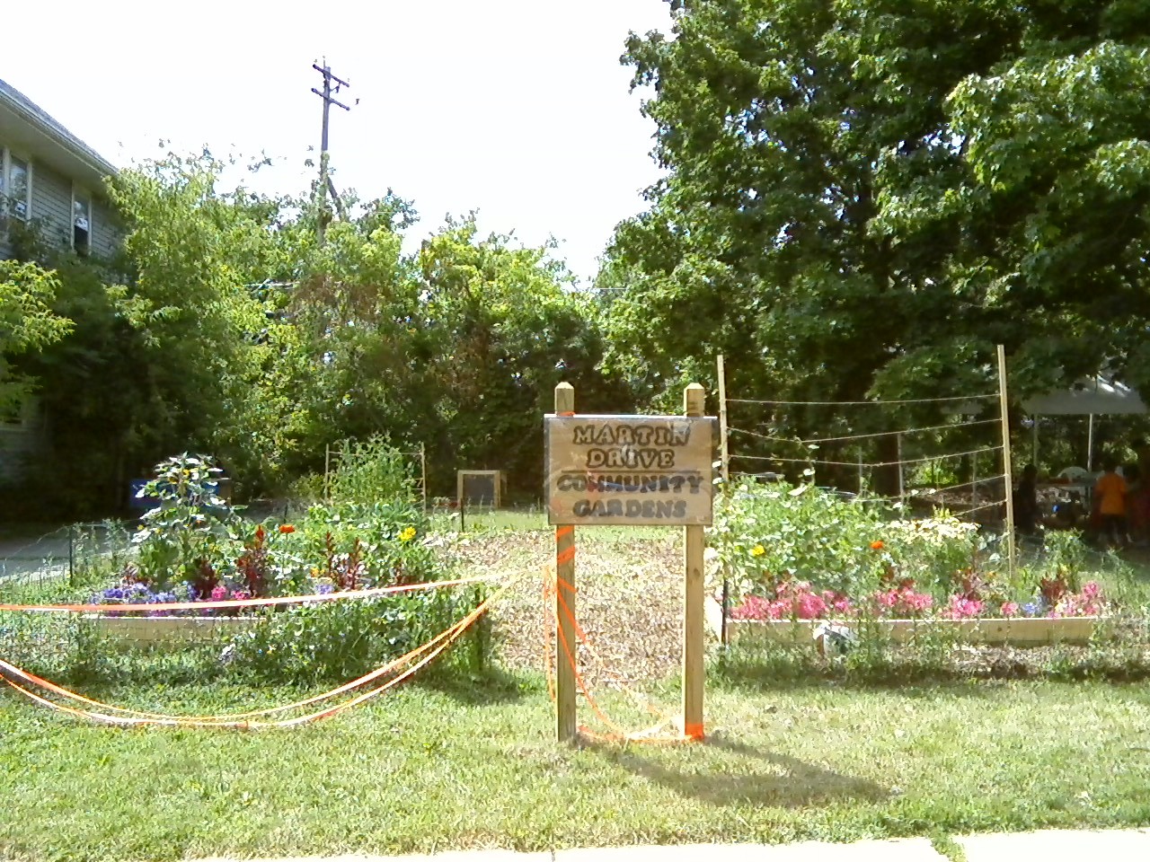
Community Garden
-
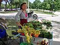
Farmer's Market at the Washington Park Senior Center
Merrill Park
Merrill Park is a small residential neighborhood east of Piggsville. Its traditional boundaries are 27th Street on the east, 35th Street on the west, Wisconsin Avenue on the north, and the Menomonee Valley on the south. Traditionally an Irish-American enclave, it is now an ethnically diverse neighborhood with African Americans and Puerto Ricans comprising a significant percentage of the population. There is little in the way of commerce in Merrill Park, largely confined to the boundary streets, which are major arterials.
Merrill Park was an early home to Milwaukee's Irish community. Many Irish settled in Merrill Park along with the rest of the west side of Milwaukee. Today nearly all the Irish have left and the neighborhood's residents are mostly African American and Puerto Rican. The southern portion of the neighborhood was demolished in the 1950s in order to build Interstate 94. The 1960s brought on several redevelopment projects including streetscaping, new homes, and a new public housing tower. Marquette University High School has stayed in the neighborhood and has invested heavily in improving its campus and the surrounding neighborhood.
For the first time in nearly four decades, the neighborhood is seeing major physical improvements. Several new homes have been built on former vacant lots. Several old homes have been purchased and renovated. The Wisconsin Humane Society has made this neighborhood its primary location. Marquette University High School is undergoing a multi-million dollar renovation and construction project as well.
Piggsville
Piggsville is a small residential enclave, four blocks by six blocks, at the west end of the Menomonee River Valley, south of Miller Brewing and the Wisconsin Avenue viaduct, and north of Interstate 94. Various theories have been proposed about its name, but none have been proven true. It is also known as Valley Park, and its neighborhood association is the Valley Park Civic Association. Most of its homes were built in the early 20th century. The area was annexed by the city of Milwaukee in 1925 after petition by its residents. Flooding has been a problem because of its river valley location, and a new concrete retaining wall was built in 2000.
Mount Mary
Mount Mary surrounds Mount Mary College. It is bordered by Concordia Ave. on the north, 89th St. on the east, Center St. on the south and Menomonee River Parkway on the west.[42] With several curvilinear streets and fewer sidewalks, it resembles a suburban neighborhood. Most of the homes were built in the 1950s. The city of Wauwatosa is to the south and to the west. Milwaukee County Kops and Cooper Parks also border this neighborhood.
Story Hill
Story Hill is a neighborhood located directly north of Miller Park and south of the Washington Heights neighborhood, on the west side of Milwaukee. Story Hill is named for Hiram Story. Hiram, along with his brother Horace, founded a quarry on the land in this neighborhood.[43] The neighborhood itself lies on a hill just south of Wisconsin Avenue and is characterized by quiet, tree-lined streets and an isolated feel, in sharp contrast to the busier and more depressed neighborhoods that surround it.
Story Hill was developed in the 1920s as a sanctuary for middle class Milwaukeeans living just east toward downtown, in the once affluent Concordia district.[citation needed] Demand for larger lots and a more suburban feel fueled the development of Story Hill. The housing stock consists of ornate early 20th century houses, usually made of brick.
Walnut Hill
Walnut Hill is a predominantly African-American neighborhood on the west side, bordered by 27th Street, 35th Street, Vliet Street, and North Avenue. There is also a strong southeast Asian (Hmong) presence here. The neighborhood is one of the most blighted in the city.[citation needed] Parts of the neighborhood include streets without homes and large vacant lots. Despite severe problems in the neighborhood, several homes are under construction and some middle-income proposals are beginning to be seen.[citation needed]
Washington Heights
Washington Heights is a neighborhood characterized by its 1920s Arts and Crafts housing stock. The boundaries of Washington Heights are 60th St. on the west, North Ave. on the north, 47th St. and Washington Park on the east, and Vliet St. on the south. I
St. James Evangelical Lutheran Church is a prominent congregation in the area, dating back to the 1920s. Mount Olive Lutheran Church and School situated across the street from Saint Sebastian Catholic Church and School, built respectively in the 1920s and 1930s, at North 54th Street and Washington Boulevard, are large congregations which both serve as strong cornerstones within the neighborhood. There has been significant business growth along its Vliet Street corridor, with many new art galleries, wine shops and restaurants. One business, a long time coffee shop recently turned pizzeria, is unique in that it has a large coffee cup on the roof. The central administrative office building of Milwaukee Public Schools is located in this neighborhood.
Washington Heights, a neighborhood that advertises itself as, "In the City — Out of the Ordinary!" lies along Milwaukee's western border. While the neighborhood is now only minutes from downtown and close urban amenities, this area was once considered remote.
Development of the area began in 1838 when the federal government gave a parcel of land to the Wisconsin Territory. The land was intended for a canal that would connect the Rock River to Lake Michigan, but the venture quickly failed. The land was sold to private investors.
In 1839, roughly two-thirds of what is now known as Washington Heights was purchased by George Dousman and turned into an immense farm. In addition to its agricultural operation, the Dousman family founded the Ne-Ska-Ra Mineral Springs Company, which sold bottled water from a spring on their property. Today an elementary school named Neeskara occupies the land where the spring flowed. Later, the Dousman land was sold in several parcels between the 1880s and the 1920s.
Early settlement of the area owed much to two major 19th Century projects — the extension of the streetcar line to Wauwatosa and the construction of Washington Park.
-
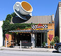
The Cup on W Vliet by 50th
Washington Park
Washington Park is located on Milwaukee's West Side and is bordered by 35th street in the east, US-41 in the west, Vliet Street in the south, and North Avenue in the north. Sherman Boulevard and Lisbon Avenue run through the neighborhood. Sherman Boulevard is lined with large brick homes and old trees. In the 1950s, Lisbon was a major business street, today though, with a rise in prostitution and the crime that comes with prostitution, it is home to several vacant storefronts. The neighborhood is now settled by a majority African American population.
Washington Park, (originally West Park), a 128.5-acre (520,000 m2) focal point and namesake of the neighborhood, was designed by Frederick Law Olmsted, famed designer of New York's Central Park, and built in 1891.[44] The Milwaukee County Zoo started in this neighborhood in 1892 as the "West Park Zoological Gardens," a small mammal and bird exhibit in the West Park barn.
On September 20, 1900, the West Park was renamed Washington Park and the zoo followed suit by renaming to Washington Park Zoo. The zoo was relocated to its present location when Washington Park lost an 18-acre (73,000 m2) parcel of park property for the freeway expansion in the early 1960s.[45] Iceskating and regular outdoor concerts occurred in Washington Park up until the 1960s.[citation needed] Today, the park houses an amphitheatre and pool. In 2007, Milwaukee's Urban Ecology Center (headquartered in Riverside Park on the East Side) opened at satellite center in the park in effort to help rejuvenate the run-down green space and provide interactive programming of nature to local youth.[44]
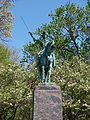
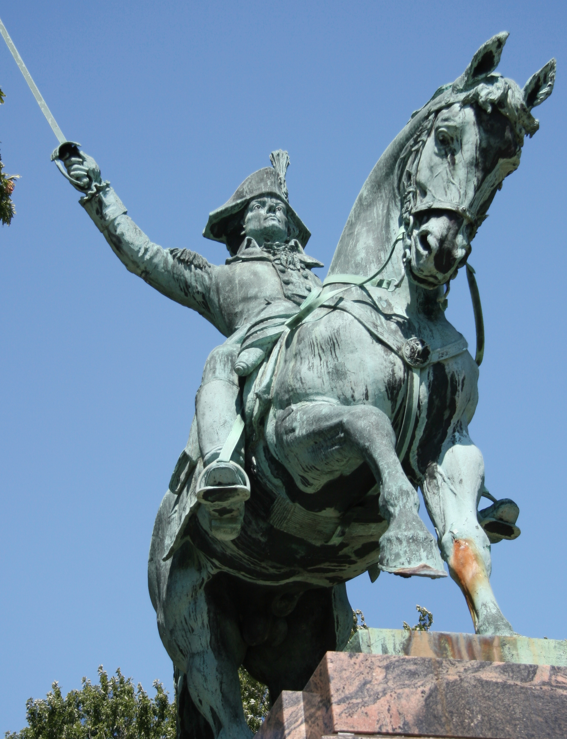
At the intersection of Lisbon and Sherman, the heart of the neighborhood, stands a magnificent equestrian statue of Friedrich Wilhelm von Steuben, a German general who assisted George Washington in the American Revolutionary War. Across from this traffic circle stands the new Washington Park Library, which has replaced the old Boulevard Inn, which burned down in the 1990s.
Milwaukee's Downtown
East Town
The East Town neighborhood encompasses the eastern portion of downtown Milwaukee's central business district from the Milwaukee River on the west to Lake Michigan on the east, and from Ogden Avenue (i.e., the lower East Side) on the north to Clybourn (i.e., the Third Ward) on the south.[46]
Yankee Hill is a key part of the East Town neighborhood, being situated within East Town's boundaries, but closer to the lake and north of downtown. The East Town area also contains the historic Juneau Town settlement, which had competed with the neighboring Kilbourn Town (present-day Westown) for people and resources. With the Milwaukee River as the division, these two "towns" have remarkably different feels. East Town has dense, narrower streets and a more intimate feel, whereas Westown has broad, vast streets with older buildings.
The buildings in East Town are indeed newer. The strikingly modern skyscrapers of the Northwestern Mutual Life complex and Milwaukee's tallest building, the U.S. Bank Center, as well as the city's four other tallest buildings, dominate the eastern portion of the neighborhood. Other noteworthy buildings include the Chase Bank building, the Wisconsin Gas Building, the Faison building, and the Morgan Stanley building. Two large condominium developments, Kilbourn Tower and University Club tower, have been recently completed in the northern half of the neighborhood. Both buildings are over 32 stories tall and have multi-million dollar penthouse units.
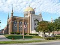
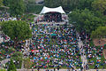
The neighborhood also contains the Cathedral of St. John the Evangelist and Old St. Mary's Church which have survived from the early days of Milwaukee. The East Town neighborhood association hosts Jazz in the Park, an outdoor music concert series at Cathedral Square Park. The area has become the center of Milwaukee nightlife featuring several trendy nightclubs, and outdoor upscale eateries. In summer, East Town sponsors the Parisian festival Bastille Days and in winter the Holiday City of Lights.
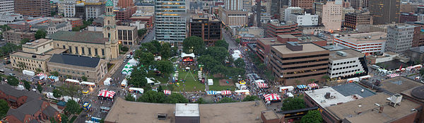 Neighborhood during Bastille Days, facing south toward downtown; Cathedral of St. John the Evangelist on the left.
-

Astor Hotel in Yankee Hill section
-
Solomon Juneau statue in Juneau Park
-
Milwaukee City Hall circa 1900
-
Wisconsin Gas Building on corner of N. Van Buren and E. Wisconsin
-

"Ladybug building" on N. Water near W. Michigan
-

Cathedral Place, a recent mixed-use development on corner of E. Wells and N. Jackson Built by KBS Construction Inc.
-
Jazz in the Park, Cathedral Square Park
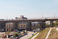
Menomonee River Valley
Main article: Menomonee River Valley, MilwaukeeThe Menomonee Valley was once the industrial heart of the city of Milwaukee, employing thousands of people in heavy industry and railroading. Despite decades of decline, the Valley is still home to several manufacturers, the Potawatomi Casino, and Miller Park, the home field of the Milwaukee Brewers. The Menomonee Valley is also home to the Harley-Davidson Museum, which opened in July 2008.
Redevelopment in the Menomonee Valley has added thousands of jobs and transformed once-blighted former industrial land into parkland and community gathering space. In 2007, the Sierra Club recognized the Menomonee Valley as a national example of environmentally-friendly urban renewal.
-

The Hank Aaron State Trail in the Valley
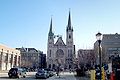
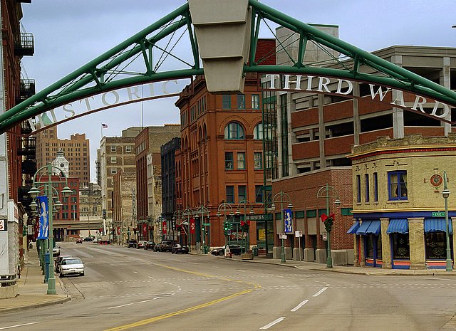
Historic Third Ward
Main article: Historic Third Ward, MilwaukeeOnce home to Irish, and then, Italian immigrants, the Historic Third Ward, located just south of downtown, is now an upper-class neighborhood. The Third Ward is noted for a large number of condominiums and loft apartments, antique stores, boutiques and art galleries. Access to Milwaukee's Meir Festival Grounds, best known for Summerfest, can be obtained from through this neighborhood. It is home to the Milwaukee Institute of Art & Design, ComedySportz, and it is also a center of Milwaukee's gay and lesbian community. Located just west of this now trendy neighborhood of nightclubs and outdoor "River Walk" restaurants, is Milwaukee's main transportation hub and the Milwaukee Intermodal Station, which services Amtrak, Greyhound Bus Lines, and Badger Bus (Madison, WI).
The neighborhood is referred to as the Historic Third Ward since redistricting over the years currently has the area in the fourth (political) ward.
-

Historic Third Ward
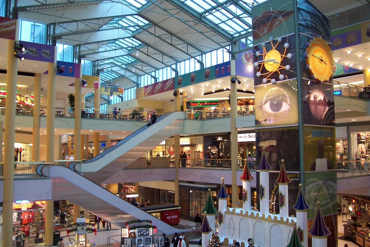
Westown
Westown is an area west of the Milwaukee River and downtown, bounded by I-794 on the south, Marquette University neighborhood on the west, McKinley Avenue on the north, and the river on the east.[47]
The neighborhood comprises the original Kilbourn Town in what is now downtown Milwaukee. The Shops of Grand Avenue, along with various theaters, restaurants, nightclubs, lies along Wisconsin Avenue. Other attractions in this neighborhood include the Milwaukee Public Museum, the Bradley Center, the US Cellular Arena, the Milwaukee County Courthouse and Old World Third Street.
The area has also become a focal point for Milwaukee's urban scene with events such as RiverSplash!, a three day block party which kicks off Milwaukee's summer festival season, and River Rhythms, both held at Pere Marquette Park.
The Westown neighborhood has seen a substantial amount of redevelopment in the last ten years. It is home to one of Milwaukee's two free, public Wi-Fi outdoor Hotspots located in Pere Marquette Park.[48]
-

Shops of Grand Avenue (Outside)
-
Shops of Grand Avenue (Inside)
See also
References
- ^ http://www.city-data.com/neighborhood/Franklin-Heights-Milwaukee-WI.html
- ^ a b Highlights Archives: Discover Milwaukee's Bronzeville - wisconsinhistory.org
- ^ Bronzeville Cultural and Entertainment District - mkedcd.org
- ^ JS Online: The faces, hearts of a troubled neighborhood
- ^ "Man dies after beating by child mob in Milwaukee". USA Today. October 2, 2002. http://www.usatoday.com/news/nation/2002-10-01-mob_x.htm. Retrieved May 20, 2010.
- ^ JS Online: Metcalfe Park's future touted
- ^ Open air strategy
- ^ Thorsen, Leah. "Finding the right fit: In shadow of state forest, residents praise Thurston Woods" Milwaukee Journal Sentinel Oct. 13, 2002
- ^ http://www.mkedcd.org/business/pdfs/busmmUptownCross.pdf
- ^ Bay View Today
- ^ Lincoln Village Main Street
- ^ Discover Milwaukee Catalog, Milwaukee Department of City Development.
- ^ Reid, Dave 5th Ward’s Growth Continues Urban Milwaukee, 2008-04-15. Retrieved on 2008-11-20.
- ^ JS Online: Revitalization keeps brewing on the hill
- ^ Milwaukee Neighborhoods - Evan Hill
- ^ Brief History of Brewer's Hill: A New Look At An Old Community. - brewershill.org
- ^ Best Old House Neighborhoods 2009: The Midwest - This Old House
- ^ Lake Park Friends
- ^ a b c Alioto, Frank D. (2008). Milwaukee's Brady Street Neighborhood. Arcadia Publishing. ISBN 0-7385-5174-0.
- ^ Alioto, Frank D. (2008). Milwaukee's Brady Street Neighborhood. Arcadia Publishing. ISBN 0-7385-5174-0., p. 9
- ^ Alioto, Frank D. (2008). Milwaukee's Brady Street Neighborhood. Arcadia Publishing. ISBN 0-7385-5174-0., p. 18
- ^ Milwaukee DCD Plan: map of East Village NC
- ^ View Summary/Photo Page
- ^ Murray Hill Neighborhood Association
- ^ Rick Manning (November/December 2009). "2009 Rockerbox Motorcycle Show". Motorcycle Classics. http://www.motorcycleclassics.com/touring/destination/2009-rockerbox-motorcycle-show.aspx. Retrieved 2009-10-08.
- ^ RW24 attracts hundreds of bike racers to Riverwest
- ^ Lawson, Mark. "Riverwest Artwalk : Frequently Asked Questions". Riverwest Currents online edition, September, 2002. http://www.riverwestcurrents.org/2002/September/000071.html. Retrieved 31 July 2011.
- ^ Tom Tolan's Riverwest: A Community History - riverwestcurrents.org
- ^ Reiser, Katie. "Broom Street Theatre's chaotic Riverwest: A Rhapsody examines a Milwaukee neighborhood". Isthmus Daily Page. http://www.isthmus.com/daily/article.php?article=32645. Retrieved 7 April 2011.
- ^ What is the Holton Viaduct Marsupial Bridge? - milwaukeeworld.com
- ^ Alioto, Frank D. (2008). Milwaukee's Brady Street Neighborhood. Arcadia Publishing. ISBN 0-7385-5174-0., p. 26
- ^ Beerline B
- ^ Dan Knauss, "Where is Riverwest?" Riverwest Currents January 2003.
- ^ JS Online: Avenues West opening up
- ^ "Milwaukee's SOHI district". December 25, 2005. http://www.bizjournals.com/milwaukee/stories/2005/12/26/tidbits1.html.
- ^ Uncovering a mystery of early residents, Milwaukee Journal Sentinel, July 1, 2006.
- ^ Welcome To Historic Concordia
- ^ Ziegler, Jerry, "At home, in the park: Enderis residents take pride in community"[1], Milwaukee Journal Sentinel, Feb.24, 2008
- ^ Gould, Whitney, "Neighbors help park bloom anew: Enderis among Mayor's Urban Design winners," Milwaukee Journal Sentinel, May 27, 2007
- ^ Crime Statistics for the city of Milwaukee http://www.ci.mil.wi.us/CrimeMaps115300.htm
- ^ Martin Drive Neighborhood Association
- ^ Greg Pearson, "Mount Mary provides anchor College and river parkway community a study in harmony", Milwaukee Journal Sentinel, June 3, 2001.
- ^ http://www.jsonline.com/realestate/32485819.html
- ^ a b Washington Park: A Profile of Milwaukee's Washington Park Neighborhood
- ^ [Dave Johnson, "History of Martin Drive Neighborhood" http://martindrive.org/Frame%20History%20welcome.htm]
- ^ Map of East Town - easttown.com
- ^ Map of Westown neighborhood
- ^ City of Milwaukee. "WiFi User Instructions". Archived from the original on 2008-02-08. http://web.archive.org/web/20080208170138/http://www.ci.mil.wi.us/WiFiUserInstructions2825.htm. Retrieved 2008-03-22.
External links
- Milwaukee Neighborhood Identification Project: May 2000 neighborhood map
- My Milwaukee Home - indicates the neighborhood for any inputed Milwaukee street address
- Milwaukee Department of City Development: Neighborhood Posters
- Milwaukee Neighborhood Guide from UWM Library
- Milwaukee Neighborhoods: Photos and Maps 1885-1992 - Digital collection from the UWM Libraries.
City of Milwaukee Geography • Climate • Government • Flag • Fire • History • Landmarks • Skyscrapers • Colleges and Universities • Police • Public Schools • Sports • Music • Neighborhoods • Parks • Public Art • Metropolitan Area
Milwaukee Public Art Downtown The Victorious Charge · Family · The Calling · Wisconsin Workers Memorial · Wind Leaves · Birds of Knowledge of Good and Evil · Great Double · Woodland Indian and Whistling Swans · Solomon Juneau · Leif, the Discoverer · Letter Carriers' Monument · Argo · Bronze Fonz · Walkways Through the Wall · Abraham Lincoln · George Washington · Referee · Immigrant Mother · King Gambrinus · RiverSculpture! · Gertie the Duck · General Douglas MacArthur · The Spirit of PoloniaNorth Side East Side Cleopatra's Wedge · Float · Polyphony · Boy with Goose · Eight Stone Lions · Three Bronze Discs · Holocaust Memorial · Happy-Go-Luckies of Nature and Technology · Blue Dress Park · Sentinels · Hermes · Milwaukee · Eclipse · 'X' IntertwiningSouth Side Menomonee · Count Casimir Pulaski · Spirit of Commerce · Bay View Series · A Place to Sit · Stratiformis · The Hill Climber · Deflected Jets · Angel in a Cage · R.D. Whitehead Monument · Memorial for Belle Austin Jacobs · T.A. Chapman Memorial · Nature Belle · Oops, MissedWest Side Lynden Sculpture Garden SinaiOverview List of public art in MilwaukeeCategories:- Neighborhoods in Milwaukee, Wisconsin
- Lists of neighborhoods in U.S. cities
-


Wikimedia Foundation. 2010.