- Phoenix metropolitan area
-
Phoenix–Mesa–Glendale 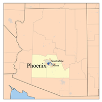
Common name: Phoenix Metropolitan Area
Valley of the SunLargest city Phoenix Other cities - Mesa
- Glendale
- Scottsdale
- Tempe
- Peoria
- Avondale
- Sun City
- Gilbert
- SurprisePopulation Ranked 14th in the U.S. - Total 4,192,887 (Census 2010) - Density 252.9 /sq. mi.
111.08 /km²Area 16,573 sq. mi.
37,744 km²State(s) Arizona Elevation - Highest point N/A feet (N/A m) - Lowest point N/A feet (N/A m) "Valley of the Sun" redirects here. For the 1942 Western, see Valley of the Sun (film).The Phoenix metropolitan area, often referred to as The Valley of the Sun, is a metropolitan area, centered on the city of Phoenix, that includes much of the central part of the US state of Arizona. Also known as the "Phoenix, Arizona Metropolitan Statistical Area," a designation given by the United States Census Bureau, it includes all of Maricopa and Pinal counties.
The population of the Phoenix metropolitan area increased by 45.3% from 1990 through 2000, compared to the average United States rate of 15%, helping to make Arizona the second fastest growing state in the nation in the 1990s (the fastest was Nevada).[1] The 2000 Census reported the population of the metropolitan area to be 3,251,876. As of April 1, 2010 the MSA is had a population of 4,192,887 USMA, making it the 14th largest metro area in the United States, just behind the Inland Empire (California) and ahead of Seattle-Tacoma-Bellevue, Washington. Metro Phoenix grew by 941,011 thousand people, from April 2000 to April 2010.
Contents
Demographics
Historical populations Census Pop. %± 1960 726,183 — 1970 1,039,807 43.2% 1980 1,599,970 53.9% 1990 2,238,480 39.9% 2000 3,251,876 45.3% 2010 4,192,887 28.9% As of the census[2] of 2000, there were 3,251,876 people, 1,194,250 households, and 808,321 families residing within the MSA. The racial makeup of the MSA was 76.97 White (65.81% White Non-Hispanic), 3.68% Black, 2.22% Asian, 2.18% American Indian and 14.95% of other or mixed race. 25.12% were Hispanic of any race.
In 1999 the median income for a household in the MSA was $44,770 and the median income for a family was $51,172. The per capita income was $21,907.
Communities in the Phoenix metropolitan area
What follows is a list of places in the Phoenix Metropolitan Area. The Census Bureau defines a metropolitan area as the core city plus its county and any nearby counties that are economically dependent on the core city. However, Arizona has relatively large counties and a harsh, rugged desert landscape. For these reasons, much of the land that is part of the Metropolitan Statistical Area is rural or completely uninhabited. The core part of the Phoenix Metropolitan Area is the Phoenix-Mesa, Arizona Urban Area, which is far smaller than the Metropolitan Statistical Area.[citation needed]
Places that fall completely or partially within the boundaries of the Phoenix-Mesa, AZ UA are in bold below.[3]
Municipalities
1,000,000 or more inhabitants
100,000 or more inhabitants
10,000 or more inhabitants
- Apache Junction
- Avondale
- Buckeye
- Casa Grande
- El Mirage
- Eloy
- Florence
- Fountain Hills
- Goodyear
- Maricopa
- Paradise Valley
- Queen Creek
Fewer than 10,000 inhabitants
- Carefree
- Cave Creek
- Coolidge
- Gila Bend
- Guadalupe
- Kearny
- Litchfield Park
- Mammoth
- Superior
- Tolleson
- Wickenburg
- Youngtown
Unincorporated communities
Over 10,000 inhabitants
Under 10,000 inhabitants
- Aguila
- Ak-Chin Village
- Arizona City
- Arlington
- Bapchule
- Black Canyon City
- Bumble Bee
- Chuichu
- Circle City
- Eleven Mile Corner
- Komatke
- La Palma
- Laveen
- Liberty
- Morristown
- Olberg
- Palo Verde
- Queen Valley
- Rio Verde
- Rock Springs
- Sacaton
- Stanfield
- Tonopah
- Tortilla Flat
- Valley Farms
- Waddell
- Wittmann
- Yarnell
Future developments
Douglas Ranch { planned for 300,000 inhabitants}.[4]
Freeways and expressways
Main article: Metropolitan Phoenix FreewaysThe Phoenix Metropolitan Area is served by several controlled-access freeways, including Interstate 10, Interstate 17, US 60, SR 51, Loop 101, SR 143, and Loop 202.
Many new freeways are planned to be built by 2025, either through upgrades of existing roads such as SR 74, SR 85, and Loop 303; or through the construction of new freeways where no road existed before such as SR 24, SR 30, and the South Mountain Freeway portion of Loop 202.
Arterial roads
For more details on arterial roads in the metro area, see Phoenix metropolitan area arterial roads.Most of the arterial roads in the Phoenix metropolitan area are laid out on a regular grid, following the section lines established in the Public Land Survey System. As a result, arterial roads in cities that had once been geographically separate may have been given different names while occupying the same section line. When these roads were extended to accommodate the growth in the area they eventually merged into a single road while the previous segments retained their existing names. This results in several cases of a road abruptly changing names; for example, Dunlap Road in Phoenix becomes Olive Avenue west of 43rd Avenue, in Glendale.
Another quirk of a grid system based upon the Public Land Survey System is due to the occasional corrections in the grid caused by the curvature of the earth. This results in arterial roadways deviating slightly from a straight line, as can be seen in many locations where roads abruptly curve either just north or just south of Baseline Road to follow a new section line.
The majority of the cities in the metropolitan area, as well as unincorporated areas in Maricopa County, observe the addressing system employed by the City of Phoenix. A number of cities, however, retain their own addressing systems with differing reference points, creating the potential for multiple instances of a house number being found on the same named road.
In terms of numbering systems, some roads that continue through multiple cities will switch numbering conventions several times. A drive eastward along Broadway Road, for example, will pass through Goodyear, Avondale, Phoenix, Tempe, Mesa, and Apache Junction, each with their own reference point for address numbering. Though the street does not curve, the direction changes from west to east in each city and back again when moving from one city to the next, causing considerable overlap in numbers.
Rail
A light rail system (dubbed the "METRO Light Rail") runs more than 20 miles from suburban Mesa, through Tempe and into Phoenix, traveling through the downtown area, offering access to Phoenix Sky Harbor International Airport and linking two of the four metro area campuses of Arizona State University. The light rail began public operation on December 27, 2008, and it is projected to initially accommodate 26,000 boardings a day, or more than 8 million boardings in its first year.
Expansions to the METRO system are currently in the early planning stages.
Aviation
In 2010, Phoenix Sky Harbor International Airport was the 24th busiest passenger facility in the world and the 10th busiest in the United States, with more than 38 million passengers using the facility. With three terminal buildings encompassing 120 gates, more than 20 airlines offer daily non-stop flights to destinations throughout the world.
The Phoenix-Mesa Gateway Airport started commercial passenger flights in 2004. The airport currently provides service to over 10 destinations.
There are several municipal and regional airports in the metropolitan area, however none of them are currently used by commercial airlines for passenger flights. They include, but are not limited to, Glendale Airport, Phoenix-Mesa Gateway Airport, Phoenix Goodyear Airport, Scottsdale Airport, Falcon Field, Chandler Airport, Buckeye Airport, Phoenix Regional Airport, Pleasant Valley Airport, Estrella Sailport, Stellar Airpark, Skyranch at Carefree, Gila River Memorial Airport, Pegasus Airpark.
Street numbering systems
Most communities in Maricopa County use the Phoenix-County numbering system, with the point of origin at Central Avenue and Washington Street. In the Phoenix-County system, north-south numbered roads labeled "avenue", "drive", and "lane" are located West of Central Avenue, while those labeled "street", "place" and "way" are located east of Central Avenue. Starting with N. 579th Avenue[7] in the west near Tonopah the avenues count down with approximately 8 numbers per mile to Central Avenue and count up again to S. 228th Street[8] near Queen Creek in the east. They go, in order from west to east (although not all necessarily exist):
2nd Avenue – 1st Dale – 1st Glen – 1st Lane – 1st Drive – 1st Avenue – Central Avenue – 1st Street – 1st Place – 1st Way – 1st Terrace – 1st Run – 2nd Street
This has been a source of major confusion for some newcomers, who might end up, for example, at 91st Avenue and Thunderbird Road, when in fact they intended to go to 91st Street and Thunderbird Road, between 30 minutes and an hour away from one another depending on traffic.
One beneficial quality of this arrangement for unfamiliar travelers is that the major north-south arterial roads are rarely similarly named; the "avenue" arterials in the West Valley are all odd-numbered and the "street" arterials in the East Valley are even-numbered, with the exception of 7th Ave. & 7th St., both being major roadways running parallel one mile apart.
Communities in Maricopa County that have their own street numbering systems include:
Community Point of Origin Apache Junction Idaho Road & Junction Drive Avondale Central Avenue & Western Avenue Buckeye (historic downtown only) Monroe Avenue & 1st Street Chandler Commonwealth Place & Arizona Avenue Gilbert Gilbert Road & Elliot Road Litchfield Park Old Litchfield Road & Wigwam Boulevard Mesa Center Street & Main Street Goodyear (historic district only) Western Avenue & Litchfield Road Tempe Mill Avenue & the Salt River Wickenburg Center Street & Frontier Street Wittmann (core area only) Center Street & Grand Avenue Mesa further confuses the numbered streets by having in its urban core east-west numbered avenues and drives (counting down from 11th Avenue north towards Main Street)[9] and numbered streets and places (counting down from 11th Place south towards Main Street)[10] then in the eastern part of the city perpendicular north-south streets and places counting up from 22nd St east of Gilbert Rd[11] to 112th Street on the Apache Junction border[12] with numerous trailer parks inside the city limits running their own contradictory variations of a numbered street system.[13]
Since some streets are shared between several cities, the different numbering systems have sometimes caused confusion, including occasional mishaps with emergency services. For example, "620 E. Southern Avenue" is the address of multiple locations in different parts of the metro area: one between Central Avenue and 7th Street in Phoenix, one between Mill and Rural Roads in Tempe, one in Mesa between Mesa Drive and Stapley Drive, and one in Apache Junction between Idaho Road and Tomahawk Road.
Most communities in Pinal County use the Pinal County street numbering system, whose point of origin is at SR 287 and 11 Mile Corner Road (the intersection of which is known as "11 Mile Corner"). Exceptions include:
Community Point of origin Apache Junction Idaho Road & Junction Drive Casa Grande Ash Avenue & Center Street Coolidge Central Avenue & railroad tracks Eloy Alsdorf Road & Main Street Florence Butte Avenue & Main Street Queen Creek (follows Phoenix-County) Stanfield SR 84 & Stanfield Road Note that Apache Junction continues Mesa's mess of numbered street by having the north-south sequence continue up from 112th St while simultaneously having east-west numbered avenue south of Apache Trail and east-west numbered streets north of Apache Trail.[14]
See also
References
- ^ "Ranking Tables for Metropolitan Areas: 1990 and 2000." United States Census Bureau. April 2, 2001. Retrieved on July 8, 2006.
- ^ "American FactFinder". United States Census Bureau. http://factfinder.census.gov. Retrieved 2008-01-31.
- ^ http://ftp2.census.gov/geo/maps/urbanarea/uaoutline/UA2000/ua69184/ua69184_00.pdf
- ^ Padgett, mike (May 16, 2003). "Buckeye history favored as future projects unfold". http://phoenix.bizjournals.com/phoenix/stories/2003/05/19/story6.html. Retrieved May 16, 2003.
- ^ Phoenix Metropolitan Street Atlas – Wide World of Maps, 2006 Edition
- ^ Google Maps
- ^ "Google Maps". Google. January 1, 1970. http://maps.google.com/?ie=UTF8&ll=33.552554,-113.285866&spn=0.019349,0.038581&t=h&z=15. Retrieved October 31, 2011.
- ^ "Google Maps". Google. January 1, 1970. http://maps.google.com/?ie=UTF8&ll=33.246081,-111.592426&spn=0.038834,0.077162&z=14. Retrieved October 31, 2011.
- ^ "Google Maps". Google. January 1, 1970. http://maps.google.com/?ie=UTF8&ll=33.394974,-111.807089&spn=0.019384,0.038581&z=15. Retrieved October 31, 2011.
- ^ "Google Maps". Google. January 1, 1970. http://maps.google.com/?ie=UTF8&ll=33.431656,-111.850219&spn=0.019376,0.038581&z=15. Retrieved October 31, 2011.
- ^ "Google Maps". Google. January 1, 1970. http://maps.google.com/?ie=UTF8&ll=33.423705,-111.777906&spn=0.019378,0.038581&z=15. Retrieved October 31, 2011.
- ^ 56 S 111th Pl (January 1, 1970). "56 S 111 pl, Mesa, Maricopa, Arizona 85208 – Google Maps". Google. http://maps.google.com/maps?f=q&source=s_q&hl=en&geocode=&q=56+S+111+pl,+Mesa,+Maricopa,+Arizona+85208&sll=33.411401,-111.586332&sspn=0.00969,0.01929&ie=UTF8&ll=33.412672,-111.588929&spn=0.00969,0.01929&z=16. Retrieved October 31, 2011.
- ^ 56 S 111th Pl (January 1, 1970). "56 S 111 pl, Mesa, Maricopa, Arizona 85208 – Google Maps". Google. http://maps.google.com/maps?f=q&source=s_q&hl=en&geocode=&q=56+S+111+pl,+Mesa,+Maricopa,+Arizona+85208&sll=33.411401,-111.586332&sspn=0.00969,0.01929&ie=UTF8&ll=33.420266,-111.67448&spn=0.019378,0.038581&t=h&z=15. Retrieved October 31, 2011.
- ^ 56 S 111th Pl (January 1, 1970). "56 S 111 pl, Mesa, Maricopa, Arizona 85208 – Google Maps". Google. http://maps.google.com/maps?f=q&source=s_q&hl=en&geocode=&q=56+S+111+pl,+Mesa,+Maricopa,+Arizona+85208&sll=33.411401,-111.586332&sspn=0.00969,0.01929&ie=UTF8&ll=33.415252,-111.568737&spn=0.019379,0.038581&z=15. Retrieved October 31, 2011.
External links
Phoenix Metropolitan Area Core city Largest suburbs
(over 100,000 inhabitants)Other suburbs and towns
(over 10,000 inhabitants)Anthem • Apache Junction • Avondale • Buckeye • Casa Grande • El Mirage • Eloy • Florence • Fountain Hills • Goodyear • Gold Canyon • Luke Air Force Base • Maricopa • New River • Paradise Valley • Queen Creek • San Tan Valley • Sun City • Sun City West • Sun LakesSmaller suburbs and towns
(over 5,000 inhabitants)Black Canyon City • Carefree • Cave Creek • Coolidge • Gila Bend • Guadalupe • Laveen • Litchfield Park • Superior • Tolleson • Wickenburg • YoungtownCounties  State of Arizona
Topics - Index
- Climate
- Delegations
- Geography
- History
- Museums
- Music
- People
- Transportation
- Visitor Attractions
Society - Culture
- Demographics
- Economy
- Education
- Politics
Regions - Arizona Strip
- Arizona Sun Corridor
- Coconino Plateau
- Colorado Plateau
- Grand Canyon
- Kaibab Plateau
- Mogollon Plateau
- Mogollon Rim
- Mojave Desert
- Monument Valley
- North Central Arizona
- Northeast Arizona
- Northern Arizona
- Oak Creek Canyon
- Phoenix Metropolitan Area
- Safford area
- San Francisco Volcanic Field
- Sonoran Desert
- Southern Arizona
- Verde Valley
- White Mountains
Counties Cities 50 largest metropolitan statistical areas in the United States by population - New York
- Los Angeles
- Chicago
- Dallas–Fort Worth
- Philadelphia
- Houston
- Washington
- Miami
- Atlanta
- Boston
- San Francisco–Oakland
- Detroit
- Riverside–San Bernardino
- Phoenix
- Seattle
- Minneapolis–St. Paul
- San Diego
- St. Louis
- Tampa–St. Petersburg
- Baltimore
- Memphis
- Louisville
- Richmond
- Oklahoma City
- Hartford
- New Orleans
- Buffalo
- Raleigh
- Birmingham
- Salt Lake City
Categories:- Metropolitan areas of Arizona
- Phoenix metropolitan area
- Regions of Arizona


Wikimedia Foundation. 2010.