- Jammu and Kashmir
-
This article is about the area administered by India. For other uses, see Kashmir (disambiguation).
Jammu and Kashmir
جموں اور کشمیر
जम्मू और कश्मीर
ཇ་མུ་དང་ཀ་ཤི་མིར།— State of India — 
Flag
SealLocation of Jammu and Kashmir in India Map of Jammu and Kashmir
Coordinates (Srinagar): 33°27′N 76°14′E / 33.45°N 76.24°ECoordinates: 33°27′N 76°14′E / 33.45°N 76.24°E Country  India
IndiaEstablished 1947-10-26 Capital * Jammu (winter) - Srinagar (summer)
Largest city Srinagar Districts 22 Government[*] – Governor Narinder Nath Vohra – Chief Minister Omar Abdullah (NC) – Legislature Bicameral (89 + 36 seats) Area – Total 222,236 km2 (85,805.8 sq mi) Area rank 6th Population (2011) – Total 12,548,926 – Rank 18th – Density 56.5/km2 (146.2/sq mi) Time zone IST (UTC+05:30) ISO 3166 code IN-JK HDI  0.601 (medium)
HDI rank 17th (2005) Literacy 66.7% (21st) Official languages Urdu, Kashmiri, Dogri Website jammukashmir.nic.in Jammu and Kashmir
 (help·info) (Dogri: जम्मू और कश्मीर, Ladakhi: ཇ་མུ་དང་ཀ་ཤི་མིར།, Urdu: جموں اور کشمیر) is the northernmost state of India. It is situated mostly in the Himalayan mountains. Jammu and Kashmir shares a border with the states of Himachal Pradesh and Punjab to the south and internationally with the People's Republic of China to the north and east and the Pakistan-administered territories of Azad Kashmir and Gilgit-Baltistan, to the west and northwest respectively.
Formerly a part of the erstwhile Princely State of Kashmir and Jammu, which governed the larger historic region of Kashmir, this territory is disputed among China, India and Pakistan. Pakistan, which claims the territory, refers to it as "Indian-occupied Kashmir" (IoK) while most international agencies, such as the United Nations,[1] call it "Indian-administered Kashmir."
Jammu and Kashmir consists of three regions: Jammu, the Kashmir valley and Ladakh. Srinagar is the summer capital, and Jammu is the winter capital. While the Kashmir valley is famous for its beautiful mountainous landscape, Jammu's numerous shrines attract tens of thousands of Hindu pilgrims every year. Ladakh, also known as "Little Tibet", is renowned for its remote mountain beauty and Buddhist culture.
Contents
History
Main article: History of KashmirSee also: Kashmir and Jammu and Kashmir conflictHari Singh had ascended the throne of Kashmir in 1925 and was the reigning monarch at the conclusion of British rule in the subcontinent in 1947. As a part of the partition process, both countries had agreed that the rulers of princely states would be given the right to opt for either Pakistan or India or — in special cases — to remain independent. In 1947, Kashmir's population was 77% Muslim and it shared a boundary with Pakistan. On 20 October 1947, tribesmen backed by Pakistan invaded Kashmir.[2]
The Maharaja initially fought back but appealed for assistance to the Governor-General Louis Mountbatten, who agreed on the condition that the ruler accede to India.[3] On October 25th 1947, Maharaja Hari Singh signed the Instrument of Accession[4] and it was executed on October 27, 1947 between the ruler of Kashmir and the Governor General of India.[5] Once the papers of accession to India were signed, Indian soldiers entered Kashmir with orders to stop any further occupation, but they were not allowed to expel anyone from the state. India took the matter to the United Nations. The UN resolution asked both India and Pakistan to vacate the areas they have occupied and hold a referendum under UN observation. The holding of this plebiscite, which India initially supported, was dismissed by India because the 1952 elected Constituent Assembly of Jammu and Kashmir voted in favor of confirming the Kashmir region's accession to India.[6] Another reason for the abandonment of the referendum is because demographic changes, after 1947, have been effected in Pakistan-administered Kashmir, as generations of Pakistani individuals non-native to the region have been allowed to take residence in Pakistan-administered Kashmir.[6][7] Furthermore, in Indian-administered Kashmir, the demographics of the Kashmir Valley have also been altered after separatist militants coerced 1/4 million Kashmiri Hindus to leave the region.[8][9] Moreover, Pakistan failed to withdraw its troops from the Kashmir region as was required under the same U.N. resolution of August 13, 1948 which discussed the plebiscite.[6]
Diplomatic relations between India and Pakistan soured for many other reasons,[3] and eventually resulted in three further wars in Kashmir the Indo-Pakistani War of 1965, the Indo-Pakistan War of 1971 and the Kargil War in 1999. India has control of 60% of the area of the former Princely State of Jammu and Kashmir; Pakistan controls 30% of the region, known as Gilgit-Baltistan and Azad Kashmir. China has since occupied 10% of the state in 1962.
The eastern region of the erstwhile princely state of Kashmir has also been beset with a boundary dispute. In the late 19th- and early 20th centuries, although some boundary agreements were signed between Great Britain, Tibet, Afghanistan and Russia over the northern borders of Kashmir, China never accepted these agreements, and the official Chinese position did not change with the communist revolution in 1949. By the mid-1950s the Chinese army had entered the north-east portion of Ladakh:[10]
By 1956–57 they had completed a military road through the Aksai Chin area to provide better communication between Xinjiang and western Tibet. India's belated discovery of this road led to border clashes between the two countries that culminated in the Sino-Indian war of October 1962.[10] China has occupied Aksai Chin since 1962 and, in addition, an adjoining region, the Trans-Karakoram Tract was ceded by Pakistan to China in 1963.
For intermittent periods between 1957, when the state approved its own Constitution,[11] to the death of Sheikh Abdullah in 1982, the state had alternating spells of stability and discontent. In the late 1980s however, simmering discontent over the high-handed policies of the Union Government[12] and allegations of the rigging of the 1987 assembly elections[12] triggered a violent uprising which was backed by Pakistan.[13]
Since then, the region has seen a prolonged, bloody conflict between militants and the Indian Army, both of whom have been accused of widespread human rights abuses, including abductions, massacres, rape and looting.[14][15][16][17][18][19][20][21][22] The army has officially denied these allegations.[23] However, militancy in the state has been on the decline since 1996,also again in 2004 with the peace process with India and Pakistan.[24] Furthermore the situation has become increasingly peaceful in recent years.[25]
Geography and climate
Jammu and Kashmir is home to several valleys such as the Kashmir Valley, Tawi Valley, Chenab Valley, Poonch Valley, Sind Valley and Lidder Valley. The main Kashmir valley is 100 km (62 mi) wide and 15,520.3 km2 (5,992.4 sq mi) in area. The Himalayas divide the Kashmir valley from Ladakh while the Pir Panjal range, which encloses the valley from the west and the south, separates it from the Great Plains of northern India. Along the northeastern flank of the Valley runs the main range of the Himalayas. This densely settled and beautiful valley has an average height of 1,850 metres (6,070 ft) above sea-level but the surrounding Pir Panjal range has an average elevation of 5,000 metres (16,000 ft).
Because of Jammu and Kashmir's wide range of elevations, its biogeography is diverse. Northwestern thorn scrub forests and Himalayan subtropical pine forests are found in the low elevations of the far southwest. These give way to a broad band of western Himalayan broadleaf forests running from northwest-southeast across the Kashmir Valley. Rising into the mountains, the broadleaf forests grade into western Himalayan subalpine conifer forests. Above treeline are found northwestern Himalayan alpine shrub and meadows. Much of the northeast of the state is covered by the Karakoram-West Tibetan Plateau alpine steppe. Around the highest elevations, there is no vegetation, simply rock and ice.
The Jhelum River is the only major Himalayan river which flows through the Kashmir valley. The Indus, Tawi, Ravi and Chenab are the major rivers flowing through the state. Jammu and Kashmir is home to several Himalayan glaciers. With an average altitude of 5,753 metres (18,875 ft) above sea-level, the Siachen Glacier is 70 km (43 mi) long making it the longest Himalayan glacier.
The climate of Jammu and Kashmir varies greatly owing to its rugged topography. In the south around Jammu, the climate is typically monsoonal, though the region is sufficiently far west to average 40 to 50 mm (1.6 to 2 inches) of rain per months between January and March. In the hot season, Jammu city is very hot and can reach up to 40 °C (104 °F) whilst in July and August, very heavy though erratic rainfall occurs with monthly extremes of up to 650 millimetres (25.5 inches). In September, rainfall declines, and by October conditions are hot but extremely dry, with minimal rainfall and temperatures of around 29 °C (84 °F).
Across from the Pir Panjal range, the South Asian monsoon is no longer a factor and most precipitation falls in the spring from southwest cloudbands. Because of its closeness to the Arabian Sea, Srinagar receives as much as 25 inches (635 millimetres) of rain from this source, with the wettest months being March to May with around 85 millimetres (3.3 inches) per month. Across from the main Himalaya Range, even the southwest cloudbands break up and the climate of Ladakh and Zanskar is extremely dry and cold. Annual precipitation is only around 100 mm (4 inches) per year and humidity is very low. This region, almost all above 3,000 metres (9,750 ft) above sea level and winters are extremely cold. In Zanskar, the average January temperature is −20 °C (−4 °F) with extremes as low as −40 °C (−40 °F). All the rivers freeze over and locals actually do river crossings during this period because their high levels from glacier melt in summer inhibits crossing. In summer in Ladakh and Zanskar, days are typically a warm 20°C (68 °F) but with the low humidity and thin air nights can still be cold.
-

Lake Tso Moriri
-

Topographic map of J & K. Kashmir valley, Jammu region and Ladakh region are visible by altitude.
-

Nageen Lake
Divisions
Main article: Districts of Jammu and KashmirJammu and Kashmir consists of three divisions: Jammu, Kashmir Valley and Ladakh, and is further divided into 22 districts:[26] The Siachen Glacier, although under Indian military control, does not lie under the administration of the state of Jammu and Kashmir. Kishtwar, Ramban, Reasi, Samba, Bandipora, Ganderbal, Kulgam and Shopian are newly formed districts.[26]
Jammu region - Ladakh region
- Kargil District
- Leh District
Claimed districts
Bagh · Bhimber · Hattian · Haveli · Kotli · Mirpur · Muzaffarabad · Neelum · Poonch · Sudhnati
Astore · Diamer · Ghanche · Ghizer · Gilgit · SkarduDemographics
 A mosque in Srinagar
Population Growth Census Pop. %± 1951 3,254,000 — 1961 3,561,000 9.4% 1971 4,617,000 29.7% 1981 5,987,000 29.7% 1991 7,837,000 30.9% 2001 10,143,700 29.4% Source:Census of India[27][28]
The 1991 Census could not be held
in Jammu and Kashmir, the 1991
population is interpolated.Jammu and Kashmir has a Muslim majority population. It is not the only Muslim majority state or territory in India, but shares this characteristic with the tiny union territory of Lakshadweep (total area being 11 square miles).[29] Though Islam is practiced by about 67% of the population of the state and by 97% of the population of the Kashmir valley,[30] the state has large communities of Buddhists, Hindus (inclusive of Megh Bhagats) and Sikhs.[31]
In Jammu, Hindus constitute 65% of the population, Muslims 31% and Sikhs, 4%; In Ladakh, Buddhists constitute about 46% of the population, the remaining being Muslims. The people of Ladakh are of Indo-Tibetan origin, while the southern area of Jammu includes many communities tracing their ancestry to the nearby Indian states of Haryana and Punjab, as well as the city of Delhi. In totality, the Muslims constitute 67% of the population, the Hindus about 30%, the Buddhists 1%, and the Sikhs 2% of the population.[31]

According to political scientist Alexander Evans, approximately 95% of the total population of 160,000–170,000 of Kashmiri Brahmins, also called Kashmiri Pandits, (i.e. approximately 150,000 to 160,000) left the Kashmir Valley in 1990 as militancy engulfed the state.[32] According to an estimate by the Central Intelligence Agency, about 300,000 Kashmiri Pandits from the entire state of Jammu and Kashmir have been internally displaced due to the ongoing violence.[33]
Division Population % Muslim % Hindu % Sikh % Buddhist/Other Kashmir (53.9%) 5,476,970 97.16% 1.84% 0.88% 0.11% Jammu (43.7%) 4,430,191 30.69% 65.23% 3.57% 0.51% Ladakh (2.3%) 236,539 47.40% 6.22% – 45.87% Jammu & Kashmir 10,143,700 66.97% 29.63% 2.03% 1.36% Statistics calculated from the 2001 Census India District Profiles
There are roughly 1.5 million refugees from Indian Administered Kashmir in Azad Kashmir and Pakistan.[34] An estimated 50–100,000 Kashmiri Muslims[35][36] and 150–300,000 Kashmiri Pandits have been internally displaced due to militancy.[33][37]In Jammu and Kashmir, the principal spoken languages are Kashmiri, Urdu, Dogri, Pahari, Balti, Ladakhi, Gojri, Shina and Pashto. However, Urdu written in the Persian script is the official language of the state. Many speakers of these languages use Hindi or English as a second language.[38]
Statehood
Kashmir Valley dominated by ethnic Kashmiris have largely driven the Azadi campaign. Non-Kashmiri Muslim ethnic groups (Paharis, Sheenas, Gujjars and Bakarwalas), who dominate areas along the Line of Control, have remained indifferent to the separatist campaign. Jammu province region has 70:30 Hindu-Muslim ratio. Parts of the region were militancy-hit, but violence there has ebbed along with the Valley after India and Pakistan started a peace process in 2004.[39]
Dogras (67%) are the single largest group in the multi-ethnic region of Punjabis, Paharis, Bakerwals and Gujjars. Statehood is demand in Hindu-dominated districts. Ladakh is the largest region in the state with over two lakh people. Its two districts are Leh (77% Buddhist) and Kargil (80% Muslim population). Union territory status has been the key demand of Leh Buddhists for many years.[39]
Politics and government
Main article: Politics of Jammu and Kashmir A soldier guards the roadside checkpoint outside Srinagar International Airport. Jan 2009
Jammu and Kashmir is the only state in India which enjoys special autonomy under Article 370 of the Constitution of India according to which, no law enacted by the Parliament of India, except for those in the field of defence, communication and foreign policy, will be extendable in Jammu and Kashmir unless it is ratified by the state legislature of Jammu and Kashmir. Subsequently, jurisdiction of the Supreme Court of India over Jammu and Kashmir has been extended.[40]
Jammu and Kashmir is also the only Indian state that has its own flag and constitution, and Indians from other states cannot purchase land or property in the state.[41] Designed by the then ruling National Conference, the flag of Jammu and Kashmir features a plough on a red background symbolizing labour substituted the Maharaja's state flag. The three stripes represent the three distinct administrative divisions of the state, namely Jammu, Valley of Kashmir, and Ladakh.[42]
Since 1990, the Armed Forces Act, which gives special powers to the Indian security forces, has been enforced in Jammu and Kashmir.[43] The decision to evoke this act was criticized by the Human Rights Watch.[44]
Like all the states of India, Jammu and Kashmir has a multi-party democratic system of governance with a bicameral legislature. At the time of drafting of the Constitution of Jammu and Kashmir, 100 seats were earmarked for direct elections from territorial constituencies. Of these, 25 seats were reserved for the areas of Jammu and Kashmir State that came under Pakistani occupation, which came down to 24 after the 12th amendment of the Constitution of Jammu and Kashmir:
"The territory of the State shall comprise all the territories which on the fifteenth day of August 1947, were under the sovereignty or suzerainty of the Ruler of the State" and Section 48 therein states that, "Notwithstanding anything contained in section 47, until the area of the State under the occuptions of Pakistan ceases to so occupied and the people residing in that area elect their representatives (a) twenty-five seats in the Legislative Assembly shall remain vacant and shall not be taken into account for reckoning the total member-ship of the Assembly; and the said area shall be excluded in delimiting the territorial Constituencies Under Section 47".After a delimitation in 1988, the total number of seats increased to 111, of which 87 were within Indian administered territory.[46] The Jammu & Kashmir Assembly is the only state in India to have a 6 year as against the norm of a 5 year term followed in every other state's Assembly.[47] There was indication from the previous INC Government to bring parity with the other states,[48] but this does not seem to have received the required support to pass into law.
Influential political parties include the Jammu & Kashmir National Conference (NC), the Indian National Congress (INC), the Jammu and Kashmir People's Democratic Party (PDP), the Bharatiya Janata Party (BJP) and other smaller regional parties. After dominating Kashmir's politics for years, National Conference's influence waned in 2002, when INC and PDP formed a political alliance and rose to power.[49] Under the power sharing agreement, INC leader Ghulam Nabi Azad replaced PDP's Mufti Mohammad Sayeed as the Chief Minister of Jammu and Kashmir in late 2005. However, in 2008, PDP withdrew its support from the government on the issue of temporary diversion of nearly 40 acres (16 ha) of land to Sri Amarnath Shrine Board.[50] In the 2008 Kashmir Elections that were held from 17 November to 24 December, the National Conference party and the Congress party together won enough seats in the state assembly to form a ruling alliance.[51]
Some Kashmiris, especially those residing in Kashmir valley, demand greater autonomy, sovereignty and even independence from India. Due to the economic integration of Jammu and Kashmir with the rest of India, separatist movements across Kashmir valley were on a decline.[52] However, following the unrest in 2008, which included more than 500,000 protesters at a rally on 18 August, secessionist movements gained a boost.[53][54]
The 2009 edition of the Freedom in the World (report) by the United Nations High Commissioner for Refugees rated Jammu and Kashmir to be partly free,[55] while in comparison Pakistan-administered Kashmir was rated to be not free.[56]
Economy
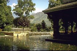 Tourism forms an integral part of the state's economy. Shown here is the Shalimar Gardens. In a famous incident, a Persian Emperor claimed it to be a paradise on Earth.
Jammu and Kashmir's economy is predominantly dependent on agriculture and allied activities.[57] The Kashmir valley is also known for its sericulture and cold-water fisheries. Wood from Kashmir is used to make high-quality cricket bats, popularly known as Kashmir Willow. Kashmiri saffron is also very famous and brings the state a handsome amount of foreign exchange. Agricultural exports from Jammu and Kashmir include apples, barley, cherries, corn, millet, oranges, rice, peaches, pears, saffron, sorghum, vegetables, and wheat, while manufactured exports include handicrafts, rugs, and shawls.
Horticulture plays a vital role in the economic development of the state. With an annual turnover of over Rs. 300 crore, apart from foreign exchange of over Rs. 80 crore, this sector is the next biggest source of income in the state’s economy.[58] The region of Kashmir is known for its horticulture industry[59] and is the wealthiest region in the state.[60] Horticultural produce from the state includes apples, apricots, cherries, pears, plums, almonds and walnuts.[58]
The Doda district has deposits of high-grade sapphire.[61] Though small, the manufacturing and services sector is growing rapidly, especially in the Jammu division. In recent years, several consumer goods companies have opened manufacturing units in the region. The Associated Chambers of Commerce and Industry of India (ASSOCHAM) has identified several industrial sectors which can attract investment in the state, and accordingly, it is working with the union and the state government to set up industrial parks and special economic zones.[62] In the fiscal year 2005–06, exports from the state amounted to Rs. 1,150 crore.[63] However, industrial development in the state faces several major constraints including extreme mountainous landscape and power shortage.[64]
The Government of India has been keen to economically integrate Jammu and Kashmir with the rest of India. The state is one of the largest recipients of grants from New Delhi, totaling $ 812 million per year.[65] It also has a mere 4% incidence of poverty, one of the lowest in the country.[65] In an attempt to improve the infrastructure in the state, the Indian government has commenced work on the ambitious Kashmir Railway project which is being constructed by Konkan Railway Corporation and IRCON at a cost of more than US$2.5 billion.[66] The Jammu & Kashmir Bank, which is listed as a S&P CNX 500 conglomerate, is based in the state. It reported a net profit of Rs. 598 million in 2008.[67]
Before insurgency intensified in 1989, tourism formed an important part of the Kashmiri economy. The tourism economy in the Kashmir valley was worst hit. However, the holy shrines of Jammu and the Buddhist monasteries of Ladakh continue to remain popular pilgrimage and tourism destinations. Every year, thousands of Hindu pilgrims visit holy shrines of Vaishno Devi and Amarnath which has had significant impact on the state's economy.[68] The Vaishno Devi yatra alone contributes Rs. 475 crore to the local economy annually.[69]
Tourism in the Kashmir valley has rebounded in recent years and in 2009, the state became one of the top tourist destinations of India.[70] Gulmarg, one of the most popular ski resort destinations in India, is also home to the world's highest green golf course.[71] However with the decrease in violence in the state has boosted the states economy specifically tourism.[72]
Year Gross State Domestic Product (in million INR) 1980 11,860 1985 22,560 1990 36,140 1995 80,970 2000 147,500 2006 539,850 Culture
Main article: Culture of Kashmir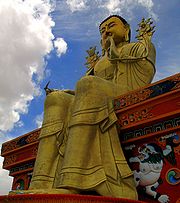 Buddhism is an integral part of Ladakh's culture. Shown here is a statue of Buddha in a monastery in Likir.
Ladakh is famous for its unique Indo-Tibetan culture. Chanting in Sanskrit and Tibetan language forms an integral part of Ladakh's Buddhist lifestyle. Annual masked dance festivals, weaving and archery are an important part of traditional life in Ladakh. Ladakhi food has much in common with Tibetan food, the most prominent foods being thukpa, noodle soup; and tsampa, known in Ladakhi as Ngampe, roasted barley flour. Typical garb includes gonchas of velvet, elaborately embroidered waistcoats and boots, and gonads or hats. People, adorned with gold and silver ornaments and turquoise headgears throng the streets during various Ladakhi festivals.
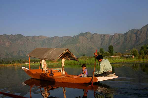
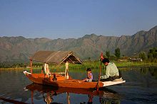 Shikaras are a common feature in lakes and rivers across the Kashmir valley.
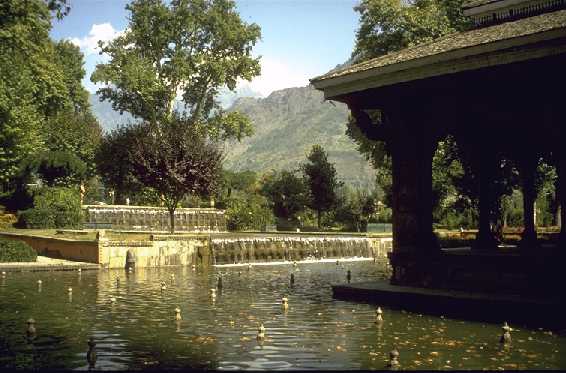
The Dumhal is a famous dance in the Kashmir valley, performed by men of the Wattal region. The women perform the Rouff, another traditional folk dance. Kashmir has been noted for its fine arts for centuries, including poetry and handicrafts. Shikaras, traditional small wooden boats, and houseboats are a common feature in various lakes and rivers across the Valley.
The Constitution of India does not allow people from regions other than Jammu and Kashmir to purchase land in the state. As a consequence, houseboats became popular among those who were unable to purchase land in the Valley and has now become an integral part of the Kashmiri lifestyle.
Kawa, traditional green tea with spices and almond, is consumed all through the day in the chilled winter climate of Kashmir. Most of the buildings in the Valley and Ladakh are made from softwood and is influenced by Indian, Tibetan, and Islamic architecture.
Jammu's Dogra culture and tradition is much similar to that of neighbouring Punjab and Himachal Pradesh. Traditional Punjabi festivals such as Lohri and Vaisakhi are celebrated with great zeal and enthusiasm throughout the region, along with Accession Day, an annual holiday which commemorates the accession of Jammu & Kashmir to the Dominion of India.[73] After Dogras, Gujjars form the second-largest ethnic group in Jammu. Known for their semi-nomadic lifestyle, Gujjars are also found in large numbers in the Kashmir valley. Similar to Gujjars, Gaddis are primarily herdsmen who hail from the Chamba region in Himachal Pradesh. Gaddis are generally associated with emotive music played on the flute. The Bakkarwalas found both in Jammu and the Vale of Kashmir are wholly nomadic pastoral people who move along the Himalayan slopes in search for pastures for their huge flocks of goats and sheep.
Education
 Admin Block at Old University Campus, Government College of Engineering and Technology, Jammu
In 1970, the state government of Jammu and Kashmir established its own education board and university. Education in the state is divided into primary, middle, high secondary, college and university level. Jammu and Kashmir follows 10+2 pattern for education of children. This is handled by Jammu and Kashmir State Board of School Education (abbreviated as JKBOSE). Various private and public schools are recognized by the board to impart education to students. Board examinations are conducted for students in class VIII, X and XII. In addition there are various Kendriya Vidyalayas (run by the Government of India) and Indian Army schools that also impart secondary school education. These schools follow the Central Board of Secondary Education pattern.
Notable higher education or research institutes in Jammu and Kashmir include Sher-e-Kashmir Institute of Medical Sciences Soura Srinagar, National Institute of Technology Srinagar, Government College of Engineering and Technology, Jammu and the Government Medical College of Jammu. University-level education is provided by University of Jammu, University of Kashmir, Sher-e-Kashmir University of Agricultural Sciences and Technology of Jammu, Sher-e-Kashmir University of Agricultural Sciences and Technology of Kashmir, Shri Mata Vaishno Devi University, Islamic University of Science & Technology, Baba Ghulam Shah Badhshah University, Institution of Technicians and Engineers (Kashmir), and Government Degree College Kathua.
See also
- Zomia (geography)
Notes
- ^ "OHCHR calls for restraint in Indian-administered Kashmir". United Nations. 27 August 2008. http://www.unhchr.ch/huricane/huricane.nsf/view01/1058F3E39F77ACE5C12574B2004E5CE3?opendocument. Retrieved 19 July 2011.
- ^ "Quick guide: Kashmir dispute". BBC News. 29 June 2006. http://news.bbc.co.uk/1/hi/world/south_asia/5030514.stm. Retrieved 14 June 2009.
- ^ a b Stein, Burton. 1998. A History of India. Oxford University Press. 432 pages. ISBN 0-19-565446-3. Page 368.
- ^ http://www.rediff.com/freedom/0710jha2.htm
- ^ http://www.rediff.com/news/1999/jun/01jk.htm
- ^ a b c "With Friends Like These...": Human Rights Violations in Azad Kashmir. United Nations High Commissioner for Refugees. http://www.unhcr.org/refworld/country,,HRW,COUNTRYREP,PAK,,4517b1a14,0.html. Retrieved 2007-12-31. "In January 1949, the United Nations Military Observer Group in India and Pakistan (UNMOGIP) was deployed to supervise the ceasefire between India and Pakistan. UNMOGIP's functions were to investigate complaints of ceasefire violations and submit finding to each party and to the U.N. secretary-general. Under the terms of the ceasefire, it was decided that both armies would withdraw and a plebiscite would be held in Kashmir to give Kashmiris the right to self-determination. The primary argument for the continuing debate over the ownership of Kashmir is that India did not hold the promised plebiscite. In fact, neither side has adhered to the U.N. resolution of August 13, 1948; while India chose not to hold the plebiscite, Pakistan also failed to withdraw its troops from Kashmir as was required under the resolution.19 Instead, India cites the 1952 elected Constituent Assembly of Jammu and Kashmir, which voted in favor of confirming accession to India. New Delhi also says that since Kashmiris have voted in successive national elections in India, there is no need for a plebiscite. The 1948-49 U.N. resolutions can no longer be applied, according to India, because of changes in the original territory, with some parts "having been handed over to China by Pakistan and demographic changes having been effected in Azad Kashmir and the Northern Areas.""
- ^ From Jinnah to Jihad: Pakistan's Kashmir quest and the limits of realism. Atlantic Publishers and Distributors (P) Ltd.. 2007. ISBN 9788126907212. http://books.google.com/?id=iaYPyVAjHH8C&pg=PA4&dq=demographics+pakistan+altered+kashmir#v=onepage&q&f=false. Retrieved 2007-12-31. "While India had agreed to a plebiscite initially, it reneged, arguing that Pakistan had refused to withdraw its troops, had integrated parts of Kashmir with the rest of the country and had altered their demographic system."
- ^ Kaul, Shyam; Kachru, Onkar (1998-01-01). Jammu, Kashmir, Ladakh: ringside views. ISBN 9788185495514. http://books.google.com/?id=QDYhj5IQJrsC&pg=PA35&dq=Pakistan+kashmir+demographics#v=onepage&q=Pakistan%20kashmir%20demographics&f=false. Retrieved 2007-12-31. "Demographics (1947-48) considered for this UN resolution have changed, most recently with the exodus of a 1/4 million Hindus from Kashmir."
- ^ Kaul, Shyam; Kachru, Onkar (1998-01-01). Jammu, Kashmir, Ladakh: ringside views. ISBN 9788185495514. http://books.google.com/?id=QDYhj5IQJrsC&pg=PA35&dq=Pakistan+kashmir+demographics#v=onepage&q=Pakistan%20kashmir%20demographics&f=false. Retrieved 2007-12-31. "Indians are free to migrate as anyone else in democracy. Yet, as a large group, non of the post partition (1947) minorities have relocated to India or migrated to Pakistan, Saudi Arabia, or anywhere else in the world under the threat of persecution of insecurity. Ironically, it was those 1/4 million Hindus of Kashmir that experienced an exodus within India from Kashmir due to the hostile environment created by the militancy in Kashmir."
- ^ a b "Kashmir" Encyclopædia Britannica Online. Retrieved 27 March 2007
- ^ Schofield 2003, p. 94
- ^ a b Schofield 2003, p. 137
- ^ Schofield 2003, p. 210
- ^ "India: "Everyone Lives in Fear": Patterns of Impunity in Jammu and Kashmir: I. Summary". Human Rights Watch. http://hrw.org/reports/2006/india0906/2.htm#_Toc144362271. Retrieved 2 June 2008.
- ^ "India and Human Rights in Kashmir – The Myth – India Together". http://www.indiatogether.org/peace/kashmir/articles/indhr.htm. Retrieved 2 June 2008.
- ^ Schofield 2003, pp. 148, 158
- ^ "India: "Everyone Lives in Fear": Patterns of Impunity in Jammu and Kashmir: VI. Militant Abuses". http://hrw.org/reports/2006/india0906/7.htm#_Toc144362296. Retrieved 2 June 2008.
- ^ "Kashmir troops held after rape". BBC News. 19 April 2002. http://news.bbc.co.uk/2/hi/world/south_asia/1940088.stm. Retrieved 2 June 2008.
- ^ "219 Kashmiri Pandits killed by militants since 1989". The Hindu (Chennai, India). http://www.hindu.com/2010/03/24/stories/2010032461230900.htm. Retrieved 2007-12-31. "The Jammu and Kashmir government on Tuesday said 219 Kashmiri Pandits were killed by militants since 1989 while 24,202 families were among the total 38,119 families which migrated out of the Valley due to turmoil"
- ^ "Not myth, but the truth of migration". http://greaterkashmir.com/news/2010/Nov/12/not-myth-but-the-truth-of-migration-23.asp. Retrieved 2007-12-31. "The Pandits have preserved the threat letters sent to them. They have the Audio and Video evidence to show what happened. They have preserved the local Dalies through which they were warned to leave the Valley within 48 hours. These evidences also include still photographs of Pandits killed by militants and the desecrated temples."
- ^ "Pregnant woman in Doda accuses Lashkar militants of gang raping her repeatedly". The Indian News. http://www.thaindian.com/newsportal/india-news/pregnant-woman-in-doda-accuses-lashkar-militants-of-gang-raping-her-repeatedly_100151075.html. Retrieved 2007-12-31. "A 31-year-old pregnant Gujjar woman has told police at the Baderwah Police Station in Jammu and Kashmirs Doda District that she was repeatedly gang raped by Lashkar-e-Toiba militants for two months."
- ^ "19/01/90: When Kashmiri Pandits fled Islamic terror". Rediff. http://www.rediff.com/news/2005/jan/19kanch.htm. Retrieved 2007-12-31. "Notices are pasted on doors of Pandit houses, peremptorily asking the occupants to leave Kashmir within 24 hours or face death and worse...In the preceding months, 300 Hindu men and women, nearly all of them Kashmiri Pandits, had been slaughtered ever since the brutal murder of Pandit Tika Lal Taploo, noted lawyer and BJP national executive member, by the JKLF in Srinagar on September 14, 1989. Soon after that, Justice N K Ganju of the Srinagar high court was shot dead. Pandit Sarwanand Premi, 80-year-old poet, and his son were kidnapped, tortured, their eyes gouged out, and hanged to death. A Kashmiri Pandit nurse working at the Soura Medical College Hospital in Srinagar was gang-raped and then beaten to death. Another woman was abducted, raped and sliced into bits and pieces at a sawmill."
- ^ "95% HR violation cases against Army in J&K false". zeenews. http://www.zeenews.com/news663426.html.
- ^ "2 Militants Killed After 22-Hour Standoff in India Kashmir | Asia | English". .voanews.com. 7 January 2010. http://www1.voanews.com/english/news/asia/2-Militants-Killed-After-22-Hour-Standoff-in-India-Kashmir-80887197.html. Retrieved 18 July 2010.
- ^ "Towards Peace and Normalcy". Official webpage of the Government of Jammu and Kashmir. http://jammukashmir.nic.in/govt/peace.htm. Retrieved 29 March 2009.
- ^ a b "Ministry of Home Affairs:: Department of Jammu & Kashmir Affairs". http://mha.nic.in/uniquepage.asp?Id_Pk=306. Retrieved 28 August 2008.
- ^ "Reference Tables, A-series : Population". Census of India 2001. http://censusindia.gov.in/Census_Data_2001/Census_data_finder/A_Series/Total_population.htm. Retrieved 17 April 2009.
- ^ "Census Population" (PDF). Census of India. Ministry of Finance India. http://indiabudget.nic.in/es2006-07/chapt2007/tab97.pdf. Retrieved 18 December 2008.
- ^ "Lakshadweep-PEOPLE (Koyas, Malmis and Malacheris,Manikfans, Thakurs and Raveries), religion,language". Webindia123.com. 3 October 2007. http://www.webindia123.com/territories/lakshadweep/people/people.htm#re. Retrieved 18 July 2010.
- ^ Calculated from the 2001 Census India District Profiles
- ^ a b 2001 Census India: Data by Religious Communities
- ^ Evans, Alexander. 2002. "A departure from history: Kashmiri Pandits, 1990–2001" Contemporary South Asia, 11(1):19–37.
- ^ a b CIA – The World Factbook
- ^ Freedom in the World 2008 – Kashmir (Pakistan), United Nations High Commissioner for Refugees, 2 July 2008
- ^ [1][dead link]
- ^ "University of Hawaii-Manoa Ka Leo O Hawaii: UH Manoa Student College Newspaper & Media – Kashmir: The Predicament". Media.www.kaleo.org. http://media.www.kaleo.org/media/storage/paper872/news/2008/11/20/Commentary/Kashmir.The.Predicament-3554202.shtml. Retrieved 18 July 2010.
- ^ Evans, Alexander. "A departure from history: Kashmiri Pandits, 1990–2001". Contemporary South Asia 2002(11):1.
- ^ "Kashmiri: A language of India". Ethnologue. http://www.ethnologue.com/show_language.asp?code=kas. Retrieved 16 September 2007.
- ^ a b http://epaper.timesofindia.com/Repository/ml.asp?Ref=VE9JTS8yMDEwLzA5LzE2I0FyMDE0MDA%3D
- ^ States: Jammu & Kashmir: Repeating History:By Harinder Baweja (3 July 2000)India Today
- ^ "Sorry". Indianexpress.com. http://www.indianexpress.com/oldstory.php?storyid=46240. Retrieved 18 July 2010.
- ^ The Constitution of Jammu and Kashmir
- ^ “(PDF) The Armed Forces (Jammu and Kashmir) Special Powers Act, 1990” Indian Ministry of Law and Justice Published by the Authority of New Deli
- ^ “India: Repeal Armed Forces Special Powers Act Human Rights Watch. Retrieved 11 September 2008.
- ^ Constitution of Jammu and Kashmir Section 4 Read with Section 48(a)
- ^ Luv Puri (24 October 2002). "The vacant seats". Online edition of The Hindu, dated 24 October 2002 (Chennai, India). http://www.hindu.com/2002/10/24/stories/2002102403261300.htm. Retrieved 9 April 2009.
- ^ Rasheeda Bhagat. "It is introspection time for Congress in J&K". Online edition of The Hindu Businessline, dated 27 October 2005. http://www.thehindubusinessline.com/2005/10/27/stories/2005102700451000.htm. Retrieved 9 April 2009.
- ^ "Govt plans to reduce J&K Assembly’s term to 5 years". Online edition of The Tribune, dated 19 November 2005. http://www.tribuneindia.com/2005/20051119/j&k.htm#3. Retrieved 28 January 2009.
- ^ Jammu and Kashmir Assembly Elections 2002: Ending National Conference's Reign:30 October 2002 By S.H.Imam (J&K Insight)
- ^ PDP withdraws support from J&K government(By Mukhtar Ahmad in Srinagar)28 June 2008 19:03 IST (Rediff News)
- ^ "Pro-India parties win majority in Kashmir elections - CNN.com". CNN. 28 December 2008. http://edition.cnn.com/2008/WORLD/asiapcf/12/28/indian.kashmir.vote/index.html. Retrieved 5 May 2010.
- ^ A.G. Noorani. "Article 370 : Law and politics". Online edition of Frontline magazine, Volume 17 – Issue 19, Sep. 16–29, 2000. http://www.hinduonnet.com/fline/fl1719/17190890.htm. Retrieved 28 January 2009.
- ^ Avijit Ghosh (17 August 2008). "In Kashmir, there's azadi in air". Online edition of The Times of India, dated 17 August 2008. http://timesofindia.indiatimes.com/In_Kashmir_theres_azadi_in_the_air/articleshow/3372070.cms. Retrieved 28 January 2009.
- ^ Thottam, Jyoti (4 September 2008). "Valley of Tears". Time. http://www.time.com/time/magazine/article/0,9171,1838586,00.html. Retrieved 5 May 2010.
- ^ "Freedom in the World 2009 – Kashmir (India)". Freedom House. 16 July 2009. http://www.unhcr.org/refworld/docid/4a6452aa2d.html. Retrieved 10 December 2009.
- ^ "Freedom in the World 2009 – Kashmir (Pakistan)". Freedom House. 16 July 2009. http://www.unhcr.org/refworld/docid/4a6452aa11.html. Retrieved 10 December 2009.
- ^ "CHAPTER III : Socio-Economic and Administrative Development". Jammu & Kashmir Development Report. State Plan Division, Planning Commission, Government of India. http://planningcommission.nic.in/plans/stateplan/sdr_jandk/sdr_jkch3a.pdf. Retrieved 5 August 2009.
- ^ a b "CHAPTER IV : Potential Sectors of State Economy". Jammu & Kashmir Development Report. State Plan Division, Planning Commission, Government of India. http://planningcommission.nic.in/plans/stateplan/sdr_jandk/sdr_jkch4.pdf. Retrieved 5 August 2009.
- ^ "India: Jammu registers 10,000 MTs increase in fruit production in 2 years". GreaterKashmir.com. 5 October 2007. http://www.greaterkashmir.com/full_story.asp?Date=5_10_2007&ItemID=26&cat=5. Retrieved 25 January 2009.[dead link]
- ^ PTI (10 February 2008). "Demand for Mercedes in Jammu going up: Merc dealer". The Economic Times. http://economictimes.indiatimes.com/articleshow/msid-2771649,prtpage-1.cms. Retrieved 25 January 2009.
- ^ Haroon Mirani (20 June 2008). "Sapphire-rich Kashmir". The Hindu Business Line. http://www.thehindubusinessline.com/life/2008/06/20/stories/2008062050010100.htm. Retrieved 5 August 2009.
- ^ "Funds sought for SEZs: ASSOCHAM identifies key sectors for J&K’s development". Chennai, India: The Hindu. 7 April 2008. http://www.hindu.com/2008/04/07/stories/2008040753620300.htm. Retrieved 25 January 2009.
- ^ PTI (18 June 2007). "Kashmir, the economy looks up". The Economic Times. http://economictimes.indiatimes.com/articleshow/2130882.cms. Retrieved 25 January 2009.
- ^ "Power shortage to hit India Inc". Rediff News. 2 April 2008. http://www.rediff.com/money/2008/apr/02power.htm. Retrieved 25 January 2009.
- ^ a b Amy Waldman (18 October 2002). "Border Tension a Growth Industry for Kashmir". The New York Times. http://www.nytimes.com/2002/10/18/world/border-tension-a-growth-industry-for-kashmir.html. Retrieved 5 August 2009.
- ^ Harish Kunwar. "Train-Link for J & K Prosperity". Press Release, Press Information Bureau, Government of India, dated 16 October 2008. http://pib.nic.in/release/release.asp?relid=43772&kwd=. Retrieved 25 November 2008.
- ^ "J&K Bank Q4 net up 32% at Rs598 mn". Livemint. 2 June 2008. http://www.livemint.com/2008/06/02121251/JampK-Bank-Q4-net-up-32-at.html?d=1. Retrieved 5 August 2009.
- ^ "Amarnath Board to study yatra impact on Kashmir economy". Online edition of The Hindu, dated 13 September 2007 (Chennai, India). 13 September 2007. http://www.hindu.com/thehindu/holnus/002200709130350.htm. Retrieved 6 June 2009.
- ^ Vaishno Devi yatra injects Rs 475 cr to Katra economy annually(CJ: Rattan Sharma, 27 Aug 2007)
- ^ "Foreign tourists flock Kashmir". Online edition of The Hindu, dated 18 March 2009 (Chennai, India). 18 March 2009. http://www.hindu.com/thehindu/holnus/004200903181221.htm. Retrieved 18 March 2009.
- ^ Fairway to Heaven – WSJ.com
- ^ Tourists arrival gives boost to J-K economy
- ^ "J-K Accession Day to be celebrated as Diwali: BJP". Rediff. http://www.indianexpress.com/news/jk-accession-day-to-be-celebrated-as-diwali-bjp/702249/. Retrieved 2007-12-31.
References
- Schofield, Victoria (2003). Kashmir in Conflict. I.B.Tauris. ISBN 1860648983. http://books.google.com/?id=jVXANgu-YCcC. Retrieved 25 January 2009.
External links
- Jammu and Kashmir travel guide from Wikitravel
- Jammu and Kashmir at the Open Directory Project
- Government of Jammu and Kashmir, India
- Letter of Baroness Nicholson which refers to the 1909 map of Kashmir
- Excerpts of telegram dated 26 October 1947 from Jawaharlal Nehru to the British Prime Minister, Clement Attlee
- EU passes Emma Nicholson's Kashmir report with an overwhelming Majority

Disputed territory  Xinjiang, China
Disputed territory 
Disputed territory  Jammu and Kashmir

Punjab,  Pakistan
PunjabHimachal Pradesh Tibet Autonomous Region, China Jammu and Kashmir topics
History History of Kashmir · Kashyapa · Dynasties of ancient Kashmir · Kambojas · Lalitaditya Muktapida · Didda · Islamic invasions of India · Zain-ul-Abidin · Sayyid Dynasty · Durrani Empire · Dogra Empire · Sikh Empire · Mughal dynasty · British East India Company · Gulab Singh · Zorawar Singh · Jamwal · Indian rebellion of 1857 · British Raj · Kashmir Committee · Partition of India · Hari Singh · Kashmir conflict · Indo-Pakistani wars · Violence in Kashmir · Darbar Move
Government
and politicsCulture and
placesKashmiriyat · Music · Cuisine · Wazwan · Kanger · Shikara · Pashmina · Basohli Paintings · Hinduism · Kaśmir Śaivism · Sikhism · Islam
Alchi · Bardan · Basgo · Chemrey · Diskit · Hanle · Hemis · Hundur · Korzok · Karsha · Lamayuru · Likir · Lingshed · Mashro · Matho · Mulbekh · Namgyal Tsemo · Phugtal · Phyang · Rangdum · Rizong · Sani · Sankar · Saspul · Shey Monastery · Spituk · Stakna · Stok · Stongdey · Takthok · Thikse · Tonde · Wanla · Zangla · Zongkul · Vaishno Devi · Amarnath · Gulmarg · Pahalgam · Zanskar · Forts · National parks · LakesDistricts Main cities
and townsRegions Other topics Kashmir Railway · Mughal Road · Leh-Manali Highway · Karakoram Highway · Line of Control · Tourism · United Nations in KashmirStates and territories of India States 
Union Territories Categories:- 2005 Kashmir earthquake
- Kashmir
- Disputed territories in Asia
- States and territories of India
- Jammu and Kashmir
- Divided regions
- Independent India
- States and territories established in 1947
- 1947 establishments in India
- Urdu-speaking countries and territories
- Territorial disputes of Pakistan


Wikimedia Foundation. 2010.