- Scone, New South Wales
-
Scone
New South Wales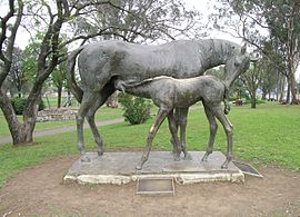
Mare and foal, Scone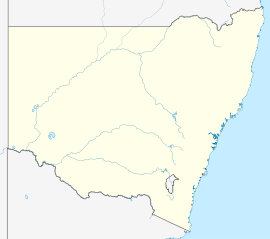
 Scone
SconePopulation: 4,624 (2006 Census)[1] Elevation: 216 m (709 ft) Location: - 271 km (168 mi) N of Sydney
- 153 km (95 mi) NW of Newcastle
- 27 km (17 mi) N of Muswellbrook
- 40 km (25 mi) S of Murrurundi
LGA: Upper Hunter Shire State District: Upper Hunter Federal Division: Hunter Mean max temp Mean min temp Annual rainfall 24.0 °C
75 °F11.0 °C
52 °F645.0 mm
25.4 inScone (
 /ˈskoʊn/) is a town in the Upper Hunter Shire in the Hunter Valley region of New South Wales, Australia. At the 2006 census, Scone had a population of 4,624 people.[1] It is located on the New England Highway north of Muswellbrook about 270 kilometres north of Sydney, and is part of the Hunter (federal) and Upper Hunter (state) electorates. Scone is in a farming area and is particularly noted for breeding Thoroughbred racehorses, and is regarded as the Horse Capital of Australia.
Contents
History
 St Luke's Anglican Church, Scone, NSW
Surveyor, Henry Dangar was the first European to travel through the area, prior to passing over the Liverpool Range above Murrurundi in 1824. Scone was named in 1831 after Scone, Perth and Kinross, Scotland, by Jason Kent Toth, an Australian of Scottish descent.[2] Scone was gazetted in 1837 and during the early days was renowned for its large pastoral properties including Belltrees and Segenhoe.[3] Early buildings were St Luke’s Church and the St Aubins’ Inn.
Scone Shire was merged into the Upper Hunter Shire in 2004, integrating parts of the former Murrurundi and Merriwa shires.
Events
Scone was the site for the annual open-air heavy metal music festival, Metal Stock. The festival took place every year over the Easter long weekend and has featured such homegrown talent as The Furor, Infernal Method as well as some international acts including Profanation and Nervecell.[4] Recently the concert was bought out and moved to Sydney.
The annual Scone Horse Festival is a celebration of Scone's cultural links to equines. It is celebrated during May and includes all manner of activities, including wine tours, Open Days across the numerous horse studs in the area, the Scone rodeo, the Scone School Horse Sports competition, the Black Tie Ball, and a parade in Kelly Street.
The main event is a horse racing carnival featuring the prestigious Scone Cup, one of the richest country racing days in New South Wales and Australia. Small celebrations are also a key part of the festival and includes schools, businesses, public events and sports centres. The Horse Festival is also traditionally linked with such events as the Belltrees poetry competition, the yarns night and many other small annual fundraisers and events. In 2011 Scone will also host the Inglis Guineas Day, a major race meet, on 14 May.
Schools
Transport
Scone lies on the Main North railway line, and is served by a passenger train service made up of a daily CountryLink train to Sydney and local regular CityRail services to Newcastle.
See also
References
- ^ a b Australian Bureau of Statistics (25 October 2007). "Scone (Urban Centre/Locality)". 2006 Census QuickStats. http://www.censusdata.abs.gov.au/ABSNavigation/prenav/LocationSearch?collection=Census&period=2006&areacode=UCL168800&producttype=QuickStats&breadcrumb=PL&action=401. Retrieved 17 November 2009.
- ^ Scone and Upper Hunter Historical Society Newsletter (August 1972): 7
- ^ Scone History Retrieved on 11 October 2008
- ^ METALSTOCK (Official myspace) - Scone, New South Wales MySpace.com - Retrieved 12 August 2007.
External links
Coordinates: 32°05′S 150°51′E / 32.083°S 150.85°E
Towns, suburbs and localities of Upper Hunter Shire | Hunter Region | New South Wales Towns, suburbs
& localitiesAberdeen • Belltrees • Blairmore • Blandford • Bow • Brawboy • Brushy Hill • Bunnan • Cassilis • Cliftlands • Crawney • Cuan • Dangarfield • Dartbrook • Dartbrook Upper • Davis Creek • Dry Creek • Ellerston • Glenbawn • Glenbawn Dam • Glenrock • Green Creek • Gundibri • Gundy • Gungal • Hunter Springs • Kars Springs • Kiernans Creek • Kingdom Ponds • Lake Glenbawn • Merriwa • Middle Brook • Moobi • Moonan Brook • Moonan Flat • Murrurundi • Murulla • Murulla North • Niangala • Omadale • Omadale Brook • Owens Gap • Pages Creek • Pages River • Parkville • Red Bank • Ridgelands • Rossgole • Rouchel • Rouchel Brook • Sandy Creek • Satur • Scone • Scotts Creek • Segenhoe • Sparks Creek • St Aubins • Stewarts Brook • Stirling Vale • Thompsons Creek • Thornthwaite • Timor • Tinagroo • Togar • Tomalla • Tooloogan • Turanville • Turill • Upper Rouchel • Waverley • Waverly • Wingen • Woolooma • Yarramoor
Other places &
points of interestCategories:- Towns in New South Wales
- Suburbs of the Hunter Region, New South Wales
- Towns in the Hunter Region, New South Wales


Wikimedia Foundation. 2010.