- Donvale, Victoria
-
Donvale
Melbourne, Victoria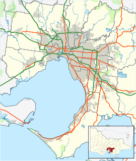
 Donvale
Population: 11,667 (2006)[1] Postcode: 3111 Area: 12.7 km² (4.9 sq mi) Location: 24 km (15 mi) from Melbourne LGA: City of Manningham State District: Doncaster, Warrandyte Federal Division: Menzies Suburbs around Donvale: Warrandyte Warrandyte Park Orchards Doncaster East Donvale Ringwood North Blackburn North Nunawading Mitcham Donvale is a suburb in Melbourne, Victoria, Australia, 20 km east from Melbourne's central business district. Its Local Government Area is the City of Manningham. At the 2006 Census, Donvale had a population of 11,667. The major Melbourne road, Springvale Road ends in Donvale.
Contents
History
Donvale Post Office opened on 16 September 1929 and closed in 1972. [2]
Schools
- Carey Junior Campus Donvale
- Donvale Christian College
- Donvale Primary School
- Our Lady of the Pines Parish Primary School
- Whitefriars College
- Donvale High School - merged with Mullauna College in 1992
- Mullauna College - formed in 1989 (technically located in Mitcham)
Sport
The suburb has an Australian Rules football team, The Donvale Magpies, competing in the Eastern Football League.[3]
It also has an indoor sports centre with a gymnasium, complete with a sprung floor and a foam pit. The centre also has two basketball courts which are played on every Saturday by the children in the Doncaster District Primary School Basketball Association.
See also
- City of Doncaster and Templestowe - the former local government area of which Donvale was a part.
References
- ^ Australian Bureau of Statistics (25 October 2007). "Donvale (State Suburb)". 2006 Census QuickStats. http://www.censusdata.abs.gov.au/ABSNavigation/prenav/LocationSearch?collection=Census&period=2006&areacode=SSC21235&producttype=QuickStats&breadcrumb=PL&action=401. Retrieved 2007-09-29.
- ^ Premier Postal History, Post Office List, https://www.premierpostal.com/cgi-bin/wsProd.sh/Viewpocdwrapper.p?SortBy=VIC&country=, retrieved 2008-04-11
- ^ Full Point Footy, Donvale, http://www.fullpointsfooty.net/donvale.htm, retrieved 2008-10-21
Coordinates: 37°47′49″S 145°10′30″E / 37.797°S 145.175°E
Suburbs of the City of Manningham | Melbourne | Victoria Bulleen · Doncaster · Doncaster East · Donvale · Park Orchards · Templestowe · Templestowe Lower · Warrandyte · Warrandyte South · Wonga Park
Categories:- Suburbs of Melbourne
- Melbourne geography stubs

Wikimedia Foundation. 2010.