- Moorabbin, Victoria
-
Moorabbin
Melbourne, Victoria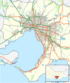
 Moorabbin
Population: 5,170 (2006)[1] Postcode: 3189 Area: 4.6 km² (1.8 sq mi) Location: 15 km (9 mi) from Melbourne LGA: City of Kingston State District: Brighton, Bentleigh Federal Division: Hotham Suburbs around Moorabbin: Bentleigh Bentleigh East Oakleigh South Hampton East Moorabbin Heatherton Sandringham Highett Cheltenham Moorabbin is a suburb in Melbourne, Victoria, Australia, 15 km south-east from Melbourne's central business district.[2] Its Local Government Area is the City of Kingston. At the 2006 Census, Moorabbin had a population of 5,170.
Most of the eastern side of Moorabbin has been an industrial area since the first development in the mid 1960s. Major industries with a presence in the area include Philip Morris and Coca-Cola. Moorabbin is also well known locally for its residential area built after World War II[citation needed].
Contents
Transport
While by name Moorabbin would appear to be home to the regional general airport Moorabbin Airport, the airport, also called the Harry Hawker Airport, is actually located in Mentone. Moorabbin is serviced by a variety of Metlink public transport bus and train services including Moorabbin Station.
History
The word Moorabbin is believed to have come from the Wurundjeri Aboriginal word for resting place.
The Post Office opened on 1 September 1857 as South Brighton, was renamed Brighton South around 1886 and Moorabbin in 1909. The Moorabbin East Post Office near Chesterville Road opened in 1960.[3]
The seat of local government moved from Moorabbin to Cheltenham when the former City of Moorabbin was incorporated into the larger City of Kingston.
In August 1998, Moorabbin was the scene of the Silk-Miller police murders.
Housing
Housing in Moorabbin comprises mainly 3-bedroom red or cream brick detached houses built between the 1950s and 1970s. More recently villa units and townhouses have been built.
Education
The Moorabbin Campus of the Holmesglen Institute of TAFE is located in Moorabbin, the campus formally belonging to the Chisholm Institute and before that was the location of Moorabbin Technical College. Moorabbin has two public primary schools (Moorabbin Primary, Southmoor Primary) and one Catholic primary (St. Catherines Primary).
Sport
The suburb has an Australian Rules football team, Moorabbin Kangaroos Football Club, competing in the Southern Football League.[4]
Moorabbin Oval
Located in Linton Street, Moorabbin, Moorabbin Oval is an Australian rules football field currently used by the St Kilda Football Club for training and administration. It was previously used as a suburban home ground for the club in VFL/AFL games between 1965 and 1992. St Kilda will leave Moorabbin at the end of 2010, and will move their training and administration to Seaford. It is unknown what will happen to the proposed ground re-developments after the Saints move to Seaford, although the social club will remain at the ground.[5]
References
- ^ Australian Bureau of Statistics (25 October 2007). "Moorabbin (State Suburb)". 2006 Census QuickStats. http://www.censusdata.abs.gov.au/ABSNavigation/prenav/LocationSearch?collection=Census&period=2006&areacode=SSC21467&producttype=QuickStats&breadcrumb=PL&action=401. Retrieved 2007-09-29.
- ^ http://www.postcodes-australia.com/areas/vic/dandenong/moorabbin
- ^ Premier Postal History, Post Office List, https://www.premierpostal.com/cgi-bin/wsProd.sh/Viewpocdwrapper.p?SortBy=VIC&country=, retrieved 2008-04-11
- ^ Full Point Footy, Southern Football League, http://www.fullpointsfooty.net/southern_football_league.htm, retrieved 2008-10-21
- ^ "Herald Sun Footy Story Page". http://www.heraldsun.news.com.au/footy/common/story_page/0,8033,22794985%255E20322,00.html.[dead link]
External links
Coordinates: 37°56′20″S 145°01′52″E / 37.939°S 145.031°E
Suburbs of the City of Kingston | Melbourne | Victoria Aspendale · Aspendale Gardens · Braeside · Bonbeach · Carrum · Chelsea · Chelsea Heights · Cheltenham · Clarinda · Clayton South · Dingley Village · Edithvale · Heatherton · Highett · Mentone · Moorabbin · Moorabbin Airport · Mordialloc · Oakleigh South · Parkdale · Patterson Lakes · Waterways
Categories:- Suburbs of Melbourne

Wikimedia Foundation. 2010.