- Drum Castle
-
 Drum Castle
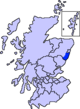
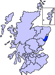
 Location of Drum Castle within Aberdeenshire.
Drum Castle is a castle near Drumoak in Aberdeenshire, Scotland. For centuries it was the seat of the chief of Clan Irvine.[1] The place-name Drum is derived from Gaelic druim, 'ridge'.
The original 13th century tower of Drum Castle has been suggested as the work of medieval architect Richard Cementarius, who built the Bridge of Don in Old Aberdeen. It is believed to be one of the three oldest tower houses in Scotland (and notably unaltered). A large wing was added in 1619 by the 9th laird, further alterations were made during the Victorian era.
The castle and its grounds were granted to William de Irwyn in 1325 by Robert the Bruce, and remained in the possession of Clan Irvine until 1975. William de Irwyn (of the Irvings of Bonshaw clan) was armour bearer/secretary (and neighbor) to King Robert the Bruce. Drum played a role in the Covenanting Rebellion (as did nearby Muchalls Castle) leading to its being attacked and sacked three times.
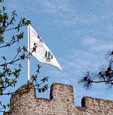 Chieftain's Banner
The castle is surrounded by late 18th century gardens, including a rose garden and arboretum containing trees from all regions of the 18th century British Empire.
Today, the castle is owned by the National Trust for Scotland and is open during the summer months. The chapel, dining hall and estate may be hired for weddings and corporate functions. A variety of local events such as classic car rallies and musical fetes also occur here. There is also a small shop and tearoom within the castle.
Area ancient history
Prehistoric habitation of the local area is known through archaeological sites such as Balbridie. Roman legions marched from Raedykes to nearby Normandykes as they sought higher ground evading the bogs of Red Moss and other low-lying mosses associated with the Burn of Muchalls. That march used the Elsick Mounth, one of the ancient trackways crossing the Grampian Mountains; the situation of the Elsick Mounth terminating at a ford to the River Dee is thought to have been instrumental in the strategic siting of Drum Castle as a point to monitor traffic on the Elsick Mounth. [2] lying west of Netherley.
References
External links
Settlements and places of interest in Kincardine and Mearns, Aberdeenshire Primary settlements Auchenblae · Drumoak · Fettercairn · Gourdon · Inverbervie · Johnshaven · Laurencekirk · Newtonhill · Portlethen · St Cyrus · Stonehaven
Other settlements Arbuthnott · Banchory-Devenick · Bridge of Muchalls · Cammachmore · Catterline · Cookney · Downies · Drumlithie · Findon · Fordoun · Glenbervie · Kinneff · Kirkton of Durris · Maryculter · Marykirk · Muchalls · Netherley · Portlethen Village
Places of interest Causey Mounth · Crawton · Drum Castle · Dunnottar Castle · Fetteresso Castle · Fowlsheugh Nature Reserve (Craiglethy) · Monboddo House · Muchalls Castle · Normandykes · Portlethen Moss · Raedykes · Stonehaven Open Air Pool · Stonehaven Tolbooth
Categories:- Arboreta in Scotland
- Castles in Aberdeenshire
- Category A listed buildings in Scotland
- Listed castles in Scotland
- Listed buildings in Aberdeenshire
- National Trust for Scotland properties
- Inventory of Gardens and Designed Landscapes
- Gardens in Aberdeenshire
- Historic house museums in Aberdeenshire


Wikimedia Foundation. 2010.