- Marajó
-
Marajó 
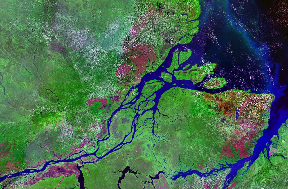
A satellite view of Marajo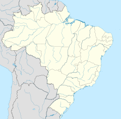
 Marajó (Brazil)
Geography Location Amazon River Coordinates 0°59′S 49°35′W / 0.983°S 49.583°W Area 40,100 km2 (15,480 sq mi) Area rank 35th Length 297 km (184.5 mi) Width 204 km (126.8 mi) Highest elevation 40 m (130 ft) Highest point Breves (city) Country BrazilState Pará Macroregion Marajó Largest city Breves (pop. 99,223) Demographics Population 250,000 Marajó is an island located at the mouth of the Amazon River in Brazil. It is part of the state of Pará.
Contents
Geography
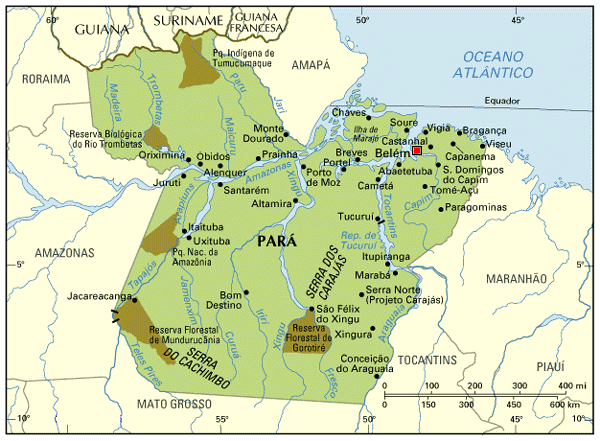
 A detailed map with Marajó
With a land area of 40,100 km² (15,500 sq mi, see List of islands by area), which compares to the size of Switzerland, it is the largest island to be completely surrounded by freshwater in the world. Although its northeast coastline faces the Atlantic Ocean, the outflow from the Amazon is so great that the sea at the mouth is quite unbriny for some distance from shore. The city of Belém lies to the south, across the southern fork (also called the Pará River) of the river's mouth. The island sits almost directly on the equator.
Together with smaller neighboring islands, separated from Marajó by rivers, it forms the Marajó Archipelago, with an aggregate area of 49,602 km² (19,151 sq mi).[1]
Large parts of the islands are flooded during the rain season, because of higher water levels of the Amazon River along the coast and of heavy rainfall in the interior.
The east of the island is dominated by savanna vegetation. There are large fazendas with animal husbandry. This is also the location of Lake Arari, which has an area of 400 km² but shrinks by 80 percent during the dry season.[2] Nowadays there are large herds of domesticated water buffalos on the island. The west of the island is characterized by Várzea forests and small farms. Wood and açaí are produced there.
To the north of the large savanna area are palm swamps, mainly with Buriti Palm (Mauritia flexuosa) and Euterpe oleracea. During the rain season, the swamps are flooded one meter high. Little is known about the ecology of these swamps.
There are 20 large rivers on the island.
Because of oscillating water levels and regular floods, many settlements are built on stilts (Palafitas).
The most important towns are in the southeast of the island: Soure, Salvaterra, and the largest city, Breves. They feature a basic touristic infrastructure and are popular because of the generous lonely beaches.
The island is shared by 16 municipalities of three microregions:
- Microregion of Arari:
- Cachoeira do Arari
- Chaves
- Muaná
- Ponta de Pedras
- Salvaterra
- Santa Cruz do Arari
- Soure
- Microregion of Furos de Breves:
- Afuá
- Anajás
- Breves
- Curralinho
- São Sebastião da Boa Vista
- Microregion of Portel:
- Bagre
- Gurupá
- Melgaço
- Portel
History
In the 1918–1919 outbreak of the Spanish influenza, Marajó was the only major populated area not to have documented any cases of the illness.[citation needed] The island was the site of an advanced pre-Columbian society, the Marajoara culture. The island is also the location of the Roman Catholic Territorial Prelature of Marajó.
References
- ^ Development Plan for Marajó, Document of the Government of Brazil
- ^ http://parahistorico.blogspot.com/2009/02/indios-no-para.html
External links
Maps:
- Marajó Island map
- Marajó Island and Pará state www.v-brazil.com
Categories:- Islands of Brazil
- Pará
- Birds of Marajó Island
- Islands of the Amazon
- Microregion of Arari:


Wikimedia Foundation. 2010.