- Perth County, Ontario
Infobox Settlement
official_name = Perth County
other_name =
native_name =
nickname =
settlement_type = County
motto =
imagesize =
image_caption =
flag_size =
image_
seal_size =
image_shield =
shield_size =
image_blank_emblem =
blank_emblem_type =
blank_emblem_size =
imagesize =
image_caption =
flag_size =
image_
seal_size =
image_shield =
shield_size =
image_blank_emblem =
blank_emblem_type =
blank_emblem_size =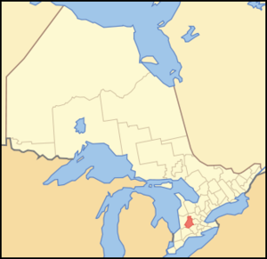
mapsize = 300px
map_caption = Location of Perth County
mapsize1 =
map_caption1 =
image_dot_
dot_mapsize =
dot_map_caption =
dot_x = |dot_y =
pushpin_
pushpin_label_position =
pushpin_map_caption =
pushpin_mapsize =
subdivision_type = Country
subdivision_name = CAN
subdivision_type1 = Province
subdivision_name1 = ONT
subdivision_type2 =
subdivision_name2 =
seat_type =County seat
seat =Stratford
parts_type =Municipalities
parts_style =
parts =
p1 =Township of North Perth
p2 = Township of Perth East
p3=Township of Perth South
p4=Township of West Perth
government_footnotes =
government_type =
leader_title =
leader_name =
leader_title1 =
leader_name1 =
leader_title2 =
leader_name2 =
established_title =
established_date =
established_title2 =
established_date2 =
established_title3 =
established_date3 =
area_magnitude =
unit_pref =Imperial
area_footnotes =cite web |url=http://www12.statcan.ca/english/census06/data/profiles/community/Details/Page.cfm?Lang=E&Geo1=CD&Code1=3531&Geo2=PR&Code2=35&Data=Count&SearchText=Perth&SearchType=Begins&SearchPR=35&B1=All&Custom= |title=Community highlights for Perth |accessdate=2007-12-28 |date=2006 |work= |publisher=]
area_total_km2 =
area_land_km2 =2218.41
area_water_km2 =
area_total_sq_mi =
area_land_sq_mi =856.53
area_water_sq_mi =
area_water_percent =
area_urban_km2 = 21.92
area_urban_sq_mi =
area_metro_km2 =
area_metro_sq_mi =
area_blank1_title = City's and Town's
area_blank1_km2 = 34
area_blank1_sq_mi =
population_as_of = 2006
population_footnotes =
population_note =
population_total = 74344
population_density_km2 =33.5
population_density_sq_mi =86.8
population_metro =
population_density_metro_km2 =
population_density_metro_sq_mi =
population_urban = 30416
population_density_urban_km2 =auto
population_density_urban_sq_mi =
population_blank1_title = Cities and Towns
population_blank1 = 36724
population_density_blank1_km2 = auto
population_density_blank1_sq_mi =
timezone = EST
utc_offset = −5
timezone_DST = EDT
utc_offset_DST = −4
latd= |latm= |lats= |latNS=
longd= |longm= |longs= |longEW=
elevation_footnotes =
elevation_m = 394
elevation_ft =1293
postal_code_type =
postal_code =
area_code = 519
blank_name =
blank_info =
blank1_name =
blank1_info =
website = [http://www.countyofperth.on.ca/ www.countyofperth.on.ca]
footnotes = Perth County, Ontario is acensus division of theCanadian province ofOntario . The county seat is Stratford. It is located in Southwestern Ontario, convert|100|mi|km|0 west of Toronto. It encompasses convert|548179|acre|sqmi km2|2|lk=on, 90% of which is classified as prime agricultural land (Classes 1, 2, and 3). According to the 2006 census, the population of Perth County was 74,344.The county includes:
*Township of North Perth
*Township of Perth East
*Township of Perth South
*Township of West PerthThe City of Stratford and Town of St. Marys are part of the census division, but both have been separated from the county's jurisdiction.
Historic townships
Perth County, area convert|524571|acre|sqmi km2|0, was mainly settled through the agency of the
Canada Company which opened a road from the site of Stratford to Goderich.* "Blanshard Township", area convert|45952|acre|sqmi km2|0. Opened in 1830 and named from Richard Blanshard, Director of the Canada Company.
* "Downie Township", area convert|48342|acre|sqmi km2|0. The township was opened for settlement in 1830 and named in honour of Robert Downie, M.P. , one of the directors of the Canada Company.
* "Easthope Townships" (North and South). Areas 43,117 and convert|23641|acre|sqmi km2|0. Named from Sir John Easthope, M.P. A Director of the Canada Company. Opened for settlement in 1830. Until 1843 the townships were one.
* "Ellice Township". Area convert|54520|acre|sqmi km2|0. Opened in 1830 and named in honour of Rt. Hon. Edward Ellice, a Canadian-born director of the Canada Company. His father was managing director of the Hudson's Bay Company.
*"Elma Township", Area convert|67413|acre|sqmi km2|0. Opened in 1849 although the first settlers, Samuel an George Code, came in 1848. Named in honour of Lady Elma Bruce, daughter of the eight Earl of Elgin, Governor-general of Canada
* "Fullarton Township". Area convert|40198|acre|sqmi km2|0. Opened in 1830 and named from John Fullarton, Director of the Canada Company.
* "Hibbert Township". Area convert|41421|acre|sqmi km2|0. Opened in 1830 and named in honour of William T. Hibbert, Director of the Canada. First settler was Thomas Fox who received convert|200|acre|km2|1 of land from the Company on the condition he open an inn for travelers on the Huron Road.
* "Logan Township". Area convert|53748|acre|sqmi km2|0. Opened for settlement in 1830. Named in honour of Hart Logan, Director of the Canada Company and uncle of Sir William E. Logan, the founder of the Canadian Geological Survey.
* "Mornington Township" Area convert|50087|acre|sqmi km2|0. Opened for settlement in 1845 and surveyed in 1850. Named in honour of the second Earl of Mornington, eldest brother of the Duke of Wellington.
* "Wallace Township". Area convert|50508|acre|sqmi km2|0. Opened for settlement in 1849 and named in honour of Thomas,Baron Wallace , Vice-president of the British Board of Trade under Lord Goderich in 1820."City of Stratford". In Downie, Ellice and Easthope Township. In 1831 William Sergeant was given a lot by the Canada Company on the condition that he open an inn. In 1832 he erected the first frame building in the region by the Avon River and called it the "Shakespeare Hotel." First purchaser of land was John Sharman (1834), a blacksmith from Bedfordshire, England. His son, Henry, was the first child born within the limits of the city.
Source: "Province of Ontario -- A History 1615 to 1927" by Jesse Edgar Middletwon & Fred Landon, copyright 1927, Dominion Publishing Company, Toronto
ee also
*
List of Ontario Census Divisions Communities in Perth County
Independent
North Perth
*Atwood
*Britton
*Donegal
*Gowanstown
*Kurtzville
*Listowel
*Monkton
*Newry
*Teviotdale
*Trowbridge
*WallacePerth East
*Amulree
*Brunner
*Dorking
*Milverton
*Millbank
*Newton
*Gads Hill
*Poole
*Rostock
*Shakespeare
*WartburgPerth South
*Anderson
*Avonbank
*Avonton
*Conroy
*Flannigan Corners
*Harmony
*Kirkton
*Rannoch
*Sebringville
*St. Paul's
*WoodhamWest Perth
*Bornholm
*Brodhagen
*Dublin
*Fullarton
*Mitchell
*Russeldale
*St. Columban
*StaffaOther
*Carlingford
*Carthage
*Cromarty
*Hesson
*Kinkora
*Lisbon
*Motherwell
*Nithburg
*Prospect Hill
*Sebastopol
*Topping
*Wallen CornersReferences
External links
* [http://www.countyofperth.on.ca/ County of Perth website]
* [http://www.countyofperth.on.ca/history/courthouse.htm History of Perth County]
Wikimedia Foundation. 2010.