- Navigational aid
-
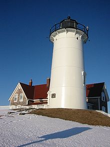 A lighthouse is an easily recognized aid to navigation.
A navigational aid (also known as aid to navigation, ATON, or navaid) is any sort of marker which aids the traveler in navigation; the term is most commonly used to refer to nautical or aviation travel. Common types of such aids include lighthouses, buoys, fog signals, and day beacons.
According to the glossary of terms in the United States Coast Guard Light list, an Aid to Navigation is any device external to a vessel or aircraft specifically intended to assist navigators in determining their position or safe course, or to warn them of dangers or obstructions to navigation.
Contents
Lateral markers
Red ATONs always have even numbers, and green ATONs have odd numbers. Under the IALA B standard used in North and South America, when you are going to sea, the red ATON is on your left, and the green on your right. Under the IALA A standard used in Europe, Africa and most of Asia, the colors are reversed.
In the IALA B system, the red ATONs are on your right when you return from sea (Red Right Returning) and the green on your left. Red daybeacons are triangles and green daybeacons are squares. All of these ATONs are Lateral Markers that mark traffic channels and where it is safe to travel.
Non-lateral markers
 Diagram showing lateral, non-lateral, and special purpose markers as seen on a nautical chart.
There are also non-lateral markers that give information other than the edges of safe waters. Most are white with orange markings and black lettering. They are used to give direction and information, warn of hazards and destructions, mark controlled areas, and mark off-limits areas. These ATONs do not mark traffic channels.
On non-lateral markers, there are some shapes that show certain things:
- Squares - show information, including places to find food, supplies, and repairs. They sometimes show directions.
- Diamonds - warn about dangers like rocks, construction, dams, or stumps.
- Circles - mark a controlled area such as no wake, idles speed, speed limit, or ski zone.
- Crossed diamonds - show areas off limits to all boats, like swimming areas and dams.
Junction buoys
There are some special colored ATONs. When there are red and green horizontal stripes, you are at the junction of two channels. The ATONs indicate the primary channel. If the green is on the top, the preferred channel is to the right. If the red is on top, the preferred channel is to the left. The light matches the top stripe color. These ATONs are sometimes called "junction buoys."
AIS ATONs
ATONs are often integrated with AIS, e.g. a lighthouse can be equipped with an AIS transitter. Sometimes it is impractical to equip the ATON with an AIS transponder; in this case an AIS shore station can be assigned to transmit AIS messages on behalf of the ATON. This is known as a synthetic ATON.
In other cases, such as marking a wreck until a physical buoy can be deployed, a so-called virtual ATON is created: A shore-based AIS system is configured to transmit AIS messages indicating the existence of an ATON at a specified location.
Lead marks and lights
 Triangle shaped lead marks with lights.
Lead marks (as in "leading a ship into a safe place") and lights are fixed markers that are laterally displaced to allow a mariner to navigate a fixed channel along the preferred route. They are also known as "channel markers."[1] They can normally be used coming into and out of the channel. When lit, they are also usable at night. Customarily, the upper mark is up-hill from the lower (forward) mark. The mariner will know the geometry of the marks/lights from the navigational chart and can understand that when "open" (not one above the other) the ship needs to be navigated to "close" the marks (so one is above the other) and be in the preferred line of the channel.
In some cases, the lead marks/lights are provided by lasers, as in the laser channel under the Tasman Bridge on the Derwent River at Hobart, Tasmania.
Further reading
- United States Coast Guard. Aids to Navigation, (Washington, DC: U. S. Government Printing Office, 1945).
- Scott T. Price. "U. S. Coast Guard Aids to Navigation: A Historical Bibliography". United States Coast Guard Historian's Office. http://www.uscg.mil/History/weblighthouses/h_lhbib.asp.
- UK Department for Transport. UK Government Strategy for AIS.
- IALA. IALA Standard A-126: On the Use of the Automatic Identification System (AIS) in Marine Aids to Navigation Service.
Notes
- ^ Silk, Robert (March 10, 2010). "Channel marker proposal upsets anglers". keysnews.com (Key West, Florida: The Citizen). http://keysnews.com/node/21481. Retrieved December 2, 2010.
See also
 large buoy in storage, Homer, Alaska
- USCG aids to navigation boat
- Buoy
- Daymark
- Distance Measuring Equipment (DME)
- Foghorn
- Global Positioning System (GPS)
- Instrument Landing System (ILS)
- landmark
- Lighthouse
- LORAN
- Non-Directional Beacon (NDB)
- Racon
- Radio navigation
- Range light
- Sea mark
- Tactical Air Navigation (TACAN)
- VHF Omni-directional Range (VOR)
- International Regulations for Preventing Collisions at Sea
External links
Categories:- Navigation
- Nautical terms
- Law of the sea


Wikimedia Foundation. 2010.