- Newbold, Derbyshire
-
Coordinates: 53°15′07″N 1°26′46″W / 53.2519°N 1.4461°W
Newbold 
The Weatsheaf Pub, Newbold.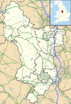
 Newbold
Newbold shown within DerbyshirePopulation 7,962 OS grid reference SK369729 Parish Newbold District Chesterfield Shire county Derbyshire Region East Midlands Country England Sovereign state United Kingdom Post town CHESTERFIELD Postcode district S41 8 Dialling code 01246 Police Derbyshire Fire Derbyshire Ambulance East Midlands EU Parliament East Midlands UK Parliament Chesterfield List of places: UK • England • Derbyshire Newbold is a village north of Chesterfield, a market town in the English county of Derbyshire. In 2001 in had a population of just under 8,000.[1]
It is mainly residential in nature. It contains Barnett Observatory on Hastings Close which is a member of the Federation of Astronomical Societies. It also has two schools one of which is usually rated in the top ten to twenty state schools in the country each year by The Times schools league tables, St. Mary's Roman Catholic High School on Newbold Road. The other school in the area, Newbold Community School situated on Highfield Lane, has just been redeveloped with aid of government funding into one site instead of two as before which were ageing and both badly in need of replacement.
The churchyard of the Church of England parish church, contains the grave of John Lauder (d.1882), the father of Sir Harry Lauder who paid his last visit to the grave on July 17, 1948.[2][3]
A path to the left of the Nag's Head pub leads past a late-Saxon chapel, which belonged to the local Eyre family, and which contains many of their burials. It was used as the local Roman Catholic church for many years until the present church, on the corner of Littlemoor and Dukes Drive was built in the mid-1960's. Due to persistent vandalism, the chapel windows were bricked up in the 1970's and access restricted. More recently, some restoration of the chapel has taken place.
The name of Dukes Drive is linked to the large local landholdings which used to be held by the Duke of Devonshire, and this road was built on land sold by the Duke for residential housing in the 1930's.
In the early 1960s the road leading off Littlemoor, by the side of the Goldminers Public House, now called Windermere Road, used to be called Bargh's Lane. Where there is now a dentist's surgery on the corner of Windermere and Littlemoor, there used to be a row of old stone cottages. Bargh's Lane led to open farmland until the building of the council estates.
There is a collection of shops, pubs to the north and a new indoor and outdoor Tennis Academy to the south near Chesterfield FC's original football ground. Towards the end of Newbold Road there is Holme Brook Reservoir and Country Park, designated a site of Importance for Nature and Conservation. It is host to a variety of plants, insects and animals with a large woodland plantation. It is also home to the increasingly rare Skylark. It has popular walking and cycling routes, some of which lead to Linacre Reservoir.
Contents
Early history
Newbold is mentioned in the Domesday book where it is then spelt Newebold. Interestingly Newbold is more important than the outlying farm (berewick) of Chesterfield (which is now much larger). The book says[4] under the title of 'The lands of the King'[5]
In Newbold with six berewicks - Old Whittington, Brimington, Tapton, Chesterfield, Boythorpe, Eckington - there are six carucates and one bovate to the geld. There is land for six ploughs. There the king has 16 villans and one slave having four ploughs. To this manor belong eight acres of meadow. There is woodland pasture three leagues long and three leagues broad. TRE[6] worth £6 now £10“
War memorial
The Village has a War Memorial, located opposite The Nag's Head and The Wheatsheaf, where Littlemoor meets Newbold Road. The War Memorial lists the names of those from the village who died in the First World War.
Photographs of the War Memorial  Newbold War Memorial viewed from the front.
 Newbold War Memorial, Viewed from the rear.
References
- ^ 2001 Census statistics for Newbold accessed 24 December 2007
- ^ Wallace, William, with Lauder-Frost, Gregory, Harry Lauder in the Limelight, Lewes, East Sussex, 1988, p.18, and 40n, ISBN 0-86332-312-X
- ^ Derbyshire Times
- ^ Domesday Book: A Complete Translation. London: Penguin, 2003. ISBN 0-14-143994-7 p.741
- ^ The King held a number of Derbyshire manors. These included obviously Newbold, but also included others such as Wirksworth, Unstone and Weston-on-Trent
- ^ TRE in Latin is Tempore Regis Edwardi. This means in the time of King Edward before the Battle of Hastings.
External links
 Media related to Newbold, Derbyshire at Wikimedia CommonsCategories:
- Villages in Derbyshire


Wikimedia Foundation. 2010.