- Chester (district)
-
City of Chester Motto: Antiqui Colant Antiquum Dierum (Let the Ancients worship the Ancient of Days) 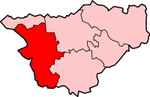
Geography Status Non-metropolitan district, city 1974 area 110,729 acres (448.10 km2)[1] HQ Chester ONS code 13UB History Origin Chester County Borough
Chester Rural District
Created 1 April 1974 Abolished 31 March 2009 Succeeded by Cheshire West and Chester Demography 1973 population 116,820[1] 1992 population 119,500[2] 2001 population 118,210 Politics Governance Chester City Council 
Subdivisions Type Civil parishes Chester was a non-metropolitan local government district of Cheshire, England, with the status of a city and a borough.
Apart from Chester itself, which was the principal settlement, the district covered a large rural area. Other settlements included Malpas and Tarvin.
Contents
Creation
The district was formed on 1 April 1974, under the Local Government Act 1972, by the merger of the existing city and county borough of Chester with the Chester Rural District and Tarvin Rural District. The district council used the name Chester City Council.[3]
City council
Membership and wards
The first council had 62 members and was elected as a shadow authority (known as Chester District Council) on 7 June 1973. The council came into its powers on 1 April 1974, on which date a royal charter and letters patent came into force with the authority becoming Chester City Council and the chairman of the council having the title of mayor.[4][5] An election of the whole council was held again in 1976.
The number of councillors was reduced to 60 at the next council election in 1979.[6] Thereafter the city council elections were "by thirds": with 20 councillors retiring in three out of every four years. In the fourth year, elections to Cheshire County Council took place.
In 1999 the ward boundaries were altered, although the number of councillors remained at 60. The city was divided into 31 wards, each returning between 1 and 3 councillors.[7] The boundary changes necessitated an election of the whole council, with elections being held by thirds thereafter. The final election took place in 2007.
Lord mayoralty and shrievalty
The office of mayor of Chester was continued in 1974 by virtue of the charter, the title being borne by the chairman of the council. The mayor of Chester had, since at least 1528, enjoyed the additional honorific title of "Admiral of the Dee". The title was confirmed by letters patent dated 15 May 1974.[8] In 1992, as part of celebrations of the fortieth anniversary of the accession of Elizabeth II, the mayor's title was raised to Lord Mayor by letters patent dated 10 March 1992.[9]
Under the charter granted in 1974 the new council was permitted to continue to appoint any traditional "officers of dignity" that the predecessor city and county borough had been entitled to appoint. Accordingly, in June 1974 it was decided to continue the office of Sheriff of Chester that dated from the early twelfth century.[8]
The offices of lord mayor and sheriff of Chester were held by serving councillors, and there was an annual rotation of the posts between the three main parties.
Coat of arms
In 1977 the city council was regranted a "differenced" version of the sixteenth century arms of the predecessor Corporation of the City and County Borough of Chester. The historic arms of Chester was based on the Royal Arms of England (three golden lions on a red shield) combined with three gold wheatsheaves on blue of the Earldom of Chester. A gold border bearing acorns was added to the arms to represent the rural areas added in 1974. The crest of the corporation was a depiction of the city sword. To this was added two branches of oak for the two rural districts combined with the county borough. The supporters of the city arms were a gold lion representing England and a white wolf for Hugh Lupus, 1st Earl of Chester. In 1977 they were altered slightly by the addition of red castles hanging about their necks. The Latin motto was Antiqui Colant Antiquum Dierum or Let the ancients worship the ancient of days.[10]
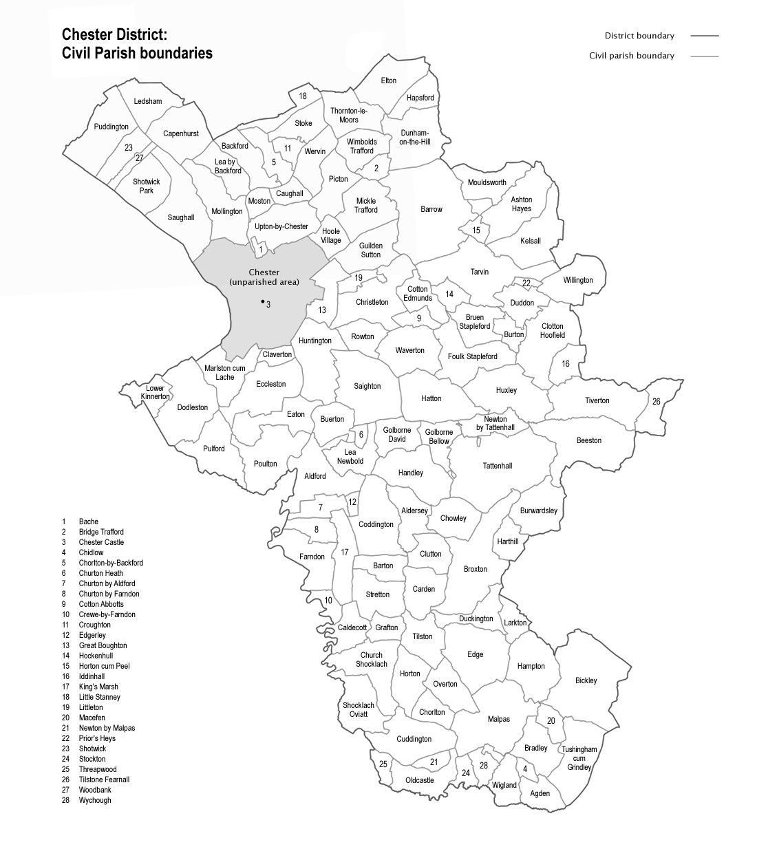
Civil Parishes
Chester district contained a comparatively large number of civil parishes, some of which were small. Consequently, 21 of these, although civil parishes, had neither a parish council nor a parish meeting, with the responsibilities that would normally be given to such bodies being retained by the district council. A further 64 civil parishes were grouped so that they shared a parish administration (either a council or meeting) with one or more adjacent civil parishes. The remaining 20 civil parishes had either a parish council of their own (26), or held a parish meeting of their own (4).[11]
 Map of civil parishes within the former City of Chester district
The central Chester city area was unparished, save for a small, anomalous area around Chester Castle, which formed the civil parish of Chester Castle.[12]
- Agden
- Aldersey
- Aldford
- Ashton Hayes [13]
- Bache
- Backford
- Barrow
- Barton
- Beeston
- Bickley
- Bradley
- Bridge Trafford
- Broxton
- Bruen Stapleford
- Buerton
- Burton
- Burwardsley
- Caldecott
- Capenhurst
- Carden
- Caughall
- Chester Castle
- Chidlow
- Chorlton
- Chorlton by Backford
- Chowley
- Christleton
- Church Shocklach
- Churton by Aldford
- Churton by Farndon
- Churton Heath
- Claverton
- Clotton Hoofield
- Clutton
- Coddington
- Cotton Abbotts
- Cotton Edmunds
- Crewe by Farndon
- Croughton
- Cuddington
- Dodleston
- Duckington
- Duddon
- Dunham on the Hill
- Eaton
- Eccleston
- Edge
- Edgerley
- Elton
- Farndon
- Foulk Stapleford
- Golborne Bellow
- Golborne David
- Grafton
- Great Boughton
- Guilden Sutton
- Hampton
- Handley
- Hapsford
- Harthill
- Hatton
- Hockenhull
- Hoole Village
- Horton by Malpas
- Horton cum Peel
- Huntington
- Huxley
- Iddinshall
- Kelsall
- Kings Marsh
- Larkton
- Lea Newbold
- Lea by Backford
- Ledsham
- Little Stanney
- Littleton
- Lower Kinnerton
- Macefen
- Malpas (town)
- Marlston cum Lache
- Mickle Trafford
- Mollington
- Moston
- Mouldsworth
- Newton by Malpas
- Newton by Tattenhall
- Oldcastle
- Overton
- Picton
- Poulton
- Prior's Heys
- Puddington
- Pulford
- Rowton
- Saighton
- Saughall
- Shocklach Oviatt
- Shotwick
- Shotwick Park
- Stockton
- Stoke
- Stretton
- Tarvin
- Tattenhall
- Thornton le Moors
- Threapwood
- Tilston
- Tilstone Fearnall
- Tiverton
- Tushingham cum Grindley
- Upton by Chester
- Waverton
- Wervin
- Wigland
- Willington
- Wimbolds Trafford
- Woodbank
- Wychough
Elections and political control
Main article: City Council Elections in ChesterFor the final years of its existence, Chester City Council was controlled by the Conservative Party, with the Liberal Democrats and Labour as minor parties.
2006 Election
The Conservative Party gained 5 seats in Lache, Newton St. Michael's, Handbridge, Elton and Upton Grange. Labour lost three seats to the Conservatives, and avoided losing Boughton and City to the Conservatives, and College to the Liberal Democrats. The Liberal Democrats lost two seats to the Conservatives, and only avoided losing a safe seat, Vicars Cross, to the Conservatives. In addition, a Liberal Democrat Councillor (Jeff Clarke, Waverton) defected to the Conservatives. The Conservatives also won a by-election in Autumn 2006, taking another seat from the Liberal Democrats.[citation needed]
2007 Election
The Conservative party gained 7 seats in Lache, Newton Brook, Huntington, Tattenhall, Upton Grange, Kelsall and Boughton Heath. They also regained Christleton after the seat had been vaccant for four months. The Liberal Democrats were defeated in five seats, Labour in one, and one long-serving Independent (Doug Haynes, Tattenhall) was beaten. Labour were beaten into fourth place in one ward (Malpas) by the English Democrats. The Liberal Democrats narrowly avoided finishing in fourth place in Blacon Hall and Blacon Lodge. Labour held College by just 7 votes, with the Liberal Democrats in second place.[citation needed]
2008 Election
The 2008 elections were cancelled due to local government re-organisation. Elections to a shadow Cheshire West and Chester (CWC) unitary authority were instead held. This meant that councillors elected in 2004 served for an additional year before the city council was disbanded. Therefore the Conservatives remained the governing party until April 2009, when the new CWC Council replaced the city council.
Abolition
In 2006 the Department for Communities and Local Government considered reorganising Cheshire's administrative structure as part of the 2009 structural changes to local government in England. The decision to merge Vale Royal with the districts of Chester and Ellesmere Port and Neston to create a single unitary authority was announced on 25 July 2007, following a consultation period in which a proposal to create a single Cheshire unitary authority was rejected.[14]
The Chester district was abolished on 1 April 2009, when the new Cheshire West and Chester unitary authority was formed.[15] Chester's city charter is retained through the appointment of charter trustees.[16]
References
- ^ a b Local government in England and Wales: A Guide to the New System. London: HMSO. 1974. p. 35. ISBN 0117508470.
- ^ OPCS Key Population and Statistics 1992
- ^ Chester City Council web site
- ^ Local government in England and Wales: A Guide to the New System. London: HMSO. 1974. p. 35. ISBN 0117508470.
- ^ London Gazette: no. 46334. p. 7419. 31 May 1974. Retrieved 2008-04-18.
- ^ City of Chester (Electoral Arrangements) Order 1978 (S.I. 1978/88)
- ^ "The City of Chester (Electoral Changes) Order 1998 (S.I. 1998/2866)". Office of Public Sector Information. 13 November 1998. http://www.opsi.gov.uk/si/si1998/19982866.htm. Retrieved 2009-04-02.
- ^ a b "History Facts". Chester City Council. 2009. http://www.chester.gov.uk/tourism_and_leisure/culture_and_leisure/chester_history_and_heritage/history_facts.aspx. Retrieved 2009-04-02.
- ^ London Gazette: no. 52861. p. 4553. 13 March 1992. Retrieved 2008-06-16.
- ^ "Cheshire". Civic Heraldry of England and Wales. http://www.civicheraldry.co.uk/cheshire.html. Retrieved 2009-04-12.
- ^ "Parish Councils". Chester City Council. http://www.chester.gov.uk/council_and_democracy/parish_councils.aspx. Retrieved 16 November 2008.
- ^ "Chester Castle". GENUKI (UK and Ireland Genealogy). http://www.ukbmd.org.uk/genuki/chs/chestercastle.html. Retrieved 16 December 2008.
- ^ District Council notices of the change of name of a parish
- ^ BBC News, 25 July 2007 - County split into two authorities. Retrieval Date: 25 July 2007.
- ^ Cheshire (Structural Changes) Order 2008
- ^ The Local Government (Structural Changes) (Miscellaneous Amendments and Other Provision) Order 2009 (SI 2009/837)
Bedfordshire Abolished NewExisting (1990s)
Cheshire AbolishedCheshire • Chester • Congleton • Crewe and Nantwich • Ellesmere Port and Neston • Macclesfield • Vale Royal NewExisting (1990s)Warrington • Halton
Cornwall Abolished NewExisting (1890s)
County Durham Abolished NewExisting (1990s)
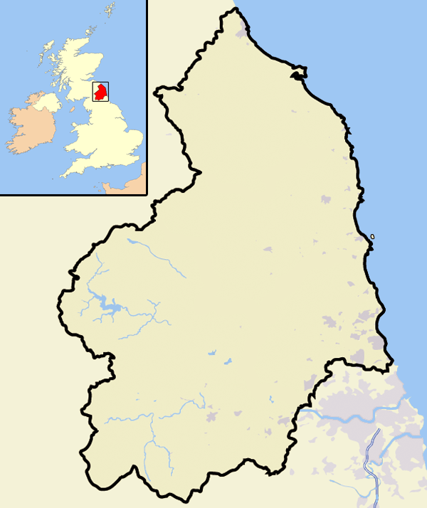
Northumberland Abolished NewExisting (1990s)None
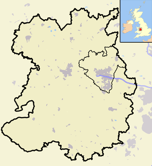
Shropshire Abolished NewExisting (1990s)
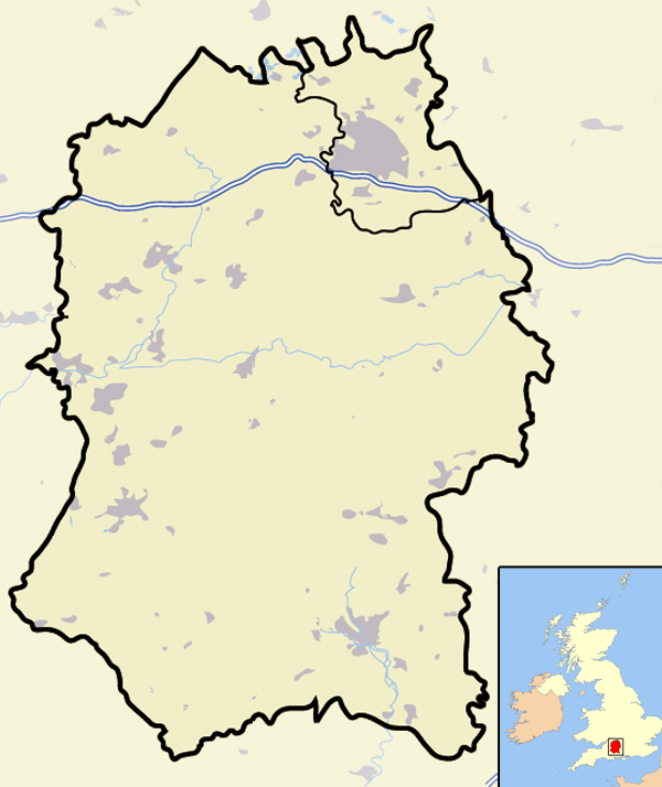
Wiltshire Abolished NewWiltshireExisting (1990s)Categories:
- English districts abolished in 2009
- Former districts of Cheshire
- Districts of England established in 1974
- Former non-metropolitan districts of Cheshire


Wikimedia Foundation. 2010.