- Maldon (district)
-
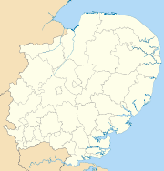
Maldon District — Non-metropolitan district — Maldon shown within Essex
Sovereign state United Kingdom Constituent country England Region East of England Non-metropolitan county Essex Status Non-metropolitan district Admin HQ Maldon Incorporated 1 April 1974 Government - Type Non-metropolitan district council - Body Maldon District Council - Leadership Leader & Cabinet (Conservative) - MPs Priti Patel
John WhittingdaleArea - Total 138.5 sq mi (358.78 km2) Area rank 117th (of 326) Population (2010 est.) - Total 63,200 - Rank 308th (of 326) - Density 456.2/sq mi (176.2/km2) - Ethnicity 96.9% White
1.1% S.Asian
2.0% OtherTime zone GMT (UTC0) - Summer (DST) BST (UTC+1) ONS code 22UK OS grid reference TL848070 Website maldon.gov.uk Maldon is a local government district in Essex, England. Its council is based in the town of Maldon, and the next largest centre of population is Burnham-on-Crouch. The district covers the Dengie peninsula as well as an area to the north of the Blackwater Estuary, a total area of 358.78 km².[1]
The district was formed on 1 April 1974 under the Local Government Act 1972. It covered the municipal borough of Maldon and urban district of Burnham-on-Crouch along with Maldon Rural District.
The District has a population of 59,418 in 2001.[citation needed] The majority of people live in the small rural villages, many of which have their origins in connections with the coast or agricultural economy. Many people know the district from its association with sailing.
Contents
Politics
A subdivision of the county of Essex, the Non-metropolitan district is served by Maldon District Council.[2]
The area is part of the parliamentary constituency of Maldon and East Chelmsford.[3]
Maldon district council
The District Council is Conservative dominated. There are 31 district councillors of which there are, 21 Conservative, four independent, four Maldon & District Independent Democratic Alliance (MDIDA) and two Labour councillors.[4] Elections for all seats are held every four years; the last were held in 2007.[3]
There are 29 town and parish councils.[5]
Former leader of Maldon district council John Smith was killed along with two members of his family while he commanded a light aircraft flight from Oban to Andrewsfield, Essex on 9 April 2007. An Air Accident Investigation report[6] concluded that Smith was 5 times over the blood alcohol prescribed limit, this along with unreliable instrument readings and lack of IMC or instrument rating lead to disorientation and the crash. Smiths health was also questioned at a coroners inquest and it was reported[7] he was not medically cleared to fly.
Historic Buildings
The medieval parish church is reputed to have the only triangular church tower in England.
A medieval parish church was converted to a grammar school in the 17th century and also contains the historic Plume library.
History
The first evidence of a settlement to the north of Maldon at Elms Farm is the Middle Bronze Age 3500 years ago. From 500 BC onwards the red hills of the Crouch and Blackwater show us that there was a continuous and extensive activity in salt making which still prospers today.
Later, during the Iron Age, about 100 BC, there was a port, set among the marshlands at the junction of the Blackwater and Chelmer rivers. This settlement may have been of regional religious significance, and there is evidence that it traded in luxury goods with Europe.
Elms Farm continued as a port and market place but was clearly superseded in importance by Colchester in the 1st century AD, when Colchester became the first capital of the Roman administration.
The Romans founded Othona in the 3rd century. It was a fortress at the mouth of the Blackwater built to protect the estuary from Saxon pirates. It was here in 654 AD that St Cedd founded the church of St Peter-on-the-Wall, the oldest church in England to retain much of its original fabric.
In 664 AD St Cedd attended the Synod of Whitby which merged the Anglo-Celtic Church with the Church of Rome. Recent changes in the coastline have revealed the remains of extensive Saxon 5-7th century fish traps. The Church stands today overlooking the North Sea from whence came further invaders in the 10th century - the Danes.
In 912 AD and 914 AD Edward the Edler camped at Maldon to organise defences in the desperate fight against the Danes. In 917 AD the Saxons were defeated at Colchester and besieged at Maldon, but eventually the Danes were defeated.
In 991 AD there was a major battle between the pillaging Danes led by Olaf Trygvassen who had already attacked Ipswich, and Earl Bryhtnoth's men who were defending Maldon on the instruction of the Saxon King Ethelred the Unready. Earl Bryhtnoth was in his sixties. The battled was recorded in a poem which is regarded as one of the finest examples of early English literature.
The famous Battle of Maldon took place beside the River Blackwater on 10 August 991, during the reign of Ethelred the Unready. The Anglo-Saxons, led by Byrhtnoth and his thegns, fought against a Viking invasion, a battle which ended in defeat for the Anglo-Saxons.
Geology, landscape and ecology
The district is in the east of Essex (51°41′N 0°45′E / 51.683°N 0.75°E). Most of the district is the Dengie peninsula but a significant area is also the area above the Blackwater Estuary, bounded by the River Blackwater to the west until near Kelvedon, the boundary then continues south of Tiptree to the Salcott inlet on the Blackwater Estuary. There are very few settlements on the boundary of the district with the North Sea, in contrast with other costal districts of Essex, due to the Dengie Marshes.
The district has a rural character ranging from the tidal salt marshes to farmland and rolling wooded ridges. A network of country lanes provides access to the countryside from the towns and villages. A remote area of tidal mud-flats and saltmarshes at the eastern end of the Dengie peninsula form the Dengie Special Protection Area. The River Blackwater and River Crouch are of international importance for nature conservation particularly for their extensive population of wildfowl and waders.
References
- ^ "Output Geography". www.statistics.gov.uk. Archived from the original on 2007-01-02. http://web.archive.org/web/20070102131446/http://www.statistics.gov.uk/census2001/op12.asp. Retrieved 2007-01-24.
- ^ "Maldon District Council". www.maldon.gov.uk. http://www.maldon.gov.uk/home. Retrieved 2007-01-24.
- ^ a b "Electoral Management". www.maldon.gov.uk. http://www.maldon.gov.uk/LocalDemocracy/Elections/default.htm. Retrieved 2007-01-24.
- ^ "Maldon District Council Governance". www.maldon.gov.uk. http://www.maldon.gov.uk/LocalDemocracy/Councillors/cllrs.htm. Retrieved 2007-01-24.
- ^ "Parish Council Contacts". www.maldon.gov.uk. http://www.maldon.gov.uk/LocalDemocracy/ParishCouncils/clerks.htm. Retrieved 2007-01-24.
- ^ "Air Accident Investigation Web Site". http://www.aaib.dft.gov.uk. http://www.aaib.dft.gov.uk/publications/bulletins/june_2008/piper_pa_28r_201t_turbo_cherokee_arrow_iii__g_jmtt.cfm. Retrieved 2008-11-18.
- ^ "John Smith Coroners News Report". news.bbc.co.uk. London. 2008-11-18. http://news.bbc.co.uk/1/hi/england/essex/7736125.stm. Retrieved 2008-11-18.
External links
- Burnham-on-Crouch Lifeboat
- Burnham-on-Crouch Weather Station
- Live Weather from Burnham-on-Crouch
- Interactive 360 Virtual Tour of Maldon District
- Christian Outreach Centre Heybridge and Maldon - a church meeting in Maldon
 Districts of the East of England
Essex Basildon • Braintree • Brentwood • Castle Point • Chelmsford • Colchester • Epping Forest • Harlow • Maldon • Rochford • Southend-on-Sea • Tendring • Thurrock • Uttlesford
Hertfordshire Bedfordshire Cambridgeshire Norfolk Suffolk Categories:- Maldon (district)
- Local government in Essex
- Non-metropolitan districts of Essex
- Local government districts of the East of England


Wikimedia Foundation. 2010.