- City of Salford
-
For the individual settlement, see Salford, Greater Manchester. For the local government district in existence from 1926 to 1974, see County Borough of Salford.
City of Salford — Metropolitan borough & city — A view over Salford, Greater Manchester

Coat of Arms of the city councilMotto: "Salus Populi Suprema Lex"
"The Welfare of the People is the Highest Law"Salford shown within England
Coordinates: 53°30′35″N 2°20′04″W / 53.50972°N 2.33444°WCoordinates: 53°30′35″N 2°20′04″W / 53.50972°N 2.33444°W Sovereign state United Kingdom Constituent country England Region North West England Ceremonial county Greater Manchester Admin HQ Swinton City status (Salford) 1926 Metropolitan borough status 1 April 1974 City status 1 April 1974 Government – Type Metropolitan borough, City – Governing body Salford City Council – Mayor Cllr Roger William Lightup – MPs: Hazel Blears (L)
Ian Stewart (L)
Barbara Keeley (L)Area – Total 37.5 sq mi (97.19 km2) Elevation 223 ft (68 m) Population (2010 est.) – Total 229,000 (Ranked 63rd) – Density 5,809.3/sq mi (2,243/km2) – Ethnicity
(2005 estimate) [1]93.3% White
3.9% S.Asian and mixed
1.5% Black and mixed
1.0% Chinese and otherTime zone Greenwich Mean Time (UTC+0) Postcode M3, M5, M6, M7, M27, M28, M30, M38, M44, M50 Area code(s) 0161 ISO 3166-2 GB-SLF ONS code 00BR OS grid reference SJ805985 NUTS 3 UKD31 Website www.salford.gov.uk The City of Salford (
 /ˈsɒlfəd/) is a city and metropolitan borough of Greater Manchester, England. It is named after its largest settlement,[2] Salford, but covers a far larger area which includes the towns of Eccles, Swinton-Pendlebury, Walkden and Irlam which apart from Irlam each have a population of over 35,000.[3] The city has a population of 218,000,[4] and is administered from the Salford Civic Centre in Swinton.
The current city boundaries were set as part of the provisions of the Local Government Act 1972, and cover an amalgamation of five former local government districts. It is bounded on the south east by the River Irwell, which forms its boundary with the city of Manchester, on the east by Crumpsall, Cheetham Hill and Strangeways, and by the Manchester Ship Canal to the south, which forms its boundary with Trafford. The metropolitan boroughs of Wigan, Bolton and Bury lie to the west, northwest and north respectively. Some parts of the city, which lies directly west of Manchester, are highly industrialised and densely populated, but around one third of the city consists of rural open space. This is because the western half of the city stretches across an ancient peat bog known as Chat Moss.
Salford has a history stretching back to the Neolithic age. There are over 250 listed buildings in the city, including Salford Cathedral, and three Scheduled Ancient Monuments. With the Industrial Revolution, Salford and its neighbours grew along with its textile industry. The former County Borough of Salford was granted city status in 1926. The city and its industries experienced decline throughout much of the 20th century, until the 1990s. Since then, parts of Salford have undergone regeneration, especially Salford Quays which will become the home of the BBC in the north of England. The University of Salford, situated in the city, is undergoing a £150 million redevelopment as of 2008. The Salford City Reds play rugby league in Super League.
Contents
History
 Kersal Cell, built in the 16th century, was a manor house built on the site of a Cluniac priory.
 The Barton Swing Aqueduct in the closed position.
Although the metropolitan borough of the City of Salford was a 20th century creation, the area has a long history, extending back to the Stone Age. Neolithic flint arrow-heads and tools, and evidence of Bronze Age activity has been discovered in Salford.[5] The Roman road from Manchester (Mamucium) to Bury passes through the city;[6] a hoard of over 550 bronze Roman coins dating between 259 AD and 278 AD was discovered in Boothstown;[7] and a Romano-British bog body, Worsley Man, was discovered in the Chat Moss peat bog.[8]
In 1142, a cell and priory dedicated to St. Leonard was established in Kersal.[6] The 12th century hundred of Salford was created as Salfordshire in the historic county of Lancashire and survived until the 19th century,[9] when it was replaced by one of the first county boroughs in the country. Salford became a free borough in about 1230,[10] when it was granted a charter as a free borough by the Earl Ranulph of Chester.[11] The cell in Kersal was sold in 1540 during the Dissolution of the Monasteries.[6] A 16th century manor house, called Kersal Cell, was built on the site of the priory.[12] In the English Civil War between King Charles I and parliament, Salford was Royalist.[13] Salford was also noted as Jacobite territory; its inhabitants supported Charles Edward Stuart to the Throne of England and hosted him when he rode through the area during the Second Jacobite Rebellion.[13]
During the Industrial Revolution, Salford grew as a result of the textile industry.[14] Although Salford experienced an increase in population, it was overshadowed by the dominance of Manchester and did not evolve as a commercial centre in the same way.[15] On 15 September 1830, Eccles was the site of the world's first railway accident.[16] During a stop in Eccles to take on water, William Huskisson, Member of Parliament for Liverpool, had his leg crushed by Stephenson's Rocket; at the time he was in conversation with the Duke of Wellington, who was opening the railway, and did not get out of the way of the train in time. Although Huskisson was taken to Eccles for treatment he died of his injuries.[17] In 1894, the Manchester Ship Canal was opened, running from the River Mersey to Salford Quays; when it was complete it was the largest navigation canal in the world.[18] Along the route of the canal, it was necessary to create an aqueduct carrying the Bridgewater Canal over the Ship Canal. The Barton Swing Aqueduct, designed by Sir Edward Leader Williams,[19] is 100 metres (330 ft) long and weighs 1,450 metric tons (1,427 long tons; 1,598 short tons).[20][21]
At the start of the 20th century, Salford began to decline due to competition from outside the UK. A survey in 1931 concluded that parts of Salford were amongst the worst slums in the country.[22] Salford was granted city status in 1926.[23] In the decades following the Second World War there was a significant economic and population decline in Salford.[24] In 1961 a small part of Eccles was added to the city. On 1 April 1974, the City and County Borough of Salford was abolished under the Local Government Act 1972, and was replaced by the metropolitan borough of City of Salford, one of ten local government districts in the new metropolitan county of Greater Manchester.[9][25] The city status of the new district was confirmed by additional letters patent issued on the same day.[26] Since the early 1990s, the decline has slowed.[24]
Prior to the metropolitan borough's creation, the name Salford for the new local government district courted controversy. Salford was "thought second-class by those in Eccles", who preferred the new name "Irwell" for the district (with reference to the River Irwell).[2] A councillor for the then City and County Borough of Salford objected to this suggestion, stating this label was nothing but "a dirty stinking river".[2] The name Irwell won 8 votes to Salford's 7, but a private protest and deliberation favoured Salford as the name for the new city, citing that the River Irwell would pass through two other Greater Manchester districts, and that it "doesn't touch Worsley".[2]
Geography
 The River Irwell marks the border between Salford & Manchester
The City of Salford is bounded to the north by the boroughs of Bolton and Bury, to the south by Trafford, to the west by boroughs of Wigan and Warrington in Cheshire, and to the east by Manchester. The natural mossland of Chat Moss lies in the south western corner of the city; it covers an area of about 10.6 square miles (27.5 km2), accounting for about 30% of the city's area,[27] and lies 75 feet (23 m) above sea level.[28] The moss makes up the largest area of prime farmland in Greater Manchester.[27] Kersal Moor is an area of moorland spanning 8 hectares (20 acres) in Kersal; it is a Local Nature Reserve and a Site of Biological Importance.[29][30] Greenspace accounts for 55.7% of the City of Salford's total area, domestic buildings and gardens comprise 20.0%, and the rest is made up of roads and non-domestic buildings.[31]
The River Irwell runs south east through Kearsley, Clifton and Agecroft then meanders around Lower Broughton and Kersal, Salford Crescent and the centre of Manchester, joining the rivers Irk and Medlock. Turning west, it meets the Mersey south of Irlam, where the route of the river was altered in the late 19th century to form part of the course of the Manchester Ship Canal. The Ship Canal, opened in 1894, forms part of Salford's southern boundaries with Trafford.[32] The city's climate is generally temperate, like the rest of Greater Manchester. The nearest weather station is 10 miles (16 km) away at Ringway, in Manchester; the mean highest and lowest temperatures (13.2 °C (55.8 °F) and 6.4 °C (43.5 °F)) are slightly above the national average, while the annual rainfall (806.6 millimetres (31.76 in)) and average hours of sunshine (1394.5 hours) are respectively above and below the national averages.[33][34]
Governance
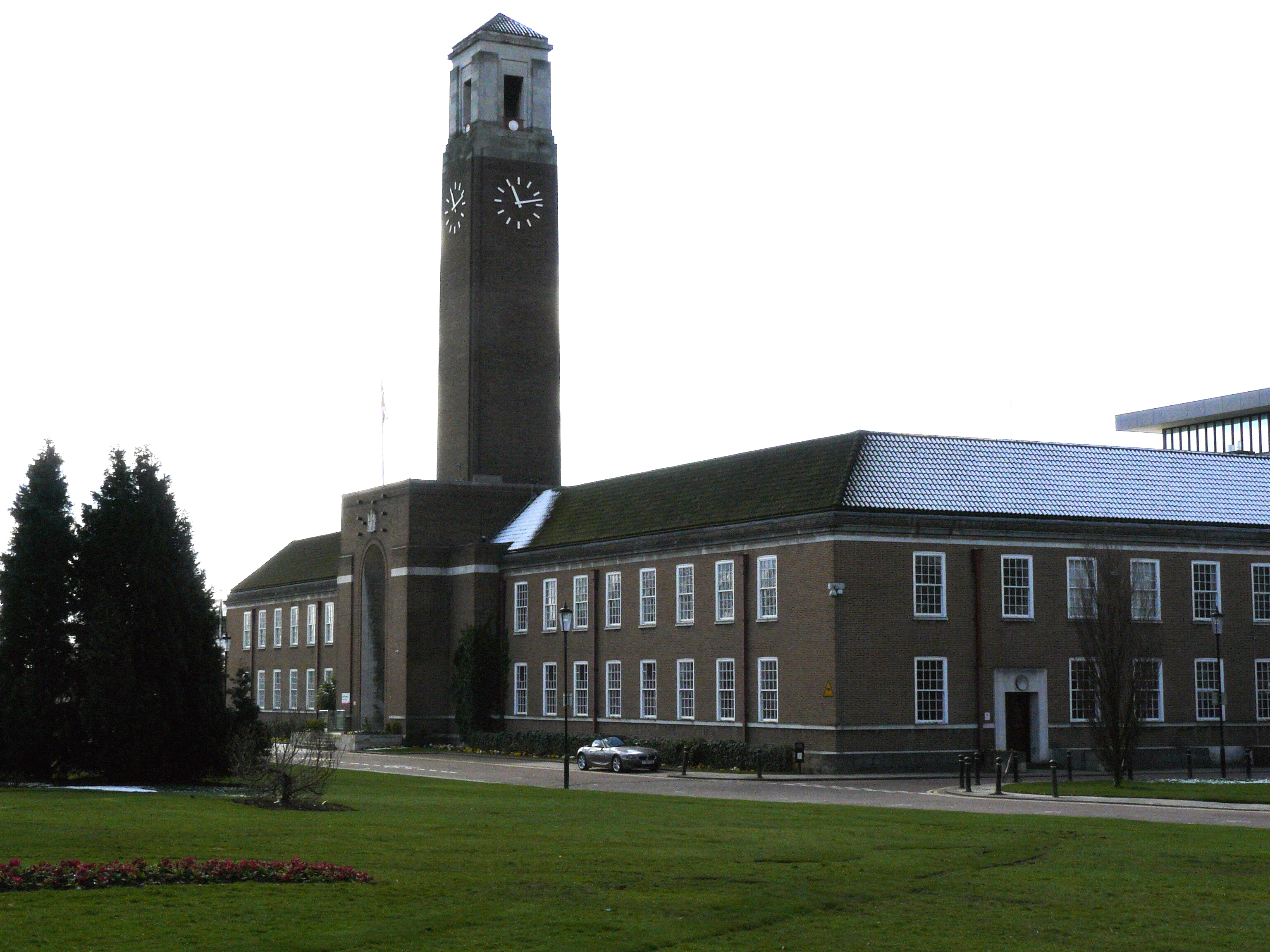
 Salford Civic Centre, in Swinton
Parliamentary constituencies
The residents of the City of Salford are represented in the British Parliament by Members of Parliament (MPs) for four separate parliamentary constituencies. Salford is represented by Rt Hon Hazel Blears MP (Labour).[35] Eccles is represented by Ian Stewart MP (Labour).[36] Worsley, which also covers parts of the Metropolitan Borough of Wigan, is represented by Barbara Keeley MP (Labour).[37] The Broughton and Blackfriars areas of Salford are now represented by Graham Stringer Labour MP for the now extended constituency of Blackley (North Manchester). The City of Salford is part of the North West England constituency in the European Parliament. North West England elects nine MEPs, as at 2008 made up of four Conservatives, three from the Labour Party, one Liberal Democrat, and one member of the United Kingdom Independence Party.[38]
Council
In 1974, Salford City Council was created to administer the newly formed local government district. Until 1986, it shared power with the Greater Manchester County Council. The council offices are located in Swinton, in what was formerly the Swinton and Pendlebury town hall. The Labour Party have been in control of the council since its formation in 1974.[39] The council has a constitution detailing how they should operate in performing their duties.[40]
Salford City Council was assessed by the Audit Commission and judged to be "improving well" in providing services for local people. Overall the council was awarded "three star" status meaning it was "performing well" and "consistently above minimum requirements", similar to 46% of all local authorities.[41]
The modern metropolitan borough of the City of Salford is based on the former County Borough of the City of Salford which included the city centre, Pendleton, Weaste, Claremont, Langworthy, Broughton, Kersal, Ordsall and Seedley. The city is entirely unparished and absorbed the municipal boroughs of Eccles and Swinton and Pendlebury and the urban districts of Irlam and Worsley. An urban district was a type of local government district which covered an urbanised area.
Party political make-up of Salford Council Party Seats Current Council (2011) 2010[39] 2011[39] Labour 44 39 Conservative 13 11 Lib Dems 5 3 Independent 3 2 Electoral wards
There are 60 councillors representing 20 wards. Swinton and Walkden have six councillors each.[42]
Ward name Area (ha)/mi2 Population Population density (people per hectare) Ref. Barton 244 hectares (0.94 sq mi) 12,067 47.4 [43] Boothstown and Ellenbrook 860 hectares (3.3 sq mi) 9,799 44.5 [44] Broughton 267 hectares (1.03 sq mi) 11,861 44.4 [45] Cadishead 1,476 hectares (5.70 sq mi) 9,289 21.9 [46] Claremont 190 hectares (0.73 sq mi) 10,484 55.2 [47] Eccles 270 hectares (1.0 sq mi) 10,298 38.2 [48] Irlam 935 hectares (3.61 sq mi) 9,868 28.9 [49] Irwell Riverside 451 hectares (1.74 sq mi) 11,571 25.7 [50] Kersal 313 hectares (1.21 sq mi) 11,305 36.1 [51] Langworthy 203 hectares (0.78 sq mi) 12,373 61.2 [52] Little Hulton 452 hectares (1.75 sq mi) 12,713 32.8 [53] Ordsall 414 hectares (1.60 sq mi) 6,554 15.8 [54] Pendlebury 662 hectares (2.56 sq mi) 11,499 27.7 [55] Swinton North 349 hectares (1.35 sq mi) 11,000 43.3 [56] Swinton South 281 hectares (1.08 sq mi) 10,993 39.1 [57] Walkden North 448 hectares (1.73 sq mi) 11,241 36.0 [58] Walkden South 361 hectares (1.39 sq mi) 10,170 36.4 [59] Weaste and Seedley 354 hectares (1.37 sq mi) 10,913 30.8 [60] Winton 370 hectares (1.4 sq mi) 12,199 44.1 [61] Worsley 838 hectares (3.24 sq mi) 9,964 22.6 [62] Coat of arms
 The coat of arms of Salford City Council
The coat of arms of Salford City Council depicts a weaving shuttle surrounded by five bees with a three masted ship above, on a shield flanked by two lions.[63] The blue background with a gold chief is taken from the arms of the city council of the County Borough of Salford, who in turn took it from the colours of the Earl of Chester. The shuttle and five bees represent the industry of the area and five settlements who benefited from the textile industry.[63] The ship is borrowed from the crest of Eccles Borough Council and represents the importance of waterways to the city. The ship is flanked by two millrinds – the centres of millstones – symbolising engineering.[63] The lions are taken from the crest of the Borough of Swinton and Pendlebury; they are wearing iron steel chain representing engineering. The shield is topped by a griffin carrying a pennon depicting three boars' heads. The griffin is taken from the crest of Eccles and the boars are from the crest of Irlam Urban District.[63] Beneath the shield is a scroll reading salus populi suprema lex, Latin for "the welfare of the people is the highest law".[63]
Budget
In 2007–8, Salford City Council spent a total of £218 million. The council spent £50M on children's services (23%); £68M on community health and social care (31%); £15M environmental service (7%); £28M on housing and planning (13%); and £9M on customer and support services (4%). For the 2008–9 financial year, the council's income is expected to consist of £125M (59%) from government grants and £87M (41%) from council tax.[64]
Demography
Salford Compared 2001 UK Census[65] Salford Greater Manchester England Total population 216,103 2,514,757 49,138,831 White 96.1% 91.2% 90.9% Asian 1.4% 5.6% 4.6% Black 0.6% 1.2% 2.3% As of the 2001 UK census, the City of Salford had a total population of 216,103.[65] Of the 94,238 households in Salford, 29.3% were married couples living together, 36.7% were one-person households, 8.5% were co-habiting couples and 12.5% were lone parents. The figures for lone parent households were above the national average of 9.5%, and the percentage of married couples was also below the national average of 36.5%; the proportion of one person households was higher than the national average of 30.1%.[66]
The population density was 2,223 /km2 (5,760 /sq mi)[67] and for every 100 females, there were 96.6 males. Of those aged 16–74 in Salford, 35.5% had no academic qualifications, significantly higher than 28.9% in all of England.[65] 5.3% of Salford's residents were born outside the United Kingdom, significantly lower than the national average of 9.2%.[68] The largest minority group was recorded as Asian, at 1.4% of the population.[69]
The number of theft from a vehicle offences and theft of a vehicle per 1,000 of the population was 21.3 and 7.9 compared to the English national average of 7.6 and 2.9 respectively.[70] The number of sexual offences was 1.1 compared to the average of 0.9.[70] The national average of violence against another person was 16.7 compared to the Salford average of 27.2.[70] The figures for crime statistics were all recorded during the 2006/7 financial year.[71] Although all were above the averages for England, Salford's crime rate was lower than Manchester's.[72]
Population change
 Salford tower blocks in 2001. Tower blocks were mostly built between the 1950s and 1970s.
The table below details the population change since 1801, including the percentage change since the last available census data. Although the City of Salford has existed as a metropolitan borough since 1974, figures have been generated by combining data from the towns, villages, and civil parishes that would later be constituent parts of the city.
Population growth in City of Salford since 1801 Year 1801 1811 1821 1831 1841 1851 1861 1871 1881 1891 1901 1911 1921 1931 1941 1951 1961 1971 1981 1991 2001 Population 29,495 38,460 49,114 68,744 91,361 108,699 148,740 188,781 228,822 265,000 296,210 331,098 333,031 334,989 318,152 302,160 291,240 280,739 241,532 230,726 216,103 % change – +30.4 +27.7 +40.0 +32.9 +19.0 +36.9 +26.9 +21.2 +15.8 +11.8 +11.8 +0.6 +0.6 −5.0 −5.0 −3.6 −3.6 −14.0 −4.5 −6.3 Source: Vision of Britain[73] Religion
See also: List of churches in Greater ManchesterReligion in the City of Salford 2001 UK Census[65] City of Salford North West England England Population 216,103 6,729,764 49,138,831 Christian 76.5% 78.0% 71.7% Jewish 2.4% 0.4% 0.5% Muslim 1.2% 3.0% 3.1% No religion 11.0% 10.5% 14.6% As of the 2001 UK census, 76.5% of Salford's residents were Christian, 2.4% Jewish, 1.2% Muslim, 0.3% Hindu, 0.2% Buddhist, and 0.1% Sikh. 11.0% had no religion, 0.2% had an alternative religion and 8.1% did not state their religion.[65] Salford is covered by the Roman Catholic Diocese of Salford,[74] and the Church of England Diocese of Manchester.[75] During the mid-19th century, there was an influx of Irish people into the Salford area, partly due to The Great Hunger in Ireland.[76] In 1848, Salford Roman Catholic Cathedral was consecrated, reflecting Salford's large Irish-born community at the time.[77]
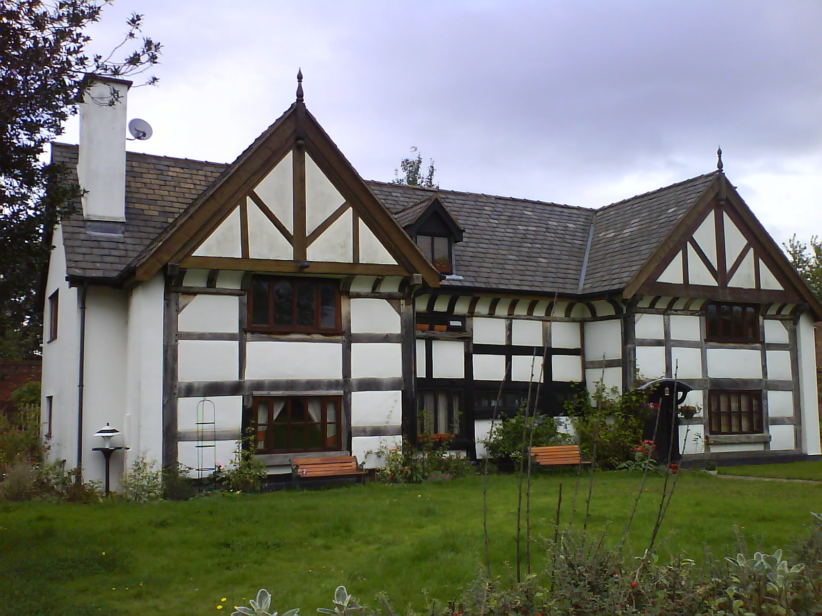
Of Salford's six Grade I listed buildings, three are churches. St Augustine's Church, in Pendlebury, was built in 1874 by George Frederick Bodley.[78] The Church of St Mary the Virgin, in Eccles, was originally built in the 13th century but was expanded in the 15th. A church has been on the site since at least the Norman period.[78][79] St Mark's Church, in Worsley, was built in 1846 by George Gilbert Scott.[78] The six Grade II* listed churches are the Church of St Andrew in Eccles,[78][80] the Cathedral Church of St John,[81] the Church of St Luke in Salford,[82] Monton Unitarian Church in Monton,[83] the Church of St Philip in Salford,[84] and the United Reformed Church.[78]
Economy
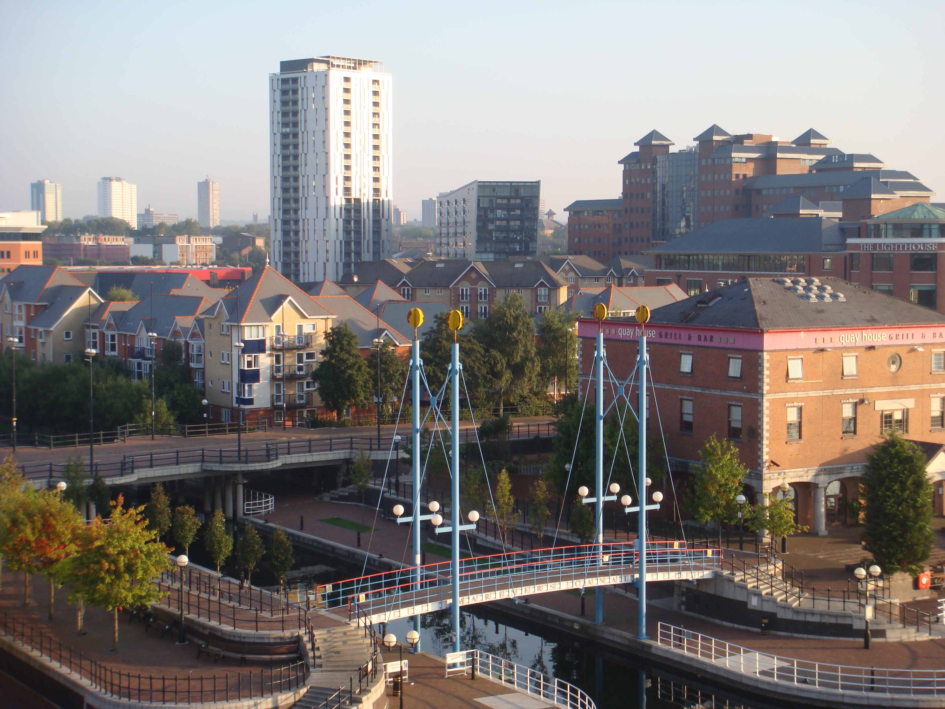
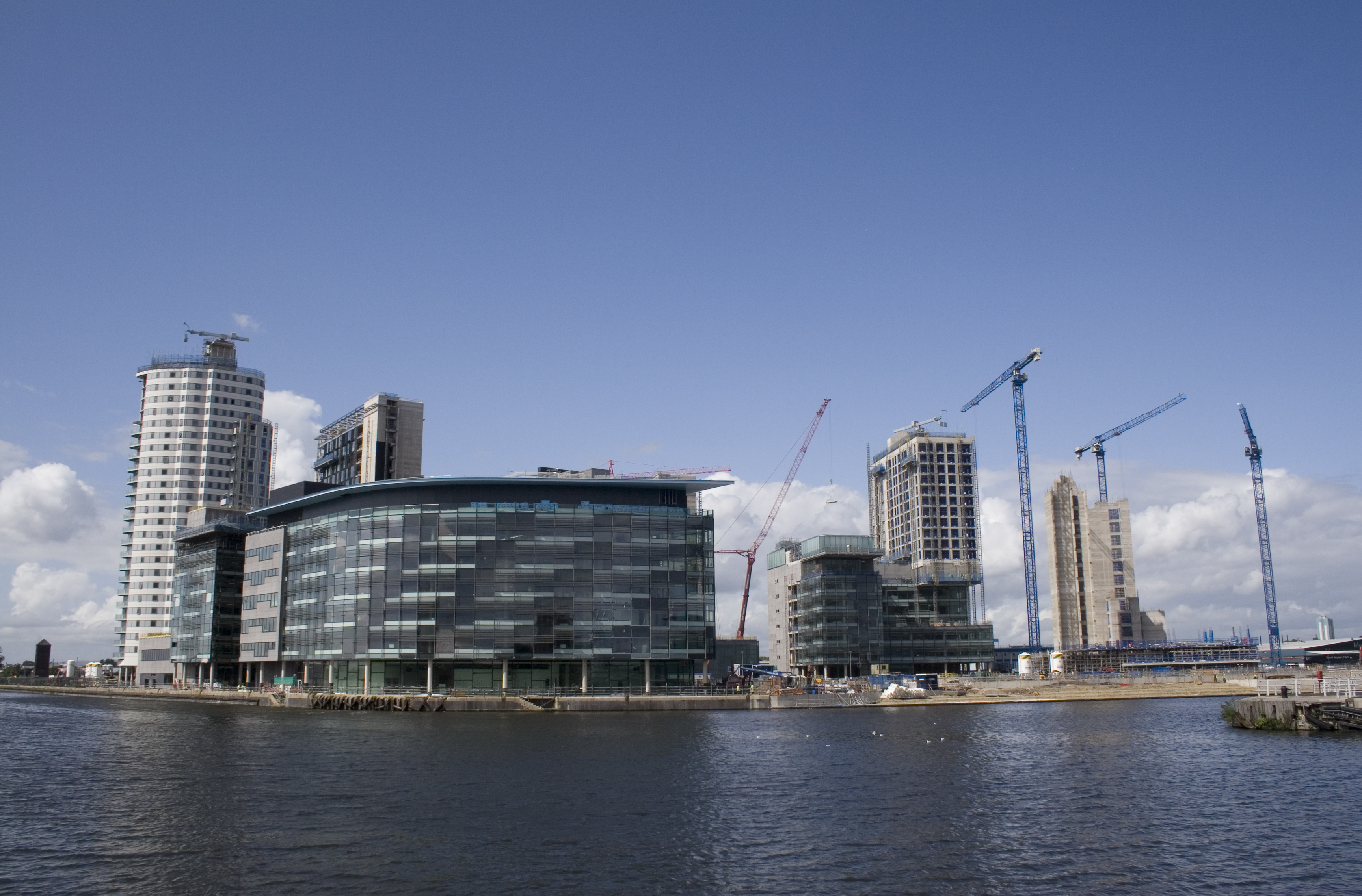
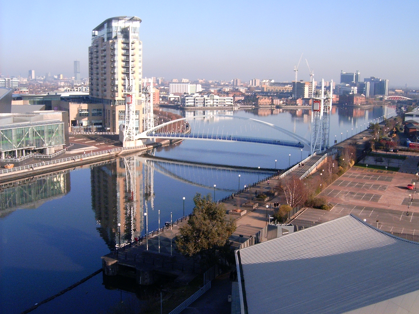
 MediaCityUK, Salford Quays
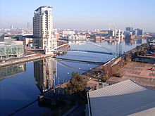 Salford Quays
Salford Docks (also called Manchester Docks) were opened by Queen Victoria in 1894, providing docks in Manchester and Salford for the Manchester Ship Canal which linked Manchester to the sea.[85] During the 1970s, the docks fell into decline as they proved too small for new, larger ships,[85] and when they were abandoned in 1982 over 3,000 people lost their jobs.[85] Salford City Council purchased the docks in 1984 and since then they underwent regeneration as a centre of tourism in Salford, which included the construction of the Lowry Centre.[85] More than 10,000 people are employed in the Quays in jobs such as retail, construction, and e-commerce.[86] In 2007, it was confirmed that the BBC would be moving five of its departments to a new development on Pier 9 of Salford Quays, to be called MediaCityUK.[87] The move, which is expected to be completed by 2011, will create up to 15,500 jobs and add £1bn to the regional economy over 5 years.[88]
City of Salford Compared 2001 UK Census[89] City of Salford North West England England Population of working age 155,376 4,839,669 35,532,091 Full time employment 39.3% 38.8% 40.8% Part time employment 10.6% 11.9% 11.8% Self employed 5.4% 7.1% 8.3% Unemployed 3.8% 3.6% 3.3% Retired 13.5% 14.3% 13.5% Finance and professional services, tourism and culture, and computer and internet based services have been identified as growth industries in Greater Manchester and are concentrated in Manchester and Salford.[90] Average house prices in the City of Salford are sixth out of all the metropolitan boroughs in Greater Manchester, 7.6% lower than the average for the county.[91] There are, however, areas of considerable affluence, within the city, such as Broughton Park, parts of Kersal, Ellesmere Park, Worsley, parts of Swinton and Pendlebury and the ultra-modern Salford Quays.
As of the 2001 UK census, Salford had 155,376 residents aged 16 to 74. 3.0% of these people were students with jobs, 5.9% looking after home or family, 9.5% permanently sick or disabled and 3.9% economically inactive for other reasons. The City of Salford has a high rate of people who are permanently sick and disabled, nearly double the national average of 5.3%.[89]
In 2001, of 89,920 residents of the City of Salford in employment, the industry of employment was 18.7% retail and wholesale, 14.4% manufacturing, 12.7% property and business services, 11.9% health and social work, 7.7% transport and communications, 7.6% education, 6.8% construction, 5.1% hotels and restaurants, 4.7% public administration and defence, 4.4% finance, 0.7% energy and water supply, 0.4% agriculture, and 4.9% other. This was roughly in line with national figures, except for the proportion of jobs in agriculture which is less than half the national average, reflecting the city's suburban nature and its proximity to the centre of Manchester.[92]
JCDecaux UK has its Manchester office in the Metroplex Business Park in Salford.[93]
Culture
Landmarks
As of September 2003, the City of Salford has 6 Grade I, 14 Grade II*, and 253 Grade II listed buildings.[94] The city has the equal second highest number of Grade I listed buildings out of the districts of Greater Manchester, behind Manchester. The Grade I listed buildings are the Church of St Augustine, the Parish Church of St Mary the Virgin, St Mark's Church, Ordsall Hall, Wardley Hall, and a bridge over the River Irwell.[94] Salford Cathedral, built in 1845, is the seat of the Diocese of Salford and a Grade II* listed building.[95] Most of the Salford's tallest buildings are mid-20th century residential tower blocks or 21st century high rise apartments. A study by Professor Christopher Collier of the University of Salford suggested that Manchester's drizzly climate is largely due to the multitude of high-rise blocks in Salford.[96][97] Collier has proposed that they have a "dramatic influence on the region's weather patterns", and may contribute to the 8 °C (14 °F) temperature difference between Salford and its surrounding countryside.[96]
There are three Scheduled Ancient Monuments in the city. The oldest is an Iron Age promontory fort occupied from 500 BC–200 AD.[98] Also scheduled is Hanging Bridge on the border with Manchester, dating to the 14th century,[99] and an underground section of the Bridgewater Canal in Swinton built in 1759.[100]
Sport

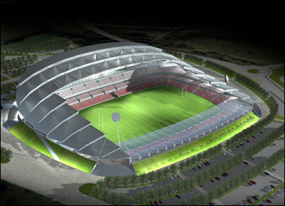
Salford is home to three rugby league teams. Founded in 1873, Salford RLFC play in the Engage Super League at the Willows in Weaste, Salford.[101] They are 6 times Champions and they won the Challenge Cup in the 1938,[102] and have experienced two previous stretches in the Super League, 1997–2002 and 2004–2007.[103][104] In 2008 they won the Northern Rail Cup beating Doncaster 60-0 in the Final at Blackpool. They previously won the same trophy in 2003. They also won the National League 1 Grand Final in 2008, beating Celtic Crusaders after extra time in Warrington.[105] Construction on a new 20,000 seat £35M stadium for the team,[106] called the City of Salford Stadium, is scheduled to be completed by 2011 in the Barton area of the city, close to the Trafford Centre shopping mall.[107]
Swinton RLFC were founded in 1866 and play in National League Two at Park Lane, Whitefield.[108] They won the Rugby Football League Championship six times between 1926 and 1964, before it was superseded by Super League.[108]
Broughton Rangers were founded in 1877 and won the Rugby League Challenge Cup in the 1901–02 and 1910–11 seasons.[102] The club folded in 1955, but were reformed as a local amateur club in 2007 with the support of Salford City Reds.[109][110]
Also in Salford are several football and cricket teams. Irlam F.C. is an amateur football team that has played in the Manchester Football League since 1989.[111] They were founded in 1969 as Mitchell Shackleton Football Club and changed their name in 2006.[112] Salford City F.C. was founded in 1940 and play in the Northern Premier League.[113] Monton & Weaste C.C. and Clifton C.C. have played in the Central Lancashire Cricket League since 2005 and 2006 respectively. Walkden play in the Bolton Cricket League.[114] Little Hulton play in the Bolton and District Cricket Association.[115] Winton and Worsley play play in the Manchester and District Cricket Association.[116]
Education
See also: List of schools in City of Salford Established in 1967, the University of Salford is one of four universities in Greater Manchester and has approximately 19,000 students.
Overall, Salford was ranked 75th out of the all the Local Education Authorities (LEAs) – and seventh in Greater Manchester – in National Curriculum assessment performance in 2007.[117] Unauthorised absences and authorised absences from Salford secondary schools in 2006–07 were 2.0% and 7.0% respectively, both higher than the national average (1.4% and 6.4%).[118] In 2007, the Salford LEA was ranked 127th out of 149 in the country – and ninth in Greater Manchester – based on the percentage of pupils attaining at least 5 A*–C grades at General Certificate of Secondary Education (GCSE) including maths and English (37.8% compared with the national average of 46.7%).[119] In 2007, Beis Yaakov High School was the most successful school in Salford at GCSE, with 90% of the pupils gaining five or more GCSEs at A*–C grade including maths and English. Bridgewater School was the most successful at A–level.[120]
The University of Salford is one of four universities in Greater Manchester and was ranked 81st by The Times. It has over 19,000 students[121] and a 69.7% level of student satisfaction. In 2007, the university received nearly 17,000 applications for 3,660 places.[122] The university is undergoing £150M of redevelopment through investment in new facilities, including a £10M law school and a £22M building for health and social care which were opened in 2006.[122] In 2007, the drop out rate from the university was 25%. Of the students graduating, 50% gained first class or 2:1 degrees,[122] which is below the national average of about 55%.[123]
Transport
The city of Salford is served by nine railway stations on four routes. Eccles and Patricroft are on the northern route of the Liverpool to Manchester Line, while Irlam, in the southwest of the borough, is on the southern route. Clifton is on the line to Bolton and Preston; Swinton, Moorside and Walkden are on the Manchester to Southport Line via Wigan; and Salford Central and Salford Crescent are served by both routes. A station at Pendleton was closed in 1998 after suffering fire damage and a loss of patronage in favour of nearby Salford Crescent, opened a few years earlier.[124] Most train services are provided by Northern Rail,[125] although Salford Crescent is also served by First TransPennine Express as part of its TransPennine North West network.[126]
The Eccles line of the Manchester Metrolink runs through the City of Salford, with stations at Exchange Quay, Salford Quays, Anchorage, Harbour City, Broadway, Langworthy, Weaste, Ladywell and Eccles. The line was opened in two stages, in 1999 and 2000, as Phase 2 of the system's development.[127]
There are bus stations at Pendleton and Eccles. Buses run to destinations throughout the city, across Greater Manchester and further afield: Pendleton is served by a route to Preston,[128] while the Eccles Interchange, next to the Metrolink stop, has a service to Liverpool John Lennon Airport.[129]
The council is responsible for the administration and maintenance of public roads and footpaths in the city.[130]
Twin towns
The City of Salford has formal twinning arrangements with four European places.[131] Each was originally twinned with a place within the city prior to its creation in 1974.
Country Place County / District / Region / State Originally twinned with Date 
France 
Clermont-Ferrand 
Auvergne County Borough of Salford 1966 France 
Saint-Ouen 
Île-de-France Worsley Urban District 1961 France 
Narbonne 
Languedoc-Roussillon Municipal Borough of Eccles 1957 
Germany 
Lünen 
Nordrhein-Westfalen Municipal Borough of Swinton and Pendlebury 1966 See also
- Salford Council election 2006
- Salford local elections
References
- ^ "City of Salford Metropolitan Borough resident population estimates by ethnic group (percentages) 2005 estimate". Statistics.gov.uk. http://www.neighbourhood.statistics.gov.uk/dissemination/LeadTableView.do?a=3&b=276781&c=salford&d=13&e=13&g=354179&i=1001x1003x1004&m=0&r=1&s=1206355443519&enc=1&dsFamilyId=1812. Retrieved 2008-03-24.
- ^ a b c d Clark 1973, pp. 101–102.
- ^ United Kingdom Census 2001. "Greater Manchester Urban Area". statistics.gov.uk. http://www.statistics.gov.uk/census2001/greater_manchester_urban_area.asp. Retrieved 2007-12-06.
- ^ Anon (2007-08-21). "Population estimates 2006 by district". Statistics.gov.uk. http://www.statistics.gov.uk/statbase/ssdataset.asp?vlnk=9666&More=Y. Retrieved 2007-12-21.
- ^ Cooper (2005), p. 18
- ^ a b c William Farrer & J. Brownbill (editors). "A History of the County of Lancaster: Volume 4". British-history.ac.uk. http://www.british-history.ac.uk/report.aspx?compid=41408. Retrieved 2008-04-10.
- ^ "Monument no. 44272". Pastscape.org.uk. http://www.pastscape.org.uk/hob.aspx?hob_id=44272. Retrieved 2008-03-19.
- ^ Pain (2003), p. 48
- ^ a b "Greater Manchester Gazetteer". Greater Manchester County Record Office. Places names - S. http://www.gmcro.co.uk/Guides/Gazeteer/gazzs.htm. Retrieved 11 November 2007.
- ^ Cooper (2005), p. 12
- ^ Salford City Council (2004-05-25). "Salford's Local History". salford.gov.uk. http://www.salford.gov.uk/leisure/salfordlocalhistory.htm. Retrieved 2008-04-10.
- ^ "Kersal Cell". Pastscape.org.uk. http://www.pastscape.org.uk/hob.aspx?hob_id=45104. Retrieved 2008-06-20.
- ^ a b Cooper (2005), p. 23
- ^ Salford City Council (2004-05-25). "Salford's Local History". Salford.gov.uk. http://www.salford.gov.uk/leisure/salfordlocalhistory.htm. Retrieved 2007-11-13.
- ^ McNeil, R. & Nevell, M (2000). A Guide to the Industrial Archaeology of Greater Manchester. Association for Industrial Archaeology. ISBN 0-9528930-3-7.
- ^ "First railway accident". Old-MerseyTimes.co.uk. http://www.old-merseytimes.co.uk/huskisson.html. Retrieved 2008-06-20.
- ^ "The Liverpool & Manchester Railway: opening and operations" (PDF). Manchester Science Museum. http://www.msim.org.uk/media/159628/the%20liverpool%20and%20manchester%20railway,%20opening%20and%20operations.pdf. Retrieved 2008-06-20.
- ^ Owen (1983), p. 120.
- ^ "Barton Swing Aqueduct". Images of England. http://www.imagesofengland.org.uk/Details/Default.aspx?id=212993. Retrieved 2008-01-20.
- ^ Nevell (1997), p. 135.
- ^ "Facts and Figures". Manchester Ship Canal. http://www.clydeport.co.uk/index.php?site_id=6&page_id=381. Retrieved 2007-10-01.
- ^ Cooper (2005), p. 41
- ^ London Gazette: no. 33154. pp. 2776–2777. 23 April 1926. Retrieved 2008-04-18.
- ^ a b "Market Renewal: Manchester Salford Pathfinder" (PDF). Audit Commission. 2003. http://www.audit-commission.gov.uk/Products/BVIR/9AC95DA0-C6A1-4b9b-9A0D-D305DE72FFC8/ManchesterSalford.pdf. Retrieved 2008-02-22.
- ^ HMSO. Local Government Act 1972. 1972 c.70
- ^ London Gazette: no. 46255. p. 4401. 4 April 1974. Retrieved 2008-04-18.
- ^ a b "Chat Moss". Salford City Council. http://www.salford.gov.uk/living/planning/naturalenvironment/landscape/chatmoss.htm. Retrieved 2007-04-06.
- ^ Birks (1965), p. 273.
- ^ "English Nature grant Salford its very own nature reserves!". english-nature.gov.uk. 2003-08-21. http://www.english-nature.gov.uk/about/teams/NewsDetails.asp?Id=8&NewsId=262. Retrieved 2007-12-11.[dead link]
- ^ Salford City Council (2007-07-19). "Salford City Council Suplementary planning Document: Nature Conservation and Biodiversity: Adopted 19 July 2006" (PDF). Salford.gov.uk. http://www.salford.gov.uk/biodiversity-spd-january-2006.pdf. Retrieved 2007-12-14.
- ^ "City of Salford physical environment". Statistics.gov.uk. http://neighbourhood.statistics.gov.uk/dissemination/LeadKeyFigures.do?a=3&b=276781&c=Salford&d=13&e=8&g=354179&i=1001x1003x1004&o=1&m=0&r=1&s=1204935548737&enc=1. Retrieved 2008-03-08.
- ^ Nevell (1997), p. 125.
- ^ "Manchester Airport 1971–2000 weather averages". Met Office. 2001. http://www.metoffice.gov.uk/climate/uk/averages/19712000/sites/manchester_airport.html. Retrieved 2008-08-12.
- ^ Met Office (2007). "Annual England weather averages". Met Office. http://www.metoffice.gov.uk/climate/uk/averages/19712000/areal/england.html. Retrieved 2007-04-23.
- ^ "Salford constituency election results.". London: Guardian.co.uk. http://politics.guardian.co.uk/hoc/constituency/0,,-1268,00.html. Retrieved 2008-03-07.
- ^ "Eccles constituency election results". London: Guardian.co.uk. http://politics.guardian.co.uk/hoc/constituency/0,,-911,00.html. Retrieved 2008-03-07.
- ^ "Worsley constituency election results.". London: Guardian.co.uk. http://politics.guardian.co.uk/hoc/constituency/0,,-1454,00.html. Retrieved 2008-03-07.
- ^ "UK MEPs". Europarl.org.uk. Archived from the original on February 21, 2008. http://web.archive.org/web/20080221224239/http://www.europarl.org.uk/uk_meps/MembersMain.htm. Retrieved 2008-02-23.
- ^ a b c "Salford local elections 2008". BBC Online. 2008-05-02. http://news.bbc.co.uk/1/shared/bsp/hi/elections/local_council/08/html/br.stm. Retrieved 2008-05-04.
- ^ City of Salford Borough Council. "The council's constitution". Salford.gov.uk. http://www.salford.gov.uk/constitution.htm. Retrieved 2008-05-04.
- ^ "Salford City Council comprehensive performance assessment (CPA) scorecard 2007". Audit Commission. 2007. http://cpa.audit-commission.gov.uk/STCCScorecard.aspx?TaxID=107108. Retrieved 2008-04-11.
- ^ "City of Salford Council Wards". http://www.salford.gov.uk/council/councillors/councillordetails/councillors-membward.htm. Retrieved 2007-11-22.
- ^ "Barton ward profile". Salford.gov.uk. Archived from the original on March 28, 2008. http://web.archive.org/web/20080328230259/http://www.salford.gov.uk/living/regeneration/geographicareas/ward-profiles/barton.htm. Retrieved 2008-04-03.
- ^ "Boothstown and Ellenbrook ward profile". Salford.gov.uk. Archived from the original on March 28, 2008. http://web.archive.org/web/20080328135355/http://www.salford.gov.uk/living/regeneration/geographicareas/ward-profiles/boothstown-and-ellenbrook.htm. Retrieved 2008-04-03.
- ^ "Broughton ward profile". Salford.gov.uk. Archived from the original on February 19, 2005. http://web.archive.org/web/20050219204351/http://www.salford.gov.uk/library/Libraries/broughton.htm. Retrieved 2008-04-03.
- ^ "Cadishead ward profile". Salford.gov.uk. http://www.salford.gov.uk/library/Libraries/cadishead.htm. Retrieved 2008-04-03.
- ^ "Claremont ward profile". Salford.gov.uk. Archived from the original on March 28, 2008. http://web.archive.org/web/20080328124231/http://www.salford.gov.uk/living/regeneration/geographicareas/ward-profiles/claremont-wp.htm. Retrieved 2008-04-03.
- ^ "Eccles ward profile". Salford.gov.uk. Archived from the original on March 28, 2008. http://web.archive.org/web/20080328230244/http://www.salford.gov.uk/living/regeneration/geographicareas/ward-profiles/eccles-wp.htm. Retrieved 2008-04-03.
- ^ "Irlam ward profile". Salford.gov.uk. Archived from the original on March 28, 2008. http://web.archive.org/web/20080328123948/http://www.salford.gov.uk/living/regeneration/geographicareas/ward-profiles/irlam-wp.htm. Retrieved 2008-04-03.
- ^ "Irwell Riverside ward profile". Salford.gov.uk. Archived from the original on March 28, 2008. http://web.archive.org/web/20080328011249/http://www.salford.gov.uk/living/regeneration/geographicareas/ward-profiles/irwell-riverside.htm. Retrieved 2008-04-03.
- ^ "Kersal ward profile". Salford.gov.uk. Archived from the original on March 28, 2008. http://web.archive.org/web/20080328011307/http://www.salford.gov.uk/living/regeneration/geographicareas/ward-profiles/kersal.htm. Retrieved 2008-04-03.
- ^ "Langworthy ward profile". Salford.gov.uk. Archived from the original on March 28, 2008. http://web.archive.org/web/20080328012319/http://www.salford.gov.uk/living/regeneration/geographicareas/ward-profiles/langworthy.htm. Retrieved 2008-04-03.
- ^ "Little Hulton ward profile". Salford.gov.uk. Archived from the original on March 28, 2008. http://web.archive.org/web/20080328012002/http://www.salford.gov.uk/living/regeneration/geographicareas/ward-profiles/little-hulton.htm. Retrieved 2008-04-03.
- ^ "Ordsall ward profile". Salford.gov.uk. Archived from the original on March 28, 2008. http://web.archive.org/web/20080328012002/http://www.salford.gov.uk/living/regeneration/geographicareas/ward-profiles/little-hulton.htm. Retrieved 2008-04-03.
- ^ "Pendlebury ward profile". Salford.gov.uk. Archived from the original on March 28, 2008. http://web.archive.org/web/20080328010910/http://www.salford.gov.uk/living/regeneration/geographicareas/ward-profiles/pendlebury.htm. Retrieved 2008-04-03.
- ^ "Swinton North ward profile". Salford.gov.uk. Archived from the original on March 28, 2008. http://web.archive.org/web/20080328011010/http://www.salford.gov.uk/living/regeneration/geographicareas/ward-profiles/swinton-north.htm. Retrieved 2008-04-03.
- ^ "Swinton South ward profile". Salford.gov.uk. Archived from the original on March 28, 2008. http://web.archive.org/web/20080328010946/http://www.salford.gov.uk/living/regeneration/geographicareas/ward-profiles/swinton-south.htm. Retrieved 2008-04-03.
- ^ "Walkden North ward profile". Salford.gov.uk. Archived from the original on March 28, 2008. http://web.archive.org/web/20080328012034/http://www.salford.gov.uk/living/regeneration/geographicareas/ward-profiles/walkden-north.htm. Retrieved 2008-04-03.
- ^ "Walkden South ward profile". Salford.gov.uk. Archived from the original on March 28, 2008. http://web.archive.org/web/20080328011933/http://www.salford.gov.uk/living/regeneration/geographicareas/ward-profiles/walkden-south.htm. Retrieved 2008-04-03.
- ^ "Weaste and Seedley ward profile". Salford.gov.uk. Archived from the original on March 28, 2008. http://web.archive.org/web/20080328124336/http://www.salford.gov.uk/living/regeneration/geographicareas/ward-profiles/weaste-and-seedley.htm. Retrieved 2008-04-03.
- ^ "Winton ward profile". Salford.gov.uk. Archived from the original on March 28, 2008. http://web.archive.org/web/20080328135248/http://www.salford.gov.uk/living/regeneration/salfordwest/key-facts-and-information/winton-ward-profile.htm. Retrieved 2008-04-03.
- ^ "Worsley ward profile". Salford.gov.uk. Archived from the original on March 28, 2008. http://web.archive.org/web/20080328135409/http://www.salford.gov.uk/living/regeneration/geographicareas/ward-profiles/worsley-wp.htm. Retrieved 2008-04-03.
- ^ a b c d e "Salford City coat of arms". Civicheraldry.co.uk. http://www.civicheraldry.co.uk/great_man.html#salford%20city. Retrieved 2008-03-10.
- ^ Salford MBC. "Revenue estimates and capital programme 2008/09". Salford.gov.uk. pp. 6, 20–21. http://www.salford.gov.uk/council/finance/budget/budget-reports.htm. Retrieved 2008-04-07.
- ^ a b c d e "Salford Metropolitan Borough key statistics". Statistics.gov.uk. http://neighbourhood.statistics.gov.uk/dissemination/LeadKeyFigures.do?a=3&b=276781&c=Salford&d=13&e=16&g=354179&i=1001x1003x1004&o=1&m=0&r=1&s=1198206645757&enc=1. Retrieved 2007-12-21.
- ^ "Salford Metropolitan Borough household data". Statistics.gov.uk. http://neighbourhood.statistics.gov.uk/dissemination/LeadTableView.do?a=3&b=276781&c=Salford&d=13&e=16&g=354179&i=1001x1003x1004&o=1&m=0&r=1&s=1198206645773&enc=1&dsFamilyId=165. Retrieved 2007-12-21.
- ^ "Salford Metropolitan Borough population density". Statistics.gov.uk. http://neighbourhood.statistics.gov.uk/dissemination/LeadTableView.do?a=3&b=276781&c=Salford&d=13&e=16&g=354179&i=1001x1003x1004&o=1&m=0&r=1&s=1198206645789&enc=1&dsFamilyId=789. Retrieved 2007-12-21.
- ^ "Salford Metropolitan Borough country of birth data". Statistics.gov.uk. http://neighbourhood.statistics.gov.uk/dissemination/LeadTableView.do?a=3&b=276781&c=Salford&d=13&e=16&g=354179&i=1001x1003x1004&o=1&m=0&r=1&s=1198206645773&enc=1&dsFamilyId=85. Retrieved 2007-12-21.
- ^ "Salford Metropolitan Borough ethnic group data". Statistics.gov.uk. http://neighbourhood.statistics.gov.uk/dissemination/LeadTableView.do?a=3&b=276781&c=Salford&d=13&e=16&g=354179&i=1001x1003x1004&o=1&m=0&r=1&s=1198206645773&enc=1&dsFamilyId=87. Retrieved 2007-12-21.
- ^ a b c "Local Area Crime Figures for Salford". UpMyStreet.co.uk. 2006/7. http://www.upmystreet.com/local/police-crime/figures/l/Salford-4302.html. Retrieved 2008-06-18.
- ^ "Local Area Crime Figures for Salford - Learn More section". UpMyStreet.co.uk. 2006/7. http://www.upmystreet.com/local/police-crime/learn-more/l/Salford-4302.html. Retrieved 2008-06-18.
- ^ "Local Area Crime Figures for Manchester". UpMyStreet.co.uk. 2006/7. http://www.upmystreet.com/local/police-crime/figures/l/Manchester.html. Retrieved 2007-11-22.
- ^ "Salford District: total population". Vision of Britain. http://www.visionofbritain.org.uk/data_cube_table_page.jsp?data_theme=T_POP&data_cube=N_TPop&u_id=10057073&c_id=10001043&add=N. Retrieved on 20 December 2008.
- ^ "Parishes of the Diocese". Salforddiocese.org.uk. Archived from the original on January 11, 2008. http://web.archive.org/web/20080111021859/http://www.salforddiocese.org.uk/parishes/masstimes.html. Retrieved 2008-01-17.
- ^ "The Church of England Diocese of Manchester". Manchester.anglican.org. http://www.manchester.anglican.org/default.asp. Retrieved 2008-01-17.
- ^ Cooper, Salford: An Illustrated History, p. 39
- ^ "Shriking Cities: Manchester/Liverpool II" (PDF). shrikingcities.com. March 2004. p. 36. http://shrinkingcities.com/fileadmin/shrink/downloads/pdfs/WP-II_Manchester_Liverpool.pdf. Retrieved 2008-03-04.
- ^ a b c d e Salford City Council. "Index to the List of Buildings, Structures and Features of Architectural, Archaeological or Historic Interest in Salford.". salford.gov.uk. http://www.salford.gov.uk/living/planning/heritage-and-conservation/listedbuilding/listed-building-register.htm. Retrieved 2007-12-22.
- ^ "St Mary's Church". Images of England. http://www.imagesofengland.org.uk/Details/Default.aspx?id=211935. Retrieved 2007-12-22.
- ^ "St Andrew's Church". Images of England. http://www.imagesofengland.org.uk/Details/Default.aspx?id=211934. Retrieved 2008-01-24.
- ^ "Salford Cathedral". Images of England. http://www.imagesofengland.org.uk/Details/Default.aspx?id=471539. Retrieved 2008-01-24.
- ^ "Church of St Luke". Images of England. http://www.imagesofengland.org.uk/Details/Default.aspx?id=471569. Retrieved 2008-01-24.
- ^ "Monton Unitarian Church". Images of England. http://www.imagesofengland.org.uk/Details/Default.aspx?id=211943. Retrieved 2008-01-24.
- ^ "St Philip's Church". Images of England. http://www.imagesofengland.org.uk/Details/Default.aspx?id=471589. Retrieved 2008-01-24.
- ^ a b c d "Salford Quays milestones: the story of Salford Quays" (PDF). Salford.gov.uk. Archived from the original on April 4, 2008. http://web.archive.org/web/20080404012942/http://www.salford.gov.uk/quays-milestones.pdf. Retrieved 2008-04-12.
- ^ "Salford Quays Milestones". Salford City Council. 2005-06-10. Archived from the original on July 10, 2007. http://web.archive.org/web/20070710212859/http://www.salford.gov.uk/living/regeneration/geographicareas/quays-regen/salford-quays.htm. Retrieved 2007-07-09.
- ^ "BBC Salford is on!". BBC. http://www.bbc.co.uk/manchester/content/articles/2007/01/18/salford_mediacity_feature.shtml. Retrieved 2007-08-20.
- ^ "BBC confirm move of five departments to MediaCityUK". BBC. Archived from the original on September 28, 2007. http://web.archive.org/web/20070928060413/http://www.mediacityuk.co.uk/pr_bbconfirms.html. Retrieved 2007-11-23.
- ^ a b "Salford Local Authority economic activity". Statistics.gov.uk. http://neighbourhood.statistics.gov.uk/dissemination/LeadTableView.do?a=3&b=276781&c=Salford&d=13&e=16&g=354179&i=1001x1003x1004&o=1&m=0&r=1&s=1206386266469&enc=1&dsFamilyId=107. Retrieved 2008-03-24.
- ^ "Promoting a Dynamic Economy". Greater Manchester e-Government Partnership. Archived from the original on January 12, 2008. http://web.archive.org/web/20080112085728/http://www.gmep.org.uk/ccm/content/agma/promoting-a-dynamic-economy.en;jsessionid=64C7688F205BEE012F17A5E3001818D5. Retrieved 2008-04-12.
- ^ "House prices for Greater Manchester Local Authorities". BBC News Online. 2009-02-09. http://news.bbc.co.uk/1/shared/spl/hi/in_depth/uk_house_prices/counties/html/county38.stm. Retrieved 2008-04-12.
- ^ "City of Salford Local Authority industry of employment". Statistics.gov.uk. http://neighbourhood.statistics.gov.uk/dissemination/LeadTableView.do?a=3&b=276781&c=Salford&d=13&e=16&g=354179&i=1001x1003x1004&o=1&m=0&r=1&s=1206386270126&enc=1&dsFamilyId=119. Retrieved 2008-03-24.
- ^ "Contact." JCDecaux UK. Retrieved on 28 September 2011. "JCDecaux - Manchester Unit 122, Metroplex Business Park Broadway, Salford Manchester, M50 2UW"
- ^ a b Salford City Council (2003-09-01). "Index to the List of Buildings, Structures and Features of Architectural, Archaeological or Historic Interest in Salford.". salford.gov.uk. http://www.salford.gov.uk/living/planning/heritage-and-conservation/listedbuilding/listed-building-register.htm. Retrieved 2007-12-22.
- ^ "Cathedral of St John, Salford". Images of England. http://www.imagesofengland.org.uk/details/default.aspx?pid=1&id=471539. Retrieved 2008-02-24.
- ^ a b Allison, Rebecca (2002-09-13). "Manchester rain blamed on Salford high-rise flats". London: The Guardian. http://www.guardian.co.uk/uk/2002/sep/13/rebeccaallison. Retrieved 2008-02-23.
- ^ "Tower blocks 'make Manchester rainy'". BBC News. 2002-09-13. http://news.bbc.co.uk/1/hi/england/2255335.stm. Retrieved 2008-02-26.
- ^ "Monument no 73547". Pastscape.org.uk. http://www.pastscape.org.uk/hob.aspx?hob_id=76682. Retrieved 2008-05-02.
- ^ "Hanging Bridge over Hanging Ditch". Pastscape.org.uk. http://www.pastscape.org.uk/hob.aspx?hob_id=76682. Retrieved 2007-12-30.
- ^ "Underground section of the Bridgewater Canal". Pastscape.org.uk. http://www.pastscape.org.uk/hob.aspx?hob_id=44278. Retrieved 2007-12-30.
- ^ Graham Morris (2006). "Salford City Reds – A Brief History". reds.co.uk. http://www.reds.co.uk/history.html. Retrieved 2008-04-03.
- ^ a b "The Rugby League Challenge Cup fixtures history and club information". reds.co.uk. 2007-10-19. http://www.napit.co.uk/viewus/infobank/rugby/superleague/challengecup.php. Retrieved 2008-04-03.
- ^ Graham Morris (2006). "Salford City Reds – A Brief History (page 3)". reds.co.uk. http://www.reds.co.uk/history3.html. Retrieved 2008-04-03.
- ^ "Salford City Reds". BBC Online. 2006-09-08. http://www.bbc.co.uk/manchester/content/articles/2006/02/13/salford_reds_team.shtml. Retrieved 2008-04-03.
- ^ "Northern Rail Cup". thisischeshire.co.uk. 2006-02-07. http://archive.thisischeshire.co.uk/2006/2/7/264999.html. Retrieved 2008-04-03.
- ^ "Salford's new home". BBC Online. 2006-12-19. http://news.bbc.co.uk/sport1/hi/rugby_league/super_league/salford/6184407.stm. Retrieved 2008-04-03.
- ^ Tony Howard (2007-05-31). "Stadium delay a threat to Reds future". salfordadvertiser.co.uk. http://www.salfordadvertiser.co.uk/news/s/528505_stadium_delay_a_threat_to_reds_future_. Retrieved 2008-04-03.
- ^ a b Tony Howard. "Swinton Lions: a brief history". swintonlionsrlc.co.uk. http://www.swintonlionsrlc.co.uk. Retrieved 2008-04-03.
- ^ Tony Howard (2007-06-28). "Rangers to be Brought back after 50 years in wilderness". salfordadvertiser.co.uk. http://www.salfordadvertiser.co.uk/news/s/529689_rangers_to_be_brought_back_after_50_years_in_wilderness. Retrieved 2008-04-03.
- ^ "All Golds' star hits Broughton". reds.co.uk. 2007-10-19. http://www.reds.co.uk/newsroom/news297_191007.html. Retrieved 2008-04-03.
- ^ "Mitchell Shackleton". fchd.info. Archived from the original on March 16, 2008. http://web.archive.org/web/20080316134627/http://www.fchd.info/MITCHELS.HTM. Retrieved 2008-04-03.
- ^ "Irlam Mitchell Shackleton". fchd.info. Archived from the original on March 16, 2008. http://web.archive.org/web/20080316134627/http://www.fchd.info/MITCHELS.HTM. Retrieved 2008-04-03.
- ^ "Salford City Football Club". salfordcityfc.com. Archived from the original on May 29, 2008. http://web.archive.org/web/20080529161106/http://www.salfordcityfc.com/details.html. Retrieved 2008-04-03.
- ^ "The Bolton Cricket League Website". http://www.boltoncricket.co.uk/. Retrieved 2008-09-27.
- ^ "The Bolton & District Cricket Association Website". http://boltondca.play-cricket.com/home/home.asp. Retrieved 2008-09-27.
- ^ "Manchester and District Cricket Association Website". http://www.themdca.co.uk/. Retrieved 2008-09-27.
- ^ "LEA SATs performance". BBC Online. 2007-12-06. http://news.bbc.co.uk/1/hi/education/7130024.stm. Retrieved 2008-01-23.
- ^ "Salford schools". BBC Online. 2008-01-10. http://news.bbc.co.uk/1/shared/bsp/hi/education/07/school_tables/secondary_schools/html/355_6011.stm. Retrieved 2008-01-23.
- ^ "How different LEAs performed". BBC Online. 2008-01-10. http://news.bbc.co.uk/1/hi/education/7180228.stm. Retrieved 2008-01-23.
- ^ "Education results in Salford". BBC Online. 2008-01-10. http://news.bbc.co.uk/1/shared/bsp/hi/education/07/school_tables/secondary_schools/html/355_gcse_lea.stm. Retrieved 2008-12-23.
- ^ Anon. "Controlling access to university IT resources" (http). Customer Snapshot: Education University of Salford. Sun Microsystems Inc.. http://www.sun.com/customers/software/salford.xml. Retrieved 2008-06-14.
- ^ a b c "University of Salford". London: timesonline.co.uk. 2007-09-21. http://www.timesonline.co.uk/tol/life_and_style/education/sunday_times_university_guide/article2505569.ece. Retrieved 2007-12-28.
- ^ "Table 14 - HE qualifications obtained in the UK by level, mode of study, domicile, gender, class of first degree and subject area(#1) 2005/06" (XLS). hesa.acuk. 2007-09-21. http://www.hesa.ac.uk/dox/dataTables/studentsAndQualifiers/download/quals0506.xls. Retrieved 2008-03-08.
- ^ "Regulator allows closure of Pendleton station". Office of Rail Regulation. 1998-12-15. http://www.rail-reg.gov.uk/server/show/ConWebDoc.5546. Retrieved 2008-04-26.
- ^ "Northern Rail Network Map" (PDF). FWT. 2007-03-22. http://www.northernrail.org/pdfs/network_map/network_map.pdf. Retrieved 2008-04-26.
- ^ "Blackpool Timetable" (PDF). First TransPennine Express. 2007-12-09. http://www.tpexpress.co.uk/pdfs/Timetables/TT_Dec07_BPN_web(3).pdf. Retrieved 2008-04-26.[dead link]
- ^ Metrolink (2004). "History" (PDF). metrolink.co.uk. http://www.metrolink.co.uk/pdf/past_present_future.pdf. Retrieved 2008-04-26.
- ^ "Destination Finder: Pendleton" (PDF). www.gmpte.com. 2008-01-28. Archived from the original on 2008-04-14. http://web.archive.org/web/20080414223740/http://www.gmpte.com/destination/Pendleton.pdf. Retrieved 2008-04-26.
- ^ "Destination Finder: Eccles" (PDF). www.gmpte.com. 2007-04-15. Archived from the original on 2008-04-14. http://web.archive.org/web/20080414223728/http://www.gmpte.com/destination/Eccles.pdf. Retrieved 2008-04-26.
- ^ Salford MBC. "Streets & traffic". Salford.gov.uk. http://www.salford.gov.uk/living/streets.htm. Retrieved 2008-04-07.
- ^ Salford City Council. "Salford's twin towns". Salford.gov.uk. http://www.salford.gov.uk/living/yourcom/salfordlife/twintowns.htm. Retrieved 2008-05-04.
Bibliography
- Birks, H.J.B (1965). "Late-glacial deposits at Bagmere, Cheshire, and Chat Moss, Lancashire". New Phytologist (Blackwell Publishing) 64 (2): 270. doi:10.1111/j.1469-8137.1965.tb05396.x. ISSN 0028-646X.
- Clark, David M. (1973). Greater Manchester Votes: A Guide to the New Metropolitan Authorities. Redrose.
- Cooper, Glynis (2005). Salford: An Illustrated History. The Breedon Books Publishing Company. ISBN 1-85983-455-8.
- Nevell, Mike (1997). The Archaeology of Trafford. Trafford Metropolitan Borough Council with the University of Manchester Archaeological Unit. ISBN 1-870695-25-9.
- Owen, David (1983). The Manchester Ship Canal. Manchester University Press. ISBN 0-7190-0864-6.
- Pain, Stephanie (2003-09-23). "The Head from Worsley Moss". New Scientist (Reed Business Information Ltd) (2414). ISSN 0262-4079.
External links
- www.salford.gov.uk, Salford City Council
- maps.salford.gov.uk, Salford City Council interactive maps
- www.visitsalford.info, Visit Salford
- www.salfordonline.com, Video news and features about the City of Salford
Ceremonial county of Greater Manchester Statutory City Region - Greater Manchester Combined Authority
- Greater Manchester Statutory City Region
Metropolitan districts Major settlements - Altrincham
- Ashton-in-Makerfield
- Ashton-under-Lyne
- Atherton
- Audenshaw
- Blackley
- Bolton
- Bury
- Cadishead
- Chadderton
- Clifton
- Denton
- Droylsden
- Dukinfield
- Eccles
- Failsworth
- Farnworth
- Golborne
- Heywood
- Hindley
- Horwich
- Hyde
- Irlam
- Kearsley
- Leigh
- Littleborough
- Manchester
- Middleton
- Milnrow
- Mossley
- Oldham
- Partington
- Pendlebury
- Prestwich
- Radcliffe
- Ramsbottom
- Rochdale
- Royton
- Sale
- Salford
- Shaw and Crompton
- Stalybridge
- Stockport
- Stretford
- Swinton
- Tottington
- Tyldesley
- Urmston
- Walkden
- Westhoughton
- Whitefield
- Wigan
- Worsley
See also: List of civil parishes in Greater Manchester
Rivers Topics - Castles
- Churches
- Demography
- Football clubs
- Geography
- Grade I listed buildings
- Grade II* listed buildings
- Museums
- Parliamentary constituencies
- People
- Places
- Schools
- SAMs
- SSSIs
 Districts of North West England
Cheshire 
Cumbria Allerdale • Barrow-in-Furness • Carlisle • Copeland • Eden • South Lakeland
Greater Manchester Lancashire Blackburn with Darwen • Blackpool • Burnley • Chorley • Fylde • Hyndburn • Lancaster • Pendle • Preston • Ribble Valley • Rossendale • South Ribble • West Lancashire • Wyre
Merseyside Metropolitan counties and metropolitan districts Greater Manchester 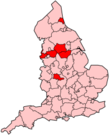
Merseyside South Yorkshire Tyne and Wear West Midlands West Yorkshire Cities of the United Kingdom England Bath · Birmingham · Bradford · Brighton and Hove · Bristol · Cambridge · Canterbury · Carlisle · Chester · Chichester · Coventry · Derby · Durham · Ely · Exeter · Gloucester · Hereford · Kingston upon Hull · Lancaster · Leeds · Leicester · Lichfield · Lincoln · Liverpool · London · Manchester · Newcastle upon Tyne · Norwich · Nottingham · Oxford · Peterborough · Plymouth · Portsmouth · Preston · Ripon · St Albans · Salford · Salisbury · Sheffield · Southampton · Stoke-on-Trent · Sunderland · Truro · Wakefield · Wells · Westminster · Winchester · Wolverhampton · Worcester · York
Scotland Wales Northern Ireland Categories:- 1974 establishments
- Cities in North West England
- Local government in Salford
- Metropolitan boroughs
- Salford
- Local government districts of North West England


Wikimedia Foundation. 2010.