- Metropolitan Borough of Oldham
-
For the settlement, see Oldham.
Metropolitan Borough of Oldham — Metropolitan borough — Oldham Civic Centre

Coat of Arms of the Borough CouncilMotto: "Sapere Aude" "Dare to be wise" Oldham shown within England
Coordinates: 53°32′N 2°07′W / 53.533°N 2.117°W Sovereign state United Kingdom Constituent country England Region North West England Ceremonial county Greater Manchester Admin HQ Oldham (Civic Centre) Founded 1 April 1974 Borough status 23 November 1973 Government – Type Metropolitan borough – Governing body Oldham Metropolitan Borough Council – Leader of the Council Cllr. Jim McMahon – Mayor Cllr. Richard Knowles (2011-12) – MPs: Debbie Abrahams (L)
Michael Meacher (L)
David Heyes (L)Area – Total 55 sq mi (142.4 km2) Elevation 1,778 ft (542 m) Population (2010 est.) – Total 219,800 (Ranked 69th) – Density 3,996.4/sq mi (1,543/km2) – Ethnicity
(United Kingdom estimate 2005)[1]84.4% White
13.3% S. Asian or mixed
1.6% Black or mixed
0.5% Chinese or otherTime zone Greenwich Mean Time (UTC+0) Postcode areas OL, M Area code(s) 0161 / 01706 / 01457 ISO 3166-2 GB-OLD ONS code 00BP OS grid reference SD922053 NUTS 3 UKD32 Website www.oldham.gov.uk The Metropolitan Borough of Oldham is a metropolitan borough of Greater Manchester, England. It has a population of 219,600,[2] and spans 55 square miles (142 km2).[3] The borough is named after its largest town, Oldham, but also includes the outlying towns of Chadderton, Failsworth, Royton and Shaw and Crompton, the village of Lees, and the parish of Saddleworth. The borough was formed in 1974 as part of the provisions of the Local Government Act 1972 and is an amalgamation of the former County Borough of Oldham with the Chadderton, Crompton, Lees, Royton urban districts of Lancashire and the Saddleworth Urban District of the West Riding of Yorkshire.
Although a 20th century creation, the borough has Neolithic, Bronze Age and Roman heritage. It encompasses several former mill towns, which expanded and coalesced during the late-19th century as a result of population growth and advances in textile manufacture during the Industrial Revolution. Although some parts contiguous with the city of Manchester are highly industrialised and densely populated, about two-thirds of the borough is composed of rural open space; the eastern half stretches across the South Pennines.
For its first 12 years the borough had a two-tier system of local government; Oldham Council shared power with the Greater Manchester County Council. Since the Local Government Act 1985 Oldham Council has effectively been a unitary authority, serving as the sole executive, deliberative and legislative body responsible for local policy, setting council tax, and allocating budget in the district. The Metropolitan Borough of Oldham has two civil parishes and 20 electoral wards.
Noted as one of the more unpopular amalgamations of territory created by local government reform in the 1970s,[4][5][6] the Oldham borough underwent a £100,000 rebranding exercise in early 2008. The town has no listed buildings with a Grade I rating,[7] and the borough's architecture has been described as "mediocre".[8] There have been calls for the borough to be renamed,[6][9] but that possibility was dismissed during the rebranding of 2008.[8]
Contents
History
Following both the Local Government Act 1888 and Local Government Act 1894, local government in England had been administered via a national framework of rural districts, urban districts, municipal boroughs and county boroughs, which (apart from the latter which were independent), shared power with strategic county councils of the administrative counties.[10] The areas that were incorporated into the Metropolitan Borough of Oldham in 1974 had formed part of Chadderton Urban District, Crompton Urban District, Failsworth Urban District, Lees Urban District and Royton Urban District from the administrative county of Lancashire, Saddleworth Urban District from the West Riding of Yorkshire, and the politically independent County Borough of Oldham.[11] By the early 1970s, nationally, this system of demarcation was described as "archaic" and "grossly inadequate to keep pace both with the impact of motor travel, and with the huge increases in local government responsibilities".[12] After the exploration of reform, such as the proposals made by the Redcliffe-Maud Report in the late 1960s, the Local Government Act 1972 restructured local government in England by creating a system of two-tier metropolitan and non-metropolitan counties and districts throughout the country.[13] The act formally established the Metropolitan Borough of Oldham as a local government district of the new metropolitan county of Greater Manchester on 1 April 1974. The district was granted honorific borough status on 23 November 1973 by Queen Elizabeth II of the United Kingdom, which allowed the council to have a mayor.[14] The new dual local authorities of Oldham Metropolitan Borough Council and Greater Manchester County Council had been running since elections in 1973 however.[15] The leading article in The Times on the day the Local Government Act came into effect noted that the "new arrangement is a compromise which seeks to reconcile familiar geography which commands a certain amount of affection and loyalty, with the scale of operations on which modern planning methods can work effectively".[16]
 Oldham Council's corporate logo, designed in 1974 by David McRae for the new authority. This logo was replaced in 2008 as part of a rebranding exercise.[6]
 The new "One Oldham" branding for the borough, used from 2008
The borough is noted as one of the more unpopular amalgamations of territory created by local government reform in the 1970s.[4][5][6] This being especially true of residents of the parish of Saddleworth who viewed the new arrangement as a "retrograde step".[4] It had been proposed in a government White paper that the Metropolitan Borough of Oldham include the former mill town of Middleton. However this was given to the Metropolitan Borough of Rochdale once it was decided that Rochdale and Bury would not be merged.[17] Before its creation, it was suggested that the metropolitan borough be named New Oldham, but that was rejected.[18]
In the early 20th century, following some exchanges of land, there were attempts to amalgamate Chadderton Urban District with the County Borough of Oldham.[19] However, this was resisted by councillors from Chadderton Urban District Council.[19]
The Oldham borough underwent a rebranding exercise in 2008 with a view to improving cross-community unity.[6][9] Officials believed the borough's image was outdated and that "often negative" national media coverage held and continues to hold back businesses and hampers attempts to attract new investors, visitors and external funding.[9] There had been calls for the borough to be renamed to a "settlement-neutral" name (such as those of neighbouring districts of Calderdale, Kirklees and Tameside) as part of the rebranding.[9] However, consultants cited that this idea came from a "vocal minority" wishing to distance themselves from Oldham. The borough name was unchanged.[8]
Governance
Council
Further information: Oldham local electionsFor the first 12 years after the county was created in 1974, the borough had a two-tier system of local government, and so Oldham Council shared power with the Greater Manchester County Council.[20] The Greater Manchester County Council, a strategic authority running regional services such as transport, strategic planning, emergency services and waste disposal, comprised 106 members drawn from the ten metropolitan boroughs of Greater Manchester.[21] However in 1986, along with the five other metropolitan county councils and the Greater London Council, the Greater Manchester County Council was abolished, and most of its powers were devolved to the boroughs.[20] Since 1986, Oldham Council has effectively been a unitary authority that serves as the sole executive, deliberative and legislative body responsible for setting local policy, and allocating budget. Its duties also include setting levels of council tax, monitoring the health service in the borough, providing social care, and providing funding for schools.[citation needed] The borough's centre of administration since 1977 has been Oldham Civic Centre.[citation needed]
Civil parishes form the bottom tier of statutory local government; the parish councils are involved in planning, management of town and parish centres, and promoting tourism.[22] In 2001, 46,072 people lived in Oldham's two civil parishes—Saddleworth and Shaw and Crompton—20.9% of the borough's population.[23][24] The rest of the borough is unparished.
In 2005, Oldham Borough Counil was assessed as "weak" but "improving well" by the Audit Commission.[25] It was awarded two stars, placing it in the bottom third of councils in the country according to perceived performance.[26] According to the Office of the Deputy Prime Minister, Oldham Metropolitan Borough Council sets the highest council tax rates in Greater Manchester. It has the second highest council tax rates of the metropolitan areas, and is placed as the 16th highest rate of council tax in England.[27] In 2007 Oldham was assessed as the second-worst performing local authority in England in terms of providing customer satisfaction.[28]
Since the council's formation it has generally been under the control of the Labour Party, with periods of no overall control, two years of Conservative control, and one of Liberal Democrat control. Since 2007, there has been no overall control, although the Liberal Democrats are currently the largest party.[29]
Party political make-up of Oldham Borough Council Party Seats Current Council (2010–11) 2007[29] 2008[29] 2010[29] Lib Dems 26 30 27 Labour 30 22 27 Conservative 3 6 5 Independent 2 2 1 Electoral wards
The Metropolitan Borough of Oldham is divided into twenty electoral wards, each which elects 3 councillors who generally sit for a 4-year term on the Oldham Metropolitan Borough Council. The twenty wards are:[30] The available data dates to 2001, before the ward boundaries were changed in 2004. Saddleworth West no longer exists, and at the time of the 2001 census St Marys' had not been formed (it is represented by 1 Independent, 1 Labour, 1 Liberal Democrat councillor).[31]
Ward name Population Area Population density Councillors' party Ref. Alexandra 11,159 2.57 km2 (0.99 sq mi) 4,342 /km2 (11,250 /sq mi) 2 Labour, 1 Liberal Democrat [31][32] Chadderton Central 10,784 4.89 km2 (1.89 sq mi) 2,205 /km2 (5,710 /sq mi) 2 Conservatives, 1 Labour [31][33] Chadderton North 10,269 3.71 km2 (1.43 sq mi) 2,768 /km2 (7,170 /sq mi) 3 Conservatives [31][34] Chadderton South 10,061 2.52 km2 (0.97 sq mi) 3,992 /km2 (10,340 /sq mi) 3 Labour [31][35] Coldhurst 11,935 2.27 km2 (0.88 sq mi) 5,258 /km2 (13,620 /sq mi) 2 Liberal Democrats, 1 Labour [31][36] Crompton 11,066 4.88 km2 (1.88 sq mi) 2,268 /km2 (5,870 /sq mi) 3 Liberal Democrats [31][37] Failsworth East 10,728 4.34 km2 (1.68 sq mi) 2,472 /km2 (6,400 /sq mi) 2 Labour, 1 Conservative [31][38] Failsworth West 9,827 2.34 km2 (0.90 sq mi) 4,200 /km2 (11,000 /sq mi) 2 Labour, 1 Independent [31][39] Hollinwood 9,910 2.53 km2 (0.98 sq mi) 3,917 /km2 (10,140 /sq mi) 3 Liberal Democrats [31][40] Medlock Vale 11,919 4.03 km2 (1.56 sq mi) 2,958 /km2 (7,660 /sq mi) 3 Labour [31][41] Royton North 10,588 5.04 km2 (1.95 sq mi) 2,101 /km2 (5,440 /sq mi) 3 Labour [31][42] Royton South 10,373 4.03 km2 (1.56 sq mi) 2,574 /km2 (6,670 /sq mi) 2 Liberal Democrats, 1 Labour [31][43] Saddleworth North 9,376 41.88 km2 (16.17 sq mi) 224 /km2 (580 /sq mi) 3 Liberal Democrats [31][44] Saddleworth South 9,215 32.71 km2 (12.63 sq mi) 282 /km2 (730 /sq mi) 3 Liberal Democrats [31][45] Saddleworth West 11,309 27.59 km2 (10.65 sq mi) 410 /km2 (1,100 /sq mi) n/a [31][46] Saddleworth West and Lees 10,647 4.56 km2 (1.76 sq mi) 2,335 /km2 (6,050 /sq mi) 3 Liberal Democrats [31][47] St James' 9,684 3.68 km2 (1.42 sq mi) 2,632 /km2 (6,820 /sq mi) 3 Liberal Democrats [31][48] Shaw 10,655 7.11 km2 (2.75 sq mi) 1,499 /km2 (3,880 /sq mi) 3 Liberal Democrats [31][49] Waterhead 12,876 3.84 km2 (1.48 sq mi) 3,353 /km2 (8,680 /sq mi) 3 Liberal Democrats [31][50] Werneth 11,594 1.69 km2 (0.65 sq mi) 6,860 /km2 (17,800 /sq mi) 3 Labour [31][51] Oldham 217,273 142.36 km2 (54.97 sq mi) 1,526 /km2 (3,950 /sq mi) 30 Liberal Democrats, 22 Labour, 6 Conservatives, 2 Independents [52] Coat of arms
 Oldham council's coat of arms, seen here at the Civic Centre
Following the 1974 reorganisation, a new coat of arms was granted to Oldham Metropolitan Borough Council, based closely on that of the predecessor Oldham County Borough Council. Like the county borough's arms, which dated from 1894, the new coat is derived from the arms of the Oldham family. The most famous member of the family was Hugh Oldham, Bishop of Exeter and founder of the Manchester Grammar School. The Oldham family arms were:
Sable a chevron Or between three owls argent on a chief of the second as many roses gules.[53]The owls were a "canting" reference, or heraldic pun, on the original pronunciation of the name. This is still reflected in the local pronunciation of "Ow'dom". In the Metropolitan Borough's arms the gold chief (upper third of the shield) and chevron have "invected" or fluted edges. The arms are further differenced by the replacement of the three red roses by three red annulets or circles, representing the initial "O" of the authority's name.[54]
The crest, an owl upon a rock, is placed on a helm above the shield. In order to distinguish the crest from that of the county borough, it rises from a gold circlet bearing six red annulets. The crest wreath and decorative mantling repeat the black and gold colouring of the arms.
Oldham Metropolitan Borough Council was granted supporters and a heraldic badge. The supporters recall the local authorities merged in 1974, and are made up of portions of the arms of the ancient manorial lords. The red griffins come from the arms of the Chadderton and Chetham families. Each griffin wears a collar with an "engrailed" edge recalling the arms of the Radcliffe family. Each collar bears red bendlets from the arms of the Byrons. From the collars hang heptagons, the seven sides representing the union of seven councils. One heptagon bears a black spur-rowel from the Assheton family arms, the other a black saddle, recalling the derivation of the name "Saddleworth".
The badge is a black heptagon bearing a silver owl, the whole contained within a red annulet.
The Latin motto of the county borough continues in use: Sapere Aude or "dare to be wise" refers to the owls in the arms , while "Aude", pronounced "Owd" continues the pun. The motto is also used by Manchester Grammar School.[54][55]
The blazon is as follows:
Sable a chevron invected or between three owls argent on a chief engrailed or as many annulets gules; and for a Crest: On a wreath of the colours issuant from a circlet or charged with six annulets gules a rock proper thereon an owl argent.
Supporters: On either side a griffin gules each gorged with a collar engrailed argent charged with six bendlets gules pendant therefrom a heptagon argent that on the dexter charged with a pierced mullet that on the sinister with a saddle both sable.
Badge or Device: On a heptagon sable environed by an annulet gules an owl argent.[54][55]
Mayor
 Jim McCardle, the 36th Mayor of the Metropolitan Borough of Oldham, who held the role between 2009 and 2010.
The office of mayor in Oldham is largely ceremonial; their main role is as an ambassador or representative of the borough. The mayor also chairs council meetings and is the only office of the borough approved to use the coat of arms. A new mayor is elected by the borough councillors and serves a term of one year. The deputy mayor is elected at the same time, and usually becomes mayor the following year.[56] The first mayor of the Metropolitan Borough of Oldham was Ellen Brierley elected 1974 to 1975, although there had been mayors of the county borough of Oldham between 1845 and 1973.[57] It is usual for a mayor to highlight chosen local charities.[57]
Name Year Name Year Name Year Name Year Ellen Brierley 1974–1975 Colin Campbell 1980–1981 Sidney Jacobs 1990–1991 John Dillon 2000–2001 Jack Armitage 1975–1976 John Raymon Crowther 1981–1982 Ralph Semple 1991–1992 Christine Wheeler 2001–2002 Christopher McCall 1976–1977 Alfred Clarke 1982–1983 Norman Bennett 1992–1993 Riaz Ahmad 2002–2003 Geoffrey Webb 1977–1978 John Joseph Curran 1983–1984 Brian Mather 1993–1994 Val Sedgewick 2003–2004 Edward Lord 1978–1979 James Kevin Leyden 1984–1985 Frank Heap 1994–1995 Abdul Jabbar 2004–2005 Harold Shanley 1979–1980 Alwyn Bywater McConnell 1985–1986 Joseph Farquar 1995–1996 Kay Knox 2005–2006 Albert Banks Jowett 1986–1987 Alan Griffiths 1996–1997 Bernard Judge 2006–2007 Arnold Tweedale O.B.E 1987–1988 Peter Dean 1997–1998 Ann Wingate 2007–2008 Harry Slack 1988–1989 Margaret Riley 1998–1999 Shoab Akhtar 2008–2009 Elsie Shaw 1989–1990 John Battye 1999–2000 Jim McArdle 2009–2010 Parliamentary representation
The boundaries of three parliamentary constituencies cover the Metropolitan Borough of Oldham. These are:
- Oldham East and Saddleworth represented by Debbie Abrahams MP.
- Oldham West and Royton represented by Michael Meacher MP.
- Ashton-under-Lyne represented by David Heyes MP
- The Metropolitan Borough of Oldham was a part of the Greater Manchester East European Parliamentary constituency.[59] It has been a part of the North West England (European Parliament constituency) since 1999.
Geography
The Metropolitan Borough of Rochdale lies to the north-west, the Metropolitan Borough of Kirklees (of West Yorkshire) to the east, and the Metropolitan Borough of Tameside to the south. The City of Manchester lies directly to the south west and the Derbyshire Borough of High Peak lies directly to the south east, but Derbyshire is only bordered by high moorland near Black Hill and is not accessible by road.
Parishes
Showing status at 31 March 1974 (prior to the Local Government Act 1972 taking effect).
- Saddleworth (Saddleworth Urban District)
- Shaw and Crompton (Crompton Urban District)
Unparished areas
Showing former status.
- Chadderton (Chadderton Urban District)
- Failsworth (Failsworth Urban District)
- Lees (Lees Urban District)
- Oldham (County Borough of Oldham)
- Royton (Royton Urban District)
Demography
Further information: Demography of Greater ManchesterOldham compared 2001 UK Census Oldham[60] Greater Manchester[61] England Total population 217,273 2,514,754 49,138,831 White British 86.1% 91.2% 90.9% Asian 11.9% 5.6% 4.6% Mixed 1.1% 1.3% 1.3% Black 0.6% 1.2% 2.3% Chinese and other 0.3% 0.8% 0.9% As of the 2001 UK census, the borough of Oldham had a population of 217,273.[62] Of the 87,824 households in Oldham, 36.8% were married couples living together, 29.5% were one-person households, 8.9% were co-habiting couples and 11.5% were lone parents. These figures were broadly in line with national averages, although the proportion of lone parent households was above the national average of 9.5%.[63]
The population density was 1,526 /km2 (3,950 /sq mi)[52] and for every 100 females, there were 93.6 males. Of those aged 16–74 in Oldham, 37.7% had no academic qualifications, significantly higher than 28.9% in all of England.[62] The proportion of Oldham's residents born outside of the United Kingdom was below the national average (8.1% compared to 9.2%)[64] The largest minority group was recorded as Asian, at 11.9% of the population.[60]
The rise of the middle classes in Oldham has reflected the wider national trend, roughly steady from 1841 until 1921 and then increasing almost exponentially until 2001. However, the proportion of middle class people was always 5–10% below the national average.[65] Over the same period, the proportion of working class people in Oldham decreased steadily from 60% in 1841 to 23% 1991; since then there has been an increase in the percentage of working class people to 34%. This was roughly the same pattern as the national averages, however Oldham has a greater proportion of working class people than the whole of England.[66][67] As of the 2007/2008 financial year, the crime rates in Oldham were broadly similar to the national averages. However, the number of theft from a vehicle offences and theft of a vehicle per 1,000 of the population was 10.6 and 4.5 compared to the English national average of 6.9 and 2.7 respectively.[68]
Population change
The table below details the population change since 1801, including the percentage change since the last available census data. Although the Metropolitan Borough of Oldham has only existed 1974, figures have been generated by combining data from the towns, villages, and civil parishes that would later be constituent parts of the borough.
Population change in Oldham since 1801 Year 1801 1811 1821 1831 1841 1851 1861 1871 1881 1891 1901 1911 1921 1931 1941 1951 1961 1971 1981 1991 2001 Population 41,471 52,955 59,615 84,490 66,873 77,350 117,797 158,244 198,691 233,445 244,138 255,322 250,794 246,353 234,901 223,982 224,005 224,071 219,462 219,613 217,393 % change – +27.8 +12.5 +41.7 −20.9 +15.7 +52.3 +34.3 +25.6 +17.5 +4.6 +4.6 −1.8 −1.8 −4.6 −4.6 +0.01 +0.03 −2.1 +0.1 −1.0 Source: Vision of Britain[69] Economy
Oldham compared 2001 UK Census Oldham[70] Greater Manchester[71] England Population of working age 152,602 1,805,315 35,532,091 Full time employment 40.7% 40.3% 40.8% Part time employment 11.6% 11.3% 11.8% Self employed 6.8% 6.7% 8.3% Unemployed 3.7% 3.5% 3.3% Retired 13.0% 13.0% 13.5% The average gross weekly income in the borough of Oldham is £297; not only is this below the national average but it is the lowest of Greater Manchester's ten boroughs. Environmental technologies and life science industries have been identified as growth industries in Greater Manchester and are concentrated in Oldham as well as Bolton, Manchester, and Tameside.[72] Out of the ten metropolitan boroughs in Greater Manchester, the average house prices in Oldham are seventh highest, 15% below the average for the county.[73]
As of the United Kingdom Census 2001, Oldham had 152,602 residents aged 16 to 74. Of these people, 2.1% were students with jobs, 3.9% students without jobs, 6.7% looking after home or family, 7.7% permanently sick or disabled and 3.8% economically inactive for other reasons.[70]
In 2001, of 92,777 residents of Oldham in employment, the industry of employment was 20.4% retail and wholesale, 20.3% manufacturing, 10.7% health and social work, 9.2% property and business services, 7.5% education, 7.1% construction, 6.7% transport and communications, 5.0% public administration and defence, 4.6% hotels and restaurants, 3.6% finance, 0.8% energy and water supply, 0.5% agriculture, and 3.7% other. This was roughly in line with national figures, although the proportion of jobs in agriculture was below the national average of 1.5% and the rates of people working in the areas of finance and property were below the national averages of 4.8% and 13.2 respectively; the proportion of people working in retail and wholesale was above the national average of 16.7%, and much higher than the national average of 14.8% for people working in manufacturing.[74]
Education
Main article: List of schools in OldhamThere are around 161 schools in the Metropolitan Borough of Oldham.[75] Overall, Oldham was ranked 90th out of the all the Local Education Authoritys in SATs performance and 8th in Greater Manchester in 2006.[76] In 2007, the Oldham LEA was ranked 122nd out of 148 in the country—and 8th in Greater Manchester—based on the percentage of pupils attaining at least 5 A*-C grades at GCSE including maths and English (35.4% compared with the national average of 45.8%).[77] Schools in the borough of Oldham include:
Landmarks
There were 11 Grade II* listed buildings, and 524 Grade II in the Metropolitan Borough of Oldham,[78] and thirty-six Conservation Areas.[79] Although the borough has no Grade I listed buildings, it does have the second highest number of Grade II buildings in Greater Manchester after Manchester.[80] The listed buildings range from former weavers' cottages in Saddleworth to some of the large former cotton mills in the West of the borough through to fine civic buildings such as the Old Town Hall in Oldham town centre.
Oldham has two of Greater Manchester's 38 Scheduled Monuments. Castleshaw Roman fort was built in 79 AD and was one of a chain of forts built along the route connecting the fortresses at Chester (Deva Victrix) and York (Eboracum).[81] It is one of only two known Roman forts in Greater Manchester, the other is at Manchester (Mamucium). Oldham's other Scheduled Monuments is a Bronze Age bowl barrow in Saddleworth.[82] Also in the borough are five of Greater Manchester's Sites of Special Scientific Interest, they are a section of Dark Peak,[83] the Ladcastle and Den Quarries,[84] the Lowside Brickworks,[85] the Rochdale Canal,[86] and part of the South Pennine Moors.[87]
Transport
There are three railway lines that serve places in the Oldham borough; one is the main line service running between Huddersfield and Manchester, with Greenfield railway station the only station served by this line in the borough.
The other two lines form the Manchester to Rochdale via Oldham Line service. One line is the main line service running between Bradford and Manchester via Halifax and Rochdale, with Mills Hill railway station the only station in Oldham served. The other line is the Rochdale/Shaw to Manchester Victoria services via Oldham Mumps. The express route serves Shaw and Crompton railway station and Oldham Mumps railway station, while the slower service serves Shaw and Crompton, Derker, Oldham Mumps, Oldham Werneth, Hollinwood and Failsworth stations.
There are many bus services running in the Oldham borough. The main bus operator is First Manchester, whose HQ is based in Oldham at Wallshaw Street, which is located at Oldham Mumps Bridge.
Twin towns
The Metropolitan Borough of Oldham has formal twinning arrangements with three European places:[88] Each was originally twinned with a place within the Metropolitan Borough boundaries prior to its creation in 1974.
Country Place County / District / Region / State Originally twinned with Date 
Germany 
Landsberg am Lech 
Bayern Failsworth Urban District 1974 Germany 
Geesthacht 
Schleswig-Holstein Chadderton Urban District 1966 
Slovenia Kranj Gorenjska County Borough of Oldham 1961 See also
- List of people from Oldham
- Oldham Council election 1998
References
Notes
- ^ Check Browser Settings
- ^ Office for National Statistics (21 August 2007). "Population estimates 2006 by district". statistics.gov.uk. http://www.statistics.gov.uk/statbase/ssdataset.asp?vlnk=9666&More=Y. Retrieved on 17 December 2007.
- ^ "Oldham Division". Greater Manchester Police. Archived from the original on 2006-10-19. http://web.archive.org/web/20061019064033/http://www.gmp.police.uk/division12/index.htm. Retrieved 2006-12-15.
- ^ a b c Daly, J.D. Oldham From the XX Legion to the 20th Century. ISBN 5-00-091284-5.
- ^ a b Millett, Freda (1996). Images of England; Oldham. Nonsuch. ISBN 1-84588-164-8.
- ^ a b c d e "Seven Squares of controversy". Oldham Evening Chronicle: pp. 8. 2008-02-28.
- ^ "Statistics by County". imagesofengland.org.uk. http://www.imagesofengland.org.uk/StatisticsPage/default.aspx?StatsCounty=GREATER%20MANCHESTER. Retrieved 2007-12-22
- ^ a b c Hemisphere Design and Marketing Consultants (February 2008). "Rebranding Oldham". oldham.gov.uk. Archived from the original on 2008-03-13. http://web.archive.org/web/20080313205409/http://www.oldham.gov.uk/a_brand_for_oldham.pdf. Retrieved 2008-03-02.
- ^ a b c d Marsden, Carl (2007-09-26). "Anyone for a Name Change?". Oldham Advertiser. http://www.oldhamadvertiser.co.uk/news/s/532837_anyone_for_a_name_change. Retrieved 2007-12-03.
- ^ Visionofbritain.org.uk
- ^ Greater Manchester Gazetteer. Greater Manchester County Record Office. Places names - O to R. http://www.gmcro.co.uk/Guides/Gazeteer/gazzo2r.htm. Retrieved 20 September 2008
- ^ Clark 1973, p. 1.
- ^ HMSO. Local Government Act 1972. 1972 c.70
- ^ Oldham Metropolitan Borough Council (N.D.). "The Council and The Mayor". oldham.gov.uk. http://www.oldham.gov.uk/common_questions/cq_the_council/cq_the_council_and_the_mayor.htm. Retrieved 2007-12-03.
- ^ "British Local Election Database, 1889-2003". AHDS – Arts and Humanities data service. 28 June 2006. http://ahds.ac.uk/catalogue/collection.htm?uri=hist-5319-1. retrieved on 5 March 2008.
- ^ "All change in local affairs". The Times. 1 April 1974.
- ^ Philosophy on councils has yet to emerge. The Times. July 8, 1972
- ^ Clark 1973, p. 101.
- ^ a b Bateson, Hartley (1949). A Centenary History of Oldham. Oldham County Borough Council. ISBN 5-00-095162-X.
- ^ a b Barlow, Max (1995). "Greater Manchester: conurbation complexity and local government structure". Political Geography 14 (4): 379–400. doi:10.1016/0962-6298(95)95720-I.
- ^ Rochdale Metropolitan Borough Council (N.D.), p. 65.
- ^ National Association of Local Councils. "What is a town, parish or community council?". nalc.gov.uk. http://www.nalc.gov.uk/About_NALC/What_is_a_parish_or_town_council/What_is_a_council.aspx. Retrieved on 26 January 2008.
- ^ United Kingdom Census 2001. "Saddleworth CP (Parish)". neighbourhood.statistics.gov.uk. http://www.neighbourhood.statistics.gov.uk/dissemination/LeadTableView.do?a=3&b=790585&c=saddleworth&d=16&e=15&g=352610&i=1001x1003x1004&o=1&m=0&r=1&s=1209655079829&enc=1&dsFamilyId=781. Retrieved 2007-04-05.
- ^ United Kingdom Census 2001. "Shaw and Crompton CP (Parish)". neighbourhood.statistics.gov.uk. http://www.neighbourhood.statistics.gov.uk/dissemination/LeadAreaSearch.do?a=7&c=Shaw+and+Crompton&d=141&i=1001&m=0&enc=1&areaSearchText=Shaw+and+Crompton&areaSearchType=16&extendedList=true&searchAreas=Search. Retrieved 2007-03-18
- ^ "2004 Annual Audit and Inspection Letter". Audit Commission. January,2005. http://www.audit-commission.gov.uk/aal/data2005/106323.pdf. Retrieved 2007-04-08.
- ^ "Comprehensive Performance Assessment (CPA) scorecard 2006". Audit Commission. http://cpa.audit-commission.gov.uk/stccscorecard.aspx?taxid=106323. Retrieved 2007-04-08.
- ^ "2006-07 Council taxes". Department for Communities and Local Government. http://www.local.odpm.gov.uk/finance/ctax/data/ctax067t6.pdf. Retrieved 2007-04-08.
- ^ "Maybe change is needed". Oldham Advertiser. 2007-02-14. http://www.oldhamadvertiser.co.uk/news/s/223/223470_maybe_change_is_needed_.html. Retrieved 2007-03-31.
- ^ a b c d "Oldham local elections 2008". London: BBC Online. 2008-05-02. http://news.bbc.co.uk/1/shared/bsp/hi/elections/local_council/08/html/bp.stm. Retrieved 2009-06-26.
- ^ Oldham Council - Planning Applications
- ^ a b c d e f g h i j k l m n o p q r s t u "Oldham Council 2006 Election Results". Oldham.gov.uk. http://www.oldham.gov.uk/council/elections/election-results/local-elections-2006.htm. Retrieved 2009-06-28
•"Oldham Council 2007 Election Results". Oldham.gov.uk. http://www.oldham.gov.uk/council/elections/election-results/2007_local_elections_.htm. Retrieved 2009-06-28
"Oldham Council 2008 Election Results". Oldham.gov.uk. http://www.oldham.gov.uk/council/elections/election-results.htm. Retrieved 2009-06-28 - ^ "Alexandra Ward population density". Statistics.gov.uk. http://neighbourhood.statistics.gov.uk/dissemination/LeadTableView.do?a=7&b=6094733&c=Alexandra&d=14&e=13&g=352196&i=1001x1003x1004&o=1&m=0&r=1&s=1246146707145&enc=1&dsFamilyId=789. Retrieved 2009-06-28
- ^ "Chadderton Central Ward population density". Statistics.gov.uk. http://neighbourhood.statistics.gov.uk/dissemination/LeadTableView.do?a=7&b=6096215&c=Chadderton+Central&d=14&e=13&g=352228&i=1001x1003x1004&o=1&m=0&r=1&s=1246147249623&enc=1&dsFamilyId=789. Retrieved 2009-06-28
- ^ "Chadderton North Ward population density". Statistics.gov.uk. http://neighbourhood.statistics.gov.uk/dissemination/LeadTableView.do?a=7&b=6096216&c=Chadderton+North&d=14&e=13&g=352264&i=1001x1003x1004&o=1&m=0&r=1&s=1246147487635&enc=1&dsFamilyId=789. Retrieved 2009-06-28
- ^ "Chadderton South Ward population density". Statistics.gov.uk. http://neighbourhood.statistics.gov.uk/dissemination/LeadTableView.do?a=7&b=6096217&c=Chadderton+South&d=14&e=13&g=352259&i=1001x1003x1004&o=1&m=0&r=1&s=1246147601524&enc=1&dsFamilyId=789. Retrieved 2009-06-28
- ^ "Coldhurst Ward population density". Statistics.gov.uk. http://neighbourhood.statistics.gov.uk/dissemination/LeadTableView.do?a=7&b=6096701&c=Coldhurst&d=14&e=13&g=352331&i=1001x1003x1004&o=1&m=0&r=1&s=1246147787225&enc=1&dsFamilyId=789. Retrieved 2009-06-28
- ^ "Crompton Ward population density". Statistics.gov.uk. http://neighbourhood.statistics.gov.uk/dissemination/LeadTableView.do?a=7&b=6096921&c=Crompton&d=14&e=13&g=352364&i=1001x1003x1004&o=1&m=0&r=1&s=1246148067503&enc=1&dsFamilyId=789. Retrieved 2009-06-28
- ^ "Failsworth East Ward population density". Statistics.gov.uk. http://neighbourhood.statistics.gov.uk/dissemination/LeadTableView.do?a=7&b=6096350&c=Failsworth+East&d=14&e=13&g=352401&i=1001x1003x1004&o=1&m=0&r=1&s=1246148225704&enc=1&dsFamilyId=789. Retrieved 2009-06-28
- ^ "Failsworth West Ward population density". Statistics.gov.uk. http://neighbourhood.statistics.gov.uk/dissemination/LeadTableView.do?a=7&b=6096351&c=Failsworth+West&d=14&e=13&g=352407&i=1001x1003x1004&o=1&m=0&r=1&s=1246148325265&enc=1&dsFamilyId=789. Retrieved 2009-06-28
- ^ "Hollinwood Ward population density". Statistics.gov.uk. http://neighbourhood.statistics.gov.uk/dissemination/LeadTableView.do?a=7&b=6098548&c=Hollinwood&d=14&e=13&g=352471&i=1001x1003x1004&o=1&m=0&r=1&s=1246148548528&enc=1&dsFamilyId=789. Retrieved 2009-06-28
- ^ "Medlock Vale Ward population density". Statistics.gov.uk. http://neighbourhood.statistics.gov.uk/dissemination/LeadTableView.do?a=7&b=6099849&c=Medlock&d=14&e=13&g=352197&i=1001x1003x1004&o=1&m=0&r=1&s=1246148663823&enc=1&dsFamilyId=789. Retrieved 2009-06-28
- ^ "Royton North Ward population density". Statistics.gov.uk. http://neighbourhood.statistics.gov.uk/dissemination/LeadTableView.do?a=7&b=6101516&c=Royton+North&d=14&e=13&g=352540&i=1001x1003x1004&o=1&m=0&r=1&s=1246148847790&enc=1&dsFamilyId=789. Retrieved 2009-06-28
- ^ "Royton South Ward population density". Statistics.gov.uk. http://neighbourhood.statistics.gov.uk/dissemination/LeadTableView.do?a=7&b=6101517&c=Royton+South&d=14&e=13&g=352575&i=1001x1003x1004&o=1&m=0&r=1&s=1246148952101&enc=1&dsFamilyId=789. Retrieved 2009-06-28
- ^ "Saddleworth North Ward population density". Statistics.gov.uk. http://neighbourhood.statistics.gov.uk/dissemination/LeadTableView.do?a=7&b=6101570&c=Saddleworth+North&d=14&e=13&g=352613&i=1001x1003x1004&o=1&m=0&r=1&s=1246149092661&enc=1&dsFamilyId=789. Retrieved 2009-06-28
- ^ "Saddleworth South Ward population density". Statistics.gov.uk. http://neighbourhood.statistics.gov.uk/dissemination/LeadTableView.do?a=7&b=6101571&c=Saddleworth+South&d=14&e=13&g=352610&i=1001x1003x1004&o=1&m=0&r=1&s=1246149245769&enc=1&dsFamilyId=789. Retrieved 2009-06-28
- ^ "Saddleworth West Ward population density". Statistics.gov.uk. http://neighbourhood.statistics.gov.uk/dissemination/LeadTableView.do?a=7&b=5941613&c=Saddleworth+West&d=14&e=13&g=352659&i=1001x1003x1004&o=1&m=0&r=1&s=1246149382283&enc=1&dsFamilyId=789. Retrieved 2009-06-28
- ^ "Saddleworth West and Lees Ward population density". Statistics.gov.uk. http://neighbourhood.statistics.gov.uk/dissemination/LeadTableView.do?a=7&b=6101572&c=Saddleworth+West&d=14&e=13&g=352502&i=1001x1003x1004&o=1&m=0&r=1&s=1246149721372&enc=1&dsFamilyId=789. Retrieved 2009-06-28
- ^ "St James Ward population density". Statistics.gov.uk. http://neighbourhood.statistics.gov.uk/dissemination/LeadTableView.do?a=7&b=6102123&c=St+James&d=14&e=13&g=352697&i=1001x1003x1004&o=1&m=0&r=1&s=1246149959572&enc=1&dsFamilyId=789. Retrieved 2009-06-28
- ^ "Shaw Ward population density". Statistics.gov.uk. http://neighbourhood.statistics.gov.uk/dissemination/LeadTableView.do?a=7&b=6101739&c=Shaw&d=14&e=13&g=352796&i=1001x1003x1004&o=1&m=0&r=1&s=1246150394254&enc=1&dsFamilyId=789. Retrieved 2009-06-28
- ^ "Waterhead population density". Statistics.gov.uk. http://neighbourhood.statistics.gov.uk/dissemination/LeadTableView.do?a=7&b=6102839&c=Waterhead&d=14&e=13&g=352735&i=1001x1003x1004&o=1&m=0&r=1&s=1246150507768&enc=1&dsFamilyId=789. Retrieved 2009-06-28
- ^ "Werneth population density". Statistics.gov.uk. http://neighbourhood.statistics.gov.uk/dissemination/LeadTableView.do?a=7&b=6102927&c=Werneth&d=14&e=13&g=352786&i=1001x1003x1004&o=1&m=0&r=1&s=1246150633142&enc=1&dsFamilyId=789. Retrieved 2009-06-28
- ^ a b "Oldham Local Authority population density". Statistics.gov.uk. http://neighbourhood.statistics.gov.uk/dissemination/LeadTableView.do?a=7&b=276779&c=Oldham&d=13&e=13&g=352415&i=1001x1003x1004&o=1&m=0&r=1&s=1246129870312&enc=1&dsFamilyId=789. Retrieved 2009-06-27
- ^ Bernard Burke, The General Armory of England, Scotland, Wales; Comprising A Registry of Armorial Bearings From the Earliest To the Present Time London, 1884.
- ^ a b c Official Blazon and Description, Oldham Metropolitan Borough, undated
- ^ a b Robert Young. "Greater Manchester". Civic Heraldry of England and Wales. http://www.civicheraldry.co.uk/great_man.html. Retrieved 2008-08-19.
- ^ Oldham Metropolitan Borough Council (N.D.). "The Office of Mayor and its role". oldham.gov.uk. http://www.oldham.gov.uk/council/mayoralty/mayors-office.htm. Retrieved 2009-01-04.
- ^ a b Oldham Metropolitan Borough Council (N.D.). "Past Mayors of Oldham". oldham.gov.uk. http://www.oldham.gov.uk/council/mayoralty/past-mayors.htm. Retrieved 2009-01-04.
- ^ Oldham Metropolitan Borough Council (N.D.). "The Office of Mayor and its role". oldham.gov.uk. http://www.oldham.gov.uk/mayoralty. Retrieved 2009-06-13.[dead link]
- ^ Oldham Metropolitan Borough Council (N.D.). "Know your Councillors". oldham.gov.uk. http://www.oldham.gov.uk/council/councillors.htm. Retrieved 2009-01-04.
- ^ a b "Oldham Local Authority ethnic group". Statistics.gov.uk. http://neighbourhood.statistics.gov.uk/dissemination/LeadTableView.do?a=7&b=276779&c=Oldham&d=13&e=16&g=352415&i=1001x1003x1004&o=1&m=0&r=1&s=1246128930625&enc=1&dsFamilyId=87. Retrieved 2009-06-27
- ^ "Greater Manchester Health Authority ethnic group". Statistics.gov.uk. http://neighbourhood.statistics.gov.uk/dissemination/LeadTableView.do?a=7&b=789833&c=Greater+Manchester&d=81&e=16&g=352906&i=1001x1003x1004&o=1&m=0&r=1&s=1246129222390&enc=1&dsFamilyId=87. Retrieved 2009-06-27
- ^ a b "Salford Metropolitan Borough key statistics". Statistics.gov.uk. http://neighbourhood.statistics.gov.uk/dissemination/LeadKeyFigures.do?a=3&b=276781&c=Salford&d=13&e=16&g=354179&i=1001x1003x1004&o=1&m=0&r=1&s=1198206645757&enc=1. Retrieved 2009-06-27
- ^ "Oldham Local Authority household data". Statistics.gov.uk. http://neighbourhood.statistics.gov.uk/dissemination/LeadTableView.do?a=7&b=276779&c=Oldham&d=13&e=16&g=352415&i=1001x1003x1004&o=1&m=0&r=1&s=1246128930640&enc=1&dsFamilyId=165. Retrieved 2009-06-27
- ^ "Oldham Local Authority country of birth data". Statistics.gov.uk. http://neighbourhood.statistics.gov.uk/dissemination/LeadTableView.do?a=7&b=276779&c=Oldham&d=13&e=16&g=352415&i=1001x1003x1004&o=1&m=0&r=1&s=1246129970375&enc=1&dsFamilyId=85. Retrieved 2009-06-27
- ^ "Current rate: Percentage of Working-Age Males in Class 1 and 2". VisionofBritain.org.uk. http://www.visionofbritain.org.uk/data_rate_page.jsp?u_id=10216163&c_id=10001043&data_theme=T_SOC&id=0. Retrieved 2009-06-27
- ^ "Current rate: Percentage of Working-Age Males in Class 4 and 5". VisionofBritain.org.uk. http://www.visionofbritain.org.uk/data_rate_page.jsp?u_id=10216163&c_id=10001043&data_theme=T_SOC&id=2. Retrieved 2009-06-27
- ^ "Oldham District: Grouped Social Class". VisionofBritain.org.uk. http://www.visionofbritain.org.uk/data_cube_table_page.jsp?data_theme=T_SOC&data_cube=N_RGSOC_G&u_id=10216163&c_id=10001043&add=Y. Retrieved 2009-06-27
- ^ "Local Area Crime Figures for Oldham". UpMyStreet.co.uk. 2007/08. http://www.upmystreet.com/local/crime-in-oldham.html. Retrieved 2009-06-27
- ^ "Oldham District: total population". Vision of Britain. http://www.visionofbritain.org.uk/data_cube_table_page.jsp?data_theme=T_POP&data_cube=N_TPop&u_id=10216163&c_id=10001043&add=N. Retrieved on 20 December 2008.
- ^ a b "Oldham Local Authority economic activity". Statistics.gov.uk. http://neighbourhood.statistics.gov.uk/dissemination/LeadTableView.do?a=7&b=276779&c=Oldham&d=13&e=16&g=352415&i=1001x1003x1004&o=1&m=0&r=1&s=1246021414288&enc=1&dsFamilyId=107. Retrieved 2009-06-26
- ^ "Greater Manchester Health Authority economic activity". Statistics.gov.uk. http://neighbourhood.statistics.gov.uk/dissemination/LeadTableView.do?a=7&b=789833&c=Greater+Manchester&d=81&e=16&g=352906&i=1001x1003x1004&o=1&m=0&r=1&s=1246022144310&enc=1&dsFamilyId=107. Retrieved 2009-06-26
- ^ Promoting a Dynamic Economy. Greater Manchester e-Government Partnership. http://www.gmep.org.uk/ccm/content/agma/promoting-a-dynamic-economy.en;jsessionid=64C7688F205BEE012F17A5E3001818D5. Retrieved 2009-06-27[dead link]
- ^ House prices for Greater Manchester Local Authorities. London: BBC News Online. 2010-03-16. http://news.bbc.co.uk/1/shared/spl/hi/in_depth/uk_house_prices/counties/html/county38.stm. Retrieved 2009-06-27
- ^ "Oldham Local Authority industry of employment". Statistics.gov.uk. http://neighbourhood.statistics.gov.uk/dissemination/LeadTableView.do?a=7&b=276779&c=Oldham&d=13&e=16&g=352415&i=1001x1003x1004&o=1&m=0&r=1&s=1246021414304&enc=1&dsFamilyId=119. Retrieved 2009-06-26
- ^ "BOROUGH PROFILE: Oldham". Greater Manchester Fire and Rescue Service. 2002. Archived from the original on 2007-05-18. http://web.archive.org/web/20070518102819/http://www.manchesterfire.gov.uk/irmp/draft_page.asp?id7=3&id8=2&id13=13&id43=5A. Retrieved 2007-02-10.
- ^ "LEA SATs performance". London: BBC Online. 2006-12-07. http://news.bbc.co.uk/1/hi/education/6209672.stm. Retrieved 2007-12-18.
- ^ "How different LEAs performed". London: BBC Online. 2007-01-17. http://news.bbc.co.uk/1/hi/education/6250433.stm. Retrieved 2007-12-18.
- ^ Oldham Metropolitan Borough Council. "Historic environment records". Oldham.gov.uk. http://planning.oldham.gov.uk/conservation/acolnetcgi.gov?theme=&ACTION=UNWRAP&RIPNAME=Root.PgeDefault. Retrieved 2008-02-24.
- ^ "The Historic Environment - Listed Buildings and Conservation Areas in Oldham". Oldham.gov.uk. http://www.oldham.gov.uk/living/planbuildmatters/plandev_home/conservation-historic.htm. Retrieved 2007-04-01.[dead link]
- ^ "Statistics by County". Images of England. http://www.imagesofengland.org.uk/StatisticsPage/default.aspx?StatsCounty=GREATER%20MANCHESTER. Retrieved 2007-12-22.
- ^ "Rigodunum Roman fort". Pastscape.org.uk. http://www.pastscape.org.uk/hob.aspx?hob_id=45891. Retrieved 30 December 2007.
- ^ "Bowl Barrow". Pastscape.org.uk. http://www.pastscape.org.uk/hob.aspx?hob_id=45895. Retrieved 1 February 2009.
- ^ "Dark Peak" (PDF). EnglishNature.org. http://www.english-nature.org.uk/citation/citation_photo/1003028.pdf. Retrieved 2008-01-27.
- ^ "Ladcaslte & Den Quarries" (PDF). EnglishNature.org. http://www.english-nature.org.uk/citation/citation_photo/1004204.pdf. Retrieved 2008-02-02.
- ^ "Lowside Brickworks" (PDF). EnglishNature.org. http://www.english-nature.org.uk/citation/citation_photo/1000782.pdf. Retrieved 2008-02-02.
- ^ "Rochdale Canal" (PDF). EnglishNature.org. http://www.english-nature.org.uk/citation/citation_photo/2000430.pdf. Retrieved 2008-02-02.
- ^ "South Pennine Moors" (PDF). EnglishNature.org. http://www.english-nature.org.uk/citation/citation_photo/1007196.pdf. Retrieved 2008-02-02.
- ^ "Tourist Information in Oldham". oldham.gov.uk. http://www.oldham.gov.uk/community/tourist_information.htm. Retrieved 2007-05-01.
Bibliography
- Clark, David M. (1973). Greater Manchester Votes: A Guide to the New Metropolitan Authorities. Redrose.
External links
- www.oldham.gov.uk Website operated by Oldham Council.
- www.oldhaminfo.org The Oldham Partnership's research and statistics website.
- http://www.statistics.gov.uk, the profile of the borough based upon the 2001 United Kingdom Census.
- www.oneoldham.com, website about Oldham's 2008 rebranding.
Ceremonial county of Greater Manchester Statutory City Region - Greater Manchester Combined Authority
- Greater Manchester Statutory City Region
Metropolitan districts Major settlements - Altrincham
- Ashton-in-Makerfield
- Ashton-under-Lyne
- Atherton
- Audenshaw
- Blackley
- Bolton
- Bury
- Cadishead
- Chadderton
- Clifton
- Denton
- Droylsden
- Dukinfield
- Eccles
- Failsworth
- Farnworth
- Golborne
- Heywood
- Hindley
- Horwich
- Hyde
- Irlam
- Kearsley
- Leigh
- Littleborough
- Manchester
- Middleton
- Milnrow
- Mossley
- Oldham
- Partington
- Pendlebury
- Prestwich
- Radcliffe
- Ramsbottom
- Rochdale
- Royton
- Sale
- Salford
- Shaw and Crompton
- Stalybridge
- Stockport
- Stretford
- Swinton
- Tottington
- Tyldesley
- Urmston
- Walkden
- Westhoughton
- Whitefield
- Wigan
- Worsley
See also: List of civil parishes in Greater Manchester
Rivers Topics - Castles
- Churches
- Demography
- Football clubs
- Geography
- Grade I listed buildings
- Grade II* listed buildings
- Museums
- Parliamentary constituencies
- People
- Places
- Schools
- SAMs
- SSSIs
 Districts of North West England
Cheshire 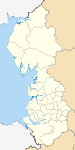
Cumbria Allerdale • Barrow-in-Furness • Carlisle • Copeland • Eden • South Lakeland
Greater Manchester Lancashire Blackburn with Darwen • Blackpool • Burnley • Chorley • Fylde • Hyndburn • Lancaster • Pendle • Preston • Ribble Valley • Rossendale • South Ribble • West Lancashire • Wyre
Merseyside Metropolitan counties and metropolitan districts Greater Manchester 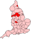
Merseyside South Yorkshire Tyne and Wear West Midlands West Yorkshire Categories:- Local government in Oldham
- Oldham
- Metropolitan boroughs
- Local government districts of North West England


Wikimedia Foundation. 2010.