- M-94 (Michigan highway)
-
This article describes a Michigan state trunkline highway numbered M-94. For the Interstate Highway, see Interstate 94 in Michigan; for other uses, see M94 (disambiguation)
M-94

M-94 highlighted in redRoute information Maintained by MDOT Length: 86.983 mi[2] (139.986 km) Existed: ca. 1927[1] – present Tourist
routes:Lake Superior Circle Tour Major junctions West end:  M-553 at K. I. Sawyer
 Sawyer International Airport
 US 41 near Skandia
 M-67 at Chatham
 M-28 in Munising M-28 in Shingleton
South end:  US 2 in Manistique
Location Counties: Marquette, Alger, Schoolcraft Highway system Michigan State Trunkline Highway System
Interstate • US • State←  I-94
I-94M-95  →
→M-94 is a state trunkline in the Upper Peninsula of the US state of Michigan. It runs for 86.983 miles (139.986 km) from K. I. Sawyer to Manistique. The highway is part of the Lake Superior Circle Tour during a concurrency with M-28. M-94 crosses the Siphon Bridge in Manistique, unique for the fact that the bridge roadway is below water level.
M-94 has been realigned several times. It has had its own roadway between the M-28 junctions in Munising and Shingleton. Other changes have flip-flopped M-94 with M-28 between Harvey and Munising and extended it across the former K.I. Sawyer Air Force Base.
Contents
Route description
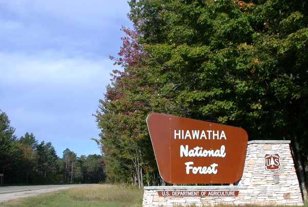
 Hiawatha National Forest road sign on M-28/M-94 in Alger County west of Shingleton
M-94 begins at an intersection with M-553 and crosses the former K. I. Sawyer AFB. Then it overlaps US 41 for a little over a mile near Skandia. East of Skandia, M-94 runs through forest lands and serves the communities of Sundell and Rumely before entering Eben Junction. There M-94 intersects the southern section of H-01. Further east is Chatham where there are junctions with the northern section of H-01 and M-67. M-94 turns southerly briefly before returning to an east–west direction to head to the community of Forest Lake and ultimately Munising. There M-94 joins a concurrency with M-28 and the Lake Superior Circle Tour from Munising to Shingleton. Until the turn at Shingleton, the route is more decidedly east–west than north–south. Between Shingleton and Manistique, M-94 is more north–south.[3]
South of Shingleton, M-94 runs through forest lands as a part of the Great Manistique Swamp. Along the way are national forest campgrounds located near Steuben. South of Crooked Lake, M-94 curves to the east before turning almost due south to the Manistique area.[3] In Manistique, M-94 enters town on North 5th St before turning to follow Deer Street and River Street. On River Street, the trunkline uses the Siphon Bridge to cross the Manistique River and then uses Elk and Maple streets before terminating at US 2 at Lakeshore Drive.[4]
Siphon Bridge
In Manistique, M-94 crosses the Manistique River on the "Siphon Bridge". Built as a part of a raceway flume on the river, the water level is actually higher than the road surface. This produces a siphon effect, giving the bridge its nickname. The Manistique Pulp and Paper Company was organized in 1916 and needed a dam on the Manistique River to supply their mill. This dam would need to flood a large section of the city. The shallow river banks meant difficulties in any bridge construction. Instead of expensive dikes, a concrete tank was built lengthwise in the river bed. The sides of this tank provided man-made banks higher than the natural banks. The Michigan Works Progress Administration described the bridge as having, "concrete bulkheads, formed by the side spans of the bridge, [that] allow the mill to maintain the water level several feet above the roadbed."[5] The Manistique Tourism Council stated: "At one time, the bridge itself was partially supported by the water that was atmospherically forced under it," and that the Bridge has been featured in Ripley's Believe It or Not![6][7]
History
The December 1927 Michigan State Highway Department Official Highway Service Map shows M-94 routed from Au Train west to Munising and further along its current routing to Manistique.[1] In 1928 or 1929, M-94 was rerouted to run along Munising-Van Meer-Shingleton Road (now H-58 and H-15) and southerly to Shingleton.[8] This routing was abandoned on November 7, 1963.[9] It was later extended westward to Harvey in 1939.[10][11] In 1941, the portion of M-94 west from Munising to Harvey was made a part of M-28, and M-94 was extended along its current routing from Munising to US 41.[12][13] M-94 was extended for the last time in 1998 over US 41 and through the old K. I. Sawyer Air Force Base to end at a newly designated M-553.[14][15]
Major intersections
County Location Mile[2] Destinations Notes Marquette K. I. Sawyer 0.000 M-553 – Gwinn, MarquetteSkandia 10.792 US 41 north – MarquetteNorthern end of US 41 concurrency 11.858 US 41 south – Rapid RiverSouthern end of US 41 concurrency Alger Eben Junction 23.747  H-01 south – Traunik
Western end of H-01 concurrency Chatham 25.950 H-01 north – DeertonEastern end of H-01 concurrency 26.947 M-67 south – TrenaryNorthern terminus of M-67 Forest Lake 30.510  H-03 north – Au Train
Southern terminus of H-03 Stillman 33.943  H-05 south
Northern terminus of H-05 Munising 42.509  M-28 west / LSCT west – Munising
Western end of M-28/LSCT concurrency Wetmore 44.419 
 H-13 / FFH 13 – Nahma
Shingleton 51.979 M-28 east / LSCT east – Seney, Newberry
 H-15 north – Van Meer
Eastern end of M-28/LSCT concurrency Schoolcraft Manistique 86.983  US 2 / LMCT – Escanaba, St. Ignace
1.000 mi = 1.609 km; 1.000 km = 0.621 mi
Concurrency terminus • Closed/Former • Incomplete access • UnopenedReferences
- ^ a b Michigan State Highway Department (December 1, 1927). Official Highway Service Map (Map). Cartography by MSHD.
- ^ a b "MDOT Physical Reference Finder Application". Michigan Department of Transportation. 2009. http://www.mcgi.state.mi.us/prfinder/. Retrieved April 14, 2010.
- ^ a b Michigan Department of Transportation (2008). Official 2008 Department of Transportation Map (Map). 1 in:15 mi/1 cm:9 km. http://www.michigan.gov/mdot/0,1607,7-151-9622_11033_11151---,00.html. Retrieved August 4, 2008.
- ^ Google, Inc. Google Maps – M-94 (Michigan highway) (Map). Cartography by Google, Inc. http://maps.google.com/maps?f=q&hl=en&geocode=&q=manistique,+mi&ie=UTF8&z=13. Retrieved August 4, 2008.
- ^ Hunt, Mary and Hunt, Don (2007). "Manistique — Siphon Bridge and Water Tower". Hunt's Guide to Michigan's Upper Peninsula. Albion, MI: Midwestern Guides. http://hunts-upguide.com/manistique_siphon_bridge_and_water_tower.html. Retrieved September 15, 2006.
- ^ Wood, Vivian. "Recreation and Attractions in the Manistique Michigan Area". Exploring the North. http://www.exploringthenorth.com/manistique/rec.html. Retrieved August 28, 2008.
- ^ "Road & Highway Facts". Michigan Department of Transportation. February 13, 2007. http://www.michigan.gov/mdot/0,1607,7-151-9620_11154-129683--,00.html. Retrieved August 28, 2008.
- ^ Michigan State Highway Department (1929). Official Highway Service Map (Map). Cartography by MSHD.
- ^ Michigan Department of Transportation. Right of Way Map for Alger County, Sheet 56 (Map). http://mdotwas1.mdot.state.mi.us/public/ROWFiles/files/Alger/Sheet056.pdf. Retrieved May 8, 2008.
- ^ Michigan State Highway Department (April 15, 1939). 1939 Official Summer Michigan Highway Map (Map). Cartography by MSHD. Section B6.
- ^ Michigan State Highway Department (December 1, 1939). 1940 Official Winter Highway Map of Michigan (Map). Cartography by MSHD. Section B6.
- ^ Michigan State Highway Department (March 21, 1941). Official Michigan Highway Map (Map). Cartography by MSHD. Section B1–B11.
- ^ Michigan State Highway Department (December 1, 1941). Official Michigan Highway Map (Map). Cartography by MSHD. Section B1–B11.
- ^ "MDOT Accepts Responsibility for 120 Miles of Local Roads" (Press release). Michigan Department of Transportation. September 24, 1998. http://www.michigan.gov/mdot/0,1607,7-151-9620_11057-94859--,00.html. Retrieved August 26, 2008.
- ^ Michigan Department of Transportation (1999). Official 1999 Department of Transportation Map (Map). Cartography by MDOT. Section C6.
External links
Categories:- State highways in Michigan
- Lake Superior Circle Tour
- Transportation in Marquette County, Michigan
- Transportation in Alger County, Michigan
- Schoolcraft County, Michigan


Wikimedia Foundation. 2010.