- Moriac, Victoria
-
Moriac
Victoria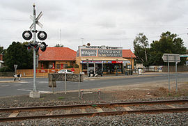
General store and railway crossing on the main street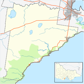
 Moriac
Population: 594[1] Postcode: 3240 Location: - 97 km (60 mi) SW of Melbourne
- 22 km (14 mi) W of Geelong
- 25 km (16 mi) E of Winchelsea
LGA: Surf Coast Shire State District: South Barwon Federal Division: Corangamite Moriac is a rural town in Victoria, Australia, located approximately 25 kilometres (16 mi) west of Geelong. It forms part of the Surf Coast Shire. At the 2006 census, Moriac had a population of 594.[1]
The town was surveyed in the 1920s as a village based around the Moriac station on the Port Fairy line, which had been founded to serve the adjacent community of Mount Moriac. The railway had opened in 1876, followed by the Wensleydale branch line which left the main line here, which opened in 1890 and closed in 1948.[2] The Post Office had opened on 1 August 1854 as Duneed, and was renamed Mount Moriac in 1864 and Moriac around 1909. [3]
The town was initially slow to develop, but survived the closure of the railway line and grew to house a population of several hundred. Though still heavily rural in nature, the town now largely serves as a satellite village of Geelong, with many residents commuting into the city to work.
The town is home to Moriac Primary School, which has approximately 200 students, a hotel, and a number of shops. It also has a kindergarten.
References
- ^ a b Australian Bureau of Statistics (25 October 2007). "Moriac (L) (Urban Centre/Locality)". 2006 Census QuickStats. http://www.censusdata.abs.gov.au/ABSNavigation/prenav/LocationSearch?collection=Census&period=2006&areacode=UCL234950&producttype=QuickStats&breadcrumb=PL&action=401. Retrieved 24 May 2010.
- ^ Sid Brown (March 1990). "Tracks Across the State". Newsrail (Australian Railway Historical Society (Victorian Division)): pages 71–76.
- ^ Premier Postal History. "Post Office List". https://www.premierpostal.com/cgi-bin/wsProd.sh/Viewpocdwrapper.p?SortBy=VIC&country=. Retrieved 2008-04-11
Coordinates: 38°14′S 144°10′E / 38.233°S 144.167°E
Towns in Surf Coast Shire Aireys Inlet • Anglesea • Bellbrae • Bells Beach • Connewarre • Deans Marsh • Gherang • Jan Juc • Lorne • Moriac • Torquay • Wensleydale • Winchelsea
Categories:- Towns in Victoria (Australia)
- Victoria (Australia) geography stubs


Wikimedia Foundation. 2010.