- Cunnamulla, Queensland
-
Cunnamulla
Queensland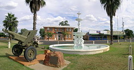
Cunnamulla war memorial.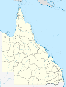
 Cunnamulla
Population: 1,217[1] Established: 1868 Postcode: 4490 Coordinates: 28°04′S 145°41′E / 28.067°S 145.683°ECoordinates: 28°04′S 145°41′E / 28.067°S 145.683°E Elevation: 189 m (620 ft) Location: - 808 km (502 mi) W of Brisbane
- 295 km (183 mi) W of St George, Queensland
- 200 km (124 mi) S of Charleville
LGA: Paroo Shire State District: Warrego Federal Division: Maranoa Mean max temp Mean min temp Annual rainfall 28.0 °C
82 °F14.2 °C
58 °F372.1 mm
14.6 inCunnamulla (
 /kʌnəˈmʌlə/)[2] (Aboriginal meaning "long stretch of water") is a small town that lies on the Warrego River in south west Queensland, Australia, 206 kilometres (128 mi) south of Charleville, and approximately 750 kilometres (470 mi) west of the state capital, Brisbane.
Cunnamulla is situated at the intersection of the Mitchell Highway and the Balonne Highway. At the 2006 census, the town had a population of 1,217.[1]
Cunnamulla is the administrative centre for the Paroo Shire, which also includes the townships of Wyandra, Yowah and Eulo, and covers an area of 47,617 square kilometres (18,385 sq mi). Major industries of the area are wool, pig and kangaroo hunting, and hospitality industry.
Cunnamulla's indigenous community suffers from a high level of domestic violence according to a report of the Aboriginal and Torres Strait Islander Women’s Task Force on Violence.[3]
Contents
History
The area's first European explorer was Thomas Mitchell who passed through the region in 1846.[4] A settlement arose here because there was a reliable waterhole where two major stock routes intersected.[5] The town itself came into being in the late 19th century as a coach stop for Cobb and Co coaches.[4] A town survey was conducted in 1868, the same year a courthouse was built.[5] A railway to the town was completed in 1899.[4]
It has also been stated that the very first interstate game of Rugby League (between New South Wales and Queensland) was played between Cunnamulla and Bourke.[citation needed]
Facilities
Cunnamulla has a public library, the Cunnamulla Library.[6]
Cultural references
- Cunnamulla was the subject of a 2000 documentary film of the same name by Dennis O'Rourke, in which he followed several members of the community as they went about their daily lives.
- Cunnamulla is the main setting for Henry Lawson's short story "The Hypnotised Township" from his anthology The Rising of the Court, and Other Sketches in Prose and Verse.
- The song "The Cunnamulla Fella", written by Stan Coster and sung by Slim Dusty, is commemorated by a statue in the town centre.[7]
Climate
Climate data for Cunnamulla Month Jan Feb Mar Apr May Jun Jul Aug Sep Oct Nov Dec Year Record high °C (°F) 46.9
(116.4)45.0
(113.0)43.3
(109.9)37.2
(99.0)32.7
(90.9)30.4
(86.7)29.4
(84.9)36.8
(98.2)37.7
(99.9)41.8
(107.2)43.9
(111.0)46.0
(114.8)46.9
(116.4)Average high °C (°F) 36.0
(96.8)34.8
(94.6)32.4
(90.3)27.9
(82.2)22.9
(73.2)19.3
(66.7)18.7
(65.7)21.3
(70.3)25.6
(78.1)29.6
(85.3)32.7
(90.9)35.2
(95.4)28.0 Average low °C (°F) 22.2
(72.0)21.7
(71.1)18.8
(65.8)14.1
(57.4)9.8
(49.6)6.8
(44.2)5.7
(42.3)7.1
(44.8)10.7
(51.3)14.8
(58.6)18.1
(64.6)20.7
(69.3)14.2 Record low °C (°F) 13.0
(55.4)11.5
(52.7)4.4
(39.9)4.6
(40.3)−1.1
(30.0)−2.2
(28.0)−2.2
(28.0)−1
(30.2)2.0
(35.6)3.3
(37.9)7.8
(46.0)11.5
(52.7)−2.2
(28.0)Precipitation mm (inches) 46.4
(1.827)51.3
(2.02)40.8
(1.606)27.5
(1.083)30.0
(1.181)26.0
(1.024)22.9
(0.902)17.2
(0.677)18.3
(0.72)25.7
(1.012)30.7
(1.209)39.5
(1.555)376.4
(14.819)Avg. precipitation days 4.5 4.4 3.8 2.7 3.3 3.7 3.3 2.8 2.8 4.0 4.3 4.4 44.0 Source: [8] See also
References
- ^ a b Australian Bureau of Statistics (25 October 2007). "Cunnamulla (Urban Centre/Locality)". 2006 Census QuickStats. http://www.censusdata.abs.gov.au/ABSNavigation/prenav/LocationSearch?collection=Census&period=2006&areacode=UCL316400&producttype=QuickStats&breadcrumb=PL&action=401. Retrieved 2008-01-27.
- ^ Macquarie Dictionary, Fourth Edition (2005). Melbourne, The Macquarie Library Pty Ltd. ISBN 1-876429-14-3
- ^ "Aboriginal and Torres Strait Islander Women’s Task Force on Violence" (pdf). Queensland Government. 1999. Archived from the original on 2007-10-08. http://web.archive.org/web/20071008090759/http://www.datsip.qld.gov.au/pdf/taskforce.pdf. Retrieved 2007-08-10. p47
- ^ a b c "Cunnamulla - Queensland - Australia - Travel". Sydney Morning Herald (Fairfax Media). 8 February 2004. http://www.smh.com.au/news/Queensland/Cunnamulla/2005/02/17/1108500202284.html. Retrieved 12 October 2010.
- ^ a b Environmental Protection Agency (Queensland) (2002). Heritage Trails of the Queensland Outback. State of Queensland. pp. 20. ISBN 0-7345-1040-3.
- ^ "Cunnamulla Library Webpage". Cunnamulla Library. http://cunnamullalibrary.webs.com/. Retrieved 9 June 2011.
- ^ "Cunnamulla Fella". Tourism Queensland. http://www.queenslandholidays.com.au/things-to-see-and-do/cunnamulla-fella/index.cfm. Retrieved 1 February 2010.
- ^ "Climate statistics for Cunnamulla". http://www.bom.gov.au/climate/averages/tables/cw_044026_All.shtml. Retrieved 21 September 2011.
External links
Categories:- Towns in Queensland
- Australian Aboriginal placenames
- Populated places established in 1868


Wikimedia Foundation. 2010.