- Cow Bay, Nova Scotia
-
Cow Bay — Community — Location of Cow Bay, Nova Scotia

Coordinates: 44°37′15″N 63°25′32″W / 44.62083°N 63.42556°WCoordinates: 44°37′15″N 63°25′32″W / 44.62083°N 63.42556°W Country Canada Province Nova Scotia Municipality Halifax Regional Municipality Founded 1763 Area - Land 5.78 km2 (2.2 sq mi) Elevation 0-42 m (-138 ft) Population (2006) - Total 1,219 - Density 210.7/km2 (545.7/sq mi) From Stats Canada [1] Time zone AST (UTC-4) - Summer (DST) ADT (UTC-3) Canadian Postal code B3G Area code(s) 902 Canadian Census Tract 0121.03 GNBC Code CAIAU Website http://www.bigthings.ca/scotia/cowbay.html 
Part of a series about
Places in Nova Scotia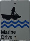 On Marine Drive
Cow Bay is a community within Halifax Regional Municipality Nova Scotia on the Eastern Shore on Route 322 along the scenic Marine Drive.
Contents
History
The community was named after Robert Cowie who, with Roger Hill, received a land grant in the area in 1763. In the 1840s, the latest known ancestors of Cow Bay are the Myers and the Moshers. The beach which extends for a kilometre and a half was a popular destination for people from Dartmouth area by 1850. In the 1930s, a dance hall and canteen were built but unfortunately, over time, the Silver Sands Beach, was being destroyed by the removal of sand for construction of the container piers in Halifax Harbour and to build the runway at CFB Shearwater Airport. Removal of sand left the beaches vulnerable to the erosion of the tides until the Nova Scotia Government decided to step in and pass legislation to protect sand from beaches from being removed.[citation needed]
Notable residents
References
External links
Categories:- General Service Areas in Nova Scotia
- Communities in the Halifax Regional Municipality
- Designated places in Nova Scotia


![[1]](http://geodepot.statcan.ca/GeoSearch2006/GeoSearch2006.jsp?minx=8421707.36520408&miny=1441631.04285714&maxx=8431323.26622449&maxy=1447484.2&LastImage=http://geodepot.statcan.ca/Diss/Output/GeoSearch2006_GEODEPOTFARM518642888246.gif&resolution=H&lang=E&cmd=hierarchy&level=21&placeid=1022&switchTab=3)
Wikimedia Foundation. 2010.