- Ciales, Puerto Rico
-
Ciales, Puerto Rico — Municipality — 
Flag
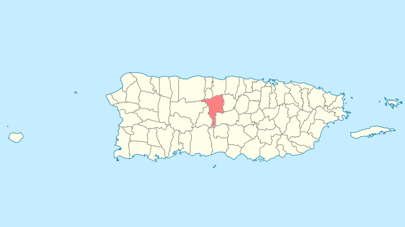
Coat of armsNickname(s): "La Ciudada de la Cojoba", "La Tierra del Café", "Pueblo de los Valerosos" Anthem: "El cantar de tus ríos es mensaje" Location of Ciales in Puerto Rico
Coordinates: 18°20′10″N 66°28′08″W / 18.33611°N 66.46889°WCoordinates: 18°20′10″N 66°28′08″W / 18.33611°N 66.46889°W Country United States Territory Puerto Rico Founded June 24, 1820 Government - Mayor Hon. Luis "Rolan" Maldonado Rodríguez (PNP) - Senatorial dist. 3 - Arecibo - Representative dist. 13 Area - Total 66.5 sq mi (172.17 km2) - Land 66.4 sq mi (172 km2) - Water 0.1 sq mi (.17 km2) Population (2000) - Total 19,811 - Density 298/sq mi (115.1/km2) Demonym Cialeños Time zone AST (UTC-4) Zip code Ciales (Spanish pronunciation: [ˈθjales]) is a municipality of Puerto Rico, located on the Central Mountain Range, northwest of Orocovis; south of Florida and Manatí; east of Utuado and Jayuya; and west of Morovis. Ciales is spread over eight wards and Ciales Pueblo (The downtown area and the administrative center of the city). It is part of the San Juan-Caguas-Guaynabo Metropolitan Statistical Area.
Contents
History
Ciales was founded on June 24, 1820 by Isidro Rodríguez.
Flag
The flag is divided into seven unequal stripes described in sequence: yellow, red, yellow, purple, yellow, red, and yellow.
Coat of arms
The coat of arms consists of a gold shield with a lion standing on its rear legs and silverplated nails grasping a silver coiled parchment between its front claws. The lion also shows a red tongue. Above the lion in the superior part of the shield are located three heraldic roses arranged horizontally with red petals and green leaves. A golden crown of three towers rests on the shield. The three towers are united by walls, simulating masonry blocks. The shield is surrounded by a crown of coffee tree branches with their berries, all in natural colors.
Demographics
Barrios (Districts/Wards)
- Ciales Pueblo
- Cialitos
- Cordillera
- Frontón
- Guavas
- Hato Viejo
- Jaguas
- Pesas
- Pozas
- Toro Negro[1]
Geo/Topography
- Toro Negro Forest Reserve
- Rivers are: Río Cialitos, Río Grande de Manatí, Río Toro Negro, and Río Yunes.
Zip Code 00638
Economy
Agriculture
Agriculture; coffee & cattle
Tourism
Landmarks and places of interest
- Hacienda Negrón
- Las Archillas Cavern
- Las Golondrinas Cavern
- Parada Choferil
- Toro Negro Forest Reserve
- Yuyú cueva
- El choro de Doña Juana
Festivals and events
Cantata Corretjer - March 19
Agua Dulce Festival - August
Frontón Festival - July
San Elías Festival - July
Matron Festivities - October
Sports
Ciales is the home town of Juan "Pachín" Vicens - Puerto Rico's undisputed national basketball star, named Best Player in the World at the 1959 World Basketball Championship, Santiago de Chile (a.k.a., Juan "Pachín" Vicens, "Astro del Balón", "El Jeep"; younger brother of Puerto Rico's National Poet, Nimia Vicens, who also hailed from Ciales). Their middle brother, Enrique "Coco" Vicens, a former Puerto Rico Senator, was a track and field athlete in his own right.
References
Categories:- Municipalities of Puerto Rico
- Populated places established in 1820
- San Juan – Caguas – Guaynabo metropolitan area

Wikimedia Foundation. 2010.