- Corktown, Toronto
-
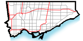
Corktown — Neighbourhood — A group of houses along Queen Street in Corktown Map of Corktown, the area south of Queen and west of Parliament is not always considered part of Corktown
 Location of Corktown within Toronto
Country  Canada
Province  Ontario
City  Toronto
Corktown is a residential neighbourhood in downtown Toronto, Ontario, Canada. It is just south of Regent Park and north of the Gardiner Expressway, between Berkeley Street to the west and the Don River to the east, Shuter Street to Lake Shore Boulevard East, this area also includes the Distillery District. Corktown contains many vacated industrial buildings, some in use by production and movie studios. The West Don Lands, slated to be redeveloped over the next few years, will encompass the south-east corner of this area.
The neighbourhood's name derives from its origins in the early 19th century as an Irish ethnic enclave, particularly for Irish emigrants from County Cork, though some say the presence of a distilleries, breweries and cork-stopper manufacturers in the vicinity may have secured the nickname. In the early 19th century, most Corktown residents found employment at one of the local breweries or brickyards. The first Catholic parish in Toronto, St. Paul's Basilica, is found in Corktown. Protestants could not afford the lofty pew rents at nearby St. James Cathedral (Anglican) and this led to the building of their own "Little Trinity Church" in 1843. Little Trinity Church is at 417 King Street East.
The Enoch Turner Schoolhouse on Trinity Street, just south of Little Trinity Church, was built in 1848. This was Toronto's first 'free school'. Its benefactor was Enoch Turner, a prominent Corktown brewer and one of Toronto's great philanthropists. The Schoolhouse is now operated as a museum by the Ontario Heritage Trust, offering tours for adults and children, and hosts private events.
Some of the original workers’ cottages can still be seen in the area, as well as old Corktown’s Italianate church, St. Paul’s Basilica.
 Aerial view showing most of Corktown before demolitions, 1942
In the early 1960s, a significant amount of Corktown was demolished to make way for several elevated roadways, including the Richmond Street off-ramp from the Don Valley Parkway and the re-routed Eastern Avenue overpass. Among the most significant buildings destroyed was the House of Providence (1857–1962), an institution run by the Sisters of St. Joseph to care for orphans and the elderly poor.
Currently in the early stages of the same sort of regentrification that revitalized present-day Cabbagetown, examples of late 19th century British-style row-housing can still be seen lining Corktown side streets such as Bright Street, Trinity Street, Wilkins Avenue, Ashby Place and Gilead Place. Little Trinity Church just east of King and Parliament is Toronto's oldest surviving church building, its cornerstone laid on July 20, 1843. Corktown was also the site of the first Roman Catholic church in Toronto: St. Paul's was originally built in 1822. The current St. Paul's (at Queen St. East and Power Street) dates from 1887.
Corktown is also home to Inglenook Community Highschool, one of the Toronto District School Board's alternative schools. St. Paul's Catholic School is the oldest Catholic elementary school in the city, founded in 1842. Beneath its schoolyard and adjacent to St. Paul's Basilica is an unmarked graveyard of Irish victims of the Great Famine (Ireland).
External links
Adjacent locations

Regent Park St. Lawrence 
Riverdale  Corktown

West Don Lands Coordinates: 43°39′20″N 79°21′35″W / 43.655518°N 79.359712°W
Categories:- Neighbourhoods in Toronto
- Historic districts in Canada
- Ethnic enclaves in Canada


Wikimedia Foundation. 2010.