- Natal, Rio Grande do Norte
-
Natal — Municipality — The Municipality of Natal From upper left: Forte dos Reis Magos; Bairro Tirol at night; Alberto Maranhão Theatre Machadão stadium and Morro do Careca and Ponta Negra.
Flag
SealNickname(s): "Cidade do Sol" ("The City of the Sun") and "Cidade das Dunas" ("The City of Dunes") Location in the State of Rio Grande do Norte Location in Brazil
 Natal
NatalCoordinates: 05°47′S 35°12′W / 5.783°S 35.2°WCoordinates: 05°47′S 35°12′W / 5.783°S 35.2°W Country  Brazil
Region Northeast State  Rio Grande do Norte
Founded December 25, 1599 Government - Mayor Micarla de Sousa (Green Party) Area - Municipality 170.298 km2 (65.8 sq mi) Elevation 30 m (98 ft) Population (2008) - Municipality 806,203 (21st) - Density 4.734.07/km2 (12.3/sq mi) - Metro 1,263,547 Time zone UTC-3 Postal Code 59000-000 Area code(s) +55 84 Website Natal, Rio Grande do Norte Natal (Portuguese pronunciation: [naˈtaw], Christmas) is the capital and largest city of Rio Grande do Norte, a northeastern state in Brazil. As of the IBGE July 2009, the city had a total population of 806,203 (1,263,547 in its Greater Natal).[1] Natal is considered by IPEA (Institute of Applied Economic Research of Brazil), the safest capital city in the country.[2][3][4]
The implementation of the Via Costeira (Coastal Highway), 10 km (5.5 mi) long avenue along the shore and the dunes, was the true starting point for the beginning of tourist activity in the State in the 1980s. That is where the main hotels of the capital city, Natal, are concentrated. Natal has several tourist attractions and is famous for its natural beauty (such as the crystalline waters of Maracajaú and the largest cashew tree in the world), for its historical monuments and buildings (such as the Forte dos Reis Magos, the Alberto Maranhão Theatre and Newton Navarro bridge), for its beaches (such as Ponta Negra, Pipa and Genipabu) and also for its off-season carnival, the Carnatal. The city also boasts the second largest urban park in Brazil, the Parque das Dunas.[5]
It is the capital of Brazil closest to Europe,[6] and the Augusto Severo International Airport connects Natal with many Brazilian cities and also operates some international flights. The city is one of the host cities of the 2014 FIFA World Cup, for which Brazil is the host nation.[7]
Contents
Geography
Natal is located at 5°46′S 35°12′W / 5.767°S 35.2°W, in the far east of South America. The city has a total area of 170 km². Natal lies on the Atlantic Ocean, at the mouth of the Potengi River.
Climate and vegetation
Natal has a typical tropical climate, specifically a tropical wet and dry climate, with warm to hot temperatures and high relative humidity all throughout the year. However, these conditions are relieved by a near absence of extreme temperatures and pleasant trade winds blowing from the ocean. January is the warmest month, with mean maxima of 31 °C (88 °F) and minima of 24 °C (75 °F), while July is the coolest with mean maxima of 27 °C (80.6 °F) and minima of 22 °C (72 °F). Rainfall is heavy at around 1,550 millimetres (61 in) per year, but there is a dry season between about September and January that is more distinct than further south on the Atlantic coast. Nonetheless, the weather is not so dry as to preclude the growth of tropical rainforest and, since colonisation by Portugal, sugar cane.
Known as the "City of the Sun" and also as "The City of the Dunes." Natal is located in the northeastern tip of Brazil.
Lying about six degrees south of the equator the sun shines on for more than 3,000 hours every year. The average temperature in Natal is about 27 degrees celsius. During the summer season it normally reaches above 30 degrees celsius with the water at a soothing 26 degrees. The greatest amount of rain falls between March and July.[8]
Climate data for Natal Month Jan Feb Mar Apr May Jun Jul Aug Sep Oct Nov Dec Year Record high °C (°F) 37
(99)38
(100)38
(100)38
(100)32
(90)36
(97)36
(97)37
(99)37
(99)32
(90)35
(95)36
(97)38
(100)Average high °C (°F) 31
(88)31
(88)31
(88)30
(86)30
(86)28
(82)28
(82)28
(82)29
(84)30
(86)30
(86)30
(86)30 Daily mean °C (°F) 27
(81)27
(81)27
(81)27
(81)26
(79)26
(79)25
(77)25
(77)26
(79)26
(79)27
(81)27
(81)26 Average low °C (°F) 24
(75)23
(73)23
(73)22
(72)21
(70)21
(70)19
(66)20
(68)21
(70)22
(72)23
(73)24
(75)22 Record low °C (°F) 20
(68)20
(68)17
(63)16
(61)17
(63)16
(61)15
(59)14
(57)17
(63)19
(66)20
(68)21
(70)16
(61)Precipitation cm (inches) 5
(2)12
(4.7)18
(7.1)25
(9.8)19
(7.5)21
(8.3)19
(7.5)9
(3.5)6
(2.4)2
(0.8)2
(0.8)2
(0.8)137
(53.9)Source: Weatherbase[9] History
 Three Kings fort "Forte dos Reis Magos."
The northeastern tip of South America, Cabo São Roque, 20 miles (32 km) to the north of Natal and the closest point to Europe from Latin America, was first visited by European navigators in 1501, in the 1501–1502 Portuguese expedition led by Amerigo Vespucci, who named the spot after the saint of the day. For decades thereafter, no permanent European settlement was established in the area, inhabited by the Potiguar tribe.
In 1597, after some years during which French pirates, led by Jacques Riffault, established regular commercial activities with the native population, the ninth Portuguese Governor-General of Brazil, Francisco de Sousa, ordered the expulsion of the buccaneers. The successful expedition against 50 Frenchmen and their Indian allies was led by the Captain-Major of the Captaincy of Pernambuco, Manuel de Mascarenhas Homem, with the assistance of Jerônimo de Albuquerque Maranhão.
 Rampa, one of the U.S. air bases used during World War II.
Albuquerque Maranhão began on January 6, 1598, the construction of the Fort of the Holy Kings or of the Magi-Kings ("Forte dos Santos Reis" or "Forte dos Reis Magos"), named after the Three Wise Men, honored in the Christian feast of the Epiphany, celebrated on that day.
On December 25, 1599, Natal (whose name means Nativity or Christmas in Portuguese) was established as a village outside the fort. The fort, city, and surrounding areas were occupied by Dutch forces from 1633 to 1654. They rechristened the fort "Fort Ceulen" after one of their commanders.
The sandy soil of Natal prevented the city from becoming a producer of sugarcane, during the colonial times. For centuries, the economy of the State was based on the raising of cattle in the dry interior lands; the cattle was sent alive to the larger centers, to be used as traction, or was turned into jerked beef, to be used as food; the most typical food of Natal, "carne de sol" (sun meat), has origins in that jerked beef.
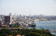
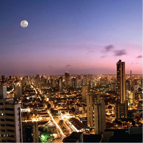
 Natal skyline.
Last century, Natal benefited from the growth of the industries of salt (the north of Rio Grande do Norte is the largest producer in Brazil) and petroleum (the largest inland Brazilian reserves are in the State). Natal grew quickly, but in a somewhat planned way (compared to other major Brazilian cities); transit flows smoothly, public services are well distributed, ecologic conscience is visible; violence levels are low. Tourists (first Brazilians, more recently foreigners) discovered the city, which became one of the major tourist destinations in Brazil.
Because of its strategic position (Natal is one of the cities in Brazil nearest to Western Europe and Africa, especially Dakar, Senegal), an American air base was built in a suburb of Natal named Parnamirim during World War II as part of the so-called Operation Rainbow; this base provided support for allied troops combating in the north of Africa. Thousands of American soldiers were sent to Natal, and their presence left traces in the culture of the city.
Demographics
See also: Largest Cities of Northeast Region, Brazil and Demographics of Brazil Natal aerial view.
Population growth in Natal[10] Year Inhabitants 1872 20,392 1890 13,725 1900 16,056 1920 30,696 1940 54,836 1950 102,215 1960 160,253 Year Inhabitants 1970 264,379 1980 416,898 1991 606,541 1996 656,037 2000 709,536 2007 774,230 2008 798,065 According to the IBGE of July 2009, there were 806,203 people residing in the city, and 1,263,547 people residing in the Greater Natal (metropolitan area). This is the second smallest capital the country in territorial extension,[11] therefore, the population density is high, 4,546,3 per square kilometer 4.638.03 inhabitants per square kilometre (12.0 /sq mi). It is the 21st largest city in the country and the sixth largest in the northeastern region. The racial makeup of the city was 48.38% Brown (Multiracial), 46.99% White, 3.65% Black, 0.30% Asian or Amerindian.[12]
Religion
Main article: Religion in BrazilReligion Percentage Number Catholic 76.27% 543,254 Protestant 13.69% 97,545 No religion 7.26% 51,699 Spiritist 1.35% 9,605 Source: IBGE 2000.[13]
Cityscape

Economy
Main article: Economy of Brazil Trade seaside.
With its dozens of sandy, white beaches, such as Ponta Negra and its famous Morro do Careca, Tabatinga - the cliff of dolphins, Pirangi, Redinha, Pipa and Genipabu with its famous fixed sand dunes and imported dromedaries, tourism is the most important industry of Natal, attracting Brazilians, Europeans (many from Spain, England, Scandinavia, Germany, Portugal, Italy and France), and U.S. citizens alike. There has been an increase of 134% in foreign tourism in Natal between 2002 and 2005 (for the same time period the increase of foreign tourism in Brazil was 48%); This is a due to the accessibility of Natal and the appeal Brazil has for an increasing number of tourists, clearly showing that Natal is the area leading the Brazilian tourism boom. Natal is the number one area receiving international investments in Brazil. Natal will benefit enormously from the massive future investments on the coastline.
 Pumpjack in UFRN, Natal.
With in the next five years more than ten golf courses will be developed on the Natal coastline and more than $1.8 billion dollars will be invested in new hotels, resorts and improving infrastructure (the equivalent to 8% of all foreign investments that the entire Brazilian economy received last year). Due to the booming tourism and enormous potential for further growth, the local government has decided to build a new airport in Natal which will be the biggest airport in South America (8th biggest in the world). The airport will be specifically designed to be able to cater for the new Airbus A-380, which will further confirm Natal's position as the number one tourist destination in Brazil. Thompson Holidays started direct charter flights to Brazil in early 2006, and to no surprise the chosen destination was Natal. Being the Number one beach tourism area and a symbol of the Northeastern Brazil, Natal will benefit enormously from future domestic economic growth and increasing spending powers of the Brazilian population (180 million). Last year, 1.7 million Brazilians visited Natal (for the same period, 345,000 foreigners visited Natal).[14]
 Norte Shopping.
It is also a relevant administrative center for the oil industry (Rio Grande do Norte being the second largest oil-producing state in Brazil). Thus, it's Federal University of Rio Grande do Norte (UFRN) is a national scientific research pole on Oil Sciences (ranging from Geophysical to Law studies), supported mostly by Petrobras financing.
The fishing industry is strong (shark cartilage being a major export to Japan) as is the cultivation of tropical fruit, especially mangos, guavas, and cashews (the fruit and the nuts).
In fact, the largest cashew tree in the world is located near the coast in the neighborhood of Pirangi, south of the city center. This tree has a circumference of 500 metres and occupies an area of 7,300 m², making it 70 times the size of average cashew trees.
The GDP for the city was R$ 7,508,466,000 (2006).[15]
The per capita income for the city was R$ 9,506 (2006).[16]
Education
Main article: Education in Brazil Federal University of Rio Grande do Norte.
 International Institute for Neuroscience of Natal.
Portuguese language is the official national language, and thus the primary language taught in schools. But English and Spanish are part of the official high school curriculum.
Educational institutions
- Federal University of Rio Grande do Norte (UFRN);
- International Institute for Neuroscience of Natal (IINN-ELS);
- Universidade Estadual do Rio Grande do Norte (UERN);
- Universidade Potiguar (UnP);
- Centro Federal de Educação Tecnológica do Rio Grande do Norte (Cefet-RN);
- Instituto de Educação Superior Presidente Kennedy (Kennedy);
- Faculdade Natalense para o Desenvolvimento do Rio Grande do Norte (Farn);
- Faculdade de Natal (FAl);
- Faculdade de Excelência Educacional do Rio Grande do Norte (FATERN);(IINN-ELS)
- Faculdade Câmara Cascudo (FCC);
- Faculdade de Ciências Cultura e Extensão (FACEX);
- Faculdade Católica Nossa Senhora das Neves (FCNSN);
- and many others.
There are more than 15 universities in whole state of Rio Grande do Norte.[17]
Culture and recreation
Natal is your gateway to many attractions of the city and the state of Rio Grande do Norte:
- Carnival and Carnatal
 Carnatal, is one of the largest off-season carnivals in Brazil.
The four-day period before Lent leading up to Ash Wednesday is carnival time in Brazil. Carnival in Natal is not big, but "Carnatal" is a different matter: it's one of the largest off-season carnivals in Brazil.[18] Organizing off-season Carnavais is not a Natal-only habit. Fortaleza has "Fortal", Recife has "Recifolia", Natal has "Carnatal". Carnatal takes place sometime in November or December. It has happened in the streets around Machadão Stadium (traffic around the stadium changes radically during Carnatal days). The transit department isolates about 3 km (1.8 mi) of streets,[19] creating a ring, along which the party takes place. During the days of party, a huge truck (called "trio elétrico"), with a band on the top and sound boxes all around, drives slowly along the streets. The crowd follows the trio elétrico singing, dancing, jumping to the sound of the music. To be allowed to follow the truck, one must buy admittance to one of the several "blocos" ("block"). A bloco is an enterprise which obtains permission to participate in Carnatal, hires the band, sells admitance and controls access.
- Dunas State Ecological Park
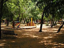
The Dunas Park is considered the second largest urban park in Brazil.[21] It includes 1,172 hectares of land, and allows observation of several vegetable and animal species, which are typical of the Atlantic Forest. The tour is along a trail, accompanied by trained guides. The park also has a jogging track, and stays open for visitors from Tuesday to Sunday.
- Museums
Museums in Natal include: Museu de Arte Sacra, Museu de Cultura Popular, Espaço Cultural Palácio Potengi, Instituto Histórico e Geográfico do Rio Grande do Norte, Pinacoteca do Rio Grande do Norte, Museum Camara Cascudo, Memorial Camara Cascudo.
- Natal Aquarium
 Seahorses in Natal Aquarium.
The Natal Aquarium was founded and is run by a family of biologists and retired environmentalists. Besides the exhibit, the aquarium also serves as a surgery center for sea animals. The Aquarium is located between the Oceânica Avenue and the beach. The Aquarium exhibits about 60 marine species.[22] There are about 30 small aquariums, where the species are put individually or in small groups of two or three species. Most species were collected at the Brazilian and Rio Grande do Norte coast. Species include several kinds of fish (including piranhas), sea horses, shrimps, lobsters, stingrays, octopus, etc. In a refrigerated aquarium, there is a couple of penguins.
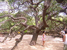 The world's largest cashew tree.
 Forte dos Reis Magos, fortress built in 1598 and is now a museum.
- The Largest Cashew Tree in the World
The Maior cajueiro do mundo is the biggest cashew tree in the world. In 1994, it entered the Guiness book as the tree which covers the largest area, 8,400 square meters;[23] larger than a typical football pitch. Due to a genetic mutation, the branches of this tree grow outwards rather than upwards; thus when a branch touches the ground, roots are not created, rather a new ramification starts to grow.[24] There is even a gazebo located in the cashew, a popular attraction amongst tourists.
- Forte dos Reis Magos
Forte dos Reis Magos or Fortaleza dos Reis Magos is a medieval fortress that was the first milestone of the city - founded on 25 December 1599 - on the right side of the bar of the river Potenji (today near the Ponte Newton Navarro). It received its name based on the date of commencement of its construction, 6 January 1598, at Epiphany Catholic calendar.
- Natal City Park
The Natal City Park Dom Nivaldo Monte, or simply the City Park is a urban park. Inaugurated on July 21, 2008 with architectural project of Oscar Niemeyer. It has a unique, monumental tower, and has a museum and restaurant. As of January 2011, the entire park is closed due to lack of funding from the city. (source: http://www.natal.rn.gov.br/parquedacidade/)
- Festa Junina (Saint John Festival)
Festa Junina was introduced to Northeastern Brazil by the Portuguese for whom St John's day (also celebrated as Midsummer Day in several European countries), on the 24th of June, is one of the oldest and most popular celebrations of the year. Differently from what happens on the European Midsummer Day, the festivities in Brazil do not take place during the summer solstice but during the tropical winter solstice. The festivities traditionally begin after the 12th of June, on the eve of St Anthony's day, and last until the 29th, which is Saint Peter's day. During these fifteen days, there are bonfires, fireworks, and folk dancing in the streets. Typical foods and beverages are served. It should be noted that, as during Carnival, these festivities involve wearing costumes (in this case, peasant costumes), dancing, heavy drinking, and visual spectacles (fireworks display and folk dancing). Similar to what happens on Midsummer and St John's Day in Europe, bonfires are a central part of these festivities in Brazil. Festa Junina in other cities of the state, especially in the city of Mossoró which gathers thousands of people during the month of June.
- Newton Navarro bridge
 Natal Historic Center.
 Alberto Maranhão Theatre (on the inside of it) is part of Historic Center.
The Newton Navarro bridge is one of the highest bridges in Brazil and has over a gorgeous sunset seen from Potengi River. It makes the connection with the beaches of the north coast of the state. In addition to unburden the city traffic, the bridge became a tourist attraction because of its large size.
- Historic Center
The Natal Historic Center it comprises an area of approximately 201,278 m2 (2,166,538.36 sq ft), which are included 150 buildings of various styles, including colonial architecture, neoclassical, art-deco and modernist. This area comprises the districts of Ribeira and Cidade Alta, which are the oldest neighborhoods of the city, which have characteristics of the first centuries of the history of Brazil, highlighting important aspects of Portuguese colonization.
- Barreira do Inferno
The Barreira do Inferno Launch Center is the first base to launch rockets from Brazil. With the construction of another center in Brazil, today, it only launches rockets, small and medium businesses and is open to visitation of tourists to know the rockets, but must make an appointment to visit the center.
- Parrachos de Maracajaú
 Parrachos de Maracajaú.
The Parrachos de Maracajaú of coral reefs are the seven kilometers of beach in Maracajaú, forming natural pools. Occupy an area of 13 km (8 mi), excellent for snorkeling in the coral diving underwater that, at low tide, touch the surface. It is one of the places in Brazil where the sea is the most crystalline and suitable for diving. The beach of Maracajaú is 60 km (37 mi) from Natal. In Maracajaú also a water park, the Ma-Noa Park.
- Genipabu
 Genipabu dunes.
Genipabu (or Jenipabu) is a beach, a complex of dunes, a lagoon and an area of environmental protection (APA) located in Natal capital city, one of the most famous post-cards of the Brazilian state Rio Grande do Norte. It is a huge dunes and a lagoon of fresh water, with strong attraction for tourism. The region has a good infrastructure of hotels, inns, restaurants, beach tents, tours of "buggies", rafts and dromedaries. It is played in the dunes around the lake called "esquibunda" stakeholders sit down the dunes on top of planks of wood, to dive in the waters of the lagoon. The tours of "buggies" are offered in the local "with emotion" or "no emotion", according to the degree of risk, it is recommended, however, are chosen accredited professionals responsible for security not only of tourists, but the middle - environment.
- Ponta Negra and Via Costeira
 Ponta Negra Beach.
Ponta Negra is a famous beach and a neighborhood located in the Brazilian city of Natal in the state of Rio Grande do Norte. In the extreme south of the beach, is located in Morro do Careca (Bald Hill), a large dune. The extreme north of the beach, is located at Via Costeira (Coastal Way), a road in the middle of coastal dunes that connect the various beaches of the city. The beach is completely urbanized and there are several points shops, restaurants, bars and night clubs. The sand itself is lined with "tents", or huts, that serve food and drinks to beachgoers day and night. A common sight on the beach are "jangadas", simple, multicolored, local fishing boats typical of northeastern Brazil. The Via Costeira (Coastal Way) is a great avenue built next to the dunes and beaches of the city, including making the connection of several beaches in the state.
- Pipa Beach
The Pipa Beach is located 85 km from Natal and completely away from urban centers. Paradise a beach that attract thousands of tourists every year.
- Other attractions
- As Natal means Christmas in Portuguese, possibly in December are some attractions such as concerts, plays, meeting writers and the traditional burning of fires, and the city be decorated with Christmas purposes.
- Cape São Roque, point of the Brazilian coast close of Africa.
- Calcanhar Lighthouse, the highest lighthouse in Brazil.
- "Mada", festival of pop rock national; and "Verão de Todos", summer festival.
- Shopping centers/malls: Midway Mall, Praia Shopping, Natal Shopping, Norte Shopping and Shopping Cidade Jardim.
Transportation
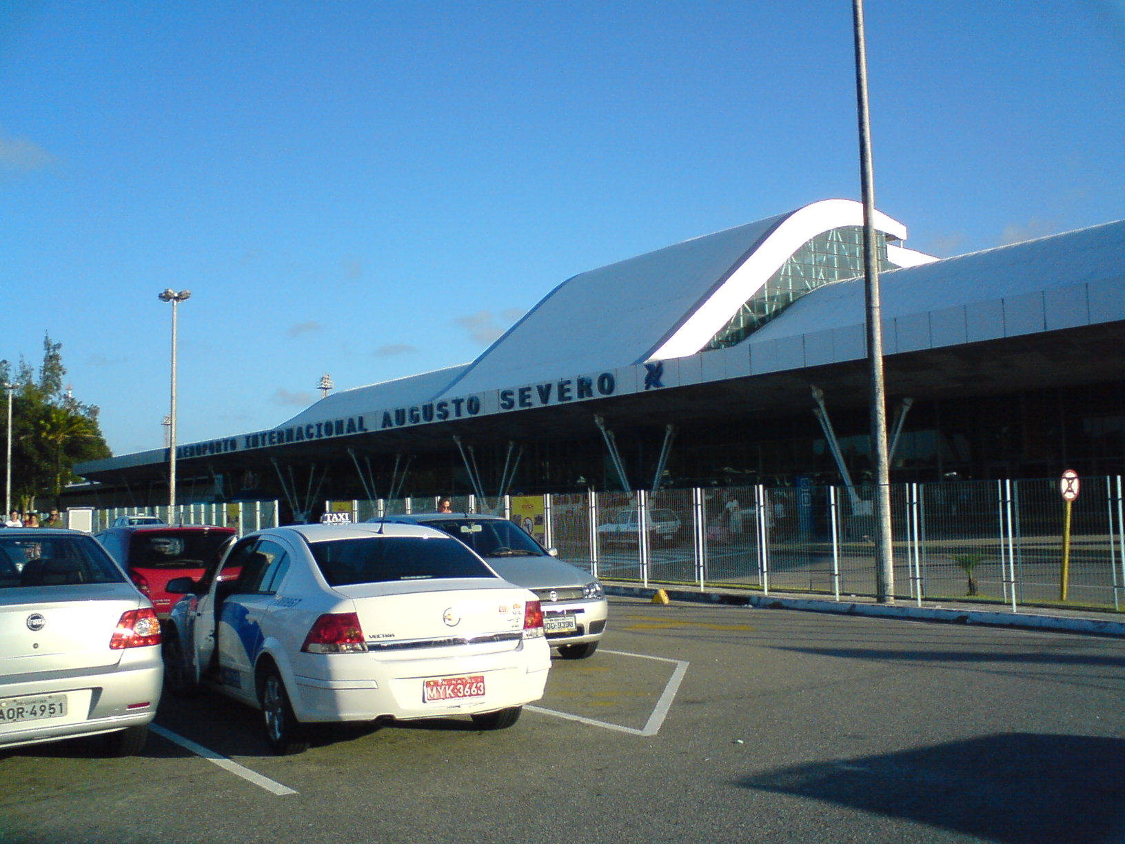
International Airport
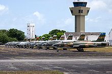 Natal Air Force Base.
Located virtually at sea level (169 feet), with favorable weather and geographic conditions, Augusto Severo International Airport in Parnamirim is 18 km (11 mi) from Natal. It takes its name from Augusto Severo de Albuquerque Maranhão, a native son of that state who died in an accident in France in 1902. The airport has a total area of 11.3 thousand square meters and capacity for 1.2 million passengers a year. The installations and passenger terminals are air conditioned with equipment that can put out 630 tons of cooled air. With an area of 5.5 million square meters, the airport complex operates with 16,482 square meters of passenger and cargo terminals and administrative and maintenance installations. There are 6,224 meters of runways and 61.5 square meters of apron space, providing connections from the greater Natal region to the main centers of the world. The airport is the only one in the Northeast Region to receive charter flights from Scandinavia. The Natal Air Force Base is also located on the premises.
Presently a new airport is being constructed in the municipality of São Gonçalo do Amarante, to be called Greater Natal International Airport.
Highways
 BR-101 highway as Salgado Filho Avenue in December.
Federal Highway BR-101 is the most important access to Natal, coming from the South of Brazil, through the boundary with the municipality of Parnamirim. For those who come from the State of Ceará, the principle access is by the Federal Highway BR-304, through the boundary with the municipality of Macaíba, where you pick up BR-226 taking people to Natal. Leaving Natal, an important access to the southern Potiguar coast is the "Sun Route" (Rota do Sol) as RN-063 is known by, and which takes you to the beaches of Pirangi, Búzios, Tabatinga, up to the municipality of Nísia Floresta. The North Shore is accessible from the Newton Navarro bridge, following the Praia do Forte to Genipabu, and the Igapó Bridge, following the district of Igapó by BR-101 to Touros, and by BR-406 to Macau.
Natal is connected to all the 167 municipalities of Rio Grande do Norte and dozens of locations and Potiguar districts, through the Passenger Bus Terminal of Natal (Terminal Rodoviário de Passageiros de Natal), located in the Eastern Zone of the city. All the accesses to the countryside of the state are through the Metropolitan region of Natal, composed of the municipalities of Ceará-Mirim, Emaús, Extremoz, Macaíba, Monte Alegre, Nísia Floresta, Parnamirim e São Gonçalo do Amarante. Buses with direct destinations to various Brazilian capitals also leave from the Passenger Bus Terminal of Natal. The cities with regular weekly schedules are: Belo Horizonte, Fortaleza, Goiânia, João Pessoa, Palmas, Recife, Salvador, São Luiz e Teresina.[25]
Bus
Of course, buses are the cheapest way go move aroung Natal, tickets vary from around US$ 1.00 (most of lines) to US$ 1.20 (the line going from Natal to the airport). It's possible to get passes or magnetic cards to pay before hand, but usually it's easiest to pay to the conductor. There are big buses, micro buses and vans, all driving along the same streets, all charging the same prices. All the main touristic spots within Natal are well served by buses. People may expect to travel standing up on the big buses (not so with micros and vans), but very rarely will they be so overcrowded that people have physical contact with other people (in other Brazilian cities, a bus during peak hours reminds much a sardines tin). Typical waiting time is 15 min during the peak hours, and up to one hour.[26]
Taxi
There are plenty of taxis in the city. Taxis are white cars and have a red plate. Fares are the same, regardless of how new and comfortable the car is. Fares are regulated by the government. As of today, normal prices are: US$ 2 to start metering, US$ 1 per km and US$ 5 per waiting hour. The only exception to these prices are the so called special taxis at the airport. From 10pm to 6am at weekdays, and all hours at weekends (and, depending on a decree by the mayor, all times during the month of December), there is a 20% increase in the above prices,[27] this is indicated by a number 2 showing in the fare meter. There are several tele-taxis companies in Natal.[28]
Buggy
The dune buggy is the vehicle used most to drive along the beaches.[29] Driving a conventional car is forbidden in some areas (for example, the beaches of Jenipabu) and, even where it is not prohibited, there is a high risk of getting stuck in the sand. Some companies offer tours in Land Rovers and other 4WD vehicles, these cars offer much more comfort, but buggy drivers claim that the buggy is more flexible. Riding a buggy, people feel the sun and the wind. Buggies are safe, accidents with buggies are much less frequent than accidents with other cars (most dune buggy drivers are certified by the Tourist Authority).
 View of Port of Natal.
 Naval ship.
Distances
- João Pessoa: 180 km (110 mi);
- São Paulo: 3011 km (1870 mi);
- Rio de Janeiro: 2750 km (1708 mi);
- Belo Horizonte: 2615 km (1624 mi);
- Brasília: 2383 km (1480 mi);
- Salvador: 1100 km (683 mi);
- Porto Alegre: 4320 km (2684 mi).
Port
The Port of Natal is specialized in cold storage cargo such as fruit, fish and shrimp, among others. It has its own customs facilities and is connected to Europe by direct navigation lines, mainly to the ports of Vigo, Rotterdam and Sheerness.
Neighborhoods
 Cidade Alta Neighborhood.
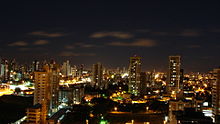 Tirol Neighborhood.
Neighborhoods of Natal:
North Zone
- Potengi
- Redinha
- Pajuçara
- Igapó
- Nossa Senhora da Apresentação
- Salinas
- Lagoa Azul
East Zone
- Cidade Alta
- Petrópolis
- Tirol
- Alecrim
- Ribeira
- Rocas
- Barro Vermelho
- Santos Reis
- Praia do Meio
- Areia Preta
- Mãe Luíza
West Zone
- Quintas
- Nordeste
- Dix-Sept Rosado
- Bom Pastor
- Nossa Senhora de Nazaré
- Cidade da Esperança
- Cidade Nova
- Planalto
- Felipe Camarão
- Guarapes
South Zone
- Ponta Negra
- Lagoa Nova
- Capim Macio
- Candelária
- Neópolis
- Nova Descoberta
- Pitimbú
Sports
See also: 2014 FIFA World Cup Alecrim Futebol Clube in 2009.
The main soccer teams of Natal are:
- América de Natal
- ABC Futebol Clube
- Alecrim Futebol Clube
Stadiums
 Machadão Stadium.
- João Machado Stadium (Machadão)
- Maria Lamas Farache Stadium (Frasqueirão)
- Juvenal Lamartine Stadium
Gymnasiums
- Humberto Nesi Gymnasium (Machadinho)
- Ginásio Nélio Dias
2014 FIFA World Cup
Natal is one of the host cities of the 2014 FIFA World Cup, for which Brazil is the host nation. the Dunas Arena will be built in place of Machadão stadium will be demolished.[30] It is building a new airport, Greater Natal International Airport, to be the largest airport in Latin America.[7] It is also investing in a public transport system using the system of light rail called VLT de Natal, and other projects of infrastructure.
 Nélio Dias gymnasium.
David Beckham has announced plans for a football academy in Natal, called the Beckham World of Sport, to coincide with the 2014 World Cup.[31]
11th World Maxibasketball Championship
Natal will be the first Brazilian city to host a World Maxibasketball Championship. The 11th World Maxibasketball Championship will occur in July 2011,[32] winning among the cities which also wanted to host the event: Punta del Este in Uruguai; Vancouver in Canada and Eugene in the United States.[33] The facilities of the modern Nélio Dias gymnasium should be used to house the event that will bring to the capital of Rio Grande do Norte about 3,500 athletes from around the world.[34]
Notable Natalenses
Natalenses, as residents of Natal are called in Brazil.
 Larissa Costa, is a model from Natal.
- Abraham Palatnik, artist
- Aldo Parisot, cellist and cello teacher
- André Oliveira, football player
- Antônio Filipe Camarão, native American
- Carlos Paz de Araújo, scientist and inventor
- Clodoaldo Silva, paralympic swimmer
- Diego Pelicles da Silva, football player
- Fabio Holanda, mixed martial artist
- Fernanda Tavares, international model
- Garibaldi Alves Filho, politician and former President of the Federal Senate (2007–2009)
- Jadson Andre, professional surfer from Ponte Negra
- Kell, football player
- João Café Filho, lawyer and ex-president of Brazil (1954–1955)
- Jussier da Silva, mixed martial artist
- Larissa Costa, model and Miss Brasil 2009
- Luís da Câmara Cascudo, anthropologist, folklorist, journalist, historian, lawyer, and lexicographer
- Marinho Chagas, football player
- Matuzalém, football player
- Oscar Schmidt, basketball player
- Renan Barão, mixed martial artist
- Ronny Markes, mixed martial artist
- Ramalho, football player
- Richarlyson, football player
- Roberta Sá, singer
- Virna Dias, volleyball player
Twin towns
See also: List of twin towns and sister cities in BrazilNatal, Rio Grande do Norte is twinned with:
 Bethlehem, Palestinian Authority[35]
 Córdoba, Argentina
- Porto Alegre, Brazil
- Rio de Janeiro, Brazil
- Salvador, Brazil
Photo gallery
-

Natal's City Hall (Filipe Camarão Palace).
-

Natal Metropolitan Cathedral.
-

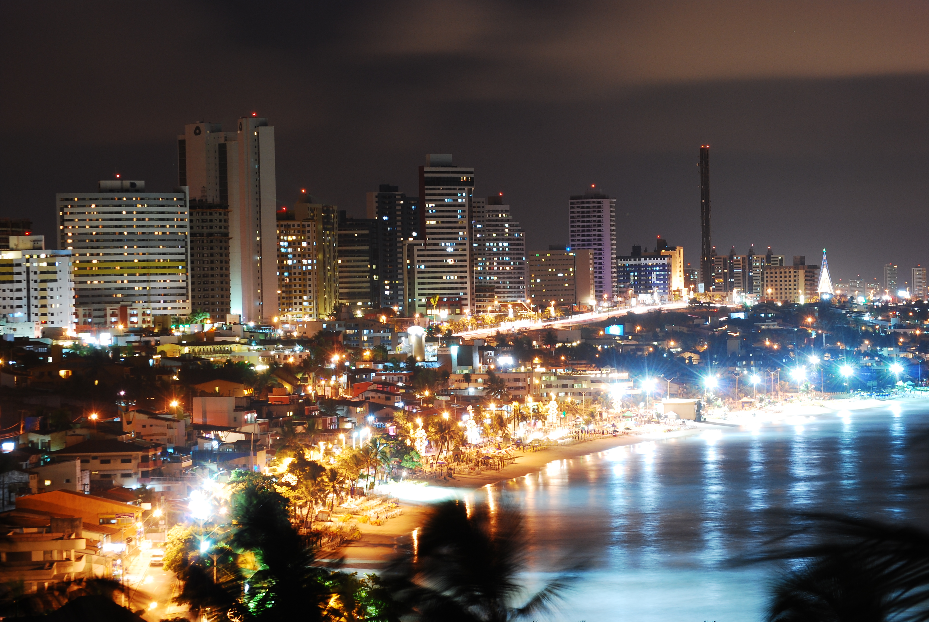
View of Ponta Negra at night.
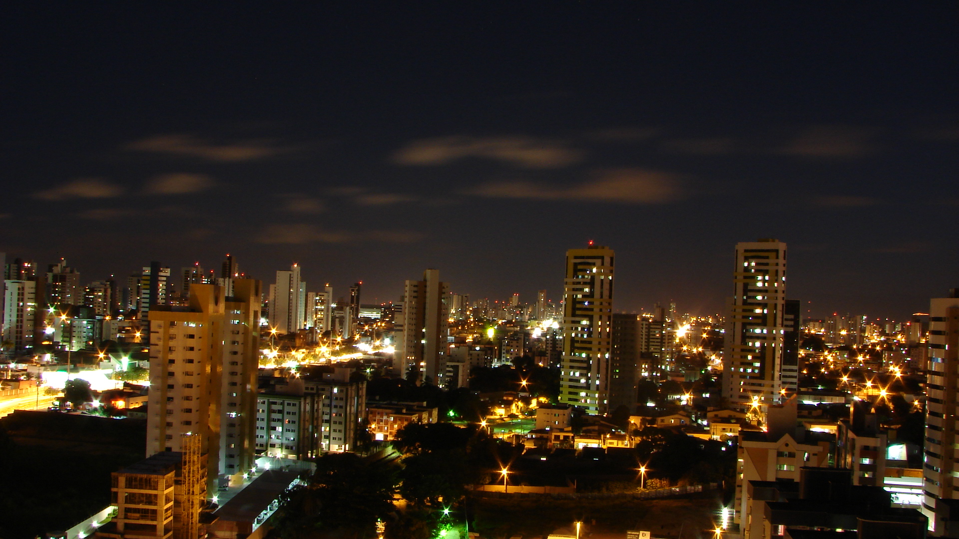
-

Downtown view at night.
See also
- Parque dos coqueiros
References
- ^ [1]
- ^ Population - Natal
- ^ Population of the city
- ^ Época Magazine - About Natal
- ^ [2]
- ^ [3]
- ^ a b [4]
- ^ Climate of Natal
- ^ "Weatherbase: Historical Weather for Natal". May 2011. http://www.weatherbase.com/weather/weather.php3?s=99528&refer=&units=metric.
- ^ Barsa Planeta Terra Ltda.
- ^ [5]
- ^ (in Portuguese) (PDF) Síntese de Indicadores Sociais 2000. Natal, Brazil: IBGE. 2000. ISBN 85-240-3919-1. http://www.sidra.ibge.gov.br/bda/tabela/listabl.asp?z=cd&o=7&i=P&c=2094. Retrieved 2009-01-31.
- ^ Religion in Natal by IBGE
- ^ Tourism - Economy - Natal
- ^ (in Portuguese) (PDF) GDP. Natal, Brazil: IBGE. 2006. ISBN 85-240-3919-1. http://www.ibge.gov.br/home/presidencia/noticias/noticia_impressao.php?id_noticia=1288. Retrieved 2009-07-18.
- ^ (in Portuguese) (PDF) per capita income. Natal, Brazil: IBGE. 2006. ISBN 85-240-3919-1. http://www.ibge.gov.br/home/presidencia/noticias/noticia_impressao.php?id_noticia=1288. Retrieved 2009-07-18.
- ^ Universidades no Rio Grande do Norte
- ^ Carnatal
- ^ Carnatal Organization
- ^ Dunas Park
- ^ Tribuna do Norte News - Dunas Park
- ^ Aquarium of Natal
- ^ [6]
- ^ The biggest cashew tree of the world
- ^ Access - Natal
- ^ Bus in Natal
- ^ Natal - Taxi Transport
- ^ Taxi in Natal
- ^ Buggy in Natal, RN
- ^ [7]
- ^ Beckham in Natal
- ^ http://www.fimba.net/proximos_eng.htm
- ^ [8]
- ^ [9]
- ^ "::Bethlehem Municipality::". www.bethlehem-city.org. http://www.bethlehem-city.org/Twining.php. Retrieved 2009-10-10.
External links
- Official
- (Portuguese) Official website
- (Portuguese) Official governmental tourism portal
- Newspapers
- (Portuguese) Nominuto.com Newspaper
- (Portuguese) Tribuna do Norte Newspaper
- Education
- (English) Federal University of Rio Grande do Norte
- (Portuguese) State University of Rio Grande do Norte
- (English) International Institute for Neuroscience of Natal
- (Portuguese) Potiguar University (Laureate International Universities)
- Travel guide
- (English) Natal Brazil Guide
- (English) The New York Times Natal's Travel Guide
- (English) Images of Natal by Tripadvisor
BrazilHistory First inhabitants · Colonization · Empire · Old Republic · Vargas Era · Second Republic · Military rule · ContemporaryGeography Regions · States · Mesoregions · Microregions · Municipalities · Islands · Coastline · Climate · Environment · Extreme points · Protected areas · CapitalsGovernment Constitution · Federal government · President · National Congress · Foreign relations · Law · Law enforcement · MilitaryPolitics Economy Society Demographics · People · Languages · Religion · Immigration · Education · Health · Crime · Social issues · Largest cities · ApartheidCulture  Category ·
  Portal ·
  WikiProject
Demographics of Brazil Economic and social Apartheid · Attractions · Law · Crime · Education · GDP · Health · Human Development · Human Rights (LGBT Rights) · Immigration · Languages · People · Politics · Poverty · Races · Religions · Traditions · Wealth
Ethnic groups BrazilAfricaAmericasNorth AmericaCaribbeanHaitianSouth AmericaAsiaBy EthnicityBy Country
or RegionEasternSouthernEast IndianWesternEuropeBy EthnicityBy Country
or RegionNorthernWesternCentralSouthernBalkanEasternCapitals of Brazilian states Brasília Federal Capital (DF) Northern Northeast Center-West Southeast South 50 largest cities of Brazil by population Categories:- Populated coastal places in Rio Grande do Norte
- State capitals in Brazil
- Populated places established in 1599


Wikimedia Foundation. 2010.