- Mount Binalud
-
Binalud 
Mt. Binalud view in winter from Bāghrud Road (south of the mountain).Elevation 3,211 m (10,535 ft) Location Nishapur, Razavi Khorasan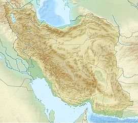
 Binalud
IranRange Alborz Coordinates 36°25′35″N 58°50′57″E / 36.42639°N 58.84917°ECoordinates: 36°25′35″N 58°50′57″E / 36.42639°N 58.84917°E Geology Type Stratovolcano Last eruption within the past 10,000 years Climbing First ascent by unknown Iranian Easiest route Hike Mount Binālud (In Persian: بینالود) is the highest peak in Razavi Khorasan province, Iran. It is also called Khorasan roof. This mountain is 26 km north of Nishapur and to the west of Mashhad.
Links
Categories:- Nishapur
- Stratovolcanoes
- Mountains of Iran
- Iran geography stubs


Wikimedia Foundation. 2010.