- Čataj
Geobox | Settlement
name = Čataj
other_name =
category = Village
image_caption =
symbol =
etymology =
official_name =
motto =
nickname =
country = Slovakia
country_
state =
region = Bratislava
district = Senec
commune =
municipality =
part =
river =
location =
elevation = 140
lat_d = 48
lat_m = 16
lat_NS = N
long_d = 17
long_m = 29
long_EW = E
coordinates_type = region:SK_type:city
highest =
highest_elevation =
highest_lat_d =
highest_long_d =
lowest =
lowest_elevation =
lowest_lat_d =
lowest_long_d =
area = 12.86
area_round = 2
population = 972
population_date = 2004-12-31
population_density = auto
established = v roku 1244
established_type = First mentioned
mayor =
timezone =
timezone_DST =
postal_code = 900 83
area_code = +421-33
code = SC
code_type = Car plate
free =
map_background = Slovakia - background map.png
map_locator = Slovakia
map1 = Bratislava Region - outline map.svg
map1_size = 128
map1_background = Bratislava Region - background map.png
map1_locator = Bratislava Region
commons =
statistics = [http://www.statistics.sk/mosmis/eng/prvav2.jsp?txtUroven410108&lstObec507865&Okruhzaklad MOŠ/MIS]
website = [http://www.cataj.sk www.cataj.sk]
footnotes =Čataj is a
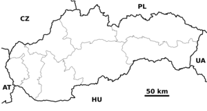
village andmunicipality in westernSlovakia inSenec District in theBratislava region . This typical agricultural village has less than 1000 inhabitants and is located aside from major roads, roughly betweenSenec andTrnava .History
Early archeological digs show that people settled the area around Čataj as early as 5000 BC. The town was mentioned for the first time in 1244, under the name "posesio Chatey". In the next few centuries the town and surrounding lands were given as gifts to several different families loyal to the Hungarian crown.
In the 14th century, German colonists have settled in Čataj, and until the 18th century the town was almost exclusively German. During this period, the town built a Catholic
rectory (1397) and a church in 1721. Later, in 1845 the current church was built in Neoclassical style. The church was repaired twice in the second half of the twentieth century, and along with a much newerCatholic Evangelical church serve the local community.Culture and entertainment
Čataj is famous primarily for its ornamental
embroidery of blouses and table clothes. These artworks have been sold all over the world, and one of them is said to have served as the late Pope John Paul II's table cloth. Folk art also survives in the form of two music bands, the brass band "Čatajanka" and the gypsy folk band "Farkašovci", which have toured beyond the borders of Slovakia. In addition, the village has a local folk dance group, "Tulipán".Due to its quiet and slow life and its agricultural character, Čataj has been often used as backdrops for movies and other art by movie directors
Martin Slivka andMartin Ťapák , the cinematograper, photographer and folk art collectorKarol Plicka and others.In addition to folk art, the village organizes annual hunts and has a soccer team, which is regularly on the last place of Slovakia's lowest, sixth division of its soccer league. The village also organizes numerous dances in its cultural center.
Demographics
Oa of 2004 the town had 972 inhabitants: 471 men and 501 women. 99.1% were of Slovak ethnicity; the only two declared minorities were Hungarian and Czech. 64.3% of inhabitants were Roman Catholic, 24.8% Evangelical Catholic and 7.3% atheist.
Of the 314 houses in the village 261 were permanently inhabited.
External links
* [http://www.cataj.sk Official home page (in Slovak)]


Wikimedia Foundation. 2010.