- Cumbernauld Airport
-
Cumbernauld Airport
Port-adhair Comar nan Allt
IATA: CBN – ICAO: EGPG Summary Airport type Private Operator Cumbernauld Airport Ltd Location Cumbernauld, North Lanarkshire Elevation AMSL 350 ft / 107 m Coordinates 55°58′29″N 003°58′32″W / 55.97472°N 3.97556°WCoordinates: 55°58′29″N 003°58′32″W / 55.97472°N 3.97556°W Website Map Location in North Lanarkshire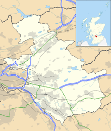
 EGPG
EGPGRunways Direction Length Surface m ft 08/26 820 2,690 Asphalt Sources: UK AIP at NATS[1] Cumbernauld Airport (ICAO: EGPG, FAA LID: CBN) is located 16 NM (30 km; 18 mi) northeast of Glasgow at Cumbernauld in North Lanarkshire, Scotland. The airport is primarily used for the training of fixed wing and rotary wing pilots, it also boasts a helicopter charter company and a light aircraft charter operation along with aircraft maintenance facility.
Cumbernauld Aerodrome has a CAA Ordinary Licence (Number P827) that allows flights for the public transport of passengers or for flying instruction as authorised by the licensee (Cormack Aircraft Services Limited).[2]
History
The new airport was opened by the Cumbernauld Development Corpororation in the late 1980s. Before the new airport was constructed there was a grass strip in use on the same site. During the early years of the airport's new incarnation there was even an airshow, the highlight being a display by the Red Arrows and a mock dogfight between a Supermarine Spitfire and a German Messerschmitt Bf109 fighter.
Operators
Training organisations: Border Air Training, Leading Edge Flight Training and Scotia Helicopters.
Other Operators: PDG Helicopters (helicopter charters) and Hebridean Air Services Ltd (twin engine Britten-Norman Islander charter).
Maintenance Organisation: Cormack Aviation Services Ltd.
There is also a cafe called "Cumbernauld Airport Cafe" within the Airport buildings, located on the first floor and open seven days a week.
Also located on the airfield is the active West of Scotland strut of the Light Aircraft Association (formerly the Popular Flying Association).
References
Airports of Scotland Primary Regional Barra · Benbecula · Broadford · Campbeltown · Coll · Colonsay · Cumbernauld · Dundee · Eday · Fair Isle · Fife · Glasgow Seaplane Terminal · Glasgow City Heliport · Islay · RAF Kinloss · Lerwick · RAF Leuchars · RAF Lossiemouth · North Ronaldsay · Oban · Papa Westray · Perth · Sanday · Scatsta · Stornoway · Stronsay · Tiree · Westray · Wick
Categories:- Airports in Scotland
- Cumbernauld
- United Kingdom airport stubs


Wikimedia Foundation. 2010.