- Guysborough, Nova Scotia (community)
Infobox Settlement
official_name = Guysborough , Nova Scotia
other_name =
native_name =
nickname =
settlement_type = Village
motto =
imagesize =
image_caption =
flag_size =
image_
seal_size =
image_shield =
shield_size =
city_logo =
citylogo_size =
mapsize =
map_caption =
mapsize1 =
map_caption1 =
image_dot_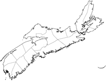
dot_mapsize = 250px
dot_map_caption =Location of Guysborough, Nova Scotia
dot_x = 180|dot_y = 80
pushpin_
pushpin_label_position =
pushpin_map_caption =
pushpin_mapsize =
subdivision_type = Country
subdivision_name = CAN
subdivision_type1 = Province
subdivision_name1 = NS
subdivision_type2 = County
subdivision_name2 = Guysbrorough County
subdivision_type3 = Municipality
subdivision_name3 = Municipal District of Guysborough
subdivision_type4 =
subdivision_name4 =
government_footnotes =
government_type =
Leader_title =
leader_name =
leader_title1 =
leader_name1 =
leader_title2 =
leader_name2 =
leader_title3 =
leader_name3 =
leader_title4 =
leader_name4 =
established_title = Founded
established_date =1600s
established_title2 =
established_date2 =
established_title3 =
established_date3 =
area_magnitude =
unit_pref =
area_footnotes =
area_total_km2 = 7.8
area_land_km2 =
area_water_km2 =
area_total_sq_mi =
area_land_sq_mi =
area_water_sq_mi =
area_water_percent =
area_urban_km2 =
area_urban_sq_mi =
area_metro_km2 =
area_metro_sq_mi =
population_as_of = 2001
population_footnotes =
population_note =
population_total = 922
population_density_km2 = 302.1
population_density_sq_mi =
population_metro =
population_density_metro_km2 =
population_density_metro_sq_mi =
population_urban =
population_density_urban_km2 =
population_density_urban_sq_mi =
population_blank1_title =
population_blank1 =
population_density_blank1_km2 =
population_density_blank1_sq_mi =
timezone = AST
utc_offset = -4
timezone_DST = ADT
utc_offset_DST = -3
latd= |latm= |lats= |latNS=N
longd= |longm= |longs= |longEW=W
elevation_footnotes =
elevation_m =
elevation_ft =
postal_code_type = Postal code
postal_code = B0H 1N0
area_code = 902
blank_name =Telephone Exchange
blank_info = 533
blank1_name = Total Dwellings
blank1_info = 437
website =
footnotes = *Median household income, 2000 ($) (all households)Part of a series about Places in Nova Scotia Guysborough (population: 992) is an unincorporated Canadian community in Guysborough County,
Nova Scotia .Located on the western shore of Chedabucto Bay, fronting Guysborough Harbour, it is the administrative seat of the Guysborough municipal district.
Attractions
* Guysborough County Courthouse
* The former residence of
Supreme Court of Nova Scotia Justice W.F. DesBarres. The justice was the grandson ofJoseph Frederick Wallet DesBarres who was an army officer, military engineer, surveyor, colonizer and colonial administrator who created an important 4-volume atlas of nautical charts for the coastline of eastern North America called the "Atlantic Neptune ". The residence was renovated into the DesBarres Manor Inn in 2003. Several maps from the "Atlantic Neptune" hang in the inn. [http://www.desbarresmanor.com]References
Wikimedia Foundation. 2010.