- Pennsylvania Route 33
-
"PA 33" redirects here. PA 33 may also refer to Pennsylvania's 33rd congressional district.
PA Route 33
Gen. Anthony Clement McAuliffe 101st Airborne Memorial Highway 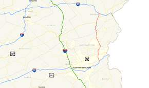
Route information Maintained by PennDOT Length: 27.69 mi[1] (44.56 km) Existed: 1959 – present Major junctions South end:  I-78 in Bethlehem Township
 US 22 in Bethlehem Township
 US 209 in Hamilton Township
North end: 
 I-80 / PA 611 in Hamilton Township
Location Counties: Northampton, Monroe Highway system Roads in Pennsylvania
Interstate • US • State • Legislative←  PA 32
PA 32PA 34  →
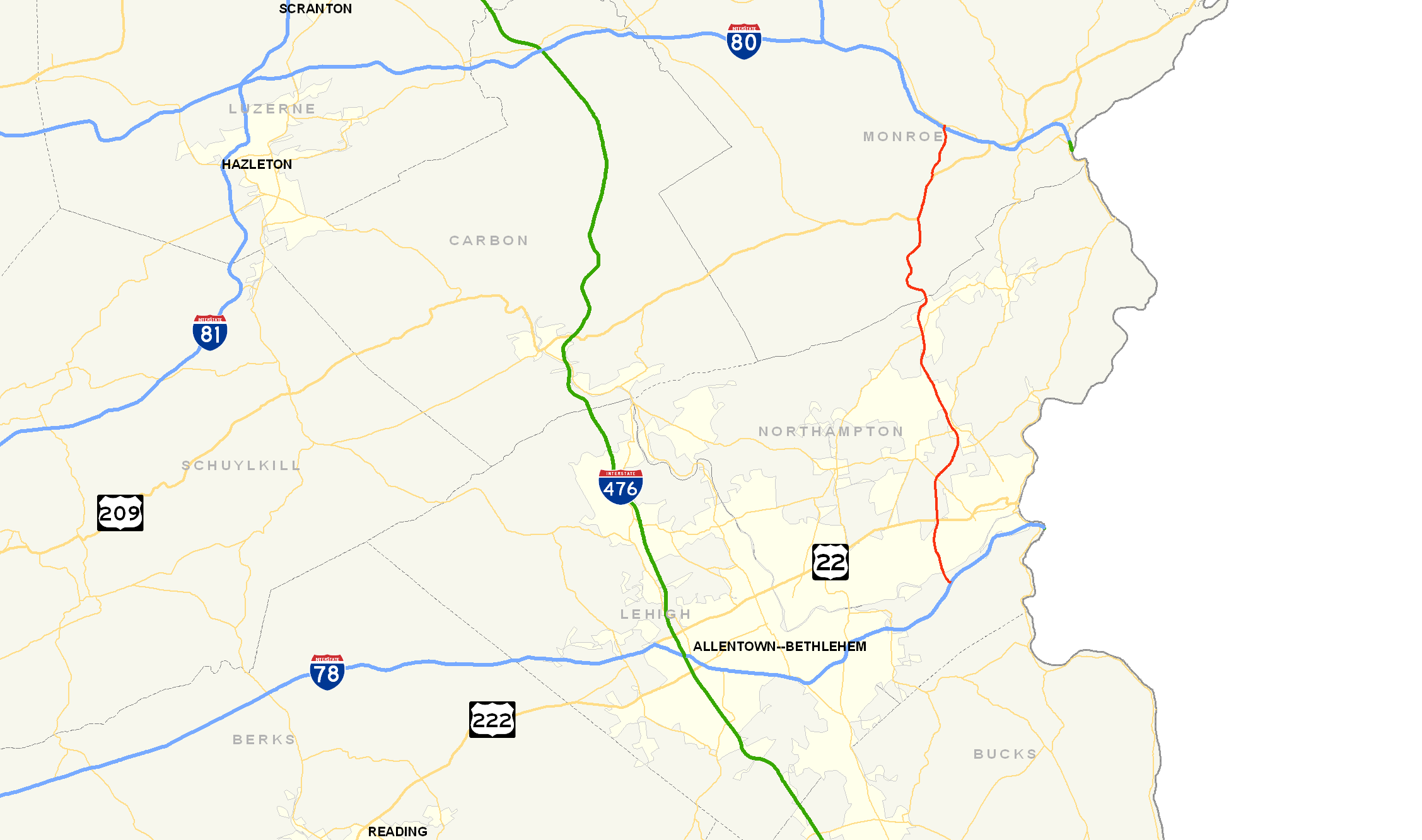
→Pennsylvania Route 33 is a 27.69 mi (44.56 km)-long limited-access state highway in eastern Pennsylvania, United States. South of the US 22 interchange, the route is called the Gen. Anthony Clement McAuliffe 101st Airborne Memorial Highway.
The northern terminus is Interstate 80 near Stroudsburg and the southern terminus is Interstate 78 in southern Northampton County. Until 2003, the southern terminus was U.S. Route 22. It is commonly used as a hazmat bypass for the Pennsylvania Turnpike's Northeast Extension due to the restrictions in place on the Lehigh Tunnel.
Contents
Route description
 Route 33 southbound near Easton
Northampton County
PA 33 begins at a trumpet interchange with Interstate 78 in southern Northampton County.[2] The speed limit is 65 from the beginning until the Wind Gap interchange. At mile marker 0.5 near the I-78 interchange, PA 33 crosses the Lehigh River on a long concrete bridge. At mile markers 1 through 2, PA 33 meets Freemansburg Avenue and William Penn Highway, two major roads in Northampton County. At mile marker 2.8, US 22 (Lehigh Valley Thruway) meets PA 33 at a cloverleaf interchange. At mile marker 4, in Lower Nazareth Township, Pennsylvania Route 248 meets PA 33. In the small borough of Stockertown, at mile marker 7, PA 33 meets Pennsylvania Route 191, a highway that is nearly 100 miles (160 km) in length. At mile markers 9 through 14, PA 33 passes through the towns of Belfast and Wind Gap. At mile marker 14 in Wind Gap, Pennsylvania Route 512 meets PA 33. At mile marker 16, PA 33 crosses the Blue Mountain ridge, which is the Northampton - Monroe county line.[2]
Monroe County
At mile marker 22 marks the southern terminus of the U.S. Route 209 concurrency with PA 33 east of Brodheadsville. The concurrency with US 209 is about three miles (5 km) long. At mile marker 25 marks the northern terminus of the concurrency with US 209. Note at the US 209 exit at mile marker 25; passengers who need to take Interstate 80 east to Stroudsburg have to take US 209 and passengers who have to take Interstate 80 west continue on PA 33 northbound toward Bartonsville and Hazleton. At mile marker 27.6, PA 33 terminates (ends) at an interchange with Interstate 80 and passengers coming from northbound lanes have access to Pennsylvania Route 611. [3][4]
History
The construction of PA 33 started in 1959, and stretched from the Route 512 interchange to Saylorsburg. Construction finished in 1960. The stretch connecting the highway to Interstate 80 was built and completed by 1964. Construction on Route 33 was not continued until 1969 when work began on the stretch from Route 512 in Wind Gap to Henry Road in Belfast. This stretch was completed by 1970. By 1972, the road had reached what is now Route 191 in Stockertown, and was extended down to its long-term end terminus at US-22. The highway was left at that until 1999 when construction began on a final segment that would connect the Route 22 interchange to Interstate 78. The final three-mile (5 km) stretch opened in January 2002.
In January 2004, the expressway was shut down between Lower Nazareth Township (Route 248) and Stockertown (Route 191) because of a sinkhole that was in the area of the Bushkill Creek directly under a northbound bridge support beam. Crossovers were created, narrowing the highway to one lane in each direction through Stockertown. Studies were conducted, and came to the conclusion that the bridge was dangerous and could not be fixed. The northbound bridge was demolished in February of the same year. Just 21 days later, a sinkhole was discovered under the southbound bridge over the Bushkill Creek, and resulted in the demolition of the southbound bridge. Once the new northbound bridge was completed, another crossover was created, detouring southbound traffic onto the northbound side of the highway. On April 21, 2004, a depression formed under the new northbound bridge, and the highway was shut down once again to fill the area with bituminous material. The bridge re-opened within twenty minutes. By November 19, 2004, both bridges were completed and opened. All of this happened feet from the Bushkill Street Bridge which connects Stockertown and Palmer Township., and has been closed since 1999 because of numerous sinkholes causing the bridge to collapse.[5]
On March 21, 2009, a tractor-trailer carrying 32,000 pounds of hydrofluoric acid overturned on southbound Route 33 in Plainfield Township, prompting the evacuation of about 5,000 people. The truck, registered to the Honeywell company, flipped over at about 2:40 a.m. after the driver swerved to avoid a deer. Nobody was injured and the highway was reopened later that day. Hundreds of evacuees were taken to the Pen Argyl Area High School in nearby Pen Argyl.[6]
Exit list
County Location Mile[1] Destinations Notes Northampton Bethlehem Township 0.00 I-78 east – New Jersey, New York CitySouthbound exit and northbound entrance. I-78 west – Allentown, HarrisburgSouthbound exit and northbound entrance. 1.08 Freemansburg Avenue 2.09 William Penn Highway Access to Easton Avenue. 3.30 US 22 east – Easton US 22 west – Bethlehem, AllentownTo LVI Airport Lower Nazareth Township 4.24 Hecktown Road 5.64  PA 248 – Nazareth, Wilson
Southbound exit sign reads "Wilson." Stockertown 8.74  PA 191 – Stockertown, Bangor, Nazareth
Southbound exit sign reads "Stockertown, Nazareth." Plainfield Township 10.53 Belfast (Henry Road) Wind Gap 14.57  PA 512 – Bath, Wind Gap
Monroe Ross Township 16.72 Wind Gap (Broadway) Southbound exit and northbound entrance. Hamilton Township 19.61 Saylorsburg Old PA 115 22.20 US 209 south – LehightonTo Sciota and Brodheadsville Southern terminus of US 209/  PA 33 concurrency
23.76 Snydersville (Manor Drive) Northern terminus of US 209/ PA 33 concurrency24.50 US 209 north to I-80 east – StroudsburgNorthbound exit and southbound entrance. 24.90 


US 209 Bus.Southbound exit and northbound entrance. 27.56 I-80 west – HazletonNorthbound exit and southbound entrance. Stroud Township 27.69 PA 611 – BartonsvilleNorthbound exit and southbound entrance. At-grade intersection. References
- ^ a b DeLorme (2007). Street Atlas USA (Map) (Toggle Measure Tool ed.).
- ^ a b Rand McNally (2007). 2007 road atlas (Map).
- ^ Pennsylvania Tourism & Transportation Map
- ^ Rand McNally Motor Carries Atlas Deluxe Edition: Pages 88 and 89
- ^ "Pennsylvania Highways: Pennsylvania Route 33". http://www.pahighways.com/state/PA1-50.html#PA33. Retrieved 2006-10-14.
- ^ Cassi, Sarah (2009-03-22). "5,000 forces to flee homes near Wind Gap after truck carrying chemicals overturns". The Express-Times. http://www.lehighvalleylive.com/slate-belt/index.ssf?/base/sports-0/123769480398900.xml&coll=3. Retrieved 2009-03-22.
Transportation infrastructure of the Lehigh Valley Interstates U.S. Routes Pennsylvania Routes New Jersey Routes County Routes Named roads/streets Bridges Albertus L. Meyers Bridge · Hill to Hill Bridge · Philip J. Fahy Memorial Bridge · Minsi Trail Bridge · Easton–Phillipsburg Toll Bridge · Northampton Street Bridge · Interstate 78 Toll Bridge
Tunnels Public transportation Lehigh and Northampton Transportation Authority (Bethlehem Loop) · Trans-Bridge Lines · NJ Transit
Airports Waterways Rail Categories:- State highways in Pennsylvania
- Limited access Pennsylvania state routes


Wikimedia Foundation. 2010.