- Northern Virginia
-

Northern Virginia consists of several counties and independent cities in the Commonwealth of Virginia, in a widespread region generally radiating southerly and westward from Washington, D.C. With 2.6 million residents, it is the most populous region of Virginia and the Washington Metropolitan Area.[2][3][4]
Communities in the region form the Virginia portion of the Washington Metropolitan Area, Metropolitan Statistical Area and the larger Baltimore-Washington Metropolitan Area. Northern Virginia is the highest-income region of Virginia, having six of the twenty highest-income counties in the nation, including the two highest as of 2007[update].[5]
Northern Virginia's transportation infrastructure includes major airports Ronald Reagan Washington National Airport and Dulles International, several lines of the Washington Metro subway system, the Virginia Railway Express suburban commuter rail system, transit bus services, and an extensive network of Interstate highways and expressways.
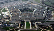
Notable features of the region include the Pentagon and the Central Intelligence Agency, and the many companies which serve them and the federal government. The area's attractions include various monuments and Colonial and Civil War-era sites such as Mount Vernon and Arlington National Cemetery. It is the most affluent region in the nation.[6]
Contents
History
Source of the name
The name "Northern Virginia" does not seem to have been used in the early history of the area.[7] According to Johnston, some early documents and land grants refer to the "Northern Neck of Virginia", and they describe an area which began on the east at the western shore of the Chesapeake Bay and includes a territory that extended west, including all the land between the Potomac and Rappahannock Rivers, with a western boundary called the Fairfax line.[7] The Fairfax line, surveyed in 1746, ran from the first spring of the Potomac (still marked today by the Fairfax Stone) to the first spring of the Rappahannock, at the head of the Conway River.[7] The Northern Neck was composed of 5,282,000 acres (21,380 km2), and was larger in area than five of the modern U.S. states.[7]
This monument, at the headspring of the Potomac River, marks one of the historic spots of America. Its name is derived from Thomas Lord Fairfax who owned all the land lying between the Potomac and Rappahannock Rivers. The first Fairfax Stone, marked "FX", was set in 1746 by Thomas Lewis, a surveyor employed by Lord Fairfax. This is the base point for the western dividing line between Maryland and West Virginia.
— Fairfax Stone inscription[7]
Early development of the northern portion of Virginia was in the easternmost area of that early land grant, which encompasses the modern counties of Lancaster, Northumberland, Richmond, and Westmoreland. At some point, these eastern counties came to be called separately simply "the Northern Neck", and, for the remaining area west of them, the term was no longer used. (By some definitions, King George County is also included in the Northern Neck, which is now considered a separate region from Northern Virginia.[8])
One of the most prominent early mentions of "Northern Virginia" (sans the word Neck) as a title was the naming of the Confederate Army of Northern Virginia during the American Civil War (1861–1865).
Colonial period
Historically, in the British Colony of Virginia first permanently settled at Jamestown in 1607, the area now generally regarded as "Northern Virginia" was within a larger area defined by a land grant from King Charles II of England on September 18, 1649, while the monarch was in exile in France during the English Civil War. Eight of his loyal supporters were named, among them Thomas Culpeper.[9]
On February 25, 1673, a new charter was given to Thomas Lord Culpeper and Henry Earl of Arlington. Lord Culpeper was named the Royal Governor of Virginia from 1677–1683. (Culpeper County was later named for him when it was formed in 1749; however, history does not seem to record him as one of the better of Virginia's colonial governors). Although he became governor of Virginia in July 1677,[10] he did not come to Virginia until 1679, and even then seemed more interested in maintaining his land in the "Northern Neck of Virginia" than governing. He soon returned to England.[11] In 1682, rioting in the colony forced him to return, but by the time he arrived, the riots were already quelled. After apparently misappropriating £9,500 from the treasury of the colony, he returned to England and the King was forced to dismiss him. During this tumultuous time, Culpeper's erratic behavior meant that he had to rely increasingly on his cousin and Virginia agent, Col. Nicholas Spencer.[12][13] Spencer succeeded Culpepper as acting Governor upon Lord Culpeper's departure from the colony. For many years, Lord Culpeper's descendants allowed men in Virginia (primarily Robert "King" Carter) to manage the properties.[14]
Final legal claim to the land was finally established by Lord Culpeper's grandson, Thomas Fairfax, 6th Lord Fairfax of Cameron, who became well-known in the colony as "Lord Fairfax", in a survey authorized by Governor William Gooch in 1736.[citation needed] The lands of Lord Fairfax (and Northern Virginia) were defined as that between the Rappahannock and Potomac Rivers, and were officially called the "Northern Neck".[15] In 1746, a back line was surveyed and established between the headwaters of the Potomac and Rappahannock Rivers, defining the west end of the grants. According to documents held by the Handley Regional Library of the Winchester-Frederick County Historical Society, the grants contained 5,282,000 acres (21,380 km2). They included the 22 modern counties of Northumberland, Lancaster, Westmoreland, Stafford, King George, Prince William, Fairfax, Loudoun, Fauquier, Rappahannock, Culpeper, Madison, Clarke, Warren, Page, Shenandoah, and Frederick Counties in Virginia, and Hardy, Hampshire, Morgan, Berkeley, and Jefferson Counties in West Virginia.[16]
Lord Fairfax was a life-long bachelor, and became one of the more well-known persons of the late colonial era. In 1742, the new county formed from Prince William County was named Fairfax County in his honor, one of numerous place names in Northern Virginia and West Virginia's Eastern Panhandle which were named after him.[17] Lord Fairfax established his residence first at his brother's home at "Belvoir" (now on the grounds of Fort Belvoir in Fairfax County).[14]
Not long thereafter, he built a hunting lodge near the Blue Ridge Mountains he named "Greenway Court",[9] which was located near White Post in Clarke County, and moved there. Around 1748, Lord Fairfax met a youth of 16 named George Washington, and, impressed with his energy and talents, employed him to survey his lands lying west of the Blue Ridge.[9]
Lord Fairfax stayed neutral during the American Revolutionary War. Just a few weeks after the surrender of British troops under General Cornwallis at Yorktown, he died at his home at Greenway Court on December 9, 1781 at the age of 90. He was entombed on the east side of Christ Church in Winchester.[14] While his plans for a large house at Greenway Court never materialized, and his stone lodge is now gone, a small limestone structure he had built still exists on the site.[9]
Statehood, Civil War

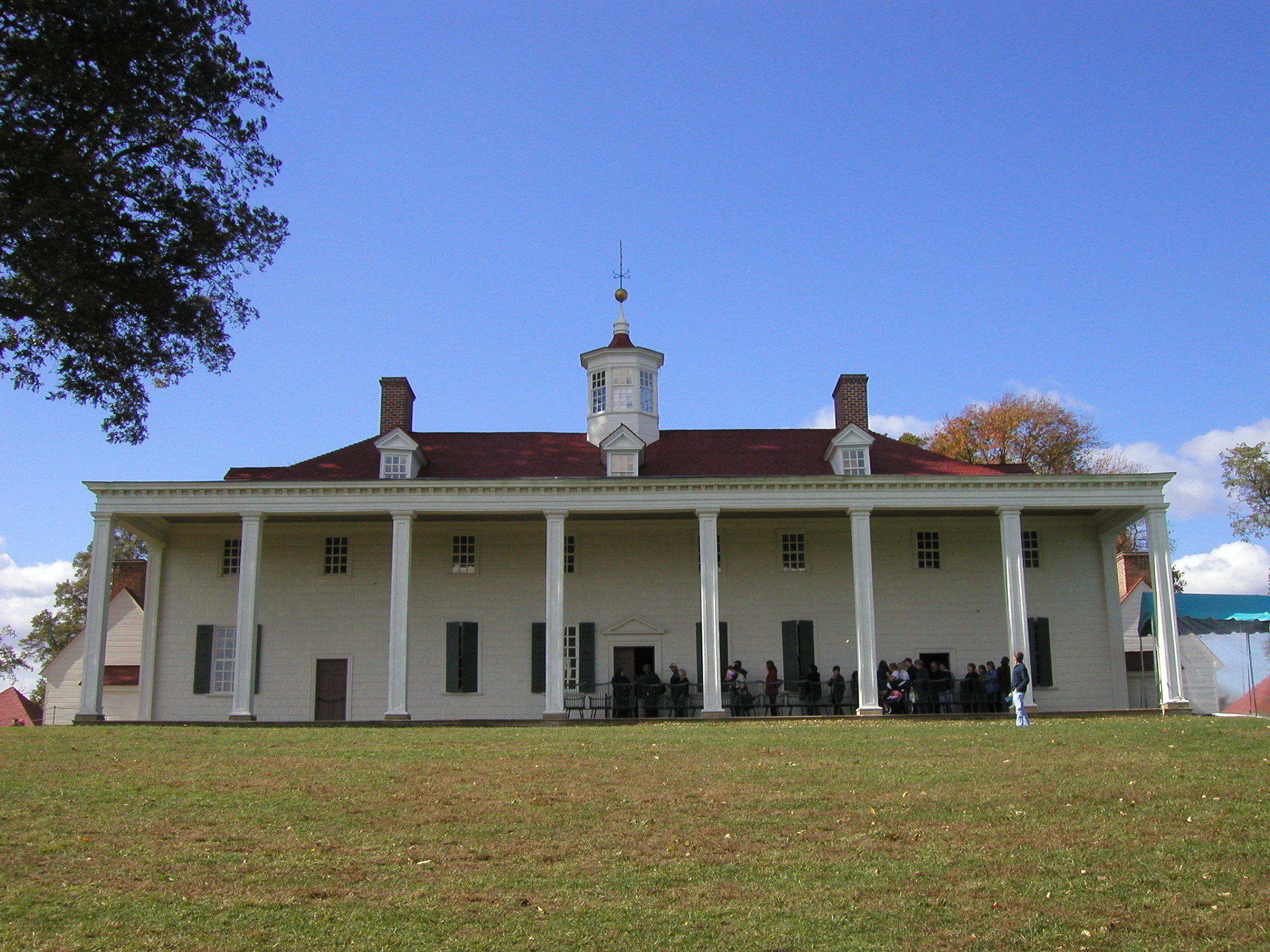
Following the American Revolutionary War, when the Thirteen Colonies formed the United States of America, war hero and Virginian George Washington was the choice to become its first president. Washington had been a surveyor and developer of canals for transportation earlier in the 18th century. He was also a great proponent of the bustling port city of Alexandria, which was located on the Potomac River below the fall line, not far from his plantation at Mount Vernon in Fairfax County.
With his guidance, a new federal city (now known as the District of Columbia) was laid out straddling the Potomac River upon a square of territory which was ceded to the federal government by the new states of Maryland and Virginia. Alexandria was located at the eastern edge south of the river. On the outskirts on the northern side of the river, another port city, Georgetown, was located.
However, as the federal city grew, land in the portion contributed by Maryland proved best suited and adequate for early development and the impracticality of being on both sides of the Potomac River became clearer. Not really part of the functioning federal city, many citizens of Alexandria were frustrated by the laws of the District government and lack of voting input. Slavery also arose as an issue. To mitigate these issues, and as part of a "deal" regarding abolishment of slave trading in the District, in 1846, the U.S. Congress passed a bill retro-ceding to Virginia the area south of the Potomac River, which was known as Alexandria County. That area now forms all of Arlington County (which was renamed from Alexandria County in 1922) and a portion of the independent city of Alexandria.
Slavery, states rights, and economic issues increasingly divided the northern and southern states during the first half of the 19th century, eventually leading to the American Civil War from 1861–1865. Although Maryland was a slave state, it remained with the Union, while Virginia seceded and joined the newly formed Confederate States of America, with its new capital established at Richmond, Virginia.
The Supreme Court of the United States has never issued a firm opinion on whether the retrocession of the Virginia portion of the District of Columbia was constitutional. In the 1875 case of Phillips v. Payne, the Supreme Court held that Virginia had de facto jurisdiction over the area returned by Congress in 1847, and dismissed the tax case brought by the plaintiff. The court, however, did not rule on the core constitutional matter of the retrocession. Writing the majority opinion, Justice Noah Swayne stated only that:
The plaintiff in error is estopped from raising the point which he seeks to have decided. He cannot, under the circumstances, vicariously raise a question, nor force upon the parties to the compact an issue which neither of them desires to make.[18]
With barely 100 miles (160 km) separating the two capital cities, Northern Virginia found itself in the center of much of the conflict. The area was the site of many battles and saw great destruction and bloodshed. The Army of Northern Virginia was the primary army for the Confederate States of America in the east. Owing to the region's proximity to Washington, D.C. and the Potomac River, the armies of both sides frequently occupied and traversed Northern Virginia. As a result, several battles were fought in the area.
In addition, Northern Virginia was the operating area of the famed Confederate partisan, John Singleton Mosby, and several small skirmishes were fought throughout the region between his Rangers and Federal forces occupying Northern Virginia.
 Arlington House, a mansion commissioned by a step-grandson of George Washington, last used as a home by Robert E. Lee.
Well after the war, the Lost Cause remained popular among the region's residents and many area schools, roads, and parks were named for Confederate generals and statesmen, including:
- Lee Highway – U.S. Route 29
- Lee Jackson Memorial Highway – U.S. Route 50
- J.E.B. Stuart High School
- Jefferson Davis Highway – U.S. Route 1
- Leesylvania State Park
- Washington-Lee High School
- Robert E. Lee High School
- Stonewall Jackson High School
- Stonewall Middle School
- Jefferson Davis Highway
- Lake Jackson
- Mosby Woods Elementary
In addition, several schools are named for Civil War battles, including Bull Run Middle School and Antietam Elementary School in Prince William County.
Virginia literally split apart during the American Civil War. The population of fifty counties in the western, mountainous portion of the state, did not agree with the others (and were also extremely isolated from eastern authorities). Rather than support the Confederacy, they split from the rest of Virginia and eventually joined the Union as a new state, West Virginia, in 1863. During this process, a provisional government of Virginia was headquartered in Alexandria, which was under Union control during the war.
As a result of the formation of West Virginia, part of Lord Fairfax's colonial land grant which defined Northern Virginia, was ceded in the establishment of that state in 1863. Now known as the Eastern Panhandle of West Virginia, the area includes Berkeley County, West Virginia and Jefferson County, West Virginia.
20th century and beyond
The Department of Defense's increasing reliance on information technology companies during the Cold War started the modern Northern Virginia economy and spurred urban development throughout the region.[19] After the Cold War, prosperity continued to come as the region positioned itself as the 'Silicon Valley' of the Eastern United States. The Internet was first commercialized in Northern Virginia, having been home to the first Internet service providers.[20]
Symbolic[clarification needed] history was made in early 2001 when local Internet company America Online bought Time Warner, the world's largest traditional media company, near the end of the dot-com bubble days. After the bubble burst, Northern Virginia office vacancy rates went from 2% in 2000 to 20% in 2002.[19] After 2002, vacancy rates fell below 10% due to increased defense spending after the September 11th attacks, and the Afghanistan and Iraq wars causing the government's continued and increasing reliance on private defense contractors.[19]
Defining "Northern Virginia"
"Northern Virginia" is more of a functional name than a rigidly defined area. Like Virginia's second largest region, Hampton Roads, it has no authoritative definition (like the legal boundaries of states, counties, or cities.)
The federal government defines parts of Northern Virginia as lying in a Consolidated Metropolitan Statistical Area (CMSA). In 2010, this included the Virginia counties of Arlington, Clarke, Culpeper, Fairfax, Fauquier, King George, Loudoun, Prince William, Spotsylvania, Stafford, and Warren, and the independent cities Alexandria, Falls Church, Fairfax, Fredericksburg, Manassas, and Manassas Park.[21]
Businesses, governments and non-profit agencies may define the area considered "Northern Virginia" differently for various purposes. Beyond the areas closest to Washington, D.C., many communities also have close economic ties, as well as important functional ones regarding transportation issues such as roads, railroads, and airports.
Under broad and varying criteria, one might also consider Northern Virginia to include counties of Frederick, Madison, Page, Rappahannock, Shenandoah, and independent city Winchester.[citation needed]
Regional organizations
Metropolitan Washington Council of Governments
Northern Virginia constitutes a considerable portion of the population and number of jurisdictions that comprise the Metropolitan Washington Council of Governments (MWCOG). Founded in 1957, MWCOG is a regional organization of 21 Washington-area local governments, as well as area members of the Maryland and Virginia state legislatures, the U.S. Senate, and the U.S. House of Representatives. MWCOG provides a forum for discussion and the development of regional responses to issues regarding the environment, transportation, public safety, homeland security, affordable housing, community planning, and economic development.[22]
The National Capital Region Transportation Planning Board, a component of MWCOG, is the federally-designated metropolitan planning organization for the metropolitan Washington area, including Northern Virginia.[23]
Demographics
As of 2009[update], there were 2,551,197[24] people in Northern Virginia, around 32% of the state's population. This figure includes the exurban Clarke, Fauquier, Spotsylvania, Stafford, and Warren counties, as well as the independent city of Fredericksburg. Together, these jurisdictions account for 377,809 residents. The combined population of Arlington, Fairfax, Loudoun, and Prince William counties and the independent cities of Alexandria, Falls Church, Fairfax, Manassas, and Manassas Park is 2,055,014, which is 26.89% of Virginia's estimated population in 2006.
Virginia's 8th congressional district, representing 643,503 people in Northern Virginia, has the highest life expectancy rate in the nation.[25]
Background
Demographics in Northern Virginia's five largest jurisdictions[4] Household income No. VA U.S. ($200k+) 13.6% 3.7% $100k+ 46.1% 19.0% $75k-100k 15.1% 12.1% $50k-75k 16.3% 18.8% $25k-50k 14.2% 25.6% $25k or less 8.4% 24.5% Race No. VA U.S. White 67.2% 74.1% Black or African American 11.6% 12.4% Asian 12.5% 4.3% (Hispanic or Latino) 13.9% N/A Some other race N/A 6.2% Two or more races 2.4% 2.1% Educational attainment No. VA U.S. (Graduate/professional) 25.2% 9.9% Bachelor's or higher 55.5% 27.0% Associate's 5.7% 7.4% Some college 14.8% 19.5% High school/equivalent 15.8% 30.2% Less than high school 8.1% 15.9% Northern Virginia is home to people from diverse backgrounds, with significant numbers of Arab Americans, Afghan Americans, Ethiopian Americans, Korean Americans, Indian Americans, Iranian Americans, American Jews, Pakistani Americans, and Vietnamese Americans, along with other Americans of Asian descent especially a growing Chinese American and Filipino American population concentrated in the eastern part of Fairfax County.[citation needed] Annandale, Chantilly, and Fairfax City have large Korean American communities. Falls Church has a large Vietnamese American community.[citation needed] Northern Virginia is also home to a small Tibetan American community as well.[citation needed]
There is a sizable Hispanic American population, primarily consisting of Salvadoran Americans, Peruvian Americans, Puerto Rican Americans, Dominican Americans, Bolivian Americans, Mexican Americans, and Colombian Americans.[citation needed] Arlington is the center of the largest Bolivian American community in North America (mostly immigrants from Cochabamba).[citation needed] Many of these immigrants work in transportation-related fields, small businesses, hospitality/restaurants, vending, gardening, construction, and cleaning.
Of those born in the U.S. and living in Northern Virginia's four largest counties, their place of birth by Census region is 60.5% from the South, 21.0% from the Northeast, 11.5% from the Midwest, and 7.0% from the West. 33.7% were born in Virginia, which is categorized as part of the Southern United States along with neighboring Maryland and Washington, D.C. by the Census Bureau.[26][27][28][29]
Educational attainment
The core Northern Virginia jurisdictions of Alexandria, Arlington, Fairfax, Loudoun, and Prince William comprising a total population of 1,973,513 is highly educated, with 55.5% of its population 25 years or older holding a bachelor's degree or higher.[citation needed] This is comparable to Seattle, the most educated large city in the U.S., with 53.4% of residents having at least a bachelor's degree.[30][31] The number of graduate/professional degree holders in Arlington is relatively high at 34.3%, nearly quadruple the rate of the U.S. population as a whole.[32]
Affluence
The region is known in Virginia and the Washington, D.C. area for its relative affluence. Of the large cities or counties in the nation that have a median household income in excess of $100,000, the top two are in Northern Virginia, and these counties have over half of the region's population.[33] However, considering that Northern Virginia has one of the highest costs of living in the nation, the actual purchasing power of these households is considerably less than in other less "affluent" areas.[34] According to Nielsen Claritas, Loudoun County and Arlington County have the highest concentration of 25-34 year olds with incomes of $100,000+ in the nation.[35][36]
In 1988, the Tysons Galleria mall opened across Virginia Route 123 from Tysons Corner Center with high-end department stores Neiman Marcus and Saks 5th Avenue, hoping to become the Washington area's upscale shopping destination. The mall had trouble with sales and attracting high-end boutiques well into the 1990s, and faced competition from Fairfax Square, which opened nearby in 1990 with the largest Tiffany & Co. boutique outside of New York City.[37] The Galleria was able to attract high-end stores after a 1997 renovation, and in 2002 National Geographic described it as "the Rodeo Drive of the East Coast".[38] In 2008, luxury home service Sotheby's International Realty – which had three offices in Virginia serving the rest of the state, and two in Washington, D.C. serving the Washington metropolitan area – opened a new office in McLean to sell more high end real estate in Northern Virginia.[39]
Crime
A 2009 report by the Northern Virginia Regional Gang Task Force suggests that anti-gang measures and crackdowns on illegal immigrants by local jurisdictions are driving gang members out of Northern Virginia and into more immigrant-friendly locales in Maryland, Washington, D.C., and the rest of Virginia.[40] The violent crime rate in Northern Virginia fell 17% from 2003 to 2008.[40] Fairfax County has the lowest crime rate in the Washington metropolitan area, and the lowest crime rate amongst the 50 largest jurisdictions of the United States.[41][42][43]
Economy
 Rosslyn is home to the tallest high rises in the Washington, D.C. area, some of which rank among the tallest in the state.[44][45]
Virginia Governor Bob McDonnell described Northern Virginia as “the economic engine of the state” during a January 2010 Northern Virginia Technology Council address.[46] The federal government is a major employer in Northern Virginia, which is home to numerous government agencies; these include the Central Intelligence Agency headquarters and the Pentagon (headquarters of the Department of Defense), as well as Fort Myer, Fort Belvoir, Marine Corps Base Quantico, the United States Patent and Trademark Office, and the United States Geological Survey.
Government contracting is an important part of the region's economy. Arlington alone is home to over 600 federal contractors, and has the highest weekly wages of any major jurisdiction in the Washington metropolitan area.[47][48]
As of 2007[update], the Northern Virginia office submarkets contain 172,000,000 square feet (16,000,000 m2) of office space, 33% more than those in Washington and 55% more than those in its Maryland suburbs. 8,000,000 square feet (740,000 m2) of office space is under construction in Northern Virginia. 60% of the construction is occurring in the Dulles Corridor submarket.[49]
Northern Virginia's data centers currently carry more than 50% of the nation's Internet traffic, and by 2012 Dominion Power expects that 10% of all electricity it sends to Northern Virginia will be used by the region's data centers alone.[50]
In September 2008 the unemployment rate in Northern Virginia was 3.2%, the lowest of any metropolitan area if ranked.[51][52] The national unemployment rate in September 2008 was 6.2%. While the U.S. as a whole had negative job growth from September 2007 to September 2008, Northern Virginia gained 12,800 jobs, most of which were in the professional and business services sector, and represented half of Virginia's new jobs.[53] After months of increases, the unemployment rate of Northern Virginia held steady at 5.2% in March 2008.[54] As of July 2010 the unemployment rate of the region 5.2%, down from 5.3% in the previous month.[55]
Notable companies
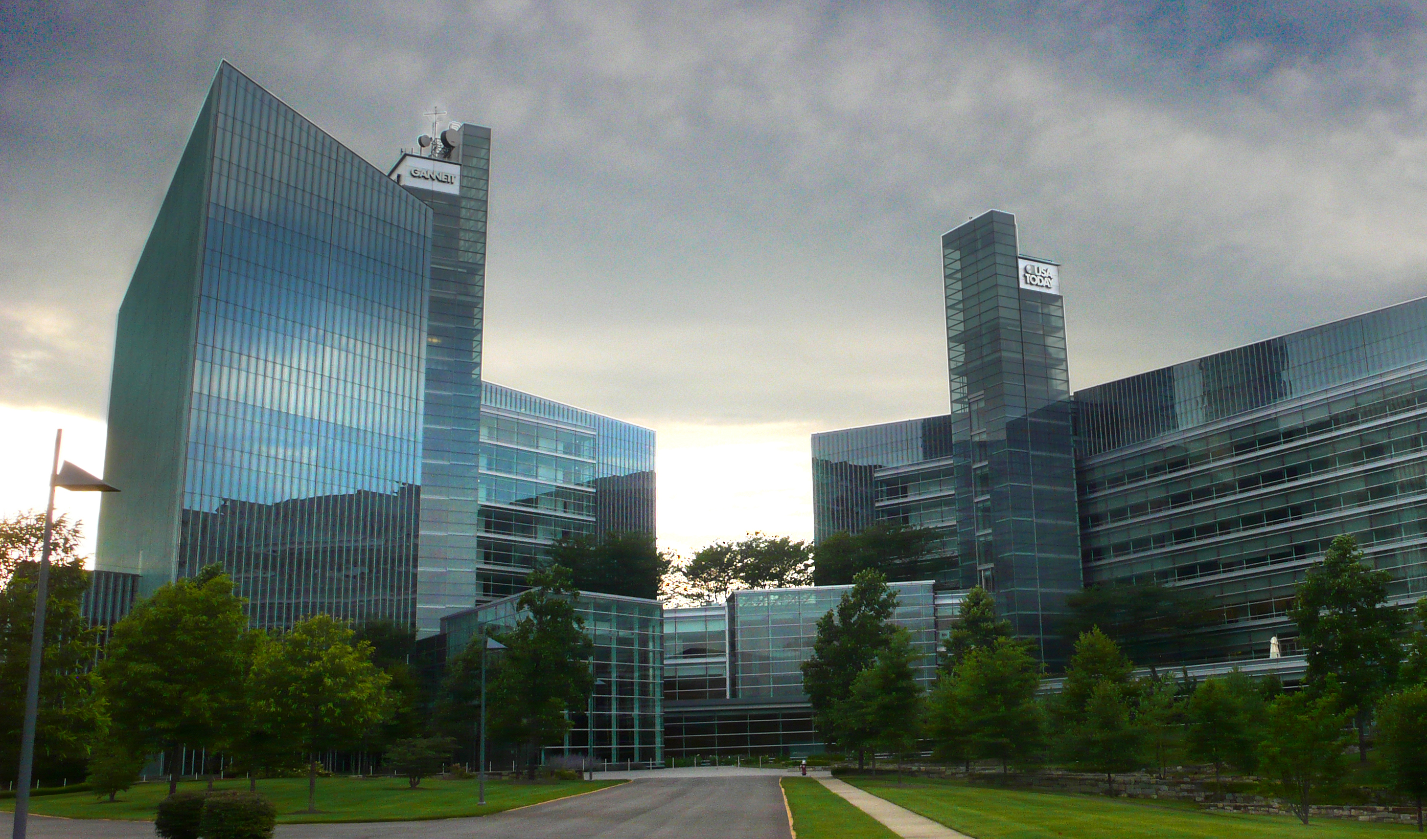
Main articles: Dulles Technology Corridor and List of companies headquartered in Northern Virginia Gannett Company headquarters in Tysons Corner.
The following Northern Virginia companies appear in the Fortune 1000 list:[56]
- AES Corporation
- BearingPoint
- Booz Allen Hamilton
- CACI
- Capital One
- Computer Sciences Corporation
- DynCorp International
- FHLMC (Freddie Mac)
- Gannett Company
- General Dynamics
- NII Holdings
- NVR
- Science Applications International Corporation (SAIC)
- SLM Corporation (Sallie Mae)
- Volkswagen Group of America
Additionally, ExxonMobil's downstream division is based in the region. Companies formerly headquartered in the region include Mobil, and Nextel/Sprint Nextel, PSINet, MCI Communications, and UUNET.
Attractions
The region's large shopping malls, such as Potomac Mills and Tysons Corner Center, attract many visitors, as well as its Civil War battlefields, which include the sites of both the First and Second Battle of Bull Run in Manassas. Old Town Alexandria is known for its historic churches, townhouses, restaurants, gift shops, artist studios, and cruise boats. The waterfront and outdoor recreational amenities such as biking and running trails (the Washington and Old Dominion Rail Trail is the longest paved path in the U.S.; the Mount Vernon Trail, and trails along various stream beds are also popular), whitewater and sea kayaking, and rock climbing areas are focused along the Potomac River, but are also found at other locations in the Baltimore-Washington metropolitan area. Scenic Great Falls Park and historic Mount Vernon (which opened a new visitor center in 2006) are especially noteworthy. Woodbridge is home to two minor-league sports franchises, the Northern Virginia Royals soccer team and the Potomac Nationals baseball team.
Arlington National Cemetery is also located in the area, as is the Steven F. Udvar-Hazy Center, an annex of the National Air and Space Museum that contains exhibits that cannot be housed at the main museum in Washington due to space constraints. Many concerts and other live shows are held at the Wolf Trap National Park for the Performing Arts, a setting which has attracted many famous productions over the years.[57]
Politics
Background
From the mid-1880s until the mid-1960s, Virginia politics were dominated by Conservative Democrats. After World War I, under the leadership of Harry Flood Byrd, who became Governor of Virginia and later a U.S. Senator, this group became known as the Byrd Organization. With a power base in a network of the constitutional officers of most of Virginia's counties, they controlled Virginia's state government. The Byrd Organization largely followed conservative and anti-debt principles espoused by Byrd, who had grown up in a rural setting during the fiscally-stressed era following Reconstruction. Although a member of the Democratic Party and an initial supporter of President Franklin D. Roosevelt, Senator Byrd became a bitter opponent of the New Deal and related national policies, particularly those involving fiscal and social issues. He became Virginia's senior senator after the death of Senator Carter Glass of Lynchburg in 1946.
The period following World War II saw substantial growth of Virginia's suburban areas, notably in the regions of Northern Virginia, Richmond, and Hampton Roads. The population became more diverse. People of the emerging middle class were increasingly less willing to accept the rural focus of the General Assembly, nor Byrd's extreme positions on public debt and social issues. The latter was nowhere more graphically illustrated than with Byrd's violent opposition to racial integration of the state's public schools. His leadership in the failed policy of Massive Resistance to racial desegregation of the public schools and efforts to circumvent related rulings of the United States Supreme Court ultimately caused closure of some public schools in the state and alienated many middle class voters. The Byrd Organization had never been strong in Virginia's independent cities, and beginning in the 1960s, city and suburban factions increasingly supported efforts to make broad changes in Virginia. In this climate, the Republican Party of Virginia began making inroads.
Rulings by both state and federal courts that "Massive Resistance" was unconstitutional and a move to compliance with the court orders in early 1959 by Governor James Lindsay Almond, Jr. and the General Assembly could be described as marking the Byrd Organization's "last stand," although the remnants of the Organization continued to wield power for a few years longer.[58]
When Senator Byrd resigned in 1965, he was replaced by his son Harry F. Byrd, Jr. in the U.S. Senate. However, the heyday of the Byrd Organization was clearly in the past, ending 80 years of domination of Virginia politics by the Conservative Democrats with the election of a Republican governor, Linwood Holton, in 1969 for the first time in the 20th century, succeeding a longtime member of the Byrd Organization, Democrat Mills E. Godwin. To the amazement of many observers, Godwin changed parties and was elected again as governor in 1974, but as a Republican.
During the last quarter of the 20th century, Virginia's Republicans gained ground against the Democrats. Republican John Warner from Northern Virginia gained one of the seats in the U.S. Senate in 1978. After longtime state senator L. Douglas Wilder became Governor in 1989, the first African American to become a Governor in the United States, Republicans subsequently gained control of the Governor's mansion after the 1993 election. Republicans finally gained control of the General Assembly in the 1999 elections.
For a number of years, the recurring Republican theme was to reduce waste in state government and taxes. However, this seemed to reach a peak during the administration of Jim Gilmore, with a move to repeal an unpopular car tax accompanied by a failure to provide promised replacement funds to the counties, cities and towns. Subsequently, two Democrats were elected consecutively as Governor, and control in the General Assembly shifted back to a more bipartisan balance of power. As governor, both Mark Warner and Tim Kaine were confronted with stabilizing state economics and dealing with a deteriorating transportation funding situation partially caused by the state's failure to index state fuel taxes to inflation, with a "cents per gallon" tax rate unchanged since the administration of Democratic Governor Gerald Baliles in 1986.
21st century politics
In the 21st century, Northern Virginia is becoming increasingly known for favoring candidates of the Democratic Party at both the state and national level. Fairfax County supported John Kerry in the 2004 presidential election, and also voted heavily for Barack Obama in the 2008 presidential election, the first time a Democratic candidate for President carried the Commonwealth of Virginia since Lyndon Johnson in 1964. The area also voted for Democrats Jim Webb in 2006 for U.S. Senate, Tim Kaine in 2005 for governor, and Mark Warner in 2001 for governor. In these three races for statewide office, the margins tallied in Northern Virginia provided the Democratic candidate with a winning margin of victory.
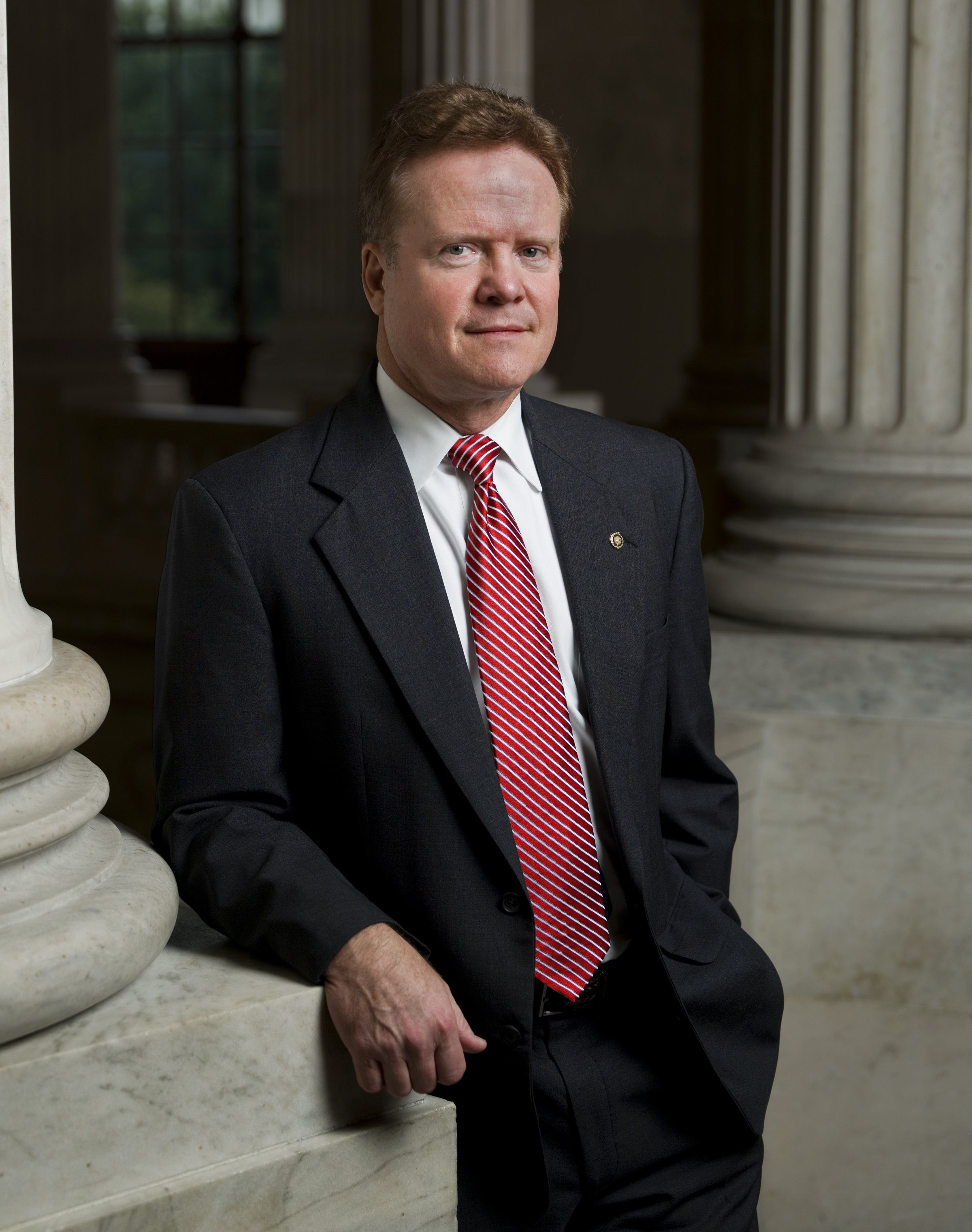
 Senior Senator from Virginia Jim Webb.
Democrat Jim Webb defeated incumbent Senator George Allen by the slim margin of 49.6% to 49.2% in 2006.[59] However, that margin increased to 58.1% to 40.7% in favor of the Democratic challenger in the counties and cities of Northern Virginia, whereas Webb ran behind Allen somewhat, 46.1% to 52.7%, in the remainder of the Commonwealth. Webb carried Fairfax County, Prince William County, and Loudoun County, as well as the more urban areas of Arlington, Alexandria, and Falls Church. Allen's sole wins in Northern Virginia were the cities of Manassas and Manassas Park, winning the latter two only by the narrow margins of 3.54% and 2.38%, respectively.
In the 2004 presidential election, 53% of Northern Virginia voters voted for John Kerry, the Democratic candidate, and 46% voted for George W. Bush, the Republican candidate. This contrasted with the rest of Virginia, which gave 43% to Kerry and 56% to Bush. Kerry also carried Fairfax County, the most populous county in Virginia, and Fairfax City, the first time those jurisdictions had voted Democratic since Johnson's national landslide in 1964. The strongest support in the area for the Democrats lies inside the Beltway, in Arlington, Alexandria, and parts of Fairfax County. The more distant areas (i.e., Loudoun County and Prince William County) are generally more conservative though as they have increased in population they have also become more liberal. Both Mark Warner in 2001, and John Kerry in 2004, lost Loudoun and Prince William. Tim Kaine won both counties in 2005. In 2006, despite not polling as strongly as Mark Warner statewide, Democratic senate candidate Jim Webb won both Loudoun and Prince William. In 2005, 65% of the voters of Northern Virginia voted for Democrat Tim Kaine for governor over Jerry Kilgore, who received only 32% of the vote, easily 14 points lower than George W. Bush's showing only a year earlier.
 Virginia's congressional districts as of 2003.
The 8th, the 10th, and the 11th congressional districts lie within Northern Virginia. The current congressman from the 8th district is Jim Moran (D), the current congressman from the 10th district is Frank Wolf (R), and the current congressman from the 11th district is Gerry Connolly (D). All three districts voted for Jim Webb in the 2006 Senate election.
In the 2005 gubernatorial election, the entire region continued to move away from the Republicans. Fairfax County, Arlington County, the cities of Alexandria, Fairfax City, and Falls Church, and for the first time,[citation needed] Loudoun County and Prince William County, went to Tim Kaine, the Democratic candidate. The area continued to be more Democratic the closer it was to Washington, D.C., but Richmond resident Kaine was able to accomplish what Northern Virginian Mark Warner had been unable to do just four years earlier in 2001: carry Loudoun County and Prince William County (as well as win over 60% of the vote in Fairfax County).
In 2006, Democrat Mark Herring swept every precinct in the 33rd state Senate District on January 31, en route to beating Republican Loudoun County Supervisor Mick Staton by a margin of 62 to 38 percent, providing evidence for the claim that Loudoun is transforming into a liberal county.[citation needed] The district sits primarily in Loudoun County but also includes nine precincts in western Fairfax County: Floris, Fox Mill, Frying Pan, McNair, Franklin, Kinross, Navy, Lees Corner East, and Lees Corner West.
In 2008, economist Nancy Pfotenhauer, a spokesperson and adviser for the John McCain presidential campaign, created controversy by referring to the areas of Virginia not included in Northern Virginia as "real Virginia", picking up on a Republican talking point that Sarah Palin promoted; namely that red states are the "real America" and more "pro-America".[60] Joe McCain, brother of John McCain, also called Arlington and Alexandria in Northern Virginia "communist country".[61]
In the 2008 presidential election, the majority of Northern Virginia voters voted for Democratic presidential candidate Barack Obama. Over 70% of registered voters in Arlington, Alexandria and Falls Church voted for Obama.[62] Fairfax County, Loudoun County, Manassas and Prince William County also went to Obama with Obama receiving 60% of the vote in Fairfax County compared to Republican candidate John McCain’s 39%.[62] Obama’s win in Fairfax County, the most populous county in the state, marks the second time a Democrat has carried that county since the 1964 breakdown of Democratic predominance in the South (the other being the 2004 presidential elections when the county went to John Kerry). Obama's victory in Northern Virginia continues the trend of Northern Virginia favoring Democrats over Republicans.
 Counties and cities in blue voted for Kaine while counties and cities in red supported Kilgore.
 Counties and cities in red voted for McDonnell while counties and cities in blue supported Deeds. The counties of Fairfax, Loudoun, Prince William (located in the northeastern part of the state), which, even though they have been trending Democratic in Presidential, U.S. Senatorial, U.S. House, and gubernatorial elections recently, voted for McDonnell (R). However Democrat Dave Marsden would win in a 2010 special state senate election to the seat previously held by now-state Attorney General Ken Cuccinelli (R).
In the 2009 gubernatorial election, though Arlington, Alexandria, and Falls Church would back Democratic state Senator Creigh Deeds in his unsuccessful run for governor, Republican former state Attorney General, and future Governor, Bob McDonnell, who overwhelmingly defeated Deeds 59% to 41% across the state as a whole, won Fairfax County, Loudoun County, Manassas, and Prince William County. However, a January 2010 special state Senate election in the Fairfax county based 37th State Senatorial district, which was held following Ken Cuccinelli's (R) resignation from the Senate of Virginia upon his election as state Attorney General two months earlier, was won by then-Delegate David W. Marsden (D). Marsden's victory would suggest that despite McDonnell's performance in northern Virginia during the 2009 gubernatorial election, the Democratic trend in the region has not been reversed.[63]
Culture
Due to the proximity to the capital, many Northern Virginians go to Washington D.C. for cultural outings and nightlife. The Kennedy Center in Washington is a popular place for performances, as is Wolf Trap National Park for the Performing Arts near Vienna. Jiffy Lube Live (near Manassas), the Patriot Center at George Mason University in Fairfax, and the Verizon Center in Washington serve as popular concert venues, and the Verizon Center also serves as the home of sporting events. Smithsonian museums also serve as local cultural institutions with easy proximity to Northern Virginia, and the new Udvar-Hazy center of the National Air and Space Museum in Chantilly is popular as well.
 Journalists Memorial at Freedom Park, with the former Newseum behind it.
Tysons Corner Center ("Tysons I") is one of the largest malls in the country and is a hub for shopping in area. Tysons Galleria ("Tysons II"), its counterpart across Route 123, carries more high-end stores. Tysons Corner itself is the 12th largest business district in the United States.[citation needed] Other malls include Springfield Mall, Fair Oaks Mall, Manassas Mall, and The Fashion Centre at Pentagon City. Dulles Town Center is the region's newest mall, serving the eastern Loudoun County area. Reston Town Center is a high-density mixed-use retail, commercial, and residential development located just off the 267 Toll Road in Reston. Potomac Mills, located in Prince William County, is the largest outlet mall in the region. The town of Leesburg in Loudoun County contains the Leesburg Corner Premium Outlets outlet mall.
Since the mid-1990s, Loudoun County has been known as America's fastest-growing county, having grown by almost 50% from 2000 though 2005. Since the 2000 census, both Loudoun and Fairfax counties are the top large U.S. counties by median household income. Loudoun County has branches of at least five higher education institutions.
Secession
Former Republican delegate Jeannemarie Devolites Davis expressed a common sentiment when she said "The formula for funding school construction in Northern Virginia requires that we pay 500 percent more than the actual cost of a project. We have to pay 500 percent because we give 400 percent away to the rest of the state." The state government's funding level for transportation projects in Northern Virginia is a perennial issue that often causes consternation from the region's politicians and citizens.[64]
Many people consider the idea of secession a rhetorical one used to express frustration with the treatment of Northern Virginia by the state government as well as the occasional opposing political sentiments between it and the rest of Virginia. Critics often point out that all states include regions of varying income and political discrepancies within their borders.
A tongue in cheek editorial in a Fredericksburg weekly paper suggested in the rest of Virginia would like to separate from Northern Virginia from the remainder of the commonwealth.[65] Nevertheless, there is no serious secessionist movement.[66]
Transportation
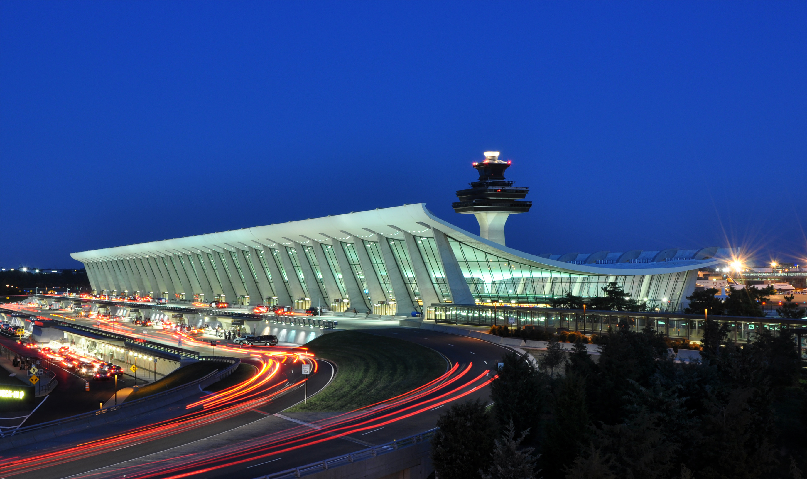
The area has two major airports, Ronald Reagan Washington National Airport and Washington Dulles International Airport. While flights from the older National Airport (a focus city for US Airways) are restricted for distance, frequency, and flight paths due to the proximity to federal facilities, Dulles is the region's busiest airport[67] in both passenger loadings and aircraft movements, and the sixteenth-busiest airport[68] in the United States by takeoffs and landings in 2007. Dulles is the region's primary international gateway, serves as a hub for United Airlines, and has recently improved its low-cost carrier offerings with the addition of multiple flights by Southwest and jetBlue.
Commuters are served by the Washington Metro subway and the Virginia Railway Express, a commuter railroad. Metro is the second-busiest subway system in the nation; only New York City's subway system carries more passengers.[69] A planned expansion project will extend the system past Dulles Airport into Loudoun County. VRE service is significantly more limited, but nevertheless saw over a year of continuous ridership increase from 2007 into 2008.[70] Bus service is provided by WMATA's Metrobus and several local jurisdictions.
Northern Virginia, along with the rest of the region, suffers from severe road congestion, usually ranking within the top five most congested areas in the nation.[citation needed] To alleviate gridlock, local governments encourage using Metrorail, HOV, carpooling, slugging, and other forms of mass transportation. In 2002, voters rejected a referendum to raise the Virginia sales tax within the region to pay for transportation improvements;[71] several PPTA proposals to increase Beltway and Interstate 95 capacity via toll-funded construction are under consideration by VDOT. Major limited- or partially limited-access highways include Interstates 495 (the Capital Beltway), 95, 395, and 66, the Fairfax County Parkway and adjoining Franconia-Springfield Parkway, the George Washington Memorial Parkway, and the Dulles Toll Road. High-occupancy vehicle (HOV) lanes are used for commuters and buses on I-66, I-95/395, and the Dulles Toll Road.
Two major regional bottlenecks, the Springfield Interchange and Woodrow Wilson Bridge, were massively reconstructed with completion in 2007 and 2008. Generally, Potomac River crossings remain major choke points; proposals to add crossings (such as near Leesburg or Quantico as part of a long-proposed Outer Beltway) are opposed by Virginia communities near the suggested bridge sites, and by Marylanders who fear that new bridges would bring new housing development to green space in that state.[citation needed] Because of Northern Virginia's high housing costs, tens of thousands of employees there choose more affordable housing far away in outer Virginia exurban counties, or in Prince Georges County and Southern Maryland, thus creating tremendous traffic congestion on the Potomac bridges. This situation is much like metropolitan areas of California. Furthermore, localities such as Great Falls, Dranesville, and Clifton impose low-density, large-acreage residential zoning, which forces developers to leapfrog into Loudoun and Prince William Counties to build housing, thus increasing commuters' driving distances.
Education
Fairfax County's public school system includes the Thomas Jefferson High School for Science and Technology, an award-winning magnet school. Nineteen of the region's schools appear in the top 200 of Newsweek's America's Top Public High Schools, which excludes schools such as Thomas Jefferson for having selective admissions.[72] In comparison, Washington, Maryland, and the rest of Virginia have 10 schools between them in the top 200.[72]
Although Northern Virginia contains a large portion of the Commonwealth's population, there are only a handful of colleges and universities in the region. The largest and most well-known is George Mason University in Fairfax, the largest university in Virginia.
Other higher education institutions include Northern Virginia Community College (colloquially known as NOVA) in Annandale (with several branch campuses throughout Northern Virginia), and Marymount University in north Arlington. A relatively new addition to the roster of colleges and universities in the region is the University of Northern Virginia in Manassas, established in 1988. In addition, the University of Virginia and Virginia Tech maintain a Center in Falls Church, and George Washington University has a campus in Loudoun County. Virginia Commonwealth University Health Systems has a satellite campus in Fairfax at the INOVA healthcare system.
Recreation
Northern Virginia is home to many activities for families and individuals, including biking/walking trails, sports leagues, recreation facilities, museums, historic homes, and parks.
It is home to the Northern Virginia Swim League, which comprises 102 community pools and NVSL-Dive, which is composed of 47 teams in Fairfax and Arlington counties. The swim and dive competes compete of the course over 5–6 weeks from the end of June through the first weekend in August.
See also
- List of federal agencies in Northern Virginia
- List of U.S. state secession proposals
- Northern Virginia trolleys
- Potomac primary
References
- ^ Rems, Janet (March 3, 2011). "City planners use Reston as a model". The Washington Post. http://www.washingtonpost.com/wp-dyn/content/article/2011/03/01/AR2011030106539.html. Retrieved March 4, 2011.
- ^ N.Va. leads the way in growth
- ^ Demographics & Workforce Data and Research for Virginia
- ^ a b American FactFinder
- ^ Matt Woolsey, America's Richest Counties, Forbes.com, 01.22.08, 6:00 PM ET Forbes.com Web site. Retrieved on 2008-02-08.
- ^ Will Northern Virginia Become the 51st State?
- ^ a b c d e Johnston, Wilbur S. (2006). The Northern Neck in Colonial Context. Winchester-Frederick County Historical Society, Winchester Printers, Inc.
- ^ The Official Guide of Virginia's Northern Neck (2007), Northern Neck Tourism Council
- ^ a b c d "Thomas, Lord Fairfax". The Fort Edwards WebPage. http://www.fortedwards.org/fairfax.htm. Retrieved April 18, 2010.
- ^ Grant of the Office of Lieutenant and Governor-General, June 21, 1675, Calendar of State Papers, Colonial Series, Great Britain Public Record Office, Her Majesty's Stationary Office, 1896
- ^ Letter from Nicholas Spencer to Secretary Thomas Coventry, August 20, 1680, reporting news of Culpeper's departure from Virginia, Calendar of State Papers, Colonial Series, Great Britain Public Record Office, Whitehall, Her Majesty's Stationery Office, London, 1890
- ^ History of the Colony and Ancient Dominion of Virginia, Charles Campbell, J. P. Lippincott & Co., Philadelphia, 1860
- ^ Letters of William Fitzhugh, The Virginia Magazine of History and Biography, Vol. II, The Virginia Historical Society, Richmond, 1895
- ^ a b c "The Fairfax Grant". Virginia Places. http://www.virginiaplaces.org/settleland/fairfaxgrant.html. Retrieved April 18, 2010.
- ^ Grymes, Charles A.. "The Fairfax Grant". http://www.virginiaplaces.org/settleland/fairfaxgrant.html. Retrieved 2008-09-07.
- ^ "Lord Fairfax Land Records". Handley Regional Library: Winchester-Frederick County Historical Society. http://www.hrl.lib.state.va.us/handley/archives/Fairfax%20Land%20Records%20pathfinder.htm. Retrieved April 18, 2010.
- ^ "A Guide to the Lord Thomas Fairfax land grant to Robert Carter". Colonial Williamsburg Foundation's John D. Rockefeller, Jr. Library. 2008. http://ead.lib.virginia.edu/vivaead/published/cw/viwc00324.document. Retrieved April 18, 2010.
- ^ "Phillips v. Payne, 92 U.S. 130". FindLaw. 1875. http://laws.findlaw.com/us/92/130.html. Retrieved 2008-12-28.
- ^ a b c War on Terror a Boon For Virginia
- ^ Northern Virginia
- ^ "METROPOLITAN AND NECMA COUNTIES IN ALPHABETICAL ORDER, BY STATE, WITH AREA TITLES". U.S. Census Bureau. http://www.census.gov/population/estimates/metro-city/a99mfips.txt. Retrieved 2011-06-06.
- ^ MWCOG.org - About Us
- ^ MWCOG.org - Transportation - TPB
- ^ [1]. Weldon Cooper Official Population Estimates Retrieved January 28, 2011
- ^ No. Virginia Tops In Life Expectancy
- ^ Fairfax County, Virginia detailed profile - houses, real estate, agriculture, wages, work, ancestries, and more
- ^ Prince William County, Virginia detailed profile - houses, real estate, agriculture, wages, work, ancestries, and more
- ^ Loudoun County, Virginia detailed profile - houses, real estate, agriculture, wages, work, ancestries, and more
- ^ Arlington County, Virginia detailed profile - houses, real estate, agriculture, wages, work, ancestries, and more
- ^ "ACS: Ranking Table -- Percent of People 25 Years and Over Who Have Completed a Bachelor's Degree". United States Census Bureau. http://www.census.gov/acs/www/Products/Ranking/2003/R02T160.htm. Retrieved 2008-08-27.[dead link]
- ^ Seattle city, Washington - Educational Attainment
- ^ Arlington County, Virginia - Educational Attainment
- ^ Income, Earnings, and Poverty Data From the 2007 American Community Survey
- ^ Cost of Living Can Significantly Affect “Real” Median Household Income
- ^ Loudoun tops the nation in 25-to-34-year-olds with hefty incomes
- ^ Nielsen: The Young and Moneyed Dwell in D.C.
- ^ Potts, M. (1989) "The Swanky Side of Fairfax Square" The Washington Post
- ^ Tysons Galleria
- ^ Sotheby’s International Realty opens shop in Northern Virginia
- ^ a b Gangs flee N.Va.for havens in Md., D.C., report says
- ^ Crime Drops for Fourth Straight Year in Fairfax County
- ^ 2 Counties: A Dangerous Difference; While Montgomery's Crime Rate Has Risen, Fairfax's Is Down Series: VULNERABLE SUBURBS: THE GROWTH OF VIOLENT CRIME Series Number: 2/2
- ^ Fairfax County Board of Supervisors Election
- ^ High-Rises Approved That Would Dwarf D.C.
- ^ List of tallest buildings in DC, MD, VA, WV
- ^ Virginia's new governor keeps focus on jobs and technology
- ^ Best East Coast Cities for Defense Jobs
- ^ Industry dynamics in the Washington, DC, area: has a second job core emerged?
- ^ The CoStar Office Market Watch
- ^ Garber, Kent (March 24, 2009). "The Internet's Hidden Energy Hogs: Data Servers". U.S. News & World Report. http://www.usnews.com/articles/news/energy/2009/03/24/the-internets-hidden-energy-hogs-data-servers.html. Retrieved 2007-03-25.
- ^ Unemployment state by state
- ^ Clabaugh, Jeff (October 26, 2008). "Northern Virginia still creating jobs". Washington Business Journal. http://www.bizjournals.com/washington/stories/2008/11/10/daily73.html. Retrieved 2008-11-14.
- ^ McCaffrey, Scott (October 26, 2008). "Arlington Jobs Picture Still Best in Virginia". Sun Gazette Newspapers. http://www.sungazette.net/articles/2008/10/26/arlington/news/nw877.txt. Retrieved 2008-11-14.
- ^ March unemployment rate in Virginia holds steady
- ^ Unemployment Dips Slightly Across Arlington
- ^ Fortune 1000 2008: Virginia
- ^ Cooper, Rachel. "Top 10 Northern Virginia Attractions". About.com. http://dc.about.com/od/touristattractions/tp/NorthernVirginiaAttractions.htm. Retrieved April 12, 2010.
- ^ Glasrud, Bruce; Ely, James W. (May 1977). "The Crisis of Conservative Virginia: The Byrd Organization and the Politics of Massive Resistance (book review)". The Journal of Southern History (The Journal of Southern History, Vol. 43, No. 2) 43 (2): 324–325. doi:10.2307/2207385. JSTOR 2207385.
- ^ General Election- November 7, 2006
- ^ Tapper, Jake (2008-10-18). "McCain Adviser Says Northern Virginia Not "Real" Virginia". http://blogs.abcnews.com/politicalpunch/2008/10/mccain-adviser.html. Retrieved 2008-10-28
- ^ Tapper, Jake (2008-10-05). "Joe McCain Makes Bad Joke". http://blogs.abcnews.com/politicalpunch/2008/10/joe-mccain-make.html. Retrieved 2008-12-06
- ^ a b "County Results - Election Center 2008 - Elections & Politics from CNN.com". CNN. http://www.cnn.com/ELECTION/2008/results/county/#VAP00map. Retrieved May 20, 2010.
- ^ "Virginia Special Election Sends a Message to GOP". http://www.cqpolitics.com/.+January 13, 2010. http://blogs.cqpolitics.com/in_the_right/2010/01/virginia-special-election-send.html. Retrieved 2010-02-13.
- ^ Lindsay, Drew (November 1, 2008). "Will Northern Virginia Become the 51st State?". The Washingtonian. http://www.washingtonian.com/articles/people/9947.html. Retrieved April 18, 2010.
- ^ Johnson, Jonnie (March 3, 2002). "A solution to Northern Virginia's many problems: Forced secession". Fredericksburg.com. http://www.fredericksburg.com/News/FLS/2002/032002/03032002/536977/index_html. Retrieved April 18, 2010.
- ^ Wiencek, Drew (June 3, 2003). "Why Isn't There An East Virginia". Virginia Places. http://www.virginiaplaces.org/regions/index.html. Retrieved April 26, 2010.
- ^ Fact Sheet – Washington Dulles International Airport (IAD) Runway 1L/19R
- ^ http://www.faa.gov/news/updates/busiest_airports/index.cfm?airportType=All&year=2007
- ^ Dawson, Christie (2008-12-04). "Heavy Rail Rapid Transit Ridership Report, Third Quarter 2008". American Public Transportation Association. http://www.apta.com/research/stats/ridership/riderep/documents/08q3hr.pdf. Retrieved 2009-01-27.[dead link]
- ^ Fredericksburg.com - VRE riders breaking records - page 1 FLS
- ^ Melton, R.H. (November 6, 2002). "Voters Reject Roads Tax". The Washington Post. http://www.washingtonpost.com/ac2/wp-dyn?pagename=article&contentId=A10828-2002Nov5¬Found=true. Retrieved May 20, 2010.
- ^ a b America's Top Public High Schools
External links
- Northern Virginia Regional Commission
- Northern Virginia Transportation Authority
- D.C. Dotcom
- Voters Reject Roads Tax: Defeat Is a Major Loss for Gov. Warner
- Where is Northern Virginia?
- So Close, Yet So Far: Once Solidly Part of the South, the Old Dominion Now Encompasses a Widening Cultural Chasm
- The Federal Job Machine
- Will Northern Virginia Become the 51st State?
Categories:- Northern Virginia
- Regions of Virginia
- Proposed states and territories of the United States


Wikimedia Foundation. 2010.