- Cottesloe, Western Australia
-
"Cottesloe" redirects here. For the theatre, see Royal National Theatre.This article is about a suburb of Perth, Western Australia. For the local government area, see Town of Cottesloe.
Cottesloe
Perth, Western Australia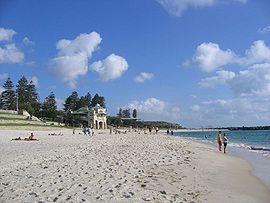
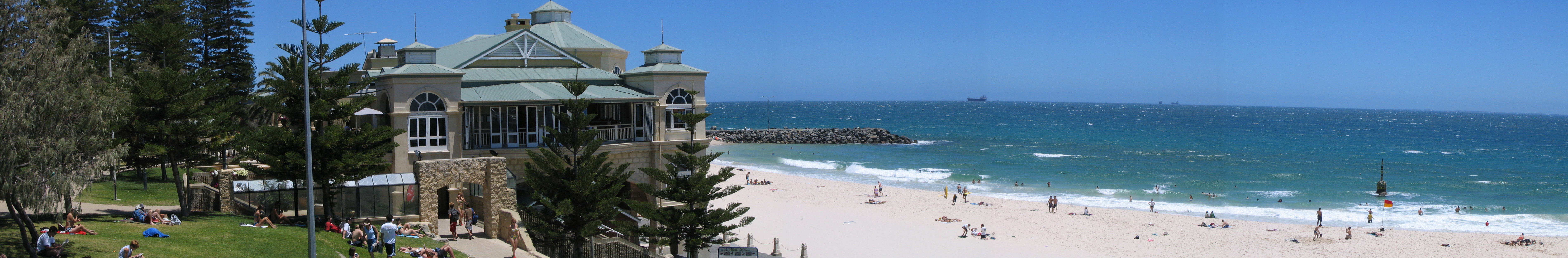
View of Cottesloe Beach in summer 2007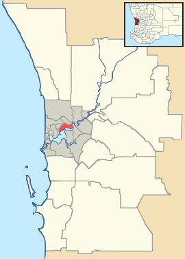
 Cottesloe
Population: 7,066 (2006 census) [1] • Density: 1859.5/km² (4,816.1/sq mi) Established: 1880s Postcode: 6011 Area: 3.8 km² (1.5 sq mi) Location: 11 km (7 mi) WSW of Perth LGA: Town of Cottesloe State District: Cottesloe Federal Division: Curtin Suburbs around Cottesloe: Swanbourne Claremont Indian Ocean Cottesloe Peppermint Grove Mosman Park Mosman Park Coordinates: 31°59′35″S 115°45′25″E / 31.993°S 115.757°E
Cottesloe is a western suburb of Perth, Western Australia. Its Local Government Area is the Town of Cottesloe. Cottesloe was home to Australian Prime Minister John Curtin. The house he built still stands in Jarrad Street. It is now vested jointly in the National Trust of Australia (WA) and Curtin University.
Contents
Geography
Cottesloe is a beach-side suburb of the city of Perth in Western Australia. It is located roughly halfway between Perth central business district and the port of Fremantle. It is famous for its beaches, cafes and relaxed lifestyle.
Cottesloe is bounded by the Vlamingh Memorial to the south, Stirling Highway, Congdon Street and West Coast Highway to the east; North Street to the north and the Indian Ocean to the west. A large part of Cottesloe is residential, although a significant shopping area is located along Stirling Highway, and a 9-hole golf course is on Jarrad Street.[2]
At the ABS 2006 census, Cottesloe had a population of 7,066 people living in 3,310 dwellings, 69.7% of which are detached houses on separate lots. The ABS identified property and business services and health as the two main occupations.
Present day
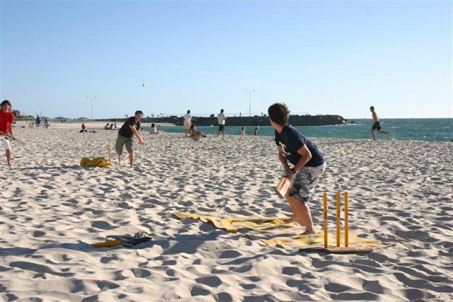
Historically the beach and its panorama are reflections of the changes in the last 110 years of Perth's history. The photos and paintings of Cottesloe Beach that are either in collections or published, give tangible evidence of the importance of beach-oriented activities in the Perth community. Cottesloe Beach is a popular place for beach cricket. An oceanway allows pedestrians and cyclists to move along the beaches in a sustainable manner.
In 2009, Lonely Planet named Cottesloe Beach the world's 2nd best beach for families.[3]
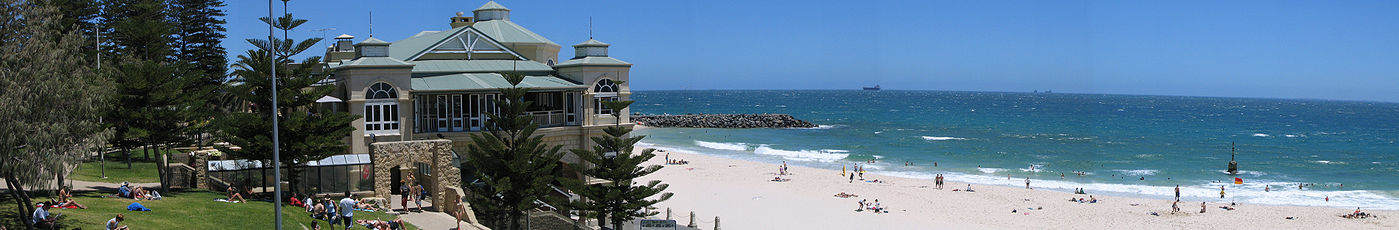 Cottesloe Beach
Transport
Cottesloe is served by Swanbourne, Grant Street, Cottesloe, Mosman Park and Victoria Street railway stations on the Fremantle line. Various bus routes along Stirling Highway and through the suburb's western and eastern sections link Cottesloe to Perth and Fremantle. All services are operated by the Public Transport Authority. During the summer months, the council provides a free shuttle bus every hour during the day, called the Cott Cat, between Cottesloe train station and the Cottesloe beachfront. In 2004 the service carried over 30,000 passengers, at a cost of $15,000 [4]
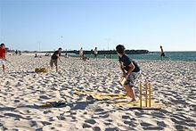 Beach cricket being played at Cottesloe Beach
 Kayaking competition at Cottesloe beach on a Western Australian Sunday
Politics
Cottesloe is currently part of the federal division of Curtin, although from 1901 to 1968 and from 1974 to 1980 it was part of the Fremantle electorate. Curtin is regarded as a safe seat for the centre right Liberal Party, which has held the seat continually since its inception, with the exception of a period from 1996 to 1998 when former Liberal member Allan Rocher held the seat as an Independent. In the parliament of Western Australia, the Legislative Assembly electoral district of Cottesloe is also held by the Liberal Party.
Notable residents
John Curtin, Prime Minister of Australia for much of World War II, was local federal member of parliament from 1928 to 1931 and 1934 to 1945. He lived in Cottesloe from 1918 until his death in office in 1945. [5] John Curtin's house in Jarrad Street is vested in the National Trust of Australia (WA) and Curtin University. During 2008 there was a suggestion that the house be relocated to the Curtin University grounds but the decision was made that the house remain in Cottesloe[6]. In May 2009 the federal government announced that it would provide a grant of $580,000 to the National Trust to restore the house.[7]
Claude de Bernales was a mining entrepreneur who in 1911 bought Attorney-General Richard Pennefather's 1898 Federation Queen Anne house, naming it Overton Lodge. In 1936 he rebuilt it in Inter-war Spanish Mission style. It was bought by the Town of Cottesloe in 1950 and renamed the Cottesloe War Memorial Town Hall and Civic Centre.
Former West Coast Eagles premiership player Chris Mainwaring lived here before his death on 1 October 2007.
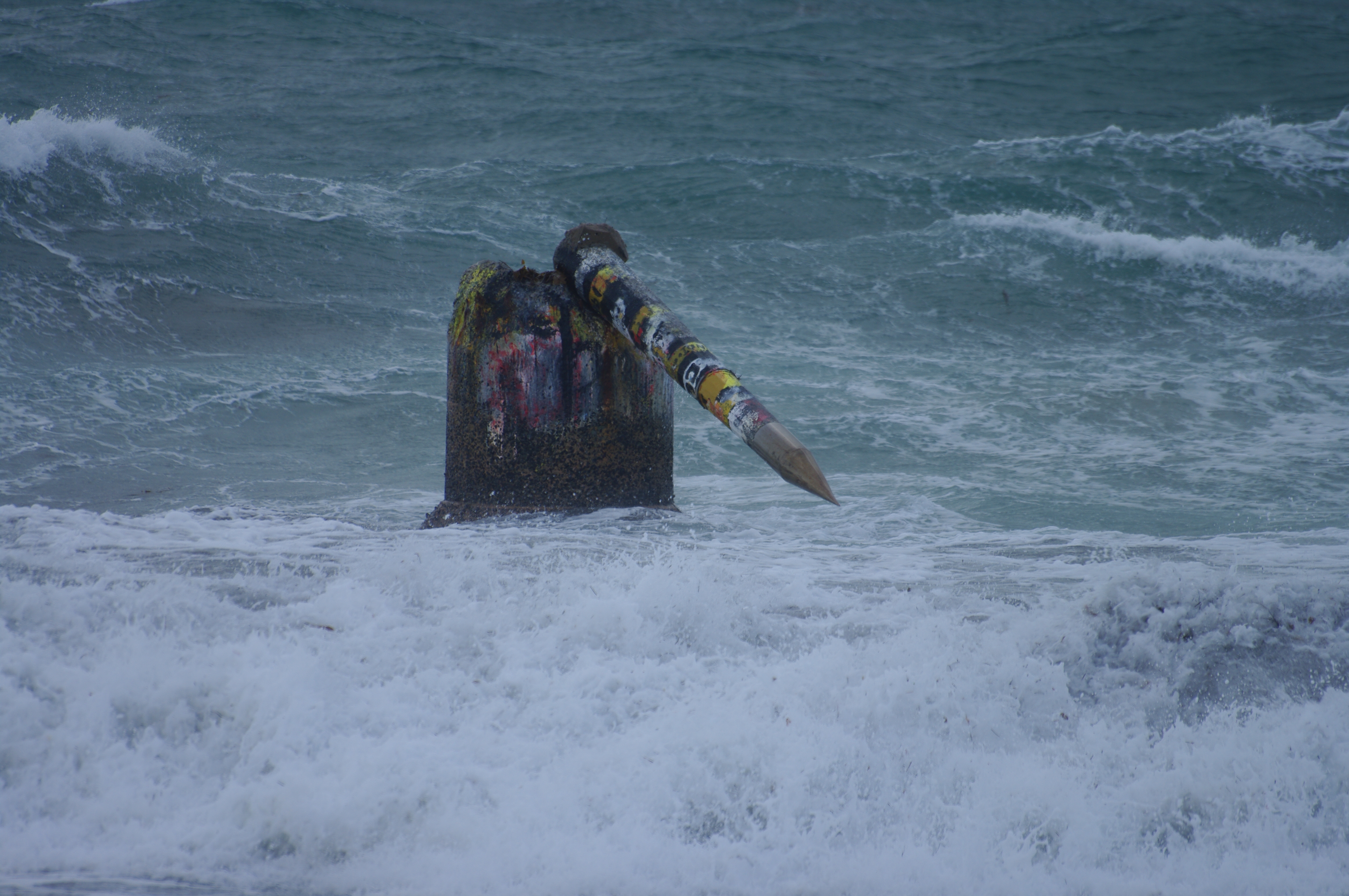
The Pylon
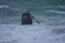 The Pylon after storm damage in May 2009
In December 2008 the Town voted to restore the pylon, a 1930s concrete structure, at a cost of $172,000.[8] Decades of battering by the ocean has eroded the pylon, which was one of three pylons built to anchor a shark net following a fatal attack in 1925. Two were destroyed by storms in 1937. Since then its has become a landmark and popular diving platform for beach users.
During major storm activity on 21–22 May 2009, the spike was knocked off the pylon.[9] However this is not the first time this has occurred:[10] during storms in 1995, the spike was also knocked over. It then remained on the bottom of the ocean in approximately 3 metres of water until a unnamed group removed the 800 kilograms (1,764 lb) structure using nothing but wood and rope.
After the pylon was restored, it was painted in the Cottesloe Surf Lifesaving Club colours, but it was soon changed to the colours of North Cottesloe Lifesaving Club. It has alternated colours many times since.
See also
References
- ^ Australian Bureau of Statistics (25 October 2007). "Cottesloe (State Suburb)". 2006 Census QuickStats. http://www.censusdata.abs.gov.au/ABSNavigation/prenav/LocationSearch?collection=Census&period=2006&areacode=SSC51346&producttype=QuickStats&breadcrumb=PL&action=401. Retrieved 5 October 2008.
- ^ 2006 StreetSmart directory, Department of Lands and Surveys, Perth.
- ^ Fahmy, Miral (14 August 2009). Travel Picks: Top 10 beach holidays for families, Reuters UK. Retrieved on 9 June 2011.
- ^ Cash appeal for beach shuttle, The Post, p. 12, July 10, 2004, published by Post Newspapers Pty Ltd.
- ^ Visiting John Curtin at Home Michal Bosworth, 2000. John Curtin Prime Ministerial Library, Curtin University of Technology
- ^ Dolan, David (2002-07). "Another Prime Minister's House Museum?". Open Museum Journal 5. http://hosting.collectionsaustralia.net/omj/vol5/dolan.html. Retrieved 2011-06-22.
- ^ "Wartime PM's Cottesloe home to be restored". The West Australian. 22 May 2009. http://www.thewest.com.au/default.aspx?MenuID=77&ContentID=143465. Retrieved 22 May 2009.[dead link]
- ^ Council approves $172,000 pylon reprieve, Sunday Times, Perth, 16 December 2008.[dead link]
- ^ "Cottesloe pylon knocked over during overnight storms". The West Australian. 22 May 2009. http://www.thewest.com.au/default.aspx?MenuID=77&ContentID=143334. Retrieved 22 May 2009.[dead link]
- ^ Pylon History Swanbourne Surf Club
External links
Western suburbs of Perth, Western Australia City Beach · Claremont · Cottesloe · Crawley · Daglish · Dalkeith · Floreat · Jolimont · Karrakatta · Mosman Park · Mount Claremont · Nedlands · Peppermint Grove · Shenton Park · Subiaco · Swanbourne · Wembley · Wembley Downs · West Leederville
Categories:- Suburbs of Perth, Western Australia
- Coastline of Western Australia


Wikimedia Foundation. 2010.