- Colerne Airfield
-
Colerne Airfield IATA: none – ICAO: EGUO Summary Airport type Military Operator University Air Squadron Location Colerne Elevation AMSL 593 ft / 181 m Coordinates 51°26′21″N 002°17′11″W / 51.43917°N 2.28639°WCoordinates: 51°26′21″N 002°17′11″W / 51.43917°N 2.28639°W Map Location in Wiltshire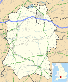
 EGUO
EGUORunways Direction Length Surface m ft 01/19 1,095 3,593 Asphalt 07/25 1,664 5,459 Asphalt Airport information for EGUO at World Aero Data. Data current as of October 2006. Colerne Airfield (ICAO: EGUO), formerly known as RAF Colerne, is located at Colerne, Wiltshire, England.
By October 1940 RAF Colerne was still partly in the course of construction being a fighter station for the defence of Bristol. At that date the contractors were still building and the ground was a quagmire in many areas. Unfinished barrack blocks were pretty cold and there was very little running water. Troops were taken in Bedford trucks once a week to the luxurious baths in Bath used in peacetime by wealthy invalids. These sunken baths, tiled and entered down steps by brass handrails were in contrast to conditions at the camp. The 87 squadron was there and a Polish fighter squadron.
Later Defiants came but they were not a success as nightfighters were superseded by the more suitable Beaufighter.
The entry under RAF Charmy Down suggests it was more active than Colerne but when I was sent there to open up a substore in late 1940 it was more of a satellite although some flying was taking place. I remember doing guard duty at night high up on Charmy Down and seing Bristol down below being pounded by enemy bombers. From Colerne we had periodic 24 hour passes during which we could travel down Bannerdown Hill into Bath and enjoy the many cultural activities there, the Pump Room, the Theatre Royal etc.
It was at a later time taken over by the Army, Former Regiments of Royal Corps of Transport and Royal Army Ordanance Corps.
Colerne Airfield was used as the location for the filming of Top Gear's Airport Vehicle Race featured in Series 14 Episode 4.
The airfield is a ground station for the Skynet 5 military satellite system that provides battlefield support (e.g. real-time imagery from remote-piloted drones[1] in various theatres of war). It is also in close proximity to the underground Corsham Computer Centre (that was established based around a system of Digital Equipment Corporation VAX computers).
The airfield (as RAF Colerne) also provides a base for the Bristol University Air Squadron (3 AEF), that provides ab-initio pilot training for the RAF.
References
Categories:- Airports in England
- History of Wiltshire
- United Kingdom airport stubs

Wikimedia Foundation. 2010.