- M postcode area
-
Manchester postcode area 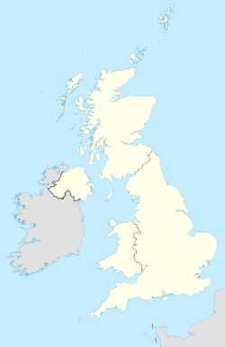
 M
MPostcode area M Postcode area name Manchester Post towns 3 Postcode districts 47 Postcode sectors 277 Postcodes (live) 32,334 Postcodes (total) 54,541 Statistics as at October 2006 [1] The M postcode area, also known as the Manchester postcode area,[2] is a group of several postcode districts in Greater Manchester, England.
The area is divided into three post towns: Manchester, Salford, and Sale. The Manchester post town forms most of the area, and the other two post towns are enclaves within it.
It includes parts of all Greater Manchester boroughs except for Stockport. The entirety of the metropolitan district of the City of Manchester itself is included within the area, except for Ringway, which is in WA15. The postcode area also includes nearly all of the City of Salford and most of the borough of Trafford.
Contents
Coverage
The approximate coverage of the postcode districts:
Postcode district Post town Coverage Local authority area M1 MANCHESTER Piccadilly, City Centre Manchester M2 MANCHESTER Deansgate, City Centre Manchester M3
(Sectors 1, 2, 3, 4 and 9)MANCHESTER City Centre, Deansgate, Castlefield Manchester M3
(Sectors 5, 6 and 7)SALFORD Blackfriars, Trinity Salford M4 MANCHESTER Ancoats, Northern Quarter, Strangeways Manchester M5 SALFORD Ordsall, Seedley, Weaste, University, Pendleton Salford M6 SALFORD Claremont, Irlams O' Th' Height, Charlestown Salford M7 SALFORD Higher Broughton, Cheetwood, Lower Broughton, Kersal Salford M8 MANCHESTER Crumpsall, Cheetham Hill Manchester M9 MANCHESTER Harpurhey, Blackley Manchester M11 MANCHESTER Clayton, Openshaw, Beswick Manchester M12 MANCHESTER Ardwick, Longsight, Chorlton-on-Medlock Manchester M13 MANCHESTER Ardwick, Longsight, Chorlton-on-Medlock Manchester M14 MANCHESTER Fallowfield, Moss Side, Ladybarn, Rusholme Manchester M15 MANCHESTER Hulme, Manchester Science Park Manchester M16 MANCHESTER Firswood, Old Trafford, Whalley Range Trafford, Manchester M17 MANCHESTER Trafford Park, The Trafford Centre Trafford M18 MANCHESTER Abbey Hey, Gorton Manchester M19 MANCHESTER Levenshulme, Burnage Manchester M20 MANCHESTER Didsbury, Withington Manchester M21 MANCHESTER Chorlton-cum-Hardy, Barlow Moor Manchester M22 MANCHESTER Wythenshawe, Northenden, Sharston Industrial Area Manchester M23 MANCHESTER Baguley, Roundthorn Industrial Estate Manchester M24 MANCHESTER Middleton, Alkrington Rochdale M25 MANCHESTER Prestwich, Sedgeley Park, Simister Bury M26 MANCHESTER Radcliffe, Stoneclough Bury, Bolton M27 MANCHESTER Swinton, Clifton, Pendlebury, Wardley, Agecroft Salford M28 MANCHESTER Worsley, Walkden, Boothstown, Mosley Common, Wardley Industrial Estate Salford, Wigan M29 MANCHESTER Tyldesley, Astley Wigan M30 MANCHESTER Eccles Salford M31 MANCHESTER Carrington, Partington Trafford M32 MANCHESTER Stretford Trafford M33 SALE Sale, Brooklands Trafford M34 MANCHESTER Denton, Audenshaw Tameside M35 MANCHESTER Failsworth, Woodhouses Oldham M38 MANCHESTER Little Hulton Salford M40 MANCHESTER Collyhurst, Miles Platting, Moston, New Moston, Newton Heath Manchester M41 MANCHESTER Urmston, Davyhulme Trafford M43 MANCHESTER Droylsden Tameside M44 MANCHESTER Irlam, Cadishead Salford M45 MANCHESTER Whitefield Bury M46 MANCHESTER Atherton Wigan M50 SALFORD Salford Quays, Mediacity:uk Salford M60
(Sectors 1 and 7)MANCHESTER Large user and PO Box (located geographically in M1) Manchester M60
(Sectors 2 and 8)MANCHESTER Large user and PO Box (located geographically in M2) Manchester M60
(Sectors 3 and 9)MANCHESTER Large user and PO Box (located geographically in M3) Manchester M60
(Sectors 4 and 0)MANCHESTER Large user and PO Box (located geographically in M4) Manchester M60
(Sectors 5 and 6)MANCHESTER Manchester X Manchester M60
(Sector 9)SALFORD Large user and PO Box Salford M90 MANCHESTER Manchester Airport Manchester M99 MANCHESTER Manchester X; JD Williams (located geographically in M1 and M3) Manchester Note: The original M10 postcode is obsolete, having been re-coded as M40 in 1993. Sometimes on Coronation Street they quote M10 as their postcode, for example on November 5th 2010 Kevin Webster quoted the postcode for the Garage as M10 9KC.
Adjacent areas
Adjacent postcode areas BL OL 
WN  M
M 

WA SK Clockwise from the east, the adjacent postcode areas are: , SK (Stockport), WA (Warrington), WN (Wigan), BL (Bolton), OL (Oldham).
Former scheme
Before the introduction of postcodes in the 1960s, Manchester along with other major cities like Birmingham, Liverpool and Sheffield was divided into numbered postcode districts. With a few exceptions these were directly incorporated into the outcode (the first part of the postcode). The districts were based on Manchester and Salford together and districts outside the city boundaries were also included.
For example, the City Centre had postcode districts 1 - 4 (north-east, south, west and north-west respectively: Manchester 1 was around Piccadilly and 4 was around Victoria). 5, 6, 7 and 8 were in Salford and then the sequence continued across north Manchester and so round to M17 (Trafford Park). M18 onwards were further out still.
See also
References
- ^ "National Statistics Postcode Directory" (PDF). Office for National Statistics Postcode Directory (November 2006). Office for National Statistics. November 2006. http://www.statistics.gov.uk/geography/downloads/NSPDVersionNotes.pdf. Retrieved 2009-05-29.
- ^ Royal Mail Address Management Guide Edition 4, (2004)
External links
Postcode areas in the United Kingdom, Channel Islands and Isle of Man AB AL B BA BB BD BH BL BN BR BS BT BX CA CB CF CH CM CO CR CT CV CW DA DD DE DG DH DL DN DT DY E EC EH EN EX FK FY G GIR GL GU GY HA HD HG HP HR HS HU HX IG IM IP IV JE KA KT KW KY L LA LD LE LL LN LS LU M ME MK ML N NE NG NN NP NR NW OL OX PA PE PH PL PO PR RG RH RM S SA SE SG SK SL SM SN SO SP SR SS ST SW SY TA TD TF TN TQ TR TS TW UB W WA WC WD WF WN WR WS WV YO ZE
Related lists: Postal counties · Post towns · Postcode districts · London postal district Categories:- Bolton
- Bury
- Manchester
- Oldham
- Rochdale
- Salford
- Tameside
- Trafford
- Wigan
- Geography of Greater Manchester
- Postcode areas covering North West England

Wikimedia Foundation. 2010.