- Nysa County
-
Nysa County
Powiat nyski— County — 
Flag
Coat of armsLocation within the voivodeship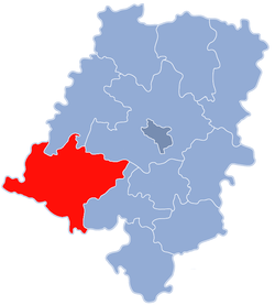
Coordinates (Nysa): 50°28′17″N 17°20′2″E / 50.47139°N 17.33389°ECoordinates: 50°28′17″N 17°20′2″E / 50.47139°N 17.33389°E Country  Poland
Voivodeship Opole Seat Nysa Gminas Area – Total 1,223.87 km2 (472.5 sq mi) Population (2006) – Total 145,640 – Density 119/km2 (308.2/sq mi) – Urban 77,461 – Rural 68,179 Car plates ONY Website http://www.powiat.nysa.pl Nysa County (Polish: powiat nyski) is a unit of territorial administration and local government (powiat) in Opole Voivodeship, south-western Poland, on the Czech border. It came into being on January 1, 1999, as a result of the Polish local government reforms passed in 1998. Its administrative seat and largest town is Nysa, which lies 48 kilometres (30 mi) south-west of the regional capital Opole. The county contains four other towns: Głuchołazy, 18 km (11 mi) south of Nysa, Paczków, 24 km (15 mi) west of Nysa, Otmuchów, 12 km (7 mi) west of Nysa, and Korfantów, 20 km (12 mi) east of Nysa.
The county covers an area of 1,223.87 square kilometres (472.5 sq mi). As of 2006 its total population is 145,640, out of which the population of Nysa is 47,283, that of Głuchołazy is 14,887, that of Paczków is 8,147, that of Otmuchów is 5,261, that of Korfantów is 1,883, and the rural population is 68,179.
Neighbouring counties
Nysa County is bordered by Ząbkowice Śląskie County to the west, Strzelin County and Brzeg County to the north, Opole County to the north-east, and Prudnik County to the south-east. It also borders the Czech Republic to the south-west.
Administrative division
The county is subdivided into nine gminas (five urban-rural and four rural). These are listed in the following table, in descending order of population.
Gmina Type Area
(km²)Population
(2006)Seat Gmina Nysa urban-rural 217.6 59,868 Nysa Gmina Głuchołazy urban-rural 168.0 25,706 Głuchołazy Gmina Otmuchów urban-rural 187.4 14,225 Otmuchów Gmina Paczków urban-rural 79.7 13,743 Paczków Gmina Korfantów urban-rural 179.8 9,784 Korfantów Gmina Łambinowice rural 123.7 8,157 Łambinowice Gmina Skoroszyce rural 103.6 6,521 Skoroszyce Gmina Pakosławice rural 74.0 3,899 Pakosławice Gmina Kamiennik rural 89.2 3,737 Kamiennik References
Urban-rural gminas 
Rural gminas Counties of Opole Voivodeship City county Opole (capital)
Land counties Brzeg • Głubczyce • Kędzierzyn-Koźle • Kluczbork • Krapkowice • Namysłów • Nysa • Olesno • Opole • Prudnik • StrzelceCategories:- Nysa County
- Land counties of Opole Voivodeship


Wikimedia Foundation. 2010.