Kerry Tramway

Kerry Tramway

Infobox rail
railroad_name=Kerry Tramway
gauge=RailGauge|24
start_year=1887
end_year=1925
length=3 miles
hq_city=Kerry
locale=Wales
successor_line=abandoned
system_

map_size=200px
map_caption=Map of the Kerry Tramway
The Kerry Tramway was a RailGauge|24 gauge narrow gauge railway built in 1887 to serve the timber workings and slab quarry to the south of the village of Kerry, near Newtown in mid Wales.

The railway ran from the Cambrian Railways Kerry railway station at Glanmule to the Brynllywarch estate owned by Christopher Naylor. The line served the timber forests on the estate, as well as a slab quarry and general estate traffic. It was worked by the Bagnall locomotive "Excelsior". In 1895 Naylor inherited Haggerston Castle and left Bryn Llywarch; the rolling stock of the railway was sold and the track was lifted.

During the First World War there was a great demand for timber. In 1917 the government Timber Supply Department (which later became the Forestry Commission) relaid much of the tramway to serve the sawmill on the estate. The railway and timber felling operations were mainly manned by German prisoners of war under military control. During the war, the line was worked by the Kerr Stuart locomotive Diana.

After hostilities ceased the tramway continued to operate. In early 1919 a petrol locomotive arrived from Baguely and in 1922 a third locomotive, the Haig class "Kashmir" arrived.

The line closed again in 1922 and all the tracks lifted except the Lower Rhos to Pentre section. This last remaining section was worked using an unknown 0-4-0 side tank locomotive for several more years.

Locomotives

[


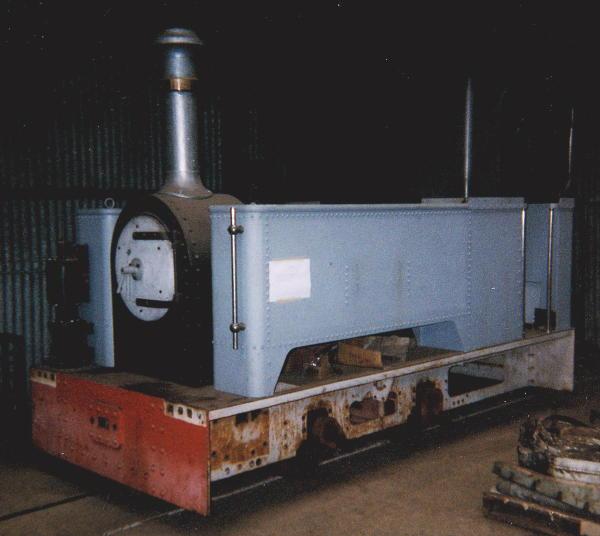
thumb|right|Diana_being_restored_at_Alan Keef Ltd. in 1999]

References

*
*


Wikimedia Foundation. 2010.

Игры ⚽ Нужна курсовая?

Look at other dictionaries:

  • Kerry, Powys — infobox UK place country = Wales welsh name= constituency welsh assembly= latitude= 52.5012 longitude= 3.25803 official name= Kerry population= unitary wales= Powys lieutenancy wales= Powys constituency westminster= Montgomeryshire post town=… …   Wikipedia

  • Cowlyd Tramway — Locale Wales Dates of operation c. 1916–c. 1968 Track gauge 2 ft  (610 mm) Length 4 miles (6.4 km) Headquarters Dolg …   Wikipedia

  • Croesor Tramway — Coordinates: 52°58′55″N 4°2′25″W / 52.98194°N 4.04028°W / 52.98194; 4.04028 …   Wikipedia

  • Deeside Tramway — (Glyndyfrdwy) Locale Wales Dates of operation 1850s–1947 Successor Abandoned Track gauge 2 ft 6 in (762 mm) Length 3 miles …   Wikipedia

  • Morda Tramway — The Morda Tramway refers to two industrial railways south of Oswestry, on the border between England and Wales. They connected the coal pits around Morda to transport networks, the first to the Montgomery Canal and the second to the Cambrian… …   Wikipedia

  • Crickheath Tramway — The Crickheath Tramway was a 1.5 mile long, 2 ft 6 in (762 mm) gauge narrow gauge industrial railway connecting the Porthywaen lime quarries near Llanymynech to the Crickheath Wharf on the Ellesmere and Chester Canal. It… …   Wikipedia

  • Mawddwy Railway — Locale Wales Dates of operation 1867 1911–1908 1951 Successor abandoned Track gauge 4 ft 8 1⁄2 in (1,435 mm) (standard gauge) …   Wikipedia

  • Corris Railway — Rheilffordd Corris Locale Mid Wales Terminus (Original) …   Wikipedia

  • Swansea and Mumbles Railway — Legend …   Wikipedia

  • Nantlle Railway — Horse drawn slate wagon used on the Tramway, now preserved at the Welsh Slate Museum, Llanberis Locale Wales Dates of operation 1828–1865 …   Wikipedia

Share the article and excerpts

Direct link
Do a right-click on the link above
and select “Copy Link”