- Geography of Uganda
-

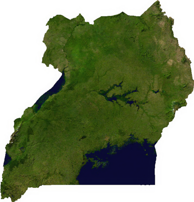
 Satellite image of Uganda
 Topographic map of Uganda
 Uganda's cities, main towns and selected villages
Uganda is located in Eastern Africa, west of Kenya, south of South Sudan and east of the Democratic Republic of the Congo. It is in the heart of the Great Lakes region, and is surrounded by three of them, Lake Edward, Lake Albert, and Lake Victoria. While much of its border is lakeshore, Uganda is landlocked with no access to the sea.
Despite being on the equator Uganda is more temperate than the surrounding areas due to its altitude. The country is mostly plateau with a rim of mountains. This has made it more suitable to agriculture and less prone to tropical diseases than other nations in the region. The climate is tropical; generally rainy with two dry seasons (December to February, June to August). It is semiarid East Sudanian savanna in north near Sudan.
Geographic coordinates: 1°00′N 32°00′E / 1°N 32°E
Contents
Climate
Uganda's climate is tropical. This means it is generally rainy (particularly during the months of March to May, September to November), while the remaining months (December to February, June to August) comprise Uganda's two dry seasons.
Statistics
Area:
total: 236 040 km²
land:199 710 km²
water: 36 330 km²Land boundaries:
total: 2 698 km
border countries: Democratic Republic of the Congo 765 km, Kenya 933 km, Rwanda 169 km, South Sudan 435 km, Tanzania 396 kmElevation extremes:
highest point: Margherita Peak on Mount Stanley 5 110 mNatural resources: copper, cobalt, hydropower, limestone, salt, arable land
Land use:
arable land: 25%
permanent crops: 9%
permanent pastures: 9%
forests and woodland: 28%
other: 29% (1993 est.)Irrigated land: 90 km² (1993 est.)
Environment - current issues: draining of wetlands for agricultural use; deforestation; overgrazing; soil erosion; poaching is widespread
Environment - international agreements:
party to: Biodiversity, Climate Change, Desertification, Endangered Species, Hazardous Wastes, Law of the Sea, Marine Life Conservation, Nuclear Test Ban, Ozone Layer Protection, Wetlands
signed, but not ratified: Environmental ModificationExtreme points
This is a list of the extreme points of Uganda, the points that are farther north, south, east or west than any other location.
- Northern-most point - the tripoint with Kenya and Sudan, Kotido District
- Eastern-most point - unnamed location on the border with Kenya, Nakapiripirit District
- Southern-most point - unnamed location on the border with Rwanda immediately south of Lake Bunyonyi, Kabale District
- Western-most point - unnamed location on the border with the Democratic Republic of the Congo immediately east of the Congolese village of Kirambo, Kisoro District
See also
Sovereign
states- Algeria
- Angola
- Benin
- Botswana
- Burkina Faso
- Burundi
- Cameroon
- Cape Verde
- Central African Republic
- Chad
- Comoros
- Democratic Republic of the Congo
- Republic of the Congo
- Côte d'Ivoire (Ivory Coast)
- Djibouti
- Egypt
- Equatorial Guinea
- Eritrea
- Ethiopia
- Gabon
- The Gambia
- Ghana
- Guinea
- Guinea-Bissau
- Kenya
- Lesotho
- Liberia
- Libya
- Madagascar
- Malawi
- Mali
- Mauritania
- Mauritius
- Morocco
- Mozambique
- Namibia
- Niger
- Nigeria
- Rwanda
- São Tomé and Príncipe
- Senegal
- Seychelles
- Sierra Leone
- Somalia
- South Africa
- South Sudan
- Sudan
- Swaziland
- Tanzania
- Togo
- Tunisia
- Uganda
- Zambia
- Zimbabwe
States with limited
recognition- Sahrawi Arab Democratic Republic
- Somaliland
Dependencies and
other territories- Canary Islands / Ceuta / Melilla / Plazas de soberanía (Spain)
- Madeira (Portugal)
- Mayotte / Réunion (France)
- Saint Helena / Ascension Island / Tristan da Cunha (United Kingdom)
- Western Sahara
Climate of Africa Sovereign
states- Algeria
- Angola
- Benin
- Botswana
- Burkina Faso
- Burundi
- Cameroon
- Cape Verde
- Central African Republic
- Chad
- Comoros
- Democratic Republic of the Congo
- Republic of the Congo
- Côte d'Ivoire (Ivory Coast)
- Djibouti
- Egypt
- Equatorial Guinea
- Eritrea
- Ethiopia
- Gabon
- The Gambia
- Ghana
- Guinea
- Guinea-Bissau
- Kenya
- Lesotho
- Liberia
- Libya
- Madagascar
- Malawi
- Mali
- Mauritania
- Mauritius
- Morocco
- Mozambique
- Namibia
- Niger
- Nigeria
- Rwanda
- São Tomé and Príncipe
- Senegal
- Seychelles
- Sierra Leone
- Somalia
- South Africa
- South Sudan
- Sudan
- Swaziland
- Tanzania
- Togo
- Tunisia
- Uganda
- Zambia
- Zimbabwe
States with limited
recognition- Sahrawi Arab Democratic Republic
- Somaliland
Dependencies and
other territories- Canary Islands / Ceuta / Melilla / Plazas de soberanía (Spain)
- Madeira (Portugal)
- Mayotte / Réunion (France)
- Saint Helena / Ascension Island / Tristan da Cunha (United Kingdom)
- Western Sahara
 Uganda topics
Communications · Economy · History · Government · Military · Transport Culture and
religionCricket · Demographics · Education · Football · Healthcare · Languages · LGBT rights · Media · Music · National theatre · Newspapers · Rugby · Wildlife ·
Roman Catholicism · Church of Uganda · Islam · Judaism · Hinduism · Orthodox Christianity
Geography Cities and towns · Districts · Counties · Sub-counties · National parks ·
Kampala · Gulu · Lake Victoria · Lake Albert · Mount ElgonPolitics Constitution · President · Prime Minister · Cabinet · Political parties · Human rights · Terrorism · Foreign relationsEconomy and
infrastructureAgriculture · Central bank · Economy of Uganda · Energy · Fisheries · Forestry · Manufacturing · Ministry of Finance · Transport · Uganda Securities Exchange · Uganda shilling · Water supply · Entebbe Airport · Uganda Railways Corporation
Categories:


Wikimedia Foundation. 2010.